Prof. Dr. Roland Pesch is a Professor at the Institute for Applied Photogrammetry and Geoinformatics (IAPG) in Lower Saxony, Germany. He leads the professorship for Fundamentals and Applications of Geoinformation Systems , focusing on marine spatial protection, biodiversity modeling, and sustainable urban-rural planning through GIS and remote sensing. Projects : Protect Baltic (2023-2028), 4N: Geo-Toolbox (2022-2026) Cooperation Partners : Lower Saxony State Office for Geoinformation and Land Surveying (LGLN) His research interests span Marine Conservation , Spatial Modeling , and Environmental Science , with applications in Biodiversity Hotspots , Climate Scenarios , and Urban Green Spaces . Recent work includes systematic reviews of public green spaces, habitat suitability analysis for Ostrea edulis , and predictive modeling of marine habitats using convolutional meshes and sonar data. Publications trend toward interdisciplinary GIS applications in marine ecology and urban sustainability , often involving remote sensing and spatiotemporal analysis . Key subfields include habitat mapping , marine protected areas , and climate change impact assessment . He supervises theses on topics like reed bed monitoring , surface sealing analysis , and green space accessibility at institutions in Lower Saxony. His lab collaborates with the LGLN to optimize land management workflows using 3D metrology and environmental data systems .
Professor Jan Blachowski serves as Head of the Department of Geodesy and Geoinformatics at the Faculty of Geoengineering, Mining and Geology, Wrocław University of Science and Technology. He also holds a position as a Visiting researcher at the Department of Geoscience and Petroleum at the Norwegian University of Science and Technology (NTNU) under the NAWA Bekker programme. His professional standing is further evidenced by his membership in Academia Professorum Iuniorum for the 2024-2025 term and his role as Chief Specialist (mining and geology) at the Institute for Territorial Development (Marshal Office of the Dolnoslaskie Voivodeship). Professor Blachowski's research interests focus on the modeling and analysis of natural and anthropogenic systems using geographic information systems, with particular emphasis on deformation of mining and post-mining areas, mining surveying, satellite remote sensing, and spatial statistics. His work bridges geospatial technology with practical mining applications, creating valuable insights for environmental monitoring and land management in regions affected by mineral extraction. The interdisciplinary nature of his research connects geodesy, mining engineering, and environmental science to address complex challenges in post-mining landscape rehabilitation. An analysis of Professor Blachowski's recent publications reveals a strong trend toward integrating advanced geospatial technologies with mining impact assessment. His work increasingly incorporates machine learning techniques (particularly Random Forest algorithms), multi-sensor 3D mapping approaches, and sophisticated remote sensing methodologies to monitor and predict ground deformations in post-mining areas. The research demonstrates a clear progression from traditional geodetic monitoring toward more comprehensive, data-driven approaches that combine multiple data sources and analytical techniques for improved accuracy in deformation modeling and environmental impact assessment. Professor Blachowski leads the Geospatial Modeling and Analysis Laboratory and has served as Principal Investigator for numerous significant research projects, including Interreg Poland-Saxony Cooperation Programme, National Centre for Research and Development Polish German Cooperation Call, and multiple National Research Centre (NCN) OPUS projects. His research portfolio spans international collaborations with institutions in Germany, Norway, and other European countries, reflecting the global relevance of his work on mining impacts and geospatial analysis.
Christoph Traun is a Researcher in Geoinformatics at Paris Lodron University Salzburg, affiliated with the International Institute for Geoinformatics. With continuous project involvement since 2001, he currently contributes to ongoing initiatives including TStour (Tien Shan tourism development, 2025-2026) and previously led roles in GI-N2K and ENERGEO projects focused on geospatial workforce development and environmental monitoring. His research centers on advanced cartographic techniques and geospatial analysis, with significant contributions to animated choropleth maps, value generalization methods, and spatial autocorrelation applications. Recent work explores AI integration in cartography (e.g., generative KI systems) and GIS education innovation, particularly examining ChatGPT's impact on teaching methodologies. He maintains strong focus on practical applications in urban planning, sustainability assessment, and tourism development. Traun's publication record reveals evolving trends from foundational GIS education research toward cutting-edge geovisualization and AI-driven spatial analysis. His 2021-2025 output demonstrates increasing emphasis on temporal data visualization, ethical AI implementation, and interdisciplinary urban studies. Award for outstanding teaching (2015) Special Achievement in GIS Award: UNIGIS (2014) As project staff in five major grants totaling over 15 years of continuous funding, Traun has secured significant resources for geospatial research including EU-funded initiatives like ENERGEO (environmental impact of energy use) and VESTA-GIS (vocational GIS training). His collaborative approach involves partnerships across Europe and Central Asia, with recent work focusing on workforce development and sustainable tourism metrics. He actively participates in the UNIGIS network and contributes to academic discourse through conference workshops and public lectures on geovisualization principles, most recently presenting at the u3Green Workshop (2024) and TStour seminar series.
Professor Richard Fry is Professor of Environment and Health in the Department of Population Data Science at Swansea University School of Medicine. He leads the Center for Research in Environment and Health (ENVHE), which includes geographers, epidemiologists, statisticians, and data scientists. Fry also serves as Joint Director of Health Data Research Wales, Associate Director of HDRUK's Triggering Social and Environmental Determinants of Health Programme, and Principal Investigator of the Wellcome Trust-funded MAGENTA project examining climate change effects on maternal health. Swansea University School of Medicine Department of Population Data Science Center for Research in Environment and Health (ENVHE) leader Joint Director of Health Data Research Wales Fry earned his BSc (hons) in Physical Geography followed by an MSc and PhD in Geographic Information Science. After completing his doctoral studies, he worked at the Wales Institute for Social and Economic Research and Data (WISERD) before returning to Swansea University in 2012 as a Senior Research Officer. His academic journey reflects a progression from spatial data connectivity research to leading major health data science initiatives. Professor Fry's research focuses on understanding how social and environmental factors influence health and well-being through advanced analytical techniques. His work specializes in environmental modeling, spatial data science, and linking health data at address level while maintaining privacy protection. He has pioneered methods for modeling environmental exposure and analyzing the geography of health, with particular emphasis on how built environments affect public health outcomes. His research often combines geographic information systems with health data to create policy-relevant information for decision-makers. Analysis of Professor Fry's recent publications reveals a strong focus on the intersection of environmental factors and health outcomes, with increasing attention to the impacts of the built environment on mental health, child development, and disease transmission. His work consistently employs spatial analysis and data linkage methodologies, with a growing emphasis on longitudinal studies and population-scale analyses. Recent publications show expanding applications of his research to address contemporary challenges like the COVID-19 pandemic and climate change impacts on health. Wellcome Trust funding for MAGENTA project Medical Research Council (MRC) support Economic and Social Research Council (ESRC) awards UK Health Data Research (HDR) funding Health and Care Research Wales grants National Institute for Health Research (NIHR) support Professor Fry contributes his expertise to multiple scientific advisory panels including the Welsh Index of Multiple Deprivation, the Housing Spine Analytical Resource, and the Social Care Working Group of the Scientific Advisory Group on Emergencies (SAGE). He serves on funding panels for major UK research funders and is an academic lead for Administrative Data Research Wales in Health and Wellbeing, Climate Change, and Social Justice areas. His ENVHE team has secured substantial funding to investigate how environmental factors affect health outcomes using linked routine data. As leader of the Center for Research in Environment and Health, Fry oversees a multidisciplinary team conducting innovative research that uses linked environmental, health, and social care data. His work connects with Health Data Research Wales and the Secure Anonymised Information Linkage Databank, creating infrastructure for population-scale health research. The ENVHE team's analytical approaches have become increasingly sophisticated, incorporating advanced spatial statistics and machine learning techniques to address complex public health questions.
Igor Ezau is a Professor at the Department of Physics and Technology , UiT The Arctic University of Norway . As Group Leader Renewable Energy , his work focuses on urban climate modeling in cold regions, atmospheric physics, and renewable energy systems. Cross-disciplinary research in Arctic urban environments Expert in turbulence-resolving simulations (e.g., PALM model) Key collaborations with international climate institutions His scientific contributions include: Urban microclimate analysis Offshore wind assessment Smart city environmental systems Climate adaptation strategies
Victor Duarte is an Assistant Professor of Finance at the Gies College of Business, University of Illinois Urbana-Champaign. His research focuses on intersections between public policy, financial economics, and quantitative methodologies. Key areas include consumer credit analysis, machine learning applications in finance, and structural econometric modeling. His work bridges theoretical finance with practical policy implications, particularly in healthcare economics and debt management. Recent studies explore medical debt impacts on credit systems and innovative approaches to portfolio optimization. Duarte also investigates computational tools for economic analysis, benchmarking software/hardware performance in quantitative research. Professional affiliations include the Gies College of Business where he contributes to both teaching and research initiatives. No academic awards or grants are explicitly listed in available materials.
Cynthia Kehoe is a Researcher (Data Scientist) at the Gies College of Business, University of Illinois Urbana-Champaign. She is affiliated with the institution’s academic and professional programs in business analytics and data-driven decision-making. Her role focuses on leveraging data science methodologies to address complex challenges in business contexts. Educational background information is listed but not detailed in the available text. Research interests inferred from her role include applications of machine learning, big data analytics, and business intelligence in operational and strategic decision-making. No recent publications, awards, or grants are explicitly listed in the provided content. She is based at 430 B Wohlers Hall, Champaign, IL, with contact details available via email and phone.
Aram Bahrini is a Teaching Assistant Professor and Deloitte Scholar at the Gies College of Business (University of Illinois at Urbana-Champaign), holding an Assistant Professor rank in Business Administration. His research focuses on mathematical modeling, optimization, game theory, and machine learning applied to resource management, healthcare systems, and supply chain operations. Education : Ph.D., Systems Engineering, University of Virginia (2023) M.S., Mathematics, University of British Columbia (2019) M.S., Industrial & Manufacturing Systems Engineering, Kansas State University (2017) Research Interests : Methods: Mathematical modeling, optimization, machine learning, game theory Applications: Supply chain management, healthcare analytics, business intelligence, renewable energy forecasting Key Contributions : His work spans predictive healthcare analytics, sustainable supply chain optimization, and AI ethics in hiring. Notable projects include developing XGBoost-based energy consumption models and analyzing post-pandemic patient flow in healthcare clinics. Awards & Service : Recipient of Teachers Ranked as Excellent (UIUC, 2023) Session chair for IEEE SIEDS (2022–2024) and INFORMS Annual Meeting (2023–2024) Ad Hoc reviewer for over 30 journals including European Journal of Operational Research and IEEE Transactions on Industrial Informatics Teaching : Courses: BADM 210/211 (Business Analytics), BADM 378 (Logistics Management), BADM 453 (Business Intelligence) Labs & Teams : Active in systems engineering and data science collaborations at the University of Virginia's Link Lab and UIUC's Business Analytics group.
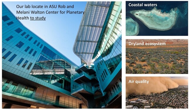
Jiwei Li is an Assistant Professor affiliated with multiple departments at Arizona State University, including the School of Ocean Futures, School of Earth and Space Exploration, Center for Global Discovery and Conservation Science, and the Global Futures initiative. His research focuses on integrating remote sensing, big data analytics, and machine learning to study human-natural system interactions at land-ocean interfaces. Key areas include coral reef conservation, aquatic ecosystem monitoring, and sustainable resource management. He leads the Remote Sensing for Global Futures (RSGF) Lab, which develops globally scalable analytical algorithms using cloud computing platforms like Google Earth Engine. His work emphasizes applications in marine spatial planning, climate change adaptation, and biodiversity preservation. Li's expertise spans satellite sensor optimization, water quality monitoring, and geophysical prospecting techniques for environmental assessment. Notable contributions include global coral reef mapping initiatives, seagrass extent algorithms, and machine learning approaches for coastal zone management. His interdisciplinary research bridges computer science, oceanography, and environmental policy, aiming to translate technical innovations into actionable conservation strategies.
Jonathan Duncan is an Associate Professor in the Department of Ecosystem Science and Management at Pennsylvania State University, and an IEE Faculty Member. His research focuses on water quality, biogeochemistry, hydrology, and ecohydrology with applications to watershed management, geomorphology, and environmental science. He is affiliated with the Institutes of Energy and the Environment (IEE), contributing to themes like Water Sustainability and Equitable Communities. His work integrates field observations, geochemical analysis, and geospatial tools to address challenges in urban and agricultural water systems. Notable projects include USDA-funded AI-driven water quality monitoring and collaborations with Monash University on Australian water quality research. Recent studies explore nitrate dynamics in agricultural peatlands, phosphorus mobilization from legacy sources, and green infrastructure placement for stormwater control. Publications highlight advancements in nutrient cycling modeling, critical zone processes, and the socio-environmental impacts of urbanization. His research emphasizes sustainable land-use practices and data-driven solutions for environmental management, with a focus on bridging ecological and human-driven systems.
Jeannette Chin is an Associate Professor in Computing Sciences at the University of East Anglia (UEA), part of the School of Computing Sciences. She specializes in Human-Computer Interaction (HCI), ubiquitous computing, and End User Programming (EUP) systems for smart environments and IoT. Her work integrates interdisciplinary approaches from social science and psychology, with a focus on interfaces sensitive to human needs. Dr. Chin holds Senior Fellowship of AdvanceHE and is a Fellow of the British Computer Society. Education: PhD in Computing Science (University of Essex, 2009) BSc First Class Honours in Internet Computing (University of Essex, 2003) Research Interests: End User Programming in physical/MR/XR environments Emotion-aware adaptive interfaces AI-driven HCI/UX Ubiquitous computing in education and security Smart environments and IoT applications Key Projects: AgriFoRwArdS CDT (EPSRC-funded, Co-Academic Lead) PREDICT-GI-IRON (NIHR-funded, Co-Investigator) Teacher Agency with Technology (ESRC-funded, Co-Investigator) myEvolution Phase 2 (UEA & URI collaboration) Awards: UEA Innovation & Impact Award (2021) Senior Fellowship of AdvanceHE (2021) Best Short Paper Award (2019) Advising & Grants: Supervises PhD projects on EUP in smart environments and has secured over £200k in research funding. Served as External Examiner at Coventry University (2016–2020). Labs & Teams: Member of Cyber Intelligence and Networks, Data Science & AI, and Visual Computing & Signal Processing groups. Leads editorial roles for Journal of Ambient Intelligence and Smart Environments and IET Smart Cities Journal .
Christopher Wong is an Assistant Professor in the Department of Forestry and Environmental Management at the University of New Brunswick (UNB). He holds a PhD in Ecology and Evolutionary Biology from the University of Toronto, an MSc in Earth and Atmospheric Sciences from the University of Alberta, and a BSc in Biology from the same institution. Prior to joining UNB in 2024, he worked as a Postdoctoral Research Scholar and Assistant Project Scientist at the University of California, Davis. His research focuses on leveraging remote sensing and plant ecophysiology to study ecosystem responses to environmental and climate change. He employs techniques across spatial scales—from leaf-level measurements to satellite imagery—and temporal scales to develop monitoring tools for forestry, agriculture, and ecological systems. Dr. Wong teaches courses such as FOR 2416 (Structure and Development of Woody Plants) and FOR 3303 (Remote Sensing). His work emphasizes interdisciplinary approaches, including high-throughput phenotyping, drone-based monitoring, and the integration of spectral data to track plant stress, photosynthetic capacity, and ecosystem resilience. He has contributed to initiatives like the Global Spectra-Trait Initiative and pioneered tools like the TSWIFT platform for frequent timeseries data collection. His research spans topics such as post-fire forest recovery, drought impacts on crop species (e.g., beans), and the use of optical signals to monitor photosynthesis in tropical forests. Notably, he explores the application of Sentinel imagery and hyperspectral sensing to address real-world challenges in conservation and agriculture. While no scientific awards are explicitly listed, his prolific publication record highlights his significant contributions to ecological and remote sensing research. Dr. Wong collaborates on projects involving satellite and drone technologies, and his work often addresses global ecological questions while maintaining practical applications. He is affiliated with UNB’s Fredericton campus and actively engages in advancing methods for ecosystem assessment and climate change mitigation strategies.
Sean Field is a UW Derecho Assistant Professor in the School of Computing and Department of Anthropology at the University of Wyoming. He specializes in computational archaeology, integrating remote sensing, geospatial analysis, and machine learning to study human-environment dynamics in past and contemporary contexts. His fieldwork focuses on the U.S. Southwest, particularly Mesa Verde National Park, and spans regions like Western Europe and Ukraine. Education: PhD from University of Notre Dame (2023), MA from University of Notre Dame (2019), MA from University of Nebraska-Lincoln (2017), BA from University of Northern Colorado (2015). Research Interests: Computational applications (R, Python, ML) GIS and LiDAR analysis Remote sensing (photogrammetry, satellite data) Human-climate interactions in the ancient and modern world Recent Articles Highlight: Focuses on Chacoan road systems, Mesa Verde climate adaptations, and global climate-pollution linkages Explores UAV-based archaeological methods and open-source tools Includes studies on cultural heritage preservation during conflict Awards & Grants: Recipient of University Presidential Fellowships Multiple grants from NSF, NASA, and cultural institutions Recognition for interdisciplinary research in climate and health Advising & Labs: Mentors 7 graduate/undergraduate students Leads the Field Lab for Applied Computational Research Collaborates across departments (Anthropology, Computing, Geology) Lab Focus: Develops computational tools for archaeological and environmental challenges, including the ArcheoSight and PAST projects.
Dr. Suyun Paul Ham is an Associate Professor of Civil Engineering at the University of Texas at Arlington (UTA), leading the Smart Infrastructure and Testing Laboratory (SITL). He holds a Professional Engineer (PE) license in Texas and has received the NAI Honorary Membership Certificate and the ASNT Fellowship Award. His research focuses on non-destructive evaluation (NDE), structural health monitoring (SHM), and AI-driven sensing technologies for infrastructure assessment. Educated at the University of Illinois at Urbana-Champaign (PhD, 2015) and Hongik University (BS, 2004), Dr. Ham has over 15 years of industry and academic experience. His expertise spans concrete durability, wireless sensing, and automated inspection systems for bridges, nuclear facilities, and transportation infrastructure. Research interests include metal hydride reactions, superadiabatic thermal waves, and AI integration for infrastructure monitoring. He has developed contactless scanning systems and advanced numerical models to assess damage in concrete structures. Awards: NAI Honorary Membership, ASNT Fellowship, multiple poster competition awards. Grants: TxDOT grant for bridge inspection (2019). Professional Roles: Committee member of ASCE Structural Identification of Constructed Systems; subcommittee member of Transportation Research Board. Dr. Ham teaches courses on nondestructive testing, infrastructure durability, and AI applications. His lab actively collaborates on projects involving robotic scanning, sensor networks, and sustainable urban infrastructure solutions.
John Maingi is an Associate Professor at Miami University's Department of Geography, affiliated with the Center for Aquatic and Watershed Sciences, Geospatial Analysis Center, and Institute for the Environment and Sustainability. His expertise spans remote sensing, GIS, ecology of wooded ecosystems, and surface hydrology. He holds a B.S. in Forestry from Moi University (1987), M.S. in Renewable Natural Resources from the University of Arizona (1992), and Ph.D. in Arid Lands Studies (1998). Research focuses on integrating remote sensing and GIS for environmental monitoring, wildfire analysis, biodiversity conservation, and human-environment interactions. Notable projects include burn scar mapping in Kenya, elephant poaching patterns, and ecological studies in afromontane forests. His work bridges geospatial technologies with socioecological systems in Africa and the U.S. Publications emphasize African ecosystems, wildfire dynamics, and GIS applications. He teaches courses like Geographic Information Systems, Remote Sensing Techniques, and Global Change Studies. Active in interdisciplinary research, he collaborates with institutions globally on environmental sustainability challenges.