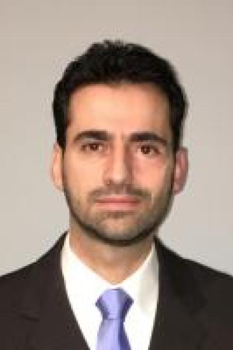
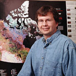
Dr. Serkan Girgin is an Associate Professor at the Department of Geo-information Processing, Faculty of Geo-Information Science and Earth Observation, University of Twente. He leads the Center of Expertise in Big Geodata (CRIB) and contributes to global initiatives in geospatial big data, cloud computing, and disaster risk assessment. His work bridges academic, private, and scientific sectors with over two decades of experience since 1996. M.Sc. and Ph.D. in Environmental Engineering Second M.Sc. in Geodetic and Geographic Information Technologies Research interests span geospatial data science, machine learning for remote sensing, open science frameworks, and Natech risk assessment. He has designed systems like ITC's Geospatial Computing Platform, eNatech Database, and RAPID-N for risk mapping. Recent publications focus on digital twins for soil-plant systems, SAR benchmark datasets, and automated workflows for Sentinel-1 interferometry. His projects include ESA EO AFRICA R&D Facility, SURF's Next Generation Data Repositories, and Netherlands eScience Centre's EcoExtreML. eScience Center Fellow (2022) SURF Research Support Champion (2022) Multiple early-career awards in programming (1993-1996) and thesis excellence (2005) He actively develops tools for citizen science (e.g., QGIS Light) and advocates for FAIR data management. His collaborations extend to Zenodo datasets and international conferences on geospatial resilience.
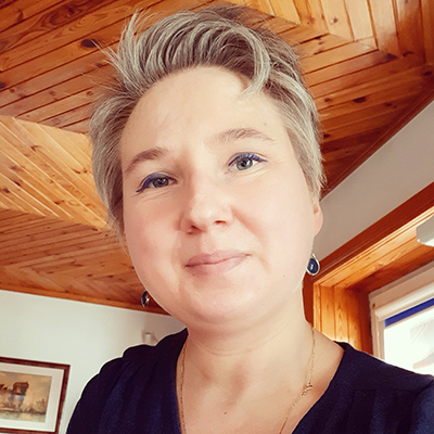
Dr. Franziska Klemstein is an active researcher specializing in monument preservation and digital humanities, with significant contributions to understanding heritage practices in the German Democratic Republic (GDR) era. Her work critically bridges historical scholarship and computational methods, particularly through the development of specialized datasets for document analysis and image retrieval in cultural heritage contexts. Her research focuses on: Monument preservation systems under socialist regimes Ethical implementation of AI in heritage documentation Diversity and inclusion challenges in conservation practices Classification methodologies for historical inventories Digital reconstruction of contested heritage sites Gender dynamics in preservation professions Analysis of Klemstein's recent publications reveals a methodological evolution from historical analysis toward technical innovation, with increasing emphasis on dataset creation (DHMTIC, DHREAAL, TexBiG) and evaluation frameworks for heritage computing. Her work consistently addresses the tension between digital efficiency and critical heritage values, particularly regarding sustainable AI implementation and inclusive documentation practices. While specific awards remain undocumented in the provided materials, her editorial leadership in significant volumes like "On the Way to a Place of Remembrance" (2024) demonstrates recognized expertise. Klemstein's collaborative projects with researchers like Tschirschwitz and Schmidgen indicate active participation in interdisciplinary teams focused on digital heritage solutions, though institutional affiliations and grant details aren't specified in the current text.
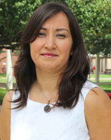
Dr. Berna Tokgoz is an Associate Professor in the Department of Industrial and Systems Engineering at Lamar University's College of Engineering. She serves as the MEM Graduate Advisor and has been a faculty member since August 2014. Her research focuses on resilience engineering, risk analysis, and systems engineering with applications in disaster management, port operations, and infrastructure resilience. Dr. Tokgoz has secured numerous research grants and has mentored several graduate students through their degree programs. Dr. Tokgoz earned her Ph.D. in Engineering Management and Systems Engineering from Old Dominion University in 2012, with a dissertation on "Probabilistic resilience quantification and visualization building performance to hurricane wind speeds." She completed her Master of Science in Chemical Engineering from Hacettepe University in Ankara, Turkey, in 2000, and her Bachelor of Science in Chemical Engineering from the same institution in 1997, where she ranked 1st among 40 students. Dr. Tokgoz's research spans multiple domains of resilience engineering and risk analysis. Her work focuses on quantifying resilience in critical infrastructure systems, particularly in the context of natural disasters like hurricanes. She has developed methodologies for assessing the resilience of power distribution networks, utility poles, and port operations. Her research integrates systems engineering approaches with advanced technologies such as drones, artificial intelligence, and machine learning to enhance infrastructure resilience. Dr. Tokgoz also investigates risk assessment methodologies for hazardous materials transportation in port environments, contributing to safer and more resilient maritime operations. Dr. Tokgoz has received multiple scientific awards including the Academic Leadership for Women Engineering NSF ASSIST Travel Grant in both 2018 and 2017. She was awarded the Ihsan Dogramaci Supreme Success Award in 1997 and ranked 1st in Chemical Engineering at Hacettepe University. Her students have also achieved recognition, with Md Morshedul Alam placing 2nd in an oral presentation at the 5th Annual Texas STEM Conference in 2017, and M. Burak Cankaya placing 2nd in a student poster presentation at the Mission Critical Big Data Analytics Workshop in 2016. Dr. Tokgoz has advised several graduate students including Md Morshedul Alam (Doctor of Engineering), M. Burak Cankaya (Doctor of Engineering), Ayberk Karakavuz (Master's), and Santhoshi X Kethineedi (Master's). She has secured numerous research grants totaling over $300,000 from Lamar University's Center for Resiliency and other sources, focusing on projects related to community resilience, infrastructure management, and disaster response. Her grant portfolio includes work on drone-based monitoring of pipelines, utility poles, and port operations, as well as risk assessment methodologies for chemical transportation. Dr. Tokgoz is actively involved with the Center for Resiliency at Lamar University, where she collaborates with researchers across disciplines to address complex resilience challenges. Her work often involves interdisciplinary teams focusing on infrastructure systems, disaster management, and risk assessment. She has developed and taught courses in Risk Management, Systems Engineering, Port Engineering Management, and Project Management, contributing to the education of future engineers in resilience and risk management principles.
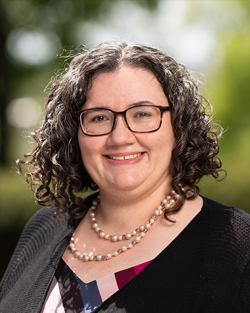
Prof. Elif Sertel is a Professor of Geomatics Engineering at Istanbul Technical University's Faculty of Civil Engineering, specializing in GIS, Remote Sensing, and Satellite Technologies. She holds a PhD from ITU (2008) and has conducted groundbreaking research on land use analysis, urbanization impacts, and geospatial AI applications. Her work integrates historical aerial photography with modern satellite data to model environmental and demographic changes. Notable projects include the GeoAI_LULC_Seg ERC-funded initiative analyzing rural depopulation and agricultural land abandonment in Turkey and Bulgaria since 1940. She has led over 30 research projects totaling €6M+, with notable funding from TÜBA, ERC, and the Ministry of Development. Awards include the 2024 Istanbul Technical University Academic Performance Award and the 2017 TÜBA Outstanding Young Scientist Award. Her teaching includes GIS in Engineering courses. Research focuses on: 1) AI-driven land cover segmentation using deep learning, 2) drought monitoring via satellite data, 3) urban heat island analysis, and 4) landscape metric correlations with satellite resolution. Recent work emphasizes historical data integration, with projects like the 1958-2020 Bursa land use study. Her team developed benchmark datasets (VHRTrees, HRPlanes) and tools like the GeoAI-based mobile drought app. Grants and projects: Over 30 completed projects including €150k ERC GeoAI_LULC_Seg (2022-2024), €5M ITU Satellite Ground Terminal Renewal (2016-2020), and TÜBA-funded city mapping initiatives. Collaborations with institutions like NASA, ESA, and European Research Council have produced over 50 peer-reviewed publications. Awards highlight sustained excellence: 2023-2024 Academic Performance Awards, 2024 Broadcasting Achievement Award, and 2017 TÜBA recognition. Her work bridges geomatics engineering with environmental policy through interdisciplinary approaches.
Phil Dennison is a Professor of Geography at the University of Utah's School of Environment, Society & Sustainability, where he serves as Director of the URSA Lab (University of Utah Remote Sensing and Applications Laboratory). Based in Gardner Commons Room 4848, he teaches core remote sensing courses including GEOG 3110 (The Earth from Space) and advanced courses in optical remote sensing and vegetation mapping. Ph.D., Geography, University of California Santa Barbara, 2003 M.A., Geography, University of California Santa Barbara, 1999 B.S., Geography, Penn State University, 1997 Dr. Dennison's research bridges remote sensing technology with critical environmental challenges. His primary focus areas include: Wildfire Safety Systems - Developing geospatial tools like GeoLCES for firefighter lookouts and escape routes Vegetation Monitoring - Using imaging spectroscopy for non-photosynthetic vegetation and biomass mapping Greenhouse Gas Tracking - Satellite-based methane emission detection and quantification Natural Hazard Assessment - Drought impacts on forest mortality and fuel moisture monitoring Analysis of his 15 most recent publications (2024-2025) reveals a strategic shift toward operational safety applications , with 60% of articles directly addressing wildfire fighter safety through geospatial decision support. His technical approach increasingly integrates machine learning with multi-sensor platforms (lidar, hyperspectral, satellite), while maintaining strong field campaign components like NASA's FireSense. The work demonstrates exceptional cross-domain applicability from Piñon-Juniper woodlands to global methane monitoring. As Director of the URSA Lab, Dr. Dennison leads a research ecosystem focused on translating remote sensing data into actionable public safety tools. His team actively collaborates with federal agencies including NASA and USFS, with recent work directly informing wildfire evacuation protocols and emission monitoring standards. The lab maintains strong field validation components through campaigns like FIREX-AQ, ensuring practical relevance of technical innovations.
Dr. Anthony Dick is an Associate Professor in the School of Computer and Mathematical Sciences at the University of Adelaide. He is affiliated with the Australian Institute for Machine Learning and the Australian Centre for Visual Technologies. His research focuses on computer vision, particularly visual tracking and 3D shape estimation. He explores applications in sports analytics (e.g., AFL player tracking), medical imaging, and visual question answering leveraging external knowledge sources. He is eligible to supervise PhD and Masters students in these areas. Research interests include: 3D shape analysis, visual tracking algorithms, machine learning integration for imagery, and multimodal reasoning (combining vision and text). His work often addresses challenges in large-scale surveillance networks and automated image interpretation. Publications span topics like neural network-based tracking, deep learning for set prediction, and benchmarking generative models. He has contributed to datasets such as Tenniset for event recognition in sports videos. Affiliated with interdisciplinary teams like the Australian Centre for Visual Technologies, his research bridges academic and applied domains, with potential industrial applications in automated video analysis and medical diagnostics.
Dr. Qingmin Meng is an Associate Professor in the Department of Geosciences at Mississippi State University, specializing in human-environment interactions through quantitative geospatial analysis. His work integrates mathematics and statistics to model landscape dynamics, natural resources, and human activities using vector, raster, and time-series datasets. Dr. Meng's educational background includes: PhD in Forestry and Natural Resources, University of Georgia (2006) MS in Statistics, University of Georgia (2005) PhD in Geography, Peking University, China (2001) MS in Geography, Lanzhou University, China (1997) BS in Geography, Shandong Normal University, China (1994) His research focuses on geospatial big data exploration , with emphasis on remote sensing data integration, ecological system assessment, and environmental-social interactions in Gulf coastal ecosystems, hydraulic fracturing impacts, and West Nile Virus dynamics. Key methodologies include GIS, remote sensing, and geospatial modeling for analyzing complex systems. Recent publications reveal a strong trend toward applied environmental justice research , particularly in urban flood vulnerability, wildfire risk disparities, and health inequities exacerbated by climate change. His work increasingly utilizes machine learning and high-resolution spatial analytics to address climate adaptation challenges. Notable recognitions include: CHANS Fellowship (2010) from the International Network of Research on Coupled Human and Natural Systems (NSF/MSU) UCGIS/ESRI Junior Faculty Award (2010) Dr. Meng mentors graduate students in geospatial science, with current advisees including PhD candidates Sadia Shammi, Khalid Hossain, and Tianyu Li. His research is supported by grants focused on environmental hazard assessment and geospatial technology development, though specific funding sources aren't detailed in available materials. His work leverages Mississippi State University's geospatial infrastructure for analyzing Gulf coastal ecosystems and hydraulic fracturing impacts, with growing emphasis on urban environmental justice and climate resilience applications.
Grażyna Chaberek serves as an Assistant Professor in the Department of Spatial Management at the Faculty of Social Sciences, University of Gdańsk. With 16 years of academic experience and a PhD in Earth Sciences specializing in economic geography, she combines expertise as an economist and logistician to advance spatial planning research. Her work focuses on the economic dimensions of urban logistics infrastructure, particularly its role in supporting businesses and residents within sustainable mobility frameworks. Her research interests center on spatial planning, urban logistics, and sustainable mobility systems. Dr. Chaberek investigates how geospatial technologies (GIS, remote sensing) and synthetic indicators can optimize transportation networks and regional development. She examines economic geography applications in urban contexts, with particular attention to railway infrastructure feasibility, last-mile logistics solutions, and socio-economic sustainability metrics across diverse geographical settings including Poland, India, Ukraine, and Serbia. Recent publications (2019-2025) demonstrate consistent focus on sustainable urban transport, with key themes including zero-emission bus adoption, e-scooter energy demands, and railway network optimization. Her work integrates economic geography with practical spatial management challenges, employing geostatistical analysis and machine learning to address real-world urban mobility problems across international contexts. As an academic tutor since 2014, Dr. Chaberek implements Design Thinking techniques from Stanford University and Oxford/Cambridge tutoring methodologies. She mentors students in research skill development, personal branding, and goal-setting through positive psychology frameworks. Her educational approach emphasizes practical application of spatial management concepts through essay writing and developmental exercises. Dr. Chaberek collaborates with commercial entities and local government teams on market expertise development projects. Her work bridges academic research with practical spatial management applications, contributing to regional planning initiatives through interdisciplinary approaches that integrate economic, social, and environmental perspectives.
Christos Kastrisios is a Research Professor at the Center for Coastal and Ocean Mapping (CCOM) within the University of New Hampshire. His work focuses on advancing nautical cartography, hydrographic data analysis, and automated charting workflows. He leads research in bathymetric data quality, interpolation uncertainty, and maritime navigation safety systems. Education: Ph.D. in Cartography, National Technical University of Athens M.P.S. in Geospatial Information Sciences, University of Maryland B.Sc. in Naval Science and Art, College of Naval Architecture, Piraeus Research Interests: Cartography, Hydrography, Nautical Chart Automation, Data Quality Visualization, and Maritime Spatial Analysis. His projects emphasize integrating geospatial standards (e.g., IHO S-122) and machine learning to enhance chart accuracy and safety. Publications Trends: Recent work addresses automated charting workflows, bathymetric uncertainty quantification, and vessel trajectory analysis. Key themes include optimizing data visualization for ECDIS systems and improving interoperability between survey data and navigation charts. Grants & Laboratories: Active in CCOM’s ocean engineering lab, contributing to projects like the Spanish EEZ mapping initiative. Collaborates on open-source tools for hydrographic surveying and marine data integration.
Marios C. Angelides is a prominent academic specializing in multimedia systems, artificial intelligence, and collaborative technologies. His work focuses on integrating machine learning, IoT, and game theory into applications such as autonomous systems, disaster response, and personalized gaming. He has authored over 90 publications, including influential papers on MPEG standards and AI-driven UAV coordination. His research bridges theoretical frameworks with practical implementations in telecommunications, emergency communications, and educational technologies. Angelides collaborates extensively with researchers like Faris A. Almalki and Harry W. Agius, advancing interdisciplinary solutions in intelligent tutoring systems and adaptive multimedia.
Ben Radford is an Adjunct Associate Professor at the UWA Oceans Institute , The University of Western Australia. His work focuses on marine ecosystems, coral reefs, and coastal environmental challenges. He contributes to UN Sustainable Development Goals related to life below water and climate action. Research Interests: Marine benthic habitats and their conservation Climate change impacts on coral reefs and fisheries Hydrodynamic influences on tropical fish assemblages Remote sensing and AI-driven ecological monitoring Marine reserve management and habitat mapping Notable Projects: WESTPORT - Benthic Habitat Mapping (WA Dept. of Transport, 2021-2024) Coral reef AI benchmarking for image surveys (2025) Geographe Marine Park long-term ecological monitoring (2019-2024) Grants & Funding: Director of National Parks (A$ millions) Fisheries Research & Development Corporation Department of Agriculture, Fisheries & Forestry Labs/Teams: Collaborates with interdisciplinary teams across UWA Oceans Institute, Australian Institute of Marine Science, and international partners in coral reef research.
Dr. Jennifer Cross is a Research Assistant Professor at Tufts University's Center for Engineering Education and Outreach (CEEO), focused on human-robot interaction in educational contexts and diversity in STEM education. She holds a PhD in Robotics from Carnegie Mellon University (CMU), where she developed the Arts & Bots program using the Hummingbird Robotics Kit to integrate robotics with non-technical disciplines like art and English. Her work emphasizes K-12 robotics integration, teacher training, and community-driven environmental monitoring. Educational Background: PhD in Robotics, Carnegie Mellon University (2017) MS in Robotics, Carnegie Mellon University (2013) BS in Electrical and Computer Engineering, Franklin W. Olin College of Engineering (2010) Research Interests: Dr. Cross's work spans creativity-oriented robotics education, STEM diversity initiatives, and community-empowered environmental sensing projects like Smell Pittsburgh. She designs tools such as the Smart Motor toolkit to introduce machine learning to elementary students and collaborates with teachers to integrate engineering into non-technical curricula. Awards & Recognition: Institute of Education Sciences (IES) Program for Interdisciplinary Education Research Fellow National Science Foundation (NSF) Graduate Research Fellowship Program Fellow Advocacy & Grants: Her research has been supported by grants focusing on robotics in education and public health. She has advised on teacher training programs and developed assessment frameworks to measure student attitudes toward robotics activities. Labs & Teams: Collaborates with CMU's Community Robotics, Education, and Technology Empowerment (CREATE) Lab and leads projects at Tufts CEEO, emphasizing accessible, inclusive STEM tools.
Steven M. Manson is a Professor in Geography, Environment and Society at the University of Minnesota, affiliated with the Minnesota Population Center. His work integrates environmental research, social science, and geographic information science (GIScience) to analyze complex human-environment systems, contributing to UN Sustainable Development Goals (SDGs) related to climate action, sustainable cities, and reduced inequalities. Research areas include Geographic Information Science (GIScience) with focus on spatiotemporal data infrastructure Big data applications in population-environment research Agent-based modeling and spatial uncertainty analysis Historical Geographic Information Systems (HGIS) Recent research outputs highlight trends in geospatial technology and methodological innovation. Notable projects include the National Spatiotemporal Population Research Infrastructure (NSF-funded) and International Population and Agricultural Census Data initiatives, enabling environmental health studies through microdata integration. Awards and honors are not explicitly mentioned in the provided texts, though his editorial roles (e.g., Geographic Information Science & Technology Body of Knowledge ) and peer-review activities underscore his disciplinary leadership. As a principal investigator and collaborator on grants from the National Science Foundation and NIH, he advances geospatial discovery environments and data infrastructure. His academic activities include chairing panels on uncertainty analysis and contributing to debates on GIScience futures.
Dr. Derek R. Peddle is a Full Professor in the Department of Geography at The University of Lethbridge, Alberta, Canada. He holds a Ph.D. in Geography/Remote Sensing from the University of Waterloo, M.Sc. in Geography from the University of Calgary, and B.Sc. Honours in Computer Science and Geography from Memorial University of Newfoundland. His academic career began in 1996 as an Assistant Professor, advancing to Associate Professor in 1999 and Full Professor in 2006. Research interests span remote sensing, GIS, and earth system science modeling with applications in global environmental change, forestry, agriculture, water resources, and mountain terrain analysis. Key methodologies include spectral mixture analysis, canopy reflectance modeling, algorithm development, and multi-temporal GIS analysis across scales from centimetres to global coverage. Major research projects include NASA's BOREAS (Boreal Forest Ecosystem Atmosphere Study), alpine terrain analysis in the Canadian Rockies, precision agriculture studies, and watershed analyses. He has developed specialized software for geomorphometric processing, image texture analysis, and hyperspectral data processing. Awards and Honors Fulbright Senior Fellowship in Environment and Climate Change (1999-2000) Canada-U.S. Fulbright Distinguished Visiting Research Chair (2006) NASA Visiting Scientist Award at Goddard Space Flight Center (1994) National Best Ph.D. Thesis Award in Remote Sensing (1997) Alberta Centennial Medal (2005) Six Best Paper Awards at international/national symposia Academic Leadership National Past-Chair of Canadian Remote Sensing Society Associate Editor, Canadian Journal of Remote Sensing NSERC CREATE AMETHYST Program Coordinator Faculty representative on University Board of Governors and Senate (2003-2005) Research Infrastructure Directs a laboratory equipped with ASD-FR spectroradiometers, hemispherical photography systems, field goniometers, GPS units, and advanced computing resources for PCI, ENVI, and ARC-GIS processing. Manages the NSERC-funded CREATE AMETHYST program for hyperspectral science training.
Professor Linlin Ge is a distinguished academic specializing in remote sensing and earth observation at the University of New South Wales (UNSW), Sydney, Australia. He holds a position in the School of Civil and Environmental Engineering and has been studying earth observation techniques since 1985. His work has significant applications in natural disaster monitoring, land subsidence measurement, and integrating radar and optical remote sensing with GPS and GIS systems. Professor Ge's educational background includes a PhD in GPS and remote sensing from UNSW, an MSc in Crustal Deformation from the Institute of Seismology, and a BEng (1st Hons and University Medal) in Optical Engineering from the Wuhan Technical University of Surveying and Mapping. He was also a postdoctoral research fellow in the Meteorological Research Institute of the Japan Meteorological Agency sponsored by the Science and Technology Agency of Japan during 1997-1998. His research interests focus on using digital images to map the Earth's surface, combining remote sensing with GPS and GIS to produce cost-effective and reliable maps, and integrating radar and optical remote sensing with GPS and GIS to measure subtle surface changes with minimal latency. Professor Ge's work aims to make remote sensing more timely, accurate, affordable, and widely applicable across various disciplines. His recent publications demonstrate a strong focus on advanced remote sensing techniques, particularly in the areas of hyperspectral image classification, landslide monitoring, earthquake damage assessment, and land subsidence analysis. His research increasingly incorporates deep learning and AI approaches while maintaining strong applications in natural disaster monitoring and management. Major Awards: JK Barrie Award for Overall Excellence (2008 Asia-Pacific Spatial Excellence Awards) NSW Scientist of the Year 2009 (Physics, Earth Sciences, Chemistry and Astronomy) UNSW Inventor of the Year finalist (2010) Australian Research Council Postdoctoral Fellowship (2002-2004) Professor Ge has supervised 25 graduated students and currently has 5 students in his lab. His research is supported by multiple grants including ARC Discovery grants, Australian Space Research Program funding, and various government and industry partnerships focused on SAR formation flying, subsidence monitoring, flood mapping, and carbon capture safeguarding. His work with satellite missions such as Envisat, ALOS, COSMO-SkyMed, Radarsat-2 and ALOS-2 demonstrates his leadership in practical applications of remote sensing technology.