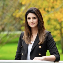
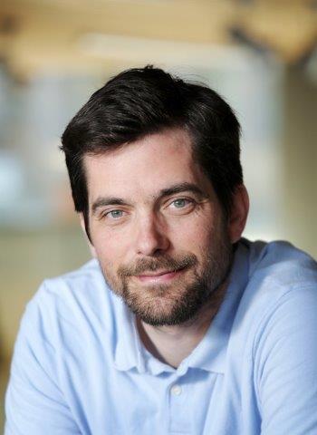
Lauren Neitzke Adamo is an Associate Professor in the Department of Earth and Planetary Sciences at Rutgers University, where she directs the Undergraduate Program (2022–present) and co-leads the Rutgers University Geology Museum (2016–present). Her career includes roles as Assistant Teaching Professor (2016–present), Lecturer (2008–2016), and prior leadership at the museum. Education : Ph.D. (2016), M.S. (2006), and B.S. (2004) from Rutgers University. Her research spans paleoceanography , stable isotope stratigraphy , and innovative geoscience education , focusing on drone-based remote sensing, 3D visualization, and museum outreach. She integrates technology like UAVs and 3D printers to enhance educational experiences and coastal process analysis. Recent publications highlight her work in virtual field trips (Newark Basin), drone-assisted coastal geomorphology, and science communication through comics and interactive museum exhibits. Collaborative projects emphasize democratizing geospatial tools and engaging diverse audiences via digital platforms.
Lars-Henrik Eriksson is a Senior Lecturer in the Department of Computer Science at Uppsala University, part of the Department of Information Technology. He holds a PhD and is recognized as an Excellent Teacher and educational mentor. He currently serves as the program director for the Master's program in Computer Science and has previously held leadership roles, including Head of the Department of Computer Science from 2004 to 2018. PhD in Computer Science Excellent Teacher Award Pedagogical Mentor at Uppsala University His research focuses on the applications of logic in computer science, particularly formal methods for software development. His work spans formal specification, verification, and synthesis, with strong emphasis on logic programming, interactive theorem proving, and logical frameworks. He has made significant contributions to the use of formal methods in safety-critical domains such as railway signaling. His current research includes modeling application domains within formal methods and formalizing concurrency theory using the Isabelle proof assistant. The recent publications reflect a sustained focus on modal logics for nominal transition systems, formal verification tools (e.g., GTO), and domain-specific applications of formal methods. These works demonstrate deep integration of theoretical logic and practical software engineering, especially in distributed and safety-critical systems. The recurring themes include concurrency, verification, and the use of domain models to enhance formal reasoning. Scientific Awards and Recognitions: Excellent Teacher Pedagogical Mentor Lars-Henrik Eriksson has advised numerous students through project supervision, thesis reviews, and course mentorship, though no formal list of advisees is provided. He has been involved in significant research management, including leading the department and directing a master’s program. He has also collaborated with industry, particularly in railway signaling, contributing to safety analysis and formal verification projects with Trafikverket and through companies he co-founded. He is a board member of Formal Methods Europe and served as program committee chair for the FME Symposium 2002 (part of FLoC’02). His work bridges academia and industry, especially in the application of formal methods to real-world engineering challenges.
Vladimír Siládi, PhD, serves as Assistant Professor and Head of the Department of Computer Science at Matej Bel University in Banská Bystrica, Slovakia, where he has held academic positions since 1995. His current roles include Project Coordinator for the Virtual University initiative and Registration Authority for SlovakGrid, with prior experience as a part-time Assistant Professor at Slovak University of Technology. Educational Background: PhD in Computer Science, Slovak University of Technology in Bratislava (1997-2007) Master's in Theology, Comenius University in Bratislava (2003-2008) Master's in Secondary Education and Teaching (cum laude) and PaedDr. (EdD), Matej Bel University (1988-1993, 2005) High School Diploma, GMN Banská Štiavnica (1984-1988) His research centers on Grid Computing architectures , parallel processing techniques , and security frameworks for distributed systems . Specialized expertise includes GPU-accelerated algorithms for NP-hard problems, trust models in ad hoc grid environments, and cloud-based educational platforms. His interdisciplinary work bridges computer science with environmental modeling and psychological applications through virtual reality systems. Publication analysis reveals a consistent focus on computational optimization across 12 major works (2006-2014), with recent contributions emphasizing trust intersection models for decentralized grids (2012-2013) and cloud-based educational infrastructure (2013). Earlier works established foundations in GPU-accelerated network topology optimization and genetic algorithms for irregular systems (2006-2010). Scientific Awards: No awards documented in source materials Project leadership includes the Virtual University of Matej Bel University (ITMS 26110230077) coordinating 85 team members across 280 courses, plus TEMPUS-FLACE distance learning development (1998-2000). His registration authority role for SlovakGrid since 2009 supports national research infrastructure. Departmental leadership involves managing the Computer Science team while teaching core courses in algorithms, grid technologies, and GPU programming, maintaining consultation hours for student engagement.
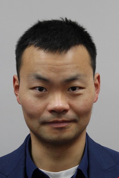
Dr. Ruoyu Jin serves as Reader in Construction Management and Technology at Brunel University's Civil and Environmental Engineering department within the College of Engineering, Design and Physical Sciences. Based in Howell Building 204, Dr. Jin can be reached at ruoyu.jin@brunel.ac.uk or by phone at +44 (0)1895 267703. Dr. Jin's research spans two primary domains: sustainable construction materials and digital construction safety. In sustainable construction, the focus is on recycled aggregate concrete, circular economy practices in construction & demolition (C&D) waste management, and Industry 4.0/5.0-featured digital technologies for C&D waste reuse. This research has yielded over 80 peer-reviewed journal articles, two book chapters, and editing one book. Notably, a research paper on C&D waste diversion earned the Most Cited Paper Award of Year 2019 in Journal of Resources, Conservation, and Recycling, while another paper received the Highly Cited Paper designation in Web of Science. In construction safety management, Dr. Jin has over ten years of practical and research experience developing digital solutions, particularly Building Information Modelling (BIM) and immersive technologies, as early-stage interventions for workforce education and pre-construction safety planning in the post-pandemic era. The interdisciplinary approach integrates artificial intelligence, construction engineering, and cognitive psychology to create interoperable digital platforms that improve safety perception and inform behavioral reactions. Dr. Jin has secured multiple research grants as Principal or Co-Investigator, including projects from the Global Challenges Research Fund, British Council Enabling Grants, Harold Samuel Research Prize, and Royal Society UK. Current PhD supervision topics include developing methodological frameworks for Industry 5.0-featured construction safety education, evaluating AI-driven building design effectiveness, and exploring digital circular economy approaches for deconstruction waste management. Professional memberships include MCIOB (Chartered Institute of Building) and FHEA (Fellowship of the Higher Education Academy), reflecting commitment to both professional practice and academic excellence in construction management and technology.
Dr. Stavros Sakellariou serves as a Research Fellow (Marie Curie) in Civil and Environmental Engineering at Brunel University London's College of Engineering, Design and Physical Sciences. His expertise centers on geospatial analysis of natural disasters, particularly wildfires and droughts, leveraging remote sensing and AI for risk management. His educational background includes: PhD in Environmental Hazards Management and Spatial Planning, University of Thessaly (2016) MSc in Geospatial Technologies (Erasmus Mundus Joint Degree), 2016 MSc in Spatial Planning & Development, University of Thessaly (2010) MEng in Spatial Planning and Regional Development, University of Thessaly (2008) Dr. Sakellariou's research integrates geographic information systems , remote sensing , and artificial intelligence to address wildfire dynamics, drought/flood modeling, and climate change impacts. His work emphasizes spatial decision support systems for disaster prevention and resilience engineering in Mediterranean ecosystems, with significant contributions to early warning frameworks and urban-wildland interface safety. Recent publications reveal a concentrated focus on wildfire risk assessment (40% of works), drought monitoring (30%), and climate adaptation modeling (20%), predominantly utilizing satellite data fusion and spatiotemporal analytics. Key innovations include optimization methods for firefighting resource deployment and vulnerability assessments of agroecosystems. His accolades include: Marie Skłodowska-Curie Postdoctoral Fellowship (FIREWISE project, 2024) 7 national/international scholarships and awards With 11.5 years of teaching experience across undergraduate and master's programs at Greek universities, he has contributed to 8 multi-partner research projects on disaster management. His service includes reviewing for 25+ journals and guest-editing special issues on natural hazards. Current work centers on the FIREWISE project's integrated framework for proactive wildfire resilience.
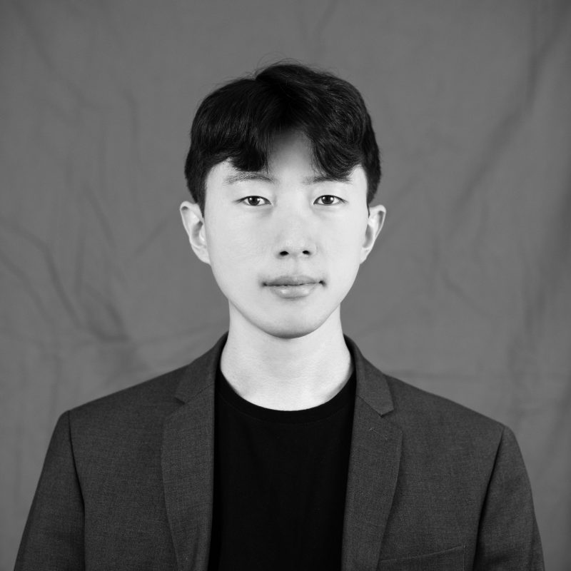
Jaeyoung Ha is an Assistant Professor in Landscape Architecture at Virginia Tech's School of Design. His research focuses on the intersection of environments and human well-being, leveraging immersive visualization technologies, and advancing climate resilience strategies. Ph.D. in Environmental Design and Planning, Kansas State University Master of Landscape Architecture (MLA), Seoul National University Bachelor of Science in Landscape Architecture, Pusan National University Mental Well-being: Investigates how landscapes influence psychological restoration through biodiversity and spatial patterns, employing VR experiments and observational studies. Immersive Visualization: Pioneers AR/VR applications in landscape education and design decision-making. Climate Resilience: Conducts interdisciplinary research on green infrastructure and urban heat island mitigation. His 15 most recent publications span 2017–2025, with recurring themes of mental health assessment , 3D urban morphology , multisensory landscape evaluation , and ecosystem services quantification . Articles combine theoretical exploration and data-driven methodologies across diverse urban contexts.
Dr. Pedro Trapero Fernandez is a Postdoctoral Researcher at the University of Cádiz, affiliated with the Department of History, Geography and Philosophy and the Institute of Viticulture and Agri-Food Research (IVAGRO). He leads the HUM240 Historical Heritage of Andalusia in Antiquity research group and specializes in Ancient History, with particular focus on Roman viticulture, landscape archaeology, and geospatial analysis. PhD in Ancient History and Archaeology (2020) with thesis on Roman Viticulture in the Hasta Regia and the Guadalquivir Estuary Research expertise in non-invasive techniques: GIS, drones, ground-penetrating radar, magnetometry Active academic collaborations with international institutions including FORTH (Greece) His research integrates classical agronomic texts like Columella with modern geospatial technologies to reconstruct ancient agricultural practices and mobility networks. Key projects include Roman road network analysis, viticulture modeling, and archaeological applications of GIS in Spain and Portugal. He has contributed to coastal and inland connectivity studies in Roman and Medieval contexts. Scientific publications demonstrate technical proficiency in geophysical prospecting and historical modeling. Notable works include: GIS applications for Roman property surveying, multidisciplinary analysis of wine production, and innovative methodologies for studying ancient transportation networks. As an educator, he has taught at undergraduate and master's levels through predoctoral contracts and developed flipped classroom methodologies for humanities teaching. Current affiliations include the Agustín de Horozco Seminar on Economic Studies and multiple international research partnerships.
Cristina Azevedo Gomes is a full-time Researcher and Coordinating Professor at the School of Education of Viseu , Polytechnic Institute of Viseu, Portugal. She has held leadership roles including President of the institution (2021–present) and Coordinator of the ICT Competence Center (2021–present). Her career spans three decades at the same institution, holding roles like Assistant Professor (1984–2005) and Adjunct Teacher (1992–2005). Education : PhD in Computer Engineering (2001), University of Coimbra Master’s in Systems and Information Technology in Education (1991), University of Coimbra Bachelor’s in Chemistry (1983), University of Coimbra Research Interests : Her work bridges Educational Technology , Robotics in Early Education , and Multisensory Learning . She focuses on digital tools for environmental education, intergenerational inclusion via apps, and algorithmic thinking in primary schools. Projects like GreenCode , MindMaths , and VIAS highlight her commitment to eco-friendly tech and social innovation. Publications & Projects : Over 15 recent articles analyze trends in mobile sensors for school health , gender dynamics in STEM , and pedagogical ICT integration . She has led EU-funded initiatives (Erasmus+, FEDER) and coordinated national programs like NÓNIO-SÉCULO XXI . Awards : António Vaquero Award (2016, 2018) Supervision & Leadership : She mentors Master’s students in education and communication, with 20+ theses supervised (2004–2023). She leads the Smart City Lab for Kids and has designed frameworks for multisensory educational software evaluation.
Dr. Farhana Sajjad is a Senior Lecturer in Marketing at the University of Surrey, School of Business and Economics, with a focus on interdisciplinary research at the intersection of marketing and information systems. She serves as Director of Student Success and Programme Director for the MSc. Strategic Marketing (2022–2025). PhD, MSc, MBA, BSc (Hon) in related fields Senior Fellow of Higher Education Academy (SFHEA) Certified Management and Business Educator (CMBE) Her research explores digital marketing, social media, technology adoption, and decision-making processes in retail contexts. Projects include improving visual usability in SurreyLearn and developing pre-arrival modules for student experience. Scientific awards include: Senior Fellow of Higher Education Academy (SFHEA) Certified Management and Business Educator (CMBE) Farhana supervises postgraduate research and has contributed to EU FP7 ICT-funded projects (2010–2012) on digital government and policy-making. She is affiliated with the UK Advising and Tutoring Association (UKAT) and certified as a Mental Health First Aider.
Duygu DURMUŞ serves as a full-time Lecturer in the Handicrafts Department at Kazım Karabekir Technical Sciences Vocational School , Kafkas University since 2021. Her academic foundation includes a Master's Degree in History from Kafkas University (2019) focusing on Urartian burial traditions, and a BA in Archaeology and Art History from Pamukkale University (2013). Education Background: MA, History, Kafkas University, Faculty of Arts and Sciences (2016-2019) BA, Archaeology and Art History, Pamukkale University, Faculty of Humanities and Social Sciences (2009-2013) Research Expertise: Dr. DURMUŞ specializes in Ancient History and Art History with concentrated research on the Urartian Kingdom, Bronze/Iron Age archaeology, and cultural heritage of the Aras Basin. Her methodological approach blends traditional field surveys with digital reconstruction techniques, particularly examining settlement patterns, burial mounds (kurgans), rock carvings, and ancient water systems. Recent work demonstrates increasing interdisciplinary integration of historical analysis, 3D modeling, and cultural studies. Publication Trends: Her 13 publications (2022-2025) reveal a consistent focus on Eastern Anatolian archaeology, with growing emphasis on Minuahinili culture, Urartian religious practices, and cultural route mapping. The works show methodological evolution from site-specific analyses toward regional synthesis and digital documentation, particularly evident in 2024-2025 outputs. Research Projects: As active researcher in four projects: Investigation of Defense Systems in Turkish-Russian Conflicts (2025-2027) Ancient Water Systems in the Middle Aras Basin (2025-2026) Urartian Surface Surveys in Ağrı-Iğdır (2019-2022) Her fieldwork directly informs publications on settlement models and kurgan traditions. Teaching & Professional Engagement: Instructs Atatürk's Principles across multiple faculties while presenting research at national conferences including the Aras Culture and Art Symposium (2022) and Çatalhöyük Scientific Congress (2025). Her scholarly impact is reflected in 18 citations and an h-index of 3.
Dr. Vonzell Agosto is a Professor of Educational Leadership and Policy Studies and Affiliate Faculty in Women and Gender Studies at the University of South Florida (USF). Her research bridges curriculum leadership, disability studies, and cultural studies, with a focus on intersectional equity and critical race theory. University: University of South Florida School: College of Education Department: Educational Leadership and Policy Studies Email: vagosto@usf.edu Her work interrogates the intersections of race, gender, and disability in educational systems, using methodologies like historiartgraphy, critical counter-cartographies, and virtual performative inquiry. She has published in journals such as Educational Researcher , Teachers College Record , and Race, Ethnicity & Education . Dr. Agosto’s recent publications explore virtual mentoring, critical race media literacy, and aesthetic leadership, reflecting a trajectory toward innovative pedagogies and dismantling systemic inequities. Key themes include racialized labor, cultural symbolism, and policy-driven activism. She has served as Principal or Co-Principal Investigator on grants totaling $4.3 million, focusing on projects like The BEST Way (Black males in healthcare), Advancing Leadership for Intersectional Equity , and PlayFL: Transformative Theatrics . Dr. Agosto is also Associate Editor of the Journal of Curriculum and Pedagogy .
Mathieu Brédif is a Permanent Researcher at LASTIG, Gustave Eiffel University, affiliated with the National School of Geographic Sciences (ENSG) and IGN. He serves as co-chair of ISPRS Working Group II/3 on Point Cloud Processing (2016-2020) and chaired ISPRS Working Group III/5 on Graphics and Remote Sensing (2012-2016). His academic appointments include Assistant Professor at École Polytechnique teaching Image Analysis and Computer Vision (INF573) and 3D Computer Graphics (INF443) since 2019-2020. Telecom ParisTech PhD (2005-2010) Stanford University Master in Computer Science (2004) École Polytechnique Engineering Degree (2000-2005) Brédif's research focuses on Lidar processing, 3D reconstruction, and geovisualization , with significant contributions to point cloud analysis, urban scene modeling, and historical image integration. His work bridges computer vision, photogrammetry, and geographic information systems, emphasizing practical applications in urban planning and cultural heritage. He has developed novel algorithms for point cloud inpainting, visibility estimation, and distributed 3D reconstruction. His publications reveal consistent focus on urban modeling through point cloud processing (58% of works), image-based rendering techniques (22%), and geovisualization systems (15%). The research trajectory shows increasing emphasis on deep learning applications for LiDAR data since 2016, alongside continued development of geometric algorithms for photogrammetric processing. ANR project leadership in geospatial data valorization (structurAtion et vaLorisation du patrimoinE géoGraphique - 9) iSpace&Time 4D web GIS development (5) European project participation in high-volume point cloud analysis (8) Brédif actively mentors doctoral candidates, currently supervising Melvin Hersent, Alexane Nghien, and Florent Geniet, with 8 completed PhDs including Pierre Biasutti and Murat Yirci. His laboratory work centers on the GEOVIS research team , developing the iTowns open-source framework for 3D geospatial visualization, which powers the Géoportail's 3D data engine and supports multiple ANR projects in cultural heritage visualization.
Dr. hab. Lidiya Dubis serves as Professor in the Department of Landscape Shaping and Design at John Paul II Catholic University of Lublin (KUL), operating within the Institute of Mathematics, Informatics and Landscape Architecture under the Faculty of Natural and Technical Sciences. Her institutional address is Konstantynów 1 H, 20-708 Lublin, with active supervision of diploma theses and research projects focused on Eastern European spatial dynamics. Her research centers on landscape architecture and spatial development, investigating how terrain morphology and geodiversity shape urban-rural planning. She examines tourism potential in protected areas, particularly Ukraine-Poland border regions, with emphasis on geotourism infrastructure and sustainable development. Her interdisciplinary approach integrates geomorphological analysis with practical spatial planning applications across Carpathian and Polesie ecosystems. Publication analysis reveals consistent focus on transboundary geotourism development, with recurring themes of geological heritage conservation and climate-terrain interactions. Her work bridges academic research and policy through the Polish Academy of Sciences' Task Force for Rural Areas, demonstrating practical application of landscape architecture principles in regional development contexts. Professor Dubis has supervised over 40 diploma theses (2016-2021) on spatial development concepts for Polish communes, village planning, and water reservoir tourism. Her research collaborations span Ukraine and Belarus, notably in the planned international Polissia Geopark project. She actively participates in conferences like the International Scientific Conference 'Geography, Economics and Tourism' while contributing to national spatial planning frameworks. As member of the Polish Academy of Sciences' Task Force for Rural Areas, she influences national spatial development policies. Her current work emphasizes transboundary cooperation for geological heritage conservation, particularly through the Ukraine-Poland-Belarus Polissia Geopark initiative, while addressing climate change impacts on landscape evolution in Eastern European regions.
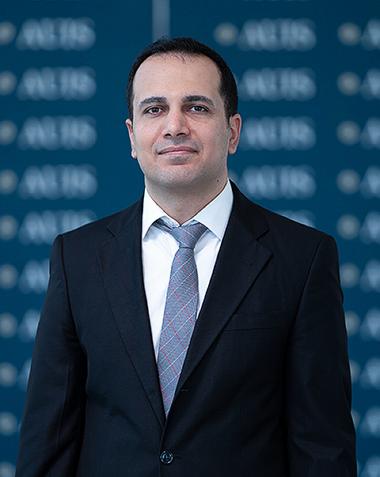
Mustafa Alattar serves as an Assistant Professor in the Department of Engineering at the American University of Iraq, Sulaimani (AUIS), where he has been employed since 2021. He holds a Ph.D. in Civil Engineering from Lehigh University (USA) and an M.A. from the University of Babylon. His academic qualifications include: Ph.D. in Civil Engineering, Lehigh University, USA M.A., University of Babylon, Iraq Dr. Alattar's research centers on hydrology with specialized focus on surface water-groundwater interactions, employing advanced modeling frameworks like MODFLOW-OWHM to analyze water budgets across the United States and Iraq. His work addresses critical water resource challenges including baseflow recession dynamics, groundwater mapping through multi-source data integration, and climate variable impacts on regional hydrology. Recent publications demonstrate increasing emphasis on Iraq's water systems, particularly groundwater dynamics in the Euphrates basin and climate analysis of precipitation-temperature patterns. His 11 publications from 2013-2024 reveal a clear research trajectory: early work focused on flood routing in Iraqi rivers using Saint Venant equations, evolving into large-scale US water budget modeling, and culminating in recent composite modeling approaches for baseflow analysis and Iraq-specific groundwater dynamics. The consistent thread is integrated hydrological modeling addressing both theoretical advancements (e.g., composite Boussinesq equations) and practical water management applications in data-scarce regions. No scientific awards are documented in the available information. The provided materials do not indicate any student advisees or research grant funding. Professional activities include membership in the American Geophysical Union where he presents research annually. Prior to AUIS, he served as research/teaching assistant at Lehigh University and the Institute of Technology in Baghdad, plus industry experience as a CAD Engineer for Nippon Koei Co., Ltd. on Iraqi infrastructure projects.
Prof. Monika Sester is a distinguished Professor and Executive Director of the Institute of Cartography and Geoinformatics at Leibniz University Hannover, within the Faculty of Civil Engineering and Geodetic Science. She also serves as Spokesperson for the Leibniz Research Center FZ:GEO and holds multiple leadership roles including Faculty Information Officer (FIO) for the Faculty of Civil Engineering and Geodetic Science, Ombudsman for Good Scientific Practice, and Exchange Coordinator for Geodetic Science and Geoinformatics. Her research focuses on the intersection of geospatial information science, cartography, and urban mobility. Prof. Sester's work spans several key areas: Geospatial data processing and analysis Cartographic representation and visualization Urban mobility and transportation systems Spatial data uncertainty and quality Digital mapping technologies and applications Historical map analysis and interpretation Prof. Sester's recent publications demonstrate a strong focus on applying advanced computational techniques to geospatial problems. Her work shows increasing emphasis on machine learning applications for map analysis, urban mobility optimization, and 3D spatial modeling. She has been particularly active in researching applications of deep learning for historical map interpretation, urban mobility patterns, and spatial uncertainty visualization. Her contributions to the field have been recognized through leadership positions in major research initiatives: Executive Director, Institute of Cartography and Geoinformatics Spokesperson, Leibniz Research Center FZ:GEO Faculty Information Officer, Faculty of Civil Engineering and Geodetic Science Ombudsman for Good Scientific Practice Member of multiple academic committees including the Admissions and Examination Board Prof. Sester actively collaborates with students and researchers across multiple projects focused on geospatial information systems, urban mobility, and cartographic visualization. Her leadership extends to guiding research directions within the Leibniz Research Center FZ:GEO, which brings together interdisciplinary expertise to address complex spatial challenges.