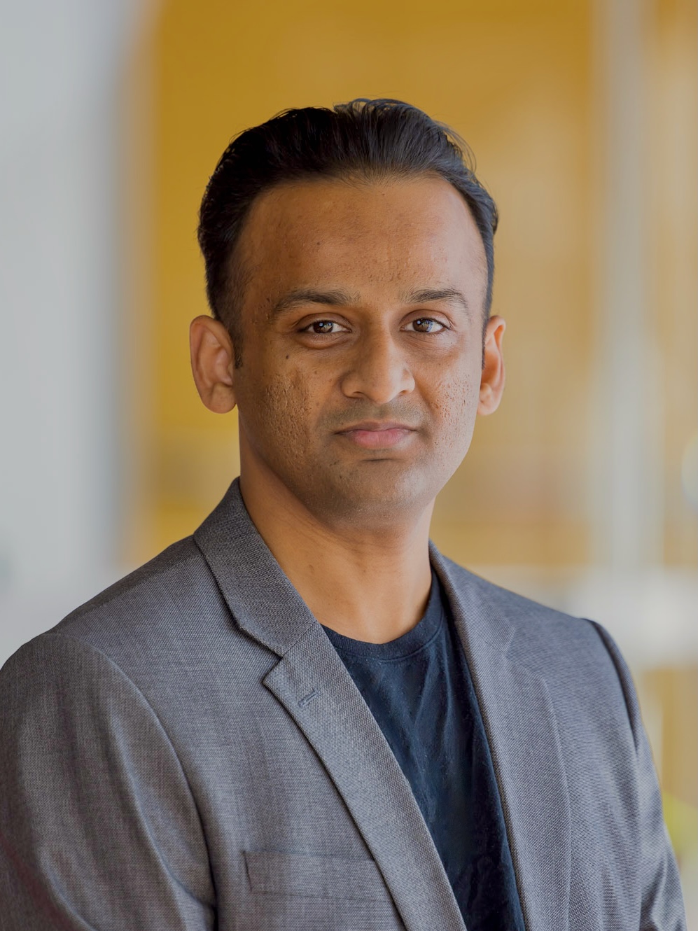
Dr. Zhang Wei is a Grant-Funded Researcher (C) at the University of Adelaide's School of Economics and Public Policy, affiliated with the Future of Employment and Skills Research Centre. He holds a PhD in economics and has held roles including Associate Lecturer at the University of Adelaide and Senior Research Fellow at Flinders University's National Institute of Labour Studies. His research focuses on labour economics, health economics, education economics, international trade, and applied game theory. Current projects include evaluations of the National Disability Insurance Scheme, impacts of ageing populations on productivity, job mismatches, and education's role in labour markets. Education: PhD in economics (thesis on multilateral vs. bilateral trade liberalisation) Research interests span policy-relevant areas such as workforce dynamics, healthcare economics, and trade agreements. He has contributed to projects funded by ARC/NHMRC, NCVER, and government departments, addressing topics like retirement policy, VET completers' job mobility, and economic security. Supervision eligibility includes co-supervision for Masters/PhD candidates.
Dr. Song Cheen is a Research Fellow at the Microbiome Research Centre, School of Pharmacy, Monash University Malaysia. His work focuses on health informatics, bioinformatics, and machine learning applications in healthcare. He earned a PhD in Bioinformatics (2021–2024) and a BSc (Hons) in Bioinformatics (2015–2018), both from University of Malaya. Education: PhD in Bioinformatics, University of Malaya (2021–2024) BSc (Hons) in Bioinformatics, University of Malaya (2015–2018) Research interests include the human microbiome’s role in health/disease, predictive modeling, and AI-driven healthcare solutions. Current projects investigate microbiome responses to probiotics, alcohol effects on gut microbiota, and FOS supplementation in elderly populations. Projects (2025–2026): Protein/Probiotics supplementation’s impact on faecal microbial composition Alcohol’s effects on gut microbiota and probiotic protection FOS supplementation for underprivileged elderly gut health Advising/Grants: Collaborator on multiple grants focused on microbiome research and healthcare analytics. No formal student advisees listed. Labs/Teams: Active contributor to the Microbiome Research Centre. Work aligns with UN SDGs related to health and innovation.
Dr. Balamurugan Soundararaj is a Research Fellow at the City Futures Research Centre, University of New South Wales (UNSW), specializing in geospatial analysis, urban planning, and data visualization. With 8 years of experience in academia and industry, he contributes cutting-edge research to digital valuation models, predictive analytics, and spatio-temporal urban studies. His work integrates machine learning and geospatial technologies to address property market dynamics, transportation systems, and smart city challenges. Fields of Interest: Urban and Regional Planning Geospatial Data Modeling Information Visualization Spatial Statistics Human Geography Grants: 2021: API Australian Property Research and Education Fund Grant for 'Towards understanding regional property markets' 2021: ADA Faculty Research Partnership Scheme Grant for Steiner/Montessori school system research 2018: UCL Yusuf Ali Travel Grant for Complex Systems Conference presentation Scientific Recognition: 2019: Best Paper (Early Career Researcher), GIS Research UK 2015: Best Paper, Construction Track, RICS Annual Conference His research employs advanced analytical methods to visualize and model large-scale spatial data, focusing on transparent communication of complex urban systems. Key publications analyze bikeability improvements, property market tools, and footfall dynamics using Wi-Fi signals.
David Andrew McMeekin is an academic researcher in the field of Computer Science , focusing on the human aspects of software development . His work extends to international NGOs in development and education sectors. Current research explores the use of Semantic Web Technologies for delivering spatial information and developing technology solutions to support Autism Spectrum workforce integration. Fields of Interest : Human-Computer Interaction, Semantic Web Technologies, Spatial Information Systems, Autism Spectrum Support, Software Engineering, Cultural Heritage Technology. Publication Trends : His recent work intersects Virtual Heritage , Photogrammetry , and Semantic Web applications, emphasizing immersive technologies like Mixed Reality and 3D Reconstruction . Collaborative approaches in Geospatial Analysis and Digital Humanities also feature prominently.
Mary Lorraine Mationg serves as an Honorary Lecturer at the National Centre for Epidemiology and Population Health (NCEPH), Australian National University, within the Department of Applied Epidemiology. Her academic role focuses on advancing population health research with particular emphasis on Southeast Asian contexts. Her research spans epidemiology, parasitology, and public health interventions with exceptional geographic specificity. Primary interests include helminth infections (schistosomiasis, soil-transmitted helminthiases), HIV/AIDS epidemiology in the Asia-Pacific, and culturally adapted health education . She pioneered the “Magic Glasses” approach – a gamified visual learning system for schoolchildren targeting intestinal worm prevention in the Philippines, now implemented across Southeast Asia. Analysis of her 15 most recent publications (2021-2025) reveals three dominant research streams: (1) Development and validation of field diagnostics for parasitic diseases, (2) Rigorous evaluation of the “Magic Glasses” intervention through cluster RCTs and cost analyses, and (3) HIV epidemiology among key populations in the Philippines. Her work consistently bridges laboratory science, behavioral research, and policy implementation with 87% of publications focused on Philippine-specific contexts. Scientific Recognition No specific awards were documented in source materials Academic Leadership While no formal student advising is documented, her publications indicate collaborative leadership across Southeast Asian research networks. Current projects involve multi-country One Health initiatives targeting Opisthorchis viverrini elimination through the “Magic Glasses Lower Mekong” adaptation. Research Infrastructure Her work operates within ANU’s NCEPH framework but leverages extensive field partnerships with Philippine Department of Health units, regional universities, and WHO collaborating centers for tropical disease research.
Dr. Mitko Aleksandrov serves as a Casual Academic and Research Associate at the University of New South Wales (UNSW), working with Geospatial Research Innovations and Development (GRID) within the School of Built Environment under the Faculty of Arts, Design & Architecture. With specialized expertise in geospatial information systems and three-dimensional modeling, Dr. Aleksandrov contributes to cutting-edge research in indoor navigation, spatial analysis, and building information modeling applications for urban planning and safety. Dr. Aleksandrov holds a Master's degree in GIS (Geographic Information Systems), though specific details about his educational institutions and timeline are not provided in the available information. His academic background has positioned him at the forefront of geospatial research with practical applications in built environments. Specializing in three-dimensional modeling and navigation systems for indoor environments, Dr. Aleksandrov's research spans geospatial analysis, building information modeling, and spatial data structures. His work focuses on evacuation planning, crowd simulation, and hazard detection through voxel-based representations of 3D spaces, visibility analysis, and the integration of BIM with geospatial data. His research bridges computer science, civil engineering, and urban design to create innovative solutions for complex spatial problems in built environments, particularly addressing safety and navigation challenges in complex buildings. Dr. Aleksandrov's publication record demonstrates a clear progression from foundational research on voxelization algorithms toward practical applications in evacuation planning and pedestrian safety. His recent work shows increasing interdisciplinary collaboration, integrating computer vision techniques with geospatial analysis to address urban challenges. He has made significant contributions to indoor navigation systems, 3D modeling for evacuation scenarios, and the application of voxel-based representations in building information modeling, with publications appearing in high-impact journals across geospatial science, computer science, and civil engineering domains. While specific awards are not mentioned in the available information, Dr. Aleksandrov's research impact is evidenced by his consistent publication record in reputable journals including Transactions in GIS, Journal of Spatial Science, and ISPRS Annals. His work has contributed to advancing methodologies in 3D geoinformation and spatial analysis for practical urban applications. Dr. Aleksandrov actively collaborates with researchers across UNSW and internationally, particularly with Sisi Zlatanova, Jennifer Barton, and other members of the geospatial research community. His publications indicate involvement in significant research projects, potentially including the CRC-LCL project referenced in his 2020 work. While specific student supervision details aren't provided, his research program suggests engagement with graduate students in the geospatial and built environment fields. Working with Geospatial Research Innovations and Development (GRID) at UNSW, Dr. Aleksandrov is part of a dynamic research team focused on advancing geospatial technologies for urban applications. His involvement in organizing academic conferences such as the 3D Geoinfo Conference and GEOINFORMATION for DISASTER MANAGEMENT demonstrates his leadership within the research community. His work with voxel-based modeling in UNITY3D suggests engagement with visualization technologies that bridge academic research and practical applications in urban planning and emergency response.
Dr. Yumeng Zhang is a Postdoctoral Research Fellow at the School of Mechanical and Mining Engineering, University of Queensland. His research focuses on structural analysis of tunnel linings, laser scanning applications, and mechanical behavior evaluation of underground structures. University of Queensland School of Mechanical and Mining Engineering PhD in Civil Engineering from Tongji University Research interests include: Tunnel structural reinforcement using stainless steel components Laser scanning for deformation tracking Hybrid analytical modeling techniques Seismic isolation material studies Joint mechanics in segmental tunnel linings Machine learning applications in construction materials Recent publications demonstrate expertise in structural diagnostics, material testing, and computational modeling for underground infrastructure. His work bridges experimental validation and numerical simulation across multiple geotechnical engineering challenges. Currently available for student supervision, Dr. Zhang specializes in tunnel engineering mechanics and contributes to advanced materials processing research. His publications span journals like Tunnelling and Underground Space Technology , Sensors , and Structural Concrete .
Dr. Edi Nuryatno is a Senior Lecturer at The Adisutjipto Institute of Aerospace Technology and holds adjunct roles at National Institute of Technology and National Research and Innovation Agency. His primary affiliation is with The University of Western Australia. He specializes in Health Informatics, Clinical Algorithms, Digital Health, and Urban Health. Graduated with a PhD in MIS from Edith Cowan University, he has received prestigious awards including the 2024 Impact and Innovation Award and the iPREP WA Scholarship. Education: MIS, PhD - Doctor of Philosophy, Edith Cowan University Research Interests: Dr. Nuryatno’s work focuses on Health Informatics applications in clinical algorithms, digital health systems, and urban health management. His research integrates data science with healthcare operations, addressing challenges in medical asset tracking, vaccine distribution via blockchain, and AI-driven healthcare solutions. Recent projects include real-time arrhythmia detection and health passport systems. Publications: His recent work spans AI in healthcare asset management, blockchain for vaccine distribution, and YOLO-based medical imaging systems. These studies highlight trends in applying machine learning to improve healthcare logistics and diagnostic processes. Awards: Excellent in Research: 2024 High Commened - Impact and Innovation Award Industry and Research Engagement Program Western Australia (iPREP WA) International Postgraduate Research Scholarship (IPRS) - Edith Cowan University (ECU) Advising & Activities: Supervises Higher Degree by Research students at UWA. Actively contributes to global initiatives like the Asia-Europe AI Network (AE4AI), focusing on AI governance and sustainable development. Has delivered keynote speeches at international forums including the International Symposium on Medical Devices and Technology Innovation (2023). Labs/Teams: Collaborates with the UWA Medical School and leads projects under the AE4AI Network, emphasizing interdisciplinary AI applications in healthcare and urban systems.
Xinyu Li is a Research Fellow at the Department of Human Centred Computing, Monash University. Their work focuses on multimodal learning analytics, AI in education, and collaborative learning dynamics, contributing to UN Sustainable Development Goals through educational technology advancements. Key research areas include generative AI's impact on learning processes, self-regulated learning strategies, and spatial data analysis for educational systems. Over 27 peer-reviewed publications since 2021 demonstrate expertise in learning analytics, educational psychology, and computer science intersections. Recent studies examine metacognitive effects of AI tools, comparative analysis between ChatGPT and human experts in learning support, and temporal dynamics of collaborative learning through sensor data. Work also extends to spatial computing with road network query optimization and ethical challenges of large language models in education. Collaborations span global institutions, reflecting interdisciplinary reach in education technology. Publications have been widely disseminated via news outlets, social platforms, and academic networks, achieving significant readership on Mendeley. Research bridges technical innovations (e.g., FLoRA Engine, VizChat systems) with educational outcomes, emphasizing practical deployments and real-world impact through field trials and randomized controlled trials.
Dr. Ioana A. Dumitru is an Associate Lecturer in the Department of Archaeology at The University of Sydney. Her research bridges the climate-environment-society nexus, focusing on responses to extreme climatic events, resource exploitation, and human-environment interactions across the Indian Ocean World, particularly in Arabia and East Africa. Ioana is a digital landscape archaeologist employing GIS, remote sensing, and social network analysis to model ancient human-environment dynamics. Her work spans projects in Romania, Turkey, Cyprus, Peru, Micronesia, Sudan, and the US. Current Research: Social resilience during the Late Antique Little Ice Age. Teaching: Courses in Social Archaeology, Human-Environment Interactions, and Digital Mapping. Scientific Awards: 2024 Faculty of Arts and Social Sciences Teaching Excellence Award (Commendation), The University of Sydney 2014 Cornelia G. Harcum Scholarship, Johns Hopkins University Her grants include the 2023 U21/ARUA Collaborative Award for 'Dynamic Coasts and Landscapes of Resilience' and a 2023 Provost’s CAPEX Fund grant for the 'Vere Gordon Childe ExoLab.'
Dr. Kithsiri Perera is a Lecturer in Surveying and Spatial Science at the University of Southern Queensland's School of Surveying and Built Environment. He holds an MEng and PhD from Chiba University. His research focuses on remote sensing, GIS applications, environmental management, and disaster mitigation, with a particular emphasis on land use analysis and spatial data science. Dr. Perera has contributed extensively to understanding human-elephant conflict dynamics in Sri Lanka using satellite imagery, flood mapping with SAR data, and bushfire warning systems leveraging social media. His work bridges geospatial technologies with real-world environmental and societal challenges. Education: MEng, Chiba University PhD, Chiba University Research Interests: Remote sensing and GIS for environmental monitoring Disaster risk reduction and mitigation Land cover/land use change analysis Wildlife conservation strategies Sustainable infrastructure planning in developing countries Recent Article Trends: His recent work emphasizes integrating satellite data (e.g., Sentinel-2, MODIS) with GIS for conflict mitigation, flood modeling, and climate change impacts. He also explores geospatial education for civil engineers and digital health record systems in Sri Lanka. Awards: No scientific awards explicitly mentioned. Grants & Advising: No grants or advising details provided in the text. His contributions are primarily through research publications.
Fayez Tarsha Kurdi is a Researcher at the School of Surveying and Built Environment, University of Southern Queensland. He holds a PhD from the University of Strasbourg. His research focuses on advancing LiDAR technology applications in 3D modeling, building extraction, and geospatial analysis. Key areas include airborne LiDAR for urban infrastructure mapping, SLAM scanner accuracy assessments, and biomass volume calculations using LiDAR data. He has extensively explored matrixial representation of point clouds and automated feature extraction algorithms. Education: PhD (Strasbourg) in Geomatics Engineering, with a focus on LiDAR applications. Research Interests: Remote Sensing and 3D Modelling Automated Building Extraction from LiDAR Machine Learning in Geospatial Data Analysis SLAM Scanner Technologies Urban and Forest LiDAR Applications Publications: Over 30 peer-reviewed articles since 2007, with recent works emphasizing LiDAR-based innovations in building modeling, vegetation analysis, and 3D reconstruction methodologies. Notable contributions include novel approaches for complex architectural structures and biomass quantification. Advising/Grants: No formal advising roles or grants mentioned in the provided texts. Labs/Teams: Affiliated with the School’s LiDAR and 3D Modelling research group, though specific lab details are not elaborated.
Subhashni Taylor is a researcher at James Cook University, with a focus on mathematics education and climate change impacts. Her work spans pedagogical strategies, environmental science, and sustainability education. Research Themes: Mathematics education, science teaching, biodiversity conservation, climate change adaptation. Key Collaborators: Neil Taylor, Philemon Chigeza, Nadya Rizk, Lalit Kumar. Recent Publications highlight innovations in mathematics teaching (e.g., procedural flowcharts, concept mapping), climate change vulnerability assessments, and teacher development frameworks. Her studies emphasize interdisciplinary approaches, linking education with ecological challenges. Methodological Expertise includes curriculum design, ecological modeling (CLIMEX), and geospatial analysis for biodiversity forecasting. She has contributed to science education journals and environmental science publications.
Dr. Debaditya Acharya is a Lecturer in Geospatial Science at RMIT University's School of Science, where he teaches Remote Sensing and Photogrammetry. His research focuses on computer vision, machine learning, and 3D building modeling, with applications in indoor localization, augmented reality, and LiDAR technologies. He holds a PhD from the University of Melbourne (Australia), where his thesis addressed visual sensing for infrastructure-free indoor positioning using 3D models. Prior to his current role, he worked as a CSIRO Postdoctoral Fellow in the Machine Learning & AI Future Science Platform and as a postdoctoral researcher at RMIT, focusing on fisheries anomaly detection and food automation via deep learning. Key projects include developing the ISPRS benchmark for indoor modeling, 3D reconstruction of the Royal Exhibition Building using LiDAR, and pedestrian tracking frameworks for the Queen Victoria Market. His work emphasizes open-source solutions for spatial digital twins and geospatial data integration in data-scarce regions. Debaditya is actively involved in supervising research students at the Masters and PhD levels, particularly in smart city frameworks leveraging digital twins, IoT, and augmented reality applications.
Matt Duckham is a Professor in Geospatial Sciences and Director of the Information in Society Enabling Impact Platform at RMIT University. He has held previous academic roles at the University of Melbourne as an Australian Research Council Future Fellow and at the University of Maine's National Center for Geographic Information and Analysis. His work bridges theoretical and applied GIScience, with a focus on AI integration and spatial knowledge infrastructure. Academic Leadership: Director, Information in Society EIP (2021–present); Acting Dean, STEMM Diversity and Inclusion (2020–2021) Research Themes: Geospatial AI, Qualitative Spatial Reasoning, Decentralized Geosensor Networks, Spatial Data Trusts Recent Publications demonstrate his commitment to advancing spatial computing through machine learning integration and explainable AI frameworks. His teaching resources include open-access textbook materials and practical exercises spanning relational spatial databases and data visualization. Professional Contributions include co-founding the Journal of Spatial Information Science and developing open educational resources under a Creative Commons Attribution license. His work addresses critical issues in data ethics , urban resilience , and emergency response systems .