معرفی
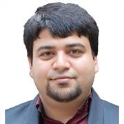
Dr. Debaditya Acharya is a Lecturer in Geospatial Science at RMIT University's School of Science, where he teaches Remote Sensing and Photogrammetry. His research focuses on computer vision, machine learning, and 3D building modeling, with applications in indoor localization, augmented reality, and LiDAR technologies.
He holds a PhD from the University of Melbourne (Australia), where his thesis addressed visual sensing for infrastructure-free indoor positioning using 3D models. Prior to his current role, he worked as a CSIRO Postdoctoral Fellow in the Machine Learning & AI Future Science Platform and as a postdoctoral researcher at RMIT, focusing on fisheries anomaly detection and food automation via deep learning.
Key projects include developing the ISPRS benchmark for indoor modeling, 3D reconstruction of the Royal Exhibition Building using LiDAR, and pedestrian tracking frameworks for the Queen Victoria Market. His work emphasizes open-source solutions for spatial digital twins and geospatial data integration in data-scarce regions.
Debaditya is actively involved in supervising research students at the Masters and PhD levels, particularly in smart city frameworks leveraging digital twins, IoT, and augmented reality applications.