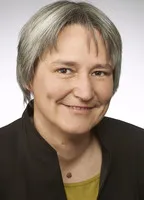
Yuliia Semenova is a Research Fellow at the Technical University of Munich (TUM), hosted by the TUM School of Engineering and Design and DGFI-TUM. Her research focuses on nonlinear ground behavior under seismic loads, with a specific emphasis on analyzing postseismic deformations at GNSS stations. Collaborating with Prof. Florian Seitz, her work aims to enhance the accuracy of the International Terrestrial Reference System (ITRS), a global coordinate framework critical for GPS and navigation. This research improves the modeling of ground instability during earthquakes, directly contributing to the stability and precision of global positioning systems. Her project integrates geophysical and geodetic methodologies to identify nonlinear ground effects through time-series analysis of GNSS data. This work bridges seismology and geodesy, addressing critical gaps in understanding post-earthquake ground behavior and its implications for infrastructure resilience. Host Institution: DGFI-TUM (Deutsches Geodätisches Forschungsinstitut) Fellowship: TUM-IAS Fellowship for Ukrainian Scientists (2022)
Roelof Rietbroek is an Assistant Professor in the Department of Water Resources at the University of Twente, Faculty of Geo-Information Science and Earth Observation. His research lies at the intersection of Earth observation, remote sensing, and geosciences, with a strong focus on climate-related phenomena such as sea-level rise, drought, flooding, and terrestrial water storage dynamics. Assistant Professor, Department of Water Resources, University of Twente Active researcher in Earth and Planetary Sciences with expertise in satellite gravimetry (GRACE), GNSS, and coastal remote sensing Contributor to open science through datasets and software (e.g., pygtide, shxarray, geoslurp) Collaborates internationally on climate adaptation, coastal hazards, and sustainable geoscience education His research interests span Earth Observation and Remote Sensing , Climate Change , GNSS Geodesy , Gravimetry , Sea Level Rise , and Terrestrial Water Storage . He leverages satellite data and geodetic techniques to monitor and model environmental changes, particularly in coastal and hydrological systems. His work integrates physical geodesy with hydrology and climate science to understand the impacts of global change. The analysis of his recent publications reveals a consistent focus on using space-based observations to address pressing environmental challenges. His articles span topics from coastal morphodynamics at Terschelling to global GNSS velocity fields and drought detection via water storage anomalies. The interdisciplinary nature of his work bridges geodesy, hydrology, and climate science, with increasing emphasis on open data, reproducibility, and educational integration. Scientific contributions and recognitions include: Active contributor to high-impact journals such as Natural Hazards and Earth System Sciences and International Journal of Sustainability in Higher Education Creator and maintainer of open-source tools: pygtide , shxarray , and geoslurp ORCID: 0000-0001-5276-5943 h-index of 21 with over 3,300 citations (Scopus) Rietbroek advises through collaborative research and supervises data and software development for environmental applications. His work is supported by institutional affiliations and access to advanced geospatial infrastructure. He is involved in educational innovation, particularly in integrating sustainability into geoscience curricula. He leads or contributes to data management frameworks that enable large-scale, cloud-based geoscientific analysis. He is a key figure in the geodetic and hydrological remote sensing community, with active research in both observational techniques and their application to societal challenges like climate adaptation and water security.
Fritz Kessler is a Teaching Professor in the Department of Geography at Pennsylvania State University, affiliated with the John A. Dutton e-Education Institute. He teaches online and residential courses in cartography, GIS, spatial statistics, and coordinate systems. Previously, he served as Professor and Chair of the Geography Department at Frostburg State University. He holds a Ph.D. in cartography from the University of Kansas (1999), under Dr. Terry Slocum. His research focuses on map projections, cartographic design, geospatial analysis, and qualitative methods. He has authored two influential books: *Thematic Cartography and Geovisualization* and *Working with Map Projections: A Guide to Their Selection*. His professional experience includes roles at USGS, Intergraph, and R.R. Donnelley & Sons. He actively contributes to the North American Cartographic Information Society (NACIS) and the Cartography and Geographic Information Science community. His work bridges academic research with practical applications, emphasizing geospatial education and geovisual analytics. Research interests extend to geospatial big data analytics and spatial modeling, with recent studies exploring pandemic impacts on cancer mortality and geodetic datum systems. His teaching innovations include embedding geovisual analytics in international education programs for adult learners.
Dr.-Ing. Jan Kodet is a researcher at the Geodetic Observatory Wettzell, affiliated with the Technical University of Munich (TUM), specifically within the Engineering Institute for Astronomical and Physical Geodesy. His work centers on advanced instrumentation and measurement techniques in space geodesy, including satellite laser ranging, VLBI, and ring laser interferometry for monitoring Earth's rotation. University: Technical University of Munich Research Institute: Engineering Institute for Astronomical and Physical Geodesy Observatory: Geodetic Observatory Wettzell Email: jan.kodet@tum.de His research interests span space geodesy, ring laser interferometry, time and frequency transfer, satellite tracking, and geodetic instrumentation. He develops high-precision systems for optical timing, photon counting, and co-location of geodetic techniques. His work contributes to global geodetic reference systems and fundamental metrology. The recent publications highlight a strong focus on measuring Earth's rotation using large ring lasers (e.g., ROMY), developing optical event timers for satellite ranging, and advancing VLBI techniques for satellite tracking. There is a clear trend toward integrating multiple geodetic techniques and achieving sub-picosecond timing precision for improved geodetic accuracy. Dr. Kodet has supervised master’s students, including Hanna, Maria (2022) on clock comparisons using event timers and Wong, Siow Kay (2018) on atomic clock synchronization via GNSS. His collaborative research involves institutions and projects like ESA, DFG (NEROGRAV, UPLIFT), and international geodetic networks. He is a key contributor to projects involving the Wettzell observatory, such as VGOS and fundamental station development. His work is supported by involvement in major research initiatives including the DFG Research Unit NEROGRAV and the DFG Research Training Group UPLIFT, indicating active grant funding and participation in structured research programs.
Anja Schlicht is a researcher at the Research Facility for Satellite Geodesy, Technical University of Munich, within the Engineering Institute for Astronomical and Physical Geodesy. She holds a Dr. rer. nat. and has made significant contributions to satellite geodesy, gravimetry, and time transfer technologies. University: Technical University of Munich School: Engineering Institute for Astronomical and Physical Geodesy Department: Research Facility for Satellite Geodesy Email: anja.schlicht@tum.de Her research focuses on precise orbit determination (POD), Earth's gravity field modeling, satellite accelerometer data analysis (GRACE, GOCE), and advanced time transfer using optical and microwave links in space missions such as ACES and Galileo. She is deeply involved in the European Laser Timing (ELT) experiment and the development of future geodetic reference systems like GETRIS. Recent publications highlight her work on combining optical and microwave observations for calibration, improving orbit accuracy through inter-satellite links, and simulating time transfer systems in space. Her research bridges geodesy, metrology, and fundamental physics, particularly in relativistic effects and clock synchronization. She has supervised numerous bachelor’s and master’s students, contributing to education in satellite geodesy and space applications. Her work is frequently presented at major conferences including the European Geosciences Union and International Laser Ranging Workshops. ESA Project MAGIC/Science ESA Project QSG4EMT DFG Research Unit NEROGRAV DFG Research Training Group UPLIFT ACES Mission (Atomic Clock Ensemble in Space) Anja Schlicht is an active researcher with a strong publication record and leadership in international geodetic projects, indicating sustained academic and scientific engagement.
Sander Varbla is a Postdoctoral Researcher at the Department of Civil Engineering and Architecture, School of Engineering, Tallinn University of Technology, and concurrently holds a postdoctoral fellowship at the Chair of Astronomical and Physical Geodesy, Technical University of Munich (2025–2027). His research spans geodesy, remote sensing, and civil engineering, with a focus on marine geoid modeling, satellite altimetry, and construction surveying technologies. His research interests include marine geoid refinement, satellite gravimetry, terrestrial and drone-based surveying, GNSS-UWB positioning, and the application of machine learning in geodetic data processing. He actively contributes to international geodetic standardization through memberships in EUREF, NKG, and the Baltic Sea Hydrographic Commission. His recent publications show a strong trend in integrating satellite data (e.g., SWOT mission) with in-situ measurements to improve marine geoid models, assess vertical land motion, and develop dynamic height references. He also investigates the quality of industrial-scale laser scanning for BIM applications and advances in underground utility mapping using low-cost sensors. Researcher of the Year, Department of Civil Engineering and Architecture, TalTech (2024) Best Research Article 2022, TalTech (2023) First Prize, National Contest for University Students (2023) ESRI Young Scholar Award (2017) CLGE Students' Contest Winner (2017) Varbla has supervised multiple Master’s theses at TalTech, focusing on drone photogrammetry, point cloud analysis, and construction surveying. He has been a lecturer in courses such as Construction Surveying and Theory of Processing Geodetic Measurements, and has led continuing education courses on UAV photogrammetry and terrestrial laser scanning. He is the principal investigator of the MarGeoid project and has participated in numerous national and EU-funded projects, including DYNAREF, BalMarGrav, and ESA initiatives. He has also contributed to major collaborative efforts such as the Baltic Sea Chart Datum 2000 and FAMOS Odin.
Dr. Philipp Zingerle is a researcher at the Chair of Astronomical & Physical Geodesy, Technical University of Munich, where he conducts advanced research in satellite gravimetry, global gravity field modeling, and future quantum-based gravity missions. He plays a key role in ESA projects such as MAGIC and QSG4EMT, as well as DFG-funded initiatives NEROGRAV and UPLIFT, contributing to next-generation Earth observation systems. Research Interests: His work focuses on high-resolution gravity field modeling (e.g., XGM series), time-variable gravity, quantum satellite missions, and integration of terrestrial and airborne data. He applies these to improve geoid determination, height systems, and monitoring of mass transport in the Earth system. The recent publications highlight a strong trend toward future quantum gravimetry missions, especially through the MAGIC and NGGM studies, emphasizing constellation design, error modeling, and hydrological applications. There is also sustained work on extending global models to higher spatial resolution (up to d/o 1440 and beyond) and improving regional solutions such as for Antarctica and North America via GRAV-D integration. Scientific Contributions: Lead and co-author of multiple high-impact journal papers on XGM models and satellite gravimetry. Active participant in international symposia including EGU, IUGG, and ESA Living Planet. Contributor to the realization of the International Height Reference System (IHRS). Advising and Research Leadership: He has supervised several bachelor’s and master’s theses, indicating an active role in student mentorship. He collaborates extensively with leading institutions and researchers across Europe and globally. While no formal awards are listed, his involvement in flagship projects underscores recognition in the geodetic community. Labs and Teams: He is embedded in the Satellite Geodesy Research Facility at TUM and contributes to multiple interdisciplinary teams including ESA MAGIC, DFG NEROGRAV, and UPLIFT, working closely with Prof. Roland Pail and other experts in geodesy and Earth observation.
Slavko Vasiljević is an Associate Professor at the Faculty of Architecture, Civil Engineering and Geodesy of the University of Banja Luka. Specializing in geodesy and geomatics, his work focuses on structural monitoring, GIS applications, cadastral systems, and geodetic network design. He has contributed to projects such as the establishment of the Republic of Srpska’s vertical reference framework and the geodetic monitoring of the Bočac Dam. His research spans geospatial data analysis, structural deformation measurement, and flood modeling. Notable work includes enhancing digital image quality using MATLAB and developing GIS models for population census analysis. He actively participates in international conferences, presenting on topics like geodetic control systems for high structures and spatial data paradigms. Projects: Led and collaborated on projects involving architectural heritage documentation, mineral detection in agriculture via remote sensing, and academic excellence in geoinformatics. Awards: Received the First Prize in the category of environmental protection and landscape architecture for the Arboretum project in Banja Luka. His interdisciplinary work bridges geodesy with civil engineering, environmental science, and urban planning, contributing to infrastructure development and disaster management strategies.
Laura Balangé is a doctoral researcher at the University of Stuttgart's Institute of Engineering Geodesy (IIGS), Faculty 6: Aerospace Engineering and Geodesy. She contributes to the Cluster of Excellence IntCDC through computational design and quality assurance research. Her work focuses on: Holistic Quality Modeling for sustainable construction Terrestrial Laser Scanning applications Coreless Filament Winding fabrication Modular Timber Shell structures Graded Concrete component monitoring Multi-Domain Co-Design frameworks Notable contributions include: 2025: Point cloud datasets for Biomimetic Shell construction 2024: Extended interrelation analysis in quality modeling 2023: Data normalization methods for co-design 2022: Production monitoring for fibrous structures 2021: Graded concrete component verification 2020: Foundational technical quality concepts She supervises academic works in: Geometric quality control Fiber cross-section analysis BIM modeling Neural network object detection Concrete positioning systems Timber fabrication quality Active in the IntCDC cluster, she collaborates with teams across architecture, engineering, and computational design domains.
Prof. Dr.-Ing. Boris Resnik is a full professor at Berlin University of Technology (BHT Berlin) in the Department of Civil Engineering and Geoinformation. Born in 1960 in Leningrad, he holds a diploma in Geodesy from the Leningrad Mining Institute (1982) and a doctorate from VNIMI (1990). His academic career spans over two decades at BHT Berlin, with prior positions at Rostock University and Brandenburg Technical University Cottbus. His research focuses on: Geodetic monitoring and deformation analysis Structural health assessment of wind turbine foundations AI and neural network applications in structural monitoring Sensor technologies (MEMS, accelerometers, inclinometers) Automated early warning systems for infrastructure He leads significant projects including the IFAF-funded WEsaFE (2014-2016) on wind turbine foundation monitoring and the DAAD Eastern Partnerships initiative (2018-2023) with Central Asian universities. Publication analysis shows a strong evolution toward AI-driven methodologies since 2019, with recent works focusing on neural networks for real-time structural monitoring, vehicle classification, and vibration analysis. His 2023-2025 publications demonstrate increasing integration of drone-based thermography and advanced sensor networks. No scientific awards are documented in the provided materials. Contact is maintained through resnik@bht-berlin.de, with office at Building D (Civil Engineering) Room D 422.
Dr. Jim Lovell serves as an Adjunct Senior Researcher in the Physics department within the School of Natural Sciences at the University of Tasmania. His research focuses on galactic astronomy, cosmology, extragalactic astronomy, and geodesy, utilizing advanced radio astronomy techniques and Very Long Baseline Interferometry (VLBI). He operates from the 464 Maths-Physics Building on the Sandy Bay Campus in Tasmania. His research interests center on galactic structure and evolution , cosmological reference frames , and geodetic applications of radio astronomy . Lovell employs VLBI arrays including the AuScope network to study interstellar scintillation, active galactic nuclei, gamma-ray sources, and Earth orientation parameters. His work bridges astronomy and geodesy through projects connecting celestial reference frames to terrestrial measurements, with significant focus on Southern Hemisphere observations. Lovell has secured substantial research funding including Australian Research Council grants and Department of Industry projects totaling over $50 million since 2006. His major projects include the AuScope VLBI Array Operations, Structure and Evolution of the Australian Continent, and Geophysical Science with AuScope Arrays. He has supervised six graduate students through doctoral and master's programs. As a key contributor to the AuScope infrastructure, Lovell operates radio telescopes at Hobart and Ceduna as part of the Long Baseline Array. His laboratory work involves the development of broadband receivers and advanced scheduling systems for geodetic VLBI observations. Current research directions include gravitational redshift experiments, methanol absorption studies in lensed quasars, and gamma-ray source characterization through multiwavelength campaigns.
Jamie McCallum is the Radio Telescope Array Operations Manager at the School of Natural Sciences, Physics, University of Tasmania. He plays a key role in the AuScope VLBI project, which collaborates with Geoscience Australia to advance global geodetic measurements using radio telescopes. Role : Operations Manager for Australian VLBI array Collaborations : Geoscience Australia, International VLBI Service for Geodesy and Astrometry (IVS) Research Interests include: Geodetic applications of VLBI Radiotelescope calibration Earth orientation parameter determination Space ties between GNSS, SLR, and VLBI Southern hemisphere observational strategies High-resolution radio interferometry Research Output Trends show a focus on: Improving geodetic precision to millimeter levels Developing mixed-mode and dynamic VLBI scheduling Analyzing interstellar scintillation effects Aligning celestial and terrestrial reference frames Tracking black hole binary systems Supervision includes: Primary supervisor for Chin Chuan Lim's doctoral research (2018-2023) on dynamic VLBI operations Funded Projects totaling over $9 million from Geoscience Australia and Department of Industry initiatives to support: AuScope VLBI array operations (2013-2028) Yarragadee telescope safety protocols (2025) Global geodetic reference frame development
David Schunck serves as a Research Fellow in Geodetic VLBI within the School of Natural Sciences at the University of Tasmania. His position is dedicated to advancing Very Long Baseline Interferometry for geodetic applications, particularly within the VLBI Global Observing System (VGOS) framework and its integration with satellite navigation systems. Dr. Schunck's research centers on geodetic VLBI, satellite geodesy, and reference frame realization techniques. Key focus areas include GNSS signal observation using VGOS arrays, simulation of VLBI observations to navigation satellites (BeiDou/Galileo) for frame ties, and radio telescope deformation analysis. His work directly contributes to improving global geodetic infrastructure and Earth orientation parameter determination accuracy. Analysis of Schunck's publication record (2017-2025) reveals consistent progression in VLBI technology for geodesy. Recent work (2024-2025) prioritizes VGOS operations, including GNSS signal observation and GENESIS mission integration. Earlier publications cover satellite simulation for frame ties and radio telescope metrology. While geodetic VLBI remains his core expertise, interdisciplinary collaborations appear in plant phenotyping (2021) and urban mobility analysis (2018). Mr. Schunck operates within an international geodesy collaboration network involving institutions engaged in VGOS and GENESIS projects. His research leverages global geodetic observing systems and advances space geodesy through multi-institutional partnerships focused on infrastructure development and observational innovation.
György Busics is an Associate Professor at Óbuda University's Alba Regia Faculty of Engineering, where he works in the Institute of Geoinformatics. He holds a PhD in Earth Sciences (2008) and graduated as a Civil Engineer from Budapest University of Technology (1977). Education PhD, Earth Sciences, 2008 Civil Engineer, Budapest University of Technology, 1977 His research focuses on GNSS technologies, geodetic network optimization, satellite positioning, and reference system transformations in geodesy. He has also contributed to quality assurance methodologies in geodetic measurements. Notable scientific awards include the Hungarian Order of Merit Knight's Cross (2014), Pro Civitate Award (2015), and the Lázár deák Memorial Medal (2017). Awards are listed chronologically: Budapest University of Technology Commemorative Medal (1977) Outstanding Employee (Cartography Company, 1980) For the Hungarian Nation (1991) Outstanding Employee of the University of Forestry and Wood Industry (1996) Outstanding Lecturer of the University of West Hungary (2004) Antal Fasching Award (2010) Hungarian Order of Merit Knight's Cross (2014) Pro Civitate Award (2015) Lázár deák Memorial Medal (2017) Additional roles include Director of Mikoviny Vocational College and Secretary of the GEO Foundation. He also serves on the editorial board of Geodesy and Cartography.
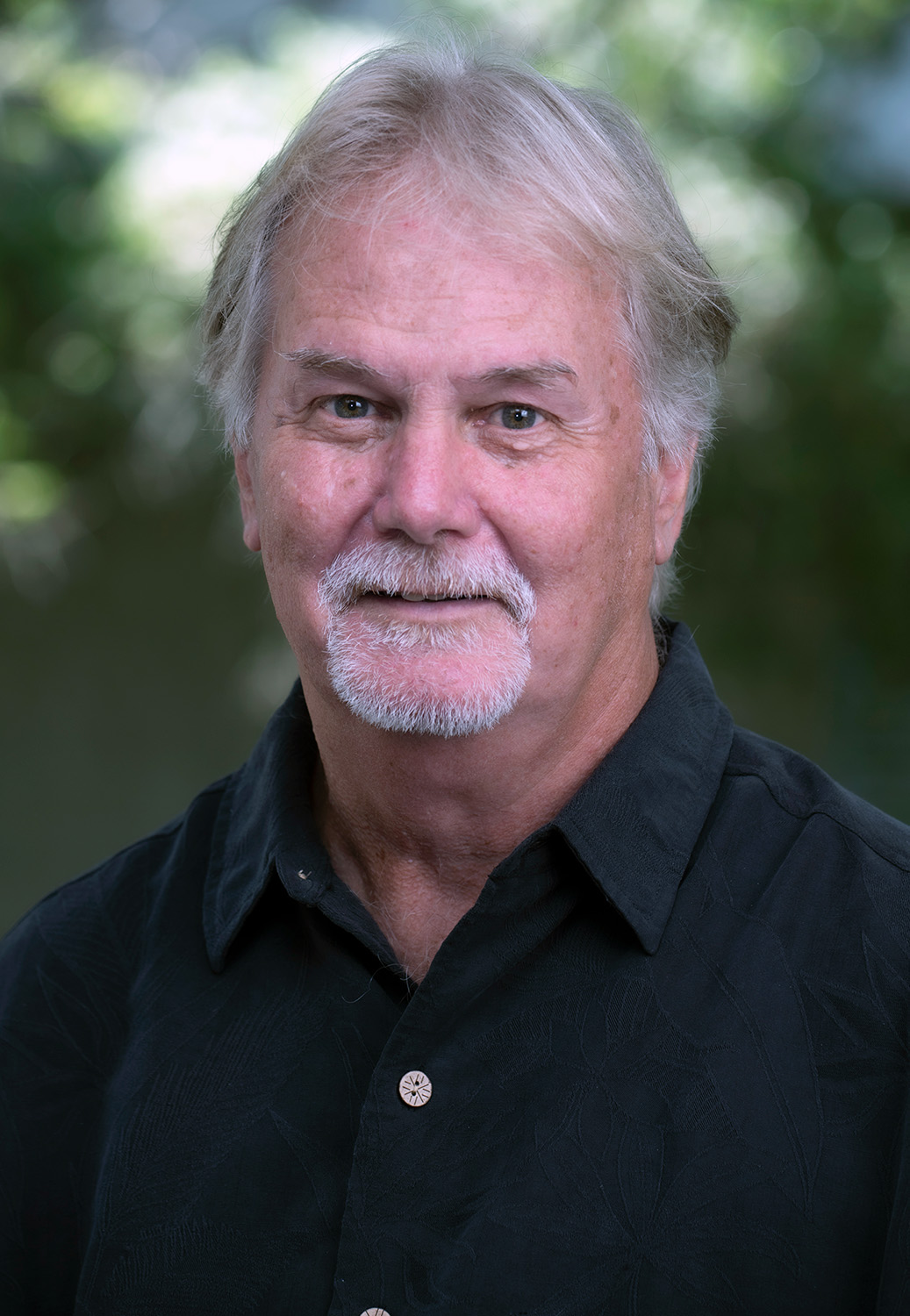
Gary Mitchum serves as Professor and Associate Dean for Research at the University of South Florida's College of Marine Science, where he has been a faculty member since 1996 after directing the University of Hawaii Sea Level Center. His research integrates satellite remote sensing and in situ data to advance understanding of sea level rise, climate change, and ocean physics phenomena. Education: Ph.D., Florida State University, 1984 Research Focus: Professor Mitchum specializes in sea level rise dynamics, El Niño impacts, ocean eddies, tidal analysis, and tsunami propagation. His work examines 20th-century sea level trends while applying ocean physics principles to fisheries management and climate adaptation. Current investigations leverage satellite altimetry to quantify ocean circulation changes and coastal vulnerability. Publication Trends: Recent publications (2023-2025) reveal concentrated efforts on global sea level monitoring systems, reprocessed altimetry datasets (TOPEX/Jason/Sentinel-6), and climate assessment contributions. Key thematic areas include sea level rise acceleration detection, tsunami warning network optimization, and integration of multi-mission ocean altimeter data for climate research, prominently featured in State of the Climate reports. Leadership & Collaboration: As Associate Dean, he directs research strategy while participating in international frameworks like the Global Sea Level Observing System (GLOSS). His technical expertise informs tide gauge benchmark monitoring standards and operational sea level networks critical for climate adaptation and disaster response. Infrastructure Contributions: Mitchum has shaped sustained ocean observing systems including the University of Hawaii Sea Level Center legacy and modern networks for tsunami science. His current work enhances real-time sea level data integration for coastal resilience and climate service applications.