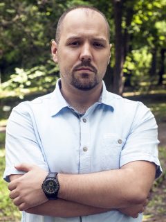
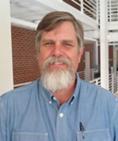
Prof. Thomas H. Kolbe is a full-time faculty member at the Technical University of Munich , holding the Chair of Geoinformatics . His research focuses on spatial-temporal-semantic modeling and 3D/4D urban environments , with expertise in digital twins , CityGML standards , and smart city infrastructure . Initiator of international standards CityGML and IndoorGML Co-author of 15+ peer-reviewed publications (2025-2024) on 3D city modeling Key projects: 3DCityDB , Smart District Data Infrastructure His work bridges geospatial information science with urban simulation and indoor navigation , emphasizing semantic interoperability and urban sustainability . He leads teams at the Leonhard Obermeyer Center and Munich Data Science Institute .
Nikolas Smilovsky serves as a Lecturer at The Design School within Arizona State University (ASU), with additional affiliations in the Central Arizona-Phoenix Long Term Ecological Research (CAP LTER) program. His academic focus bridges geospatial technologies with environmental design, emphasizing pedagogical innovation and practical applications. PhD in Geography (GCU) MAS in Environmental Design (ASU) BA in Urban and Regional Planning (UF) Research interests span Augmented Reality (AR) , GIS , geodesign , and behavioral geography , with specific projects analyzing social capital impacts on spatial behavior, AR applications for underground utility mapping, and GIS pedagogy. He explores how geospatial tools enhance urban resilience and sustainable design. Recent publications highlight AR-GIS integration for infrastructure visualization, spatial behavior modeling, and educational technology. Awards include FAA certification as a UAS Remote Pilot, GISCI professional certification, and leadership roles in geospatial outreach committees. As a GIS Solutions Director at Bad Elf (2019–present), he advances AR/GIS technologies while maintaining academic engagement through teaching roles and CAP LTER research. His work bridges industry innovation with educational frameworks in geospatial sciences.
Richard Hare is a Teaching Associate Professor in the Department of Geosciences and Natural Resource Management at the Faculty of Science, University of Copenhagen, specializing in Landscape Architecture, Planning and Design. His work bridges design methodology with environmental education and participatory practices. He holds an MA in Art and Design from Leeds Beckett University (awarded 19 March 2032), focusing on creative approaches to spatial design. His core research interests include drawing as a pedagogical tool, citizen engagement in urban planning, and the integration of music/sound into landscape experiences. Scholarly output from 2010-2020 reveals interdisciplinary trends spanning landscape architecture education, outdoor learning environments, and geodesign implementation. Key themes include syllabus development for spatial design disciplines, therapeutic applications of natural spaces in education, and cross-sectoral collaboration between parks and schools. His unexpected contribution to hematology (2020 mucormycosis study) demonstrates methodological versatility across medical and design fields. Collaborative projects highlight his role in Denmark's landscape architecture education reform, particularly the geodesign curriculum development, and research on outdoor teaching frameworks involving park managers and schools.
James L. Querry serves as Associate Professor of Geospatial Technology for Geodesign and Landscape Architecture at Thomas Jefferson University's College of Architecture & the Built Environment. A registered landscape architect (RLA, ASLA) with over 30 years of multidisciplinary experience spanning public sector, non-profit, private practice, and academia, he maintains active professional engagement in geospatial innovation. His educational foundation includes: BS in Landscape Architecture from Pennsylvania State University (1983) Master of Regional Planning from University of Pennsylvania (1996), studying under Ian McHarg and C. Dana Tomlin Querry's research pioneers the integration of parametric design, 3D modeling for sustainable urban environments, and advanced remote sensing techniques including LiDAR and UAV drone systems. His work bridges geodesign theory with practical urban planning applications, emphasizing sustainable development frameworks. Professional recognition highlights his leadership: Esri President’s Award for advancing Philadelphia's GIS capabilities during his decade-long tenure as City GIS Director He remains influential through frequent keynote addresses at international forums including the United Nations, where he presented on GIS applications for achieving the UN's 2030 Sustainable Development Agenda.
Robert Kaden is a Professor of Surveying and Geoinformatics at the University of Applied Sciences Erfurt, where he serves as Vice Dean of the Faculty of Business, Economics and Social Sciences and Head of the Geodetic Laboratory and Geodesign Center. His academic career spans teaching, research, and leadership roles focused on the integration of geospatial technologies with modern construction practices. Education: Doctorate in Geoinformatics, Technical University of Munich (2014) Master of Geodesy and Geoinformation Science, Technical University of Berlin (2009) Graduate Engineer in Surveying, Dresden University of Applied Sciences (2005) Surveyor qualification, BSZ Hans Erlwein Dresden (1999) Professor Kaden's research focuses on the intersection of geospatial technologies and digital construction methodologies. His work centers on Building Information Modeling (BIM), Geographic Information Systems (GIS), 3D city modeling, and their integration for urban planning and energy analysis. He has pioneered approaches for combining surveying precision with digital construction workflows, particularly in the areas of as-built modeling, geodetic coordinate systems within BIM environments, and energy demand estimation using semantic 3D city models. His publication record reveals a clear trajectory from foundational work in 3D city modeling toward increasingly sophisticated integration of BIM and GIS technologies. Recent publications emphasize practical applications in energy planning, virtual reality in landscape architecture, and AI-based decision support systems, reflecting the evolution of geospatial technologies from data representation toward intelligent analysis and decision-making tools. Scientific Awards: 2017 Geoinformatics Award from Runder Tisch GIS eV 2012 Oracle Spatial Excellence Award for Education and Research 2010 Harbert Book Prize from German Association for Surveying 2008 CATCON Gold Award from International Society for Photogrammetry and Remote Sensing As Academic Advisor and Head of the Geodetic Laboratory and Geodesign Center, Professor Kaden mentors students and leads research initiatives focused on practical applications of geospatial technologies. His professional activities include significant contributions to industry guidelines, particularly the 'Guide to Geodesy and BIM,' and leadership roles in professional associations including the Round Table GIS eV, German Society for Photogrammetry, and DVW – Society for Geodesy, Geoinformation and Land Management. His laboratory work centers on sensor-integrated solutions for construction surveying, BIM-GIS integration, and the development of standards for geospatial data exchange in the construction industry, positioning his team at the forefront of digital transformation in surveying and civil engineering practices.
Patrik Karlsson Nyed is an Academic Researcher at the University of Copenhagen's Department of Geosciences and Natural Resource Management (IGN), Faculty of Science. He has been affiliated with IGN since 2008 and is active in two research groups: GIScience/Geodesign (2008-present) and Nature, Health and Design (2015-present). His primary responsibilities include GIS consultancy, management of GIS servers and geospatial data, teaching GIS, and providing consultancy in statistics and research design. His educational background includes a PhD in Theoretical Ecology from Lund University (2007) and an MSc in Biology from the Swedish University of Agricultural Sciences (1999). Dr. Karlsson Nyed's research spans GIS applications in environmental management, nature-based therapy, and ecological conservation. His work demonstrates strong interdisciplinary connections between geospatial technologies, ecological research, and human health. He has developed significant expertise in long-term ecological monitoring, land use change analysis, and the therapeutic applications of natural environments. His research often involves complex geospatial data processing and statistical analysis to address environmental challenges. Analysis of his publication record reveals a clear trajectory from technical GIS applications toward nature-based therapeutic interventions. His most impactful work focuses on the efficacy of nature-based therapy for stress-related illnesses, with several highly cited randomized controlled trials published in journals like the International Journal of Environmental Research and Public Health and the British Journal of Psychiatry. His recent work has expanded into afforestation potential mapping in Denmark and therapeutic garden design evaluation. 27 total research outputs including 16 reports, 8 journal articles, and other scholarly contributions Multiple publications with significant citation counts (up to 48 citations for his 2018 British Journal of Psychiatry article) Research covered by 7 news outlets and referenced in policy documents Work featured on social media platforms with substantial academic engagement Dr. Karlsson Nyed has been involved in numerous significant research projects spanning climate change adaptation, urban vulnerability, forest conservation, and nature-based therapeutic interventions. His collaborative work extends across multiple Danish institutions and international partnerships, particularly evident in the CLUVA project which was part of the EU 7th Framework Programme. His current projects include RESONATE (2023-present), Synergi mapping for afforestation potential in Denmark (2022-23), and In The Same Sea with the SAXO institute (2024). He maintains an active role in the IGN IT Committee and continues to develop innovative approaches to geospatial data management and analysis within the university's research infrastructure.
C. Furlan is affiliated with TU Delft’s Architecture and the Built Environment school and the Environmental Technology and Design department. Their research focuses on circular economy transitions, urban planning, and geographic data analysis. Key contributions include geodesign approaches for circular cities and spatial parameters for sustainable construction hubs. Furlan has organized conferences like the Summer School on Circularity in the Built Environment and the AESOP Congress . Research interests emphasize circularity in built environments, metropolitan resource management, and ecosystem services in urban contexts. Recent work explores material loops, territorial design, and policy frameworks for sustainable development. Key Awards: Aesop Young Investigator Award (2019), Urban Studies Institute Fellowship (2020) Grants/Activities: Led REPAiR H2020 projects, contributed to datasets on waste landscapes in Amsterdam and Flanders.
Boris P. Radić is a Full Professor at the University of Belgrade’s Faculty of Forestry, Department of Planning and Design in Landscape Architecture. He holds academic ranks of Assistant Professor (2015), Associate Professor (2020), and Full Professor (2024). His expertise includes landscape ecology, GIS applications, and environmental management. Born in Jagodina, Serbia, he earned his PhD in Ecological Engineering (2014) from the same faculty. Radić has authored textbooks like Landscape Ecology (2024) and contributed to over 100 peer-reviewed articles in journals such as Remote Sensing , Land , and Applied Sciences . His research focuses on soil erosion modeling, urban green infrastructure, and geospatial techniques. Education: Bachelor of Landscape Architecture, University of Belgrade (2004) Doctor of Biotechnical Sciences (2014), University of Belgrade Research Interests: He explores landscape degradation processes, GIS for environmental protection, and sustainable urban planning. His work integrates innovative methods like remote sensing for erosion assessment and geodesign frameworks for green infrastructure development. Grants & Projects: Europeaid-funded erosion modeling projects Ministry of Serbia grants (e.g., 451-03-65/2024-03/200169) Professional Affiliations: International Association for Landscape Ecology Serbian Association of Landscape Architects He advises on over 100 professional projects, including spatial plans and environmental impact assessments, emphasizing practical applications of academic research.
Brian Deal is a Professor of Landscape Architecture at the University of Illinois at Urbana-Champaign. He serves as Director of the Land Use Evolution and Impact Assessment Modeling (LEAM) Laboratory and the Smart Energy Design Assistance Center (SEDAC). His research focuses on sustainable planning, decision support systems, and urban resilience, particularly in climate action planning and energy systems design. Deal holds a PhD in Urban and Regional Planning (2002) and a Master of Architecture (1997), both from UIUC, alongside professional licensure in architecture. Education: PhD in Regional Planning, UIUC, 2002 Master of Architecture, UIUC, 1997 BS in Architectural Studies, UIUC, 1983 Research interests include cyber-physical planning systems, urban land use transformation, and ecosystems modeling. He has led projects such as the University's climate action plan (iCAP) and collaborates with the Student Sustainability Committee. His work integrates sociohydrological modeling, geodesign processes, and smart technologies to address urban challenges. Deal previously worked in architecture and at the Army Construction Engineering Research Laboratory (CERL), focusing on sustainable design and spatial simulation. Deal chairs campus sustainability planning committees and emphasizes participatory decision-making. His laboratories develop tools for resilient infrastructure and energy efficiency, aligning with global sustainable development goals. Recent projects explore carbon sequestration potential in urban landscapes and post-pandemic urban space usage through big data analytics.
Takako Tajima is an Adjunct Associate Professor at the University of Southern California’s School of Architecture. She holds a Bachelor of Architecture from Carnegie Mellon University and dual Master’s degrees in Landscape Architecture and Urban Planning from Harvard University. Her work bridges architecture, landscape architecture, and urban design, emphasizing public spaces, historical context, and sustainable urban development. At USC, she teaches graduate design studios, undergraduate GeoDesign courses, and coordinates the Asian Architecture and Landscape Urbanism study abroad program. Her research focuses on integrating historical narratives into urban landscapes and maximizing public realm spaces amid urban density. She has received prestigious awards including the Architecture League Prize and LaFargeHolcim Foundation’s Global Gold Prize. Tajima’s courses explore design methodologies across scales, from site-specific interventions to urban systems, and emphasize field studies to understand spatial and infrastructural dynamics. Her academic contributions include fostering interdisciplinary dialogue on design’s role in preserving cultural heritage while addressing modern urban challenges.
Rhian Stotts is an Associate Teaching Professor at Arizona State University's School of Human Evolution and Social Change. Her research focuses on environmental anthropology, climate change impacts, water resource management, and cross-cultural equity in resource access. She has contributed to studies on hydrogen fuel cell adoption, urban heatwave responses, and ecosystem service valuation across diverse global contexts. Her work integrates qualitative and quantitative methods, including ethnographic decision modeling and large-scale qualitative data analysis. Notable projects include analyzing driver behavior for fuel cell vehicles in California and assessing water insecurity among homeless populations in Phoenix. She has also explored cultural norms around wastewater reuse and climate risk perception in multiple countries. Stotts emphasizes transdisciplinary approaches, collaborating with stakeholders in infrastructure planning and policy development. Her research highlights the intersection of environmental challenges with social justice and equity, particularly in marginalized communities.
Daoqin Tong is a Professor in the School of Geographical Sciences and Urban Planning at Arizona State University (ASU), with affiliations to the Water Institute and SPARC (Spatial Analysis Research Center). She is also a Senior Global Futures Scientist. Her academic background includes a Ph.D. and M.A.S. in Geography and Statistics from The Ohio State University, an M.S. in Civil Engineering from the same institution, and a B.S. in Civil Engineering from the University of Shanghai for Science & Technology, China. Her research focuses on spatial analytics, including spatial optimization, GIS, and big data applications to address urban challenges such as transportation planning, food access, public health, and water resource management. Key projects include modeling spatial data uncertainty, collaborative geodesign for alternative fuel locations, vector-borne disease spread analysis, and urban agriculture initiatives in desert cities. She has pioneered studies on rainwater harvesting for water independence and food desert mitigation through spatial optimization. Tong’s work bridges theoretical and applied spatial science, emphasizing computational methods for urban sustainability. Her collaborative projects often involve interdisciplinary teams and real-world problem-solving, such as optimizing bike-sharing station locations and analyzing pandemic impacts on food systems. Her affiliations with SPARC and the Water Institute underscore her commitment to advancing spatial technologies and water resilience.
Professor Xinyue Ye is a faculty member at Texas A&M University, specializing in the intersection of artificial intelligence (AI), geographic information science (GIScience), and urban planning. Their research focuses on GeoAI applications in climate resilience, smart cities, disaster management, and urban mobility. Key projects include developing geospatial digital twins for flood prediction, AI-driven urban design frameworks, and machine learning models for disaster risk assessment. Research interests span AI ethics in urban planning, spatial data analytics, and computational methods for understanding human dynamics in urban systems. Professor Ye has extensively explored the integration of quantum AI, generative models, and large language models (LLMs) into geospatial tasks, advancing frameworks for sustainable urban development and equitable infrastructure planning. Recent work includes studies on coastal resilience in Texas, urban heatwave mitigation through green spaces analysis, and the use of digital twins for real-time disaster response. Their interdisciplinary approach addresses both technical challenges (e.g., AI benchmarking for geospatial tasks) and societal impacts (e.g., equity in non-motorist safety and disaster vulnerability).
Liana Ricci is an Assistant Professor of Environmental Policy at the School of Architecture, Planning and Environmental Policy, University College Dublin. She holds a PhD in Urban and Land-Use Planning and an MSc in Environmental Engineering, both from Sapienza University of Rome. Her research focuses on the intersection of human-environment interactions, climate change adaptation, and sustainable infrastructure, with fieldwork in coastal cities like Dar es Salaam and European bioregions. Education: PhD and MSc from Sapienza University of Rome; Professional Certificate in University Teaching and Learning from UCD. Research: Urban-climate planning, ecosystem services in small islands, peri-urban resilience, and policy integration of climate adaptation. Grants: Leads the WECOAdapt project (2023-2024) and manages school-funded research accounts (2021-2026). Publications: Recent works analyze bioregional mobility systems, urban green space implementation gaps, and climate finance mechanisms in vulnerable regions. Professional Roles: Consultant for the InterAcademy Partnership and peer reviewer for journals like Sustainability and Urban Climate . Teaching: Coordinates modules on Environment and Development, Planning and Diversity, and Environmental Economics (2018-2025).
Ryun Jung Lee serves as an Assistant Professor in the Department of Urban and Regional Planning within the Margie and Bill Klesse College of Engineering and Integrated Design at the University of Texas at San Antonio (UTSA). His research integrates geospatial methodologies with urban planning to address sustainability and resilience challenges in community development, with particular emphasis on socially vulnerable populations. His academic credentials include: Ph.D. in Urban and Regional Sciences, Texas A&M University (2018) M.S. in Urban Planning and Engineering (Urban design track), Yonsei University, Seoul, South Korea (2009) B.S. in Urban Planning and Engineering, Yonsei University, Seoul, South Korea (2007) Lee's research program centers on four interconnected domains: Built Environment (examining urban form, vacancies, and walkability), Green Infrastructure (analyzing tree canopy, green spaces, and low-impact development through environmental justice lenses), Climate Adaptation (studying extreme weather events and disaster mitigation strategies), and Community Resilience (developing tools for neighborhood-scale risk reduction). His work employs advanced GIS and spatial modeling techniques to translate geographic patterns into actionable policy recommendations. Analysis of his recent publications reveals a strong thematic focus on the socioeconomic dimensions of environmental interventions, particularly how green infrastructure investments impact property values, health outcomes, and community vulnerability. His methodological approach consistently combines quantitative spatial analysis with environmental justice frameworks, often using Texas communities as living laboratories for urban resilience research. Lee directs the GeoDesign + Planning Lab at UTSA, which maintains an active partnership with the UTSA Westside Community Partnership to implement community-engaged research projects. The lab develops practical tools like Python scripts for vacant land duration measurement while producing policy-relevant studies on topics ranging from flood buyout impacts to campus environment-health linkages.