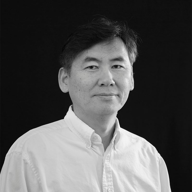
Zahra Assarkhaniki is an Assistant Professor of Sustainability and Planning at the University of Groningen, affiliated with the Faculty of Spatial Sciences and the Department of Planning. She holds a doctoral degree (PhD) and focuses on interdisciplinary research at the nexus of urban planning, environmental science, and technology. Her expertise includes sustainable urban design, climate policy implementation, and innovative technologies like machine learning and IoT to enhance urban planning processes. She actively contributes to achieving the UN Sustainable Development Goals (SDGs) through data-driven spatial strategies. Dr. Assarkhaniki’s work integrates quantitative methods such as spatial statistics and modeling with participatory GeoDesign approaches. Her office is located at Landleven 1 (Room 0340), Groningen, where she is available Monday-Wednesday-Friday between 8:00 am and 4:30 pm. Professional networks include LinkedIn, and her research emphasizes bridging academic insights with practical urban policy frameworks.
Kitty Currier is a Postdoctoral Researcher in the Department of Geography at the University of California, Santa Barbara (UCSB), with a focus on GIScience, environmental planning, and marine conservation. Her work integrates participatory mapping and digital tools in regions where computational infrastructure is limited, notably in Indonesia. PhD in Geography from UCSB, dissertating on participatory mapping for environmental planning MA in Geography from UCSB BSc in Biology with a minor in Archaeology from Stanford University, conferred with distinction Her research spans coastal monitoring, auditory representation in spatial applications, and community-driven GIS. She has extensively used kite aerial photography (KAP) for mapping and environmental documentation in Indonesia and the US. She has received prestigious awards including the Boren Fellowship (2016), Women Divers Hall of Fame Honorable Mention (2015), and multiple David S. Simonett Memorial Awards. Her grants include NSF IGERT funding (2010) and a UCSB Coastal Fund grant (2014). She is affiliated with the Center for Spatial Studies (spatial@ucsb), the STKO Lab, and non-profits like the Biosphere Foundation and Coral Triangle Center.
Liana Ricci is an Assistant Professor of Environmental Policy at the School of Architecture, Planning and Environmental Policy, University College Dublin. She holds a PhD in Urban and Land-Use Planning and an MSc in Environmental Engineering, both from Sapienza University of Rome. Her research focuses on the intersection of human-environment interactions, climate change adaptation, and sustainable infrastructure, with fieldwork in coastal cities like Dar es Salaam and European bioregions. Education: PhD and MSc from Sapienza University of Rome; Professional Certificate in University Teaching and Learning from UCD. Research: Urban-climate planning, ecosystem services in small islands, peri-urban resilience, and policy integration of climate adaptation. Grants: Leads the WECOAdapt project (2023-2024) and manages school-funded research accounts (2021-2026). Publications: Recent works analyze bioregional mobility systems, urban green space implementation gaps, and climate finance mechanisms in vulnerable regions. Professional Roles: Consultant for the InterAcademy Partnership and peer reviewer for journals like Sustainability and Urban Climate . Teaching: Coordinates modules on Environment and Development, Planning and Diversity, and Environmental Economics (2018-2025).
Philipp Urech lectures in digital landscape architecture at ETH Zürich's Department of Architecture. His pedagogy integrates point cloud technologies and narrative methods to enhance site-specific design processes. Research explores laser-scanning applications in Madagascar's water infrastructure, Swiss urban regeneration, and Singaporean landscapes. Articles demonstrate iterative frameworks bridging geospatial analysis with cultural narratives in landscape practice.
Prof. Thomas H. Kolbe is a full-time faculty member at the Technical University of Munich , holding the Chair of Geoinformatics . His research focuses on spatial-temporal-semantic modeling and 3D/4D urban environments , with expertise in digital twins , CityGML standards , and smart city infrastructure . Initiator of international standards CityGML and IndoorGML Co-author of 15+ peer-reviewed publications (2025-2024) on 3D city modeling Key projects: 3DCityDB , Smart District Data Infrastructure His work bridges geospatial information science with urban simulation and indoor navigation , emphasizing semantic interoperability and urban sustainability . He leads teams at the Leonhard Obermeyer Center and Munich Data Science Institute .
Christian Fertner is an Associate Professor in the Department of Geosciences and Natural Resource Management at the University of Copenhagen, where he has been employed since February 2017. He is a core member of the research groups Spatial Change and Planning and GIScience and Geodesign, focusing on spatial planning, sustainable urban development, and digital planning methodologies. His educational background includes a PhD in Urban and Regional Planning from the University of Copenhagen (awarded 2012) and an MSc in Urban and Regional Planning from Vienna University of Technology (awarded 2006). His doctoral research addressed urbanisation, urban growth, and planning frameworks under supervision of Gertrud Jørgensen, Thomas Sick Nielsen, and Stephan Pauleit. Fertner's research spans spatial planning, sustainable urban development, resource and energy efficient cities, land use change, urban sprawl, functional regions, small towns, spatial analysis, and digital planning. He actively investigates smart cities, urban metabolism, and peri-urban dynamics with emphasis on European and Danish contexts, particularly through EU-funded initiatives like Regions4Climate and ESPON projects. His recent publications demonstrate strong trends toward climate adaptation planning, digital spatial tools, and compact urban development. Key thematic clusters include municipal planning for carbon neutrality, ecological corridor implementation, and data-driven evaluation of planning practices, reflecting his dual focus on theoretical frameworks and practical policy applications. No scientific awards are documented in the provided information. Christian Fertner has co-supervised six PhD students: Current: Mette Juhl Jessen (climate adaptation and regional planning), Junyu Hu (e-biking in urban/rural areas) Former: Tongyun Du (social networks during urban renewal, 2021), Liang Xiao (agriculture/migration in Southwest China, 2019-2020), Lu Sun (Beijing's green belts, paused), Juliane Große (travel behaviour and urban structure, 2017) His research is supported by major grants including: Regions4Climate (EU Horizon, 2023-2026) Sustainable urban densification (Realdania, 2022-2023) Small and medium-sized towns in Denmark (EU ESPON TOWN DK, 2022) Evaluating Spatial Planning Practices with Digital Plan Data (EU ESPON DIGIPLAN, 2020-2021) Urban metabolism and waste behaviour in touristic cities (EU-H2020 URBAN WASTE, 2016-2019) He actively collaborates within IGN's Spatial Change and Planning and GIScience and Geodesign groups, integrating landscape architecture, planning theory, and geospatial analysis in interdisciplinary urban research.
Nikolas Smilovsky serves as a Lecturer at The Design School within Arizona State University (ASU), with additional affiliations in the Central Arizona-Phoenix Long Term Ecological Research (CAP LTER) program. His academic focus bridges geospatial technologies with environmental design, emphasizing pedagogical innovation and practical applications. PhD in Geography (GCU) MAS in Environmental Design (ASU) BA in Urban and Regional Planning (UF) Research interests span Augmented Reality (AR) , GIS , geodesign , and behavioral geography , with specific projects analyzing social capital impacts on spatial behavior, AR applications for underground utility mapping, and GIS pedagogy. He explores how geospatial tools enhance urban resilience and sustainable design. Recent publications highlight AR-GIS integration for infrastructure visualization, spatial behavior modeling, and educational technology. Awards include FAA certification as a UAS Remote Pilot, GISCI professional certification, and leadership roles in geospatial outreach committees. As a GIS Solutions Director at Bad Elf (2019–present), he advances AR/GIS technologies while maintaining academic engagement through teaching roles and CAP LTER research. His work bridges industry innovation with educational frameworks in geospatial sciences.
Robert Kaden is a Professor of Surveying and Geoinformatics at the University of Applied Sciences Erfurt, where he serves as Vice Dean of the Faculty of Business, Economics and Social Sciences and Head of the Geodetic Laboratory and Geodesign Center. His academic career spans teaching, research, and leadership roles focused on the integration of geospatial technologies with modern construction practices. Education: Doctorate in Geoinformatics, Technical University of Munich (2014) Master of Geodesy and Geoinformation Science, Technical University of Berlin (2009) Graduate Engineer in Surveying, Dresden University of Applied Sciences (2005) Surveyor qualification, BSZ Hans Erlwein Dresden (1999) Professor Kaden's research focuses on the intersection of geospatial technologies and digital construction methodologies. His work centers on Building Information Modeling (BIM), Geographic Information Systems (GIS), 3D city modeling, and their integration for urban planning and energy analysis. He has pioneered approaches for combining surveying precision with digital construction workflows, particularly in the areas of as-built modeling, geodetic coordinate systems within BIM environments, and energy demand estimation using semantic 3D city models. His publication record reveals a clear trajectory from foundational work in 3D city modeling toward increasingly sophisticated integration of BIM and GIS technologies. Recent publications emphasize practical applications in energy planning, virtual reality in landscape architecture, and AI-based decision support systems, reflecting the evolution of geospatial technologies from data representation toward intelligent analysis and decision-making tools. Scientific Awards: 2017 Geoinformatics Award from Runder Tisch GIS eV 2012 Oracle Spatial Excellence Award for Education and Research 2010 Harbert Book Prize from German Association for Surveying 2008 CATCON Gold Award from International Society for Photogrammetry and Remote Sensing As Academic Advisor and Head of the Geodetic Laboratory and Geodesign Center, Professor Kaden mentors students and leads research initiatives focused on practical applications of geospatial technologies. His professional activities include significant contributions to industry guidelines, particularly the 'Guide to Geodesy and BIM,' and leadership roles in professional associations including the Round Table GIS eV, German Society for Photogrammetry, and DVW – Society for Geodesy, Geoinformation and Land Management. His laboratory work centers on sensor-integrated solutions for construction surveying, BIM-GIS integration, and the development of standards for geospatial data exchange in the construction industry, positioning his team at the forefront of digital transformation in surveying and civil engineering practices.
Jeff Hamerlinck is the Director of the Wyoming Geographic Information Science Center (WyGISC) and a Senior Research Scientist at the University of Wyoming's School of Computing and Department of Geography. He earned his PhD in Geography from the University of Colorado-Boulder and holds an MA in Planning and BS in Geography from the University of Wyoming and North Dakota, respectively. His expertise spans Geographic Information Science (GIS), land-use planning, and environmental management. He serves on the Wyoming Governor's GIS Advisory Board and is an active member of multiple professional organizations. Research Interests: Spatial Data Infrastructures and Decision Support Systems Rural Planning Support Systems and Geodesign Land Use Analysis in the U.S. Mountain West and Australia Educational Applications of GIS Recent Projects include the Wyoming Natural Resource and Energy Explorer, spatial data infrastructure development, and geodesign applications. Notable awards include the 2018 Catalyst Geospatial Excellence Award and recognition from ESRI and the Western Governors' Association. His teaching focuses on GIS, environmental planning, and field-based studies in Australia.
Jonathan Davis is an Assistant Teaching Professor at Arizona State University's School of Geographical Sciences and Urban Planning. He holds a Ph.D. in Geography (2020) and advanced degrees in History and GIS from Liberty University and ASU. His research focuses on Geodesign applications in Indigenous community planning, disaster resilience, and public health equity. He has collaborated with American Indian nations on land use planning and emergency response strategies, emphasizing participatory GIS methodologies. Awards include recognition for tribal outreach projects from the American Planning Association and the Arizona Chapter. Davis teaches courses on environmental planning, geodesign, and public participation, integrating innovative pedagogical techniques like flipped classrooms. His work bridges historical narratives with spatial analysis, as seen in media features by the Washington Post and Pew Research Center. Education : B.S. in History, Liberty University (2011) M.A. in History, Liberty University (2013) M.A.S. in GIS, Arizona State University (2014) Ph.D. in Geography, Arizona State University (2020) Research Interests : Geodesign, tribal planning, spatial analysis, environmental justice, historical GIS, and disaster recovery. Davis specializes in leveraging GIS to address challenges in Indigenous communities, such as food access equity and climate adaptation. Key Contributions : Developed geodesign frameworks for disaster recovery in the Navajo Nation and Tohono O’odham Nation. Assessed WIC program compliance and healthy food access using spatial analysis. Pioneered flipped teaching techniques in environmental planning education. Awards : 2023: Best Student Project (Phoenix Youth Outreach) 2022: Best in Public Outreach (Coppermine Chapter) 2019: Best in Public Outreach (Sif-Oidak District) Labs/Teams : Collaborates with the Inter Tribal Council of Arizona and the Arizona State University Decision Theater. Engaged in projects with the CDC and community organizations addressing pandemic preparedness in tribal regions.
Travis Flohr is an Assistant Professor in the Department of Landscape Architecture at the Stuckeman School, College of Arts and Architecture, Pennsylvania State University. His research and teaching integrate landscape architecture, urban planning, and digital technologies to promote equitable and climate-resilient communities. His research focuses on three interconnected themes: Ecology plus Design , spatial design computing , and design education and pedagogy . Using mixed spatial methods, remote sensing, ENVI-met simulations, and virtual reality, he investigates urban forests, green infrastructure, and environmental justice, particularly in relation to extreme heat and ecosystem services. His work emphasizes spatial context and socio-ecological interdependencies. The analysis of his publications reveals a consistent focus on digital landscape architecture, environmental justice, and innovative design education. His recent articles highlight the use of simulation tools, virtual environments, and participatory approaches to address urban climate challenges and equity in the built environment. Travis Flohr has secured research funding from NASA and the Institute for Energy and the Environment (IEE), supporting interdisciplinary projects on urban heat vulnerability and green infrastructure. He actively collaborates with colleagues across Penn State and contributes to advancing design pedagogy through digital innovation. Flohr is involved in several research initiatives, including the development of virtual studios and immersive learning environments. He is also part of interdisciplinary teams focused on urban forest resilience and ecological governance, contributing to both applied research and community engagement.
Mintai Kim is a Professor at the School of Design at Virginia Tech, specializing in Landscape Architecture. His work bridges environmental disturbances with community resilience through two primary domains: nightscape research and Geodesign. Utilizing advanced technologies like smart sensors and brain imaging, he investigates light pollution impacts and coastal adaptation strategies. Education: Ph.D. in Environmental Planning (UC Berkeley, 2001), MLA in Landscape Architecture (UC Berkeley, 1994), BS in Landscape Architecture (University of Seoul, 1988) Dr. Kim's research emphasizes: High-resolution light pollution measurement Neurophysiological responses to day/night environments Geodesign applications for sea level rise resilience Feng Shui principles in landscape planning GIS integration for ecological design His publications span topics from urban land cover dynamics to pedestrian lighting safety , showcasing a multidisciplinary approach combining neuroscience, technology, and ecological design. Notable trends include: Longitudinal environmental monitoring Cognitive science applications in landscape Digital tools for climate adaptation Human-centered nightscape design Scientific recognitions include: CELA Excellence in Research Award (2018) Best Paper awards (2013, 2016, 2018) CAUS Scholarship Certificate ILAM Research Excellence Award
Roland Dietrich is a Professor at the Department of Geoinformatics, Technical University of Munich. He is actively involved in research and teaching, focusing on geospatial technologies, semantic modeling, geodesign, and standardization. His work addresses urban energy systems, 3D city modeling, and GIS interoperability. Email: roland.dietrich@tum.de Contact: +49.89.289.22849 | Office: Arcisstraße 21, 80333 Munich | Office hours: By appointment Research Interests Semantic Modelling and Transformation Geodesign Standardization (e.g., Digital Twin for Cities, CityGML 3.0) City and Energy Systems 3D Spatial Analysis and GIS Interoperability Key Projects include Smart Sustainable Districts , 3D City Model of New York City , CityGML Utility Network ADE , and Geodatenpool Bodensee . He also contributes to software like 3DCityDB and r:trån .
Richard Kingston is a Professor of Urban Planning and GISc at the University of Manchester, leading the NERC Digital Solutions Programme and directing the University's Digital Futures Platform. His research focuses on ICT applications in urban planning, participatory decision support systems, and spatial analysis. He previously worked at the University of Leeds and held roles in planning practice. Education: Joined the University of Manchester in 2003 after completing research at the Centre for Computational Geography, School of Geography, University of Leeds. Earlier, he worked in planning consultancies and local government. Research Interests: Combines Public Participation GIS (PPGIS), Planning Support Systems, and Spatial Data Science. His work addresses stakeholder involvement in spatial decision-making, smart cities, and sustainable urban development. Key areas include PPGIS methodologies, climate change adaptation tools, and participatory urban visioning. Notable Projects: Directs NERC's £8m Digital Solutions Programme (2021–2026), developing digital platforms for environmental data exploitation. Co-leads projects on urban mobility futures, autonomous vehicles, and transport policy. Manages the Spatial Policy Analysis Lab and the Tellus Toolkit Limited. Grants: NERC Digital Solutions Hub, ESRC Festival of Social Sciences 2024, Climate Just Mapping Tool Awards: RegioStars Awards 2012 (Sustainable Growth category) Labs/Teams: Spatial Policy Analysis Lab, Digital Futures Institute, Manchester Urban Institute Current PhD Supervision: Advises six students on topics ranging from autonomous vehicles to smart city strategies and machine learning in urban planning.
Prof. Olaf Gerhard Schroth is a Professor of Geodesign and Landscape Informatics at the Weihenstephan-Triesdorf University of Applied Sciences (HSWT), leading Germany’s first professorship in this field. He holds roles managing CAD, GIS, and remote sensing laboratories, and oversees the IMLA Virtual Campus. His academic career includes postdoctoral research at the University of British Columbia (2008-2012), roles as a lecturer at the University of Sheffield (2012-2017), and doctoral work at ETH Zurich (2003-2008). His research focuses on digital methods for sustainable development, including geodesign, GIS, UAVs, and VR/AR for landscape planning. He emphasizes integrating technology with ecological and social goals, addressing climate adaptation and urbanization challenges. Teaching includes courses on data processing, IT in planning, and digital terrain modeling. Key projects include flood risk mitigation in Indonesia, smart city microclimate modeling, and geodesign workshops for online education. He has supervised doctoral candidates like Junyi Zhao and Medria Shekar Rani, contributing to landscape informatics and participatory planning. His work bridges academia and practice, collaborating with firms and governments on projects like shelterbelt design in China and open data quality assessments in tourism planning.