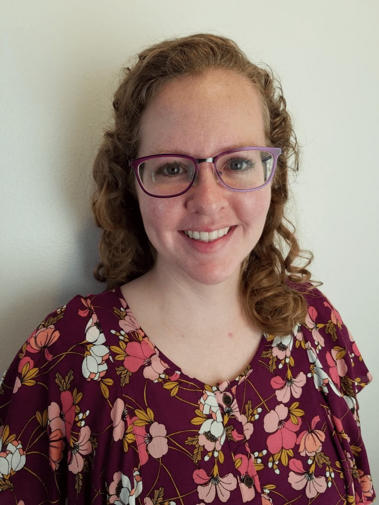
Dr. Leanne Archer is a Researcher in the School of Geographical Sciences at the University of Bristol, specializing in hydrology and climate change impacts. Her work focuses on flood risk assessment in Small Island Developing States, extreme rainfall events, and the application of convection-permitting climate models. She collaborates with experts like Prof. Paul Bates and Dr. Jonty Rougier on interdisciplinary projects addressing tropical cyclone hazards and climate adaptation strategies. Her research interests include analyzing flood exposure in vulnerable regions, soil moisture dynamics in urban flooding, and improving global flood forecasts for humanitarian operations. Archer’s publications emphasize the implications of climate change on rainfall-driven disasters, particularly in Puerto Rico and East Africa, using high-resolution climate projections to evaluate future risks under 1.5° C and 2° C warming scenarios. Recent work explores innovations like the Surface Water Ocean Topography Mission for flood modeling and evaluates the suitability of TanDEM-X data for inundation studies in island nations. Her contributions bridge environmental science with policy, aiming to enhance disaster preparedness and resilience in climate-sensitive regions.
Ruth Mostern is Associate Professor of History at the University of Pittsburgh and Director of the Institute for Spatial History Innovation (ISHI). She is Vice-President and President-Elect (2025-2026) of the World History Association and leads the award-winning World Historical Gazetteer project. Education Ph.D. in History, University of California, Berkeley, 2003 Research Interests Mostern is an interdisciplinary historian specializing in world, Chinese, environmental, and spatial history. She investigates long-term human–environment interactions at continental and millennial scales, focusing on how societies organize space, resources, and risk. Her work integrates GIS, digital gazetteers, and environmental science to reconstruct historical geographies of empire, water management, and ecological change. Current projects include: Place: A Global History – a study of itineraries, gazetteers, and databases as technologies of spatial knowledge. The Medieval Climate Anomaly and the Global Medieval Era – cultural adaptations to climate change c. 950-1250 CE. Research Trends Her recent publications span digital environmental humanities, historical GIS, Song-dynasty political economy, and pre-industrial Asian political ecology. A dominant theme is the coupling of state power with environmental transformation, exemplified by her 2021 book The Yellow River: A Natural and Unnatural History (Yale), winner of the 2023 Joseph Levenson Prize. Awards & Honors Joseph Levenson Prize, Association for Asian Studies, 2023 NEH Digital Humanities Advancement Grant, 2023-2025 Digital Humanities Awards 2021 – Best DH Tool (World Historical Gazetteer) Fudan University Fellowship for Studies of Chinese Civilization, 2019 NEH Humanities Connections Implementation Grant, 2018-2020 Chiang Ching-kuo Foundation Summer Institute Grant, 2015-2016 NSF Collaborative Research Grant, 2013-2015 ACLS Digital Innovation Fellowship, 2011-2012 Advising & Grants Mostern welcomes graduate students interested in environmental, global, Asian, or digital history. She has directed multiple externally funded projects, including the NSF-funded Center for Historical Information and Analysis and NEH-supported initiatives on water in Central Asia and global historical gazetteers. Labs & Teams She directs the Institute for Spatial History Innovation (ISHI) at the University of Pittsburgh, a hub for interdisciplinary research integrating spatial technologies with historical inquiry. ISHI hosts the World Historical Gazetteer , providing open tools and datasets that link knowledge about historical places across world regions.
Yang Zhou is an Associate Professor in the Department of Computer Science and Software Engineering at Auburn University, part of the Samuel Ginn College of Engineering. His research focuses on big data algorithms, machine learning, data mining, and distributed computing. He has contributed to advancements in federated learning frameworks, graph mining tools, and spatial machine learning for environmental applications like flood mapping. Education includes a Ph.D. in Computer Science from Georgia Tech (2021), M.E. in Computer Application Technology from Chongqing University (2016), and B.E. in Engineering from Jiangnan University (2014). His work emphasizes scalable algorithms for large-scale systems, with tools like DirDense for dense subgraph mining and FedASMU for federated learning optimization. Recent publications explore adversarial robustness, blockchain strategies in IoT, and curriculum-based learning for large language models. He advises on interdisciplinary projects at the intersection of AI and environmental science.
Tobias Bolch is a full Professor at the Institute of Geodesy, Graz University of Technology (TU Graz), Austria, specializing in cryospheric research with a focus on High Mountain Asia and the Tibetan Plateau. His work integrates advanced geodetic and remote sensing methodologies to address critical climate change impacts on glaciers and related systems. His research spans: Glacier dynamics and mass balance monitoring using InSAR and optical satellite data Rock glacier kinematics and permafrost interactions Glacial lake evolution and outburst flood hazards Climate-glacier-hydrology linkages in Central Asian river basins Long-term cryosphere reconstruction using historical satellite archives Analysis of his 2023-2025 publications reveals dominant trends in quantifying ice loss acceleration, particularly from lake-terminating glaciers, and the application of multi-sensor approaches (Sentinel, ASTER, UAV) for decadal-scale change detection. His work consistently emphasizes the hydrological consequences of glacier retreat for downstream water security across High Mountain Asia. No scientific awards or specific grant programs were documented in the provided materials. While student supervision details are absent, his position at TU Graz's Institute of Geodesy indicates active mentorship within geospatial and cryospheric research programs. His homepage (https://ifg.tugraz.at) serves as the primary hub for research dissemination through the university's PURE portal.
Peter K. Kitanidis is a Professor in the Department of Civil and Environmental Engineering and the Institute for Computational and Mathematical Engineering at Stanford University . His research focuses on groundwater flow , hydrologic forecasting , and stochastic inverse modeling , with applications to pollutant remediation and CO₂ storage monitoring . Education : Diploma, National Technical University of Athens (1974) M.S., MIT (1976) Ph.D., MIT (1978) Research Interests : Groundwater modeling and contaminant transport Hydraulic tomography and aquifer characterization Stochastic methods for uncertainty quantification Bioremediation and enhanced in-situ pollutant decay Dilution and mixing processes in heterogeneous media Real-time river flow forecasting Scientific Awards : L.G. Straub Award (1979) W.L. Huber Research Prize (1994) ISI Highly Cited Researcher (2001) AGU Hydrologic Sciences Award (2011) ASCE Pioneers in Groundwater Lecturer (2011) Advising and Grants : Advised 20+ PhD and MS students (1978–2018) Principal investigator on NSF, EPA, and DOE-funded projects Developed software for groundwater data analysis and CO₂ monitoring Contributed to bioremediation protocols and hydraulic tomography algorithms Labs and Teams : Kitanidis Laboratory for groundwater crisis solutions Collaborated with Oak Ridge National Laboratory and Stanford Hydrogeology Group Mentored postdocs (2000–2017) in reactive transport and inverse modeling
Armelle Choplin is an Associate Professor at the University of Geneva's Department of Geography and Environment within the Geneva School of Social Sciences, and affiliated with the Global Studies Institute since 2019. She serves as Director of the Institute of Environmental Governance and Territorial Development (IGEDT), leading research on urban transformations in the Global South. Research Focus Her research examines urban policies, social transformations, and development challenges in African cities and the Global South. Core interests include: urban planning dynamics, governance frameworks, construction industry impacts, poverty alleviation, sustainable development pathways, globalization effects, digital innovation in urban contexts, and postcolonial urban studies. Her geographical specialization focuses on West Africa and MENA regions. Publication Analysis Recent publications (2017-2024) demonstrate consistent focus on material urbanism, governance innovations, and spatial justice in African cities. Key thematic clusters include: urban material flows (concrete, energy), participatory planning methods, transnational urban corridors, and postcolonial urban theory. Methodologically, her work combines spatial analysis with political economy and ethnographic approaches. Research Leadership She directs multiple international projects including: Global Urb: Global Urbanism from the South MatéRhône: Construction materials in Rhone Valley West African Coastal Corridor study (Accra-Lagos axis) URBACOT: West African Coastal Urban Dynamics Observatory Map&Jerry: Participatory mapping in Cotonou Student Advising Currently supervising eight doctoral candidates researching urban development topics across Africa. Her teaching portfolio includes courses on urban globalization, metropolitan governance, spatial justice, and regional project development at both bachelor's and master's levels.
Dr. Jiaqi Gong serves as Associate Professor in Computer Science and Adjunct Associate Professor in Mechanical Engineering at The University of Alabama's College of Engineering, while directing the Alabama Center for the Advancement of Artificial Intelligence. His academic foundation includes: B.S. in Engineering, China University of Geoscience (2004) Ph.D. in Engineering, Huazhong University of Science and Technology (2010) Dr. Gong's research pioneers human-AI convergence through cyber-physical systems and smart health technologies, developing mobile/wearable platforms to enhance human perceptual, cognitive, and physical capabilities. His work spans artificial intelligence, machine learning, computer vision, and IoT with applications in healthcare, environmental monitoring, and education. The Sensor-Accelerated Intelligent Learning (SAIL) laboratory he founded drives innovation in behavior change interventions, human movement modeling, and educational data mining. Recent publications reveal strong interdisciplinary trends: healthcare AI dominates with medication adherence prediction and surgical classification systems, while environmental applications feature flood-risk communication and drought analysis. His work increasingly integrates generative AI and LLMs across domains, demonstrating methodological innovation in federated learning, knowledge graphs, and explainable storytelling frameworks. Notable recognitions include: Best Student Paper Award, IEEE/ACM Connected Health Conference (2022) Best Student Paper Award, Body Sensor Networks Conference (2019) Data Challenge Win, IEEE Biomedical Health Informatics (2018) Best Paper Award, Body Area Networks Conference (2014) Best Demonstration Award, IEEE Wireless Health Conference (2014) Dr. Gong leads significant funded projects including a $2M CDC/NIOSH grant for first responder safety and $3M NSF funding for hydrologic research. As SAIL laboratory director, he mentors students in developing clinically deployed technologies for multiple sclerosis, dementia, and mental health. Future work focuses on scaling AI applications in chronic disease management and climate resilience through the Alabama AI Center. The SAIL laboratory (founded 2017) operates as a multidisciplinary hub developing wearable/mobile systems for health applications, with active collaborations across medical clinics and engineering departments for real-world deployment of behavior change interventions and movement analysis tools.
University of North Carolina at Chapel HillUnited States
Miyuki Hino is an Assistant Professor in the Department of City and Regional Planning and an Adjunct Assistant Professor in the Environment, Ecology, and Energy Program at the University of North Carolina at Chapel Hill. She holds a Ph.D. in Environment and Resources from Stanford University and a B.S. in Chemical Engineering from Yale University. Her research focuses on climate hazards, governance, and public policy , with emphasis on equitable adaptation to climate change. Key areas include sea level rise impacts, flood risk on property markets, and managed retreat strategies. She has conducted extensive work on floodplain development policies, household relocation programs, and community resilience frameworks. Dr. Hino's interdisciplinary approach integrates environmental science, urban planning, and social equity . She collaborates with academic and municipal partners, such as the Center for Urban and Regional Studies and Annapolis, MD local governments, to develop actionable solutions for climate adaptation. Her work bridges technical analyses (e.g., sensor networks, machine learning) with policy design to ensure both effectiveness and justice in climate responses. Recent projects emphasize preventing future 'trapped households' by analyzing zoning policies and market dynamics that drive risky development. She advocates for climate-smart growth strategies to balance economic needs with environmental safety, while addressing disparities in vulnerability across communities. Her research has been featured in Science Advances , Nature Climate Change , and interdisciplinary journals. She actively engages with policymakers to translate findings into practical measures, such as equitable buyout programs and floodplain management reforms.
Christopher D.P. Baxter is a Professor and Department Chair of Civil and Environmental Engineering at the College of Engineering, University of Rhode Island , with expertise in geotechnical engineering, offshore wind energy, and coastal resilience. He holds a Ph.D. in Civil Engineering from Virginia Tech (1999), an M.S. from Purdue University (1994), and a B.S. from Tufts University (1990). Research Focus: Geotechnical characterization of marine sediments, liquefaction resistance analysis, fiber-optic sensing for infrastructure monitoring, and coastal protection systems. Recent Publications: 15+ articles (2011–2025) covering topics like shear wave velocity, offshore wind foundation dynamics, and tsunami hazard modeling. Grants: Led projects on offshore wind monitoring (2019–2024) and fiber-optic seismic sensing (2021–2023). Key Collaborations: Work with teams on submarine landslide analysis, coastal dune reinforcement, and Rhode Island infrastructure resilience. His work bridges experimental geomechanics with practical coastal engineering solutions.
Bharat Lohani is a Professor at the Department of Civil Engineering in Indian Institute of Technology Kanpur . His work focuses on Geoinformatics , utilizing LiDAR and GIS for 3D modeling and spatial analysis. Education : PhD (University of Reading, UK), ME (IIT Roorkee), BE (MMM Engineering College Gorakhpur) Research Interests : LiDAR simulation, motion correction in scanning, flood propagation modeling, historical urban mapping, GPS signal analysis, agricultural land consolidation Article Trends : His publications emphasize LiDAR data processing , sensor integration , and optimization algorithms for geospatial applications. Scientific Awards : ISRS National Award (2012), Best Paper at INCA Congress (2012), Silver Award at ISPRS (2008) Advising : Mentored 8+ students in LiDAR and spatial data analysis Labs/Teams : Leads a research group at IITK including Aswani Kumar Munnangi and Salil Goel, affiliated with the Wadhwani School of AI & Intelligent Systems .
Prof. Christian Heipke is a distinguished academic serving as Dean of the Faculty of Civil Engineering and Geodetic Science at Leibniz University Hannover, Germany. He also holds the position of Executive Director at the Institute of Photogrammetry and GeoInformation (IPI), one of the leading research institutions in geospatial sciences within the faculty. His leadership extends across multiple committees including the Curriculum and Teaching Committee, Admissions and Examination Boards for Geodetic Science and Geoinformatics, and Navigation and Environmental Robotics. As a Professor at IPI, he maintains active research while overseeing significant academic and administrative responsibilities at the university. Professor Heipke's research spans multiple domains within geospatial sciences, with particular emphasis on: Advanced photogrammetric techniques and algorithms Remote sensing applications for environmental monitoring Computer vision approaches for geospatial data analysis Urban development monitoring using satellite imagery Machine learning applications in geoinformatics Disaster prediction and management systems His recent scholarly output reveals a strong focus on integrating cutting-edge computer vision and deep learning techniques with traditional photogrammetric methods. Analysis of his 15 most recent publications shows a clear trajectory toward more sophisticated AI-driven approaches for processing geospatial data, with particular attention to time-series analysis, uncertainty quantification, and multi-view systems. His work bridges theoretical advancements with practical applications in flood forecasting, deforestation monitoring, urban planning, and construction materials analysis. The geographic scope of his research has expanded significantly, with recent projects focusing on international case studies in the Philippines and tropical regions. Professor Heipke leads the Institute of Photogrammetry and GeoInformation, a major research hub that has celebrated 75 years of contributions to the field. His leadership extends to the Graduiertenkolleg 2159: "Integrity and Collaboration in Dynamic Sensor Networks," where he serves as a professor overseeing doctoral research. The institute maintains state-of-the-art facilities for processing satellite imagery, aerial photography, and developing novel algorithms for geospatial data analysis. Under his direction, the institute has strengthened its international collaborations and interdisciplinary research approaches, particularly in addressing Sustainable Development Goals through geospatial technologies.
Confidence Duku is a researcher at Wageningen University & Research, specializing in climate resilience and agricultural systems. Their work integrates climate science, hydrology, and machine learning to address food security, deforestation impacts, and flood forecasting in data-scarce regions. Research Interests: Climate change modeling in Eastern Africa Hydrology-guided neural networks for flood forecasting Agricultural resilience (common bean, green gram) under climate stressors Economic impacts of deforestation in Brazil Climate services for financial institutions and SMEs Notable Contributions: Developed frameworks for climate-smart business planning and flood prediction, with a focus on regions like East Africa and Brazil. Their work emphasizes ecosystem services and adaptation strategies. Collaborations: Active in multi-institutional projects, including partnerships with SNV and Copernicus. Led LVVN projects on cascading climate risks and reforestation impacts.
Jim Hall is a Professor of Climate and Environmental Risk at the University of Oxford's School of Geography and the Environment, and serves as Director of Research there. He is also a Visiting Fellow at Linacre College and holds leadership roles including Chair of the Science Advisory Committee at IIASA, and Expert Advisor to the UK's National Infrastructure Commission. His work focuses on systemic risk analysis, infrastructure resilience, and policy implications of climate change adaptation. Prof Hall has pioneered methodologies like the National Infrastructure Systems Model (NISMOD) and chairs the Data and Analytics Facility for National Infrastructure (DAFNI). His research spans flood risk management, energy systems decarbonization, and transboundary water resource conflicts in regions such as the Eastern Nile Basin and the Caribbean. Key research areas include robust decision making under uncertainty, info-gap theory applications, and integrated assessments of human-environmental systems. He has contributed to major international assessments, including the IPCC's Fourth Assessment Report, and developed frameworks for multi-hazard stress testing of infrastructure networks. Scientific Awards: George Stephenson Medal (2001), Prince Sultan Prize for Water (2018), Royal Academy of Engineering Fellowship (2010) His advising and grants work includes mentoring a DPhil student Erin Canning and leading projects like MARIUS and ENHANCE. He has also developed innovative modeling tools for coastal erosion prediction and probabilistic assessments of global shipping fuel transitions. Prof Hall’s research groups actively engage in interdisciplinary projects, including the Oxford Martin Programme on Resource Stewardship and the UK Infrastructure Transitions Research Consortium. His work emphasizes bridging scientific analysis with actionable policy solutions for climate adaptation.
Dr. Jessica A Eisma is an Assistant Professor of Water Resources in the Department of Civil Engineering at the University of Texas at Arlington. Her research focuses on urban and dryland hydrology, remote sensing, machine learning, citizen science, and climate change adaptation. She holds a PhD from Purdue University (2020) and prior degrees from Purdue and Michigan State University. Her work emphasizes community-centered solutions for flood resilience and green infrastructure planning in vulnerable areas. Education: PhD, Civil Engineering, Purdue University, 2020 MS, Civil Engineering, Purdue University, 2015 BS, Civil Engineering, Michigan State University, 2012 Research Interests: Urban hydrology and climate impacts on rainfall patterns Remote sensing applications for water resource management Machine learning in hydrological modeling Citizen science for environmental data collection Green infrastructure design for flood mitigation Recent Article Trends: Dr. Eisma’s recent work addresses urbanization effects on extreme rainfall, UAV-based thermal mapping of micro-urban heat islands, and equity-focused green infrastructure planning. Her publications often bridge technical innovation and community-driven solutions for climate resilience. Awards: 2024: Faculty/Staff Graduating Student Impact Reception (UTA) 2023: Emerging Leaders Award (Purdue CEG SAC) 2020: Magoon Award for Excellence in Teaching (Purdue College of Engineering) 2015: NSF Graduate Research Fellowship Advising & Grants: Advises 3 PhD students and multiple undergrad researchers Principal Investigator on grants totaling over $1M from NOAA, NSF, and others Focus areas: Houston flood resilience, Texas urban stormwater systems Lab & Teams: Leads the SEUSI Lab, dedicated to socio-environmental solutions in urban sustainability and infrastructure. Collaborates with national and international partners on water security and climate adaptation projects.
Virginia Polytechnic Institute and State UniversityUnited States
Dr. Kevin Kochersberger is an Associate Professor in the Department of Mechanical Engineering at Virginia Tech , with a career spanning academic research, technical innovation, and educational leadership. His work focuses on autonomous aerial systems , robotic control , and applied aerodynamics , particularly through the Uncrewed Systems Laboratory . Kochersberger's research has pioneered UAV-based radiation detection , 3D terrain mapping , and low-resource drone applications , including establishing the African Drone and Data Academy in Malawi . Education: Ph.D., Mechanical Engineering, Virginia Tech (1994) M.S., Mechanical Engineering, Virginia Tech (1984) B.S., Mechanical Engineering, Virginia Tech (1983) A.S., Engineering Science, Jamestown Community College (1981) Kochersberger's publications demonstrate expertise in UAV path planning , smart material actuation , and radiation source localization , with over $9M in research funding. His scientific awards include AIAA Associate Fellow (2009) and Aviation Week Aerospace Laureate (2003). Notable projects involve helicopter-deployable robotic systems and urban canyon navigation without GPS. Recent articles highlight BVLOS drone simulators , 2.5D terrain mapping , and autonomous negative obstacle traversal , reflecting his focus on real-time adaptive control and heterogeneous robotic systems . He teaches Drone Technology and Flight Operations and Advanced Design Projects , emphasizing student-driven innovation and industry collaboration .