معرفی
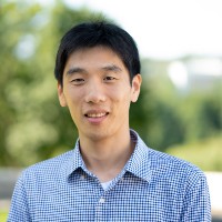
Xiaojing Tang is an Assistant Professor of Geography at the College of Integrated Science & Engineering (CISE) at James Madison University (JMU). He holds a Ph.D. in Geography from Boston University, an M.A. in Environmental Remote Sensing and GIS, and a B.E. in Geographic Information System from Tongji University. His research focuses on remote sensing and spatial analysis to monitor land use/land cover changes and their impacts on the terrestrial carbon cycle and forest ecosystems. He develops methods for regional-to-global scale monitoring using time series analysis and multi-sensor data fusion, emphasizing spatiotemporal modeling to reduce uncertainties in carbon emissions estimates.
Current research projects include NASA SERVIR-supported land change monitoring in West Africa, IARPA-funded spatiotemporal data analysis, and GEO-Microsoft Planetary Computer Programme collaborations. His work leverages freely available remote sensing data and cloud computing advancements. Courses taught include ISAT 449 (Emerging Topics in Data Science) and GEOG 485 (Processing Remotely Sensed Data).
Key research areas include remote sensing applications, GIS integration, data fusion techniques, terrestrial carbon cycle dynamics, land use change modeling, and geospatial intelligence. His GitHub repositories highlight tools for carbon bookkeeping models, near-real-time forest disturbance monitoring, and satellite data processing.