معرفی
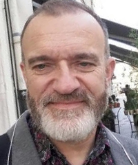
Simon Edelblutte is a Professor of Geography at the University of Lorraine within the Faculty of Historical, Geographical and Musicological Sciences. He has served as Head of the Master's in Teaching, Education and Training (MEEF) for History-Geography since 2014 and maintains active research leadership in industrial landscape studies.
His academic credentials include:
- University studies at Nancy2 University (1986-1990, 1993-1994)
- Aggregation of Geography (12th) and CAPES of History-Geography (24th) in 1991
- Doctorate (1997) on Moselle Valley spatial organization
- Accreditation to Direct Research (HDR) in 2012 on European industrial landscapes
Professor Edelblutte's research centers on industrial landscape evolution, reconversion, and heritage valorization across Northern and Northwestern Europe. His geohistorical approach examines how industrial traces—from factories to regional landscapes—influence contemporary territorial redevelopment, with particular focus on Lorraine's post-industrial transformation and urban renewal processes. Key methodological frameworks integrate spatial analysis with heritage studies to address landscape banalization and symbolic reconversion.
Recent publications (2018-2025) demonstrate consistent thematic focus on industrial legacy interpretation, with emerging emphasis on European comparative studies of company towns (Solvay), economic activity zones (Sillon Lorrain), and valley landscapes (Meurthe). His work bridges theoretical geography with practical urban planning applications, particularly regarding post-industrial site integration into contemporary territorial strategies.
He currently supervises two doctoral candidates:
- SIMON J.-M. (since 2014): 20th century urban landscapes in Lorraine
- PICON M. (since 2015, co-supervised with University of Florence): Steel valley landscapes in Pays-Haut Lorrain
As a core member of LOTERR laboratory, he contributes to the 'Landscape and Territorial Transitions' research axis, utilizing technical platforms for hydrometry, topography, sedimentology, and drone-based remote sensing. The laboratory's IKARE online mapping system for karst phenomena inventory supports his field investigations into landscape transformation processes.