معرفی
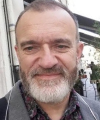
Vincent Bertrand is a Lecturer at the University of Lorraine, France, affiliated with the Laboratory of Organization and Territory, Environment, Risks, Resources (LOTERR). His academic career spans over two decades with a focus on geography and territorial planning.
Dr. Bertrand's academic background includes:
- Graduate studies in geography at the University of Nancy2
- Eligible for the agrégation in 1996
- Thesis (1996-1999): "Rurban spaces in Lorraine: from landscape to geographical system. The example of the Lunéville area" under André HUMBERT
His research centers on sustainable territorial development through rurbanization, urban sprawl, sustainable urban planning, territorial analysis, sustainable housing, eco-neighborhoods, and territories in transition (TEPOS). He employs landscape and systemic analysis methodologies, with recent work focusing on European eco-neighborhoods, housing innovation, and energy transition initiatives via the TEPOS program.
Dr. Bertrand's publications reveal unexpected interdisciplinary breadth: while core geography/planning works address climate policy and energy systems, numerous biology papers on C. elegans development indicate active collaboration with life sciences departments. This cross-disciplinary output spans developmental biology, genetics, and neuroscience alongside environmental policy and sustainable engineering.
No scientific awards or honors were mentioned in the provided text.
He co-created and heads the Master's program in Territorial Planning, Reconversions and Risks (AT2R, later TRAM) since 2004 and leads DU EDUTER for continuing education since 2010. Key research projects include:
- TEPOS (2016-present): Energy transition support for Lorraine communities
- Eco-square® (2009-present): Sustainable real estate development with NOVEMIA
- A31Bis (2014-2015): Infrastructure planning partnership with DREAL Lorraine
As a core member of LOTERR laboratory, he contributes to three thematic axes: Water and Environments; Landscape and territorial transitions; and Transitions, actors and planning. The lab maintains specialized resources including the 30,000-image LOTERR aerial photograph bank and IKARE karst phenomena mapping system.