

معرفی
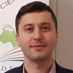
Caius Didulescu is a Professor at the Faculty of Geodesy, Department of Topography and Cadastre, Technical University of Civil Engineering in Bucharest (UTCB). He teaches courses including "Geodetic instruments and measurement methods", "Cartographic drawing and infographics", "Risk maps and hazard map analysis", and "Spatial data acquisition with terrestrial multisensors". He is an authorized individual by ANCPI (category D) since 2000 for topography, cadastre, cartography, and geodesy (series RO-BF, no. 1036), and a judicial technical expert authorized by the Ministry of Justice (license no. 36/18.05.2010, series 122/127/147/19042010).
Education:
- Master's degree in Educational Management, with expertise in Quality Management in Education, Educational Project Management, Educational Program Evaluation, Leadership, and Communication.
Research Interests:
Professor Didulescu's work focuses on applied geodesy and spatial technologies, emphasizing:
- Spatial data acquisition using terrestrial multisensors for high-precision geodetic measurements
- National-level risk and hazard mapping with spatial database development
- Creation of spatial data infrastructures (SDI/INSPIRE) aligned with ISO standards (e.g., Land Administration Domain Model)
- Modern geodetic techniques for engineering topography, cadastre, and property evaluation
- 3D modeling and visualization for geospatial applications
- Optimization methods for spatial data processing
Scientific Awards:
- No specific awards, fellowships, or medals were mentioned in the provided text.
Advising and Grants:
He actively involves master's and doctoral students in research projects while promoting national and international partnerships with universities, institutions, and business sectors to advance geospatial research. His work contributes to developing innovative services, regulations, and legislation in engineering topography and cadastre, though specific grant details are not provided.
Labs and Teams:
Professor Didulescu is a core member of UTCB's research center "Engineering Geodetic Measurements and Spatial Data Infrastructures". He represents Romania in International Federation of Surveyors (FIG) commissions for Hydrography (Commission 4), Positioning and Measurement (Commission 5), and Spatial Planning (Commission 8). He also serves on the censor commission of the Romanian Society of Photogrammetry and Remote Sensing (2023-2027), and is active in the National Commission for In Situ Behavior of Constructions and the Union of Geodesists of Romania.
Caius Didulescu در سایتهای دیگر
جستوجوهای مرتبط
شاید اینها هم برایتان مناسب باشند
 Tudorel Silviu CLINCITechnical University of Civil Engineering Bucharest · مدرس ارشد
- GGheorghe BadeaTechnical University of Civil Engineering Bucharest · استاد
 Anca ENETechnical University of Civil Engineering Bucharest · استادیار
- GGheorghe M. BadeaTechnical University of Civil Engineering Bucharest · استاد
 Anca Patricia GRĂDINARUTechnical University of Civil Engineering Bucharest · مدرس ارشد
- AAlexandru CĂLINTechnical University of Civil Engineering Bucharest · دانشیار