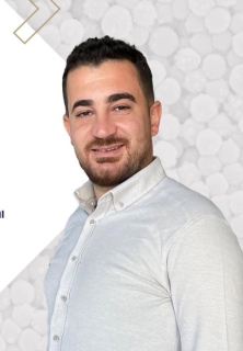
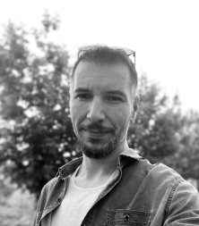
Prof. Dr. Burak Aricak is a faculty member at Bursa Technical University , where he serves in the Faculty of Forestry under the Department of Forest Engineering . His work integrates geospatial technologies and environmental science to address critical forestry challenges. Research Focus : Forest Road Planning, Harvesting Techniques, GIS & Remote Sensing Applications, and Ergonomics. Key Publications (2023-2025) explore climate change effects on forest species distribution, heavy metal accumulation in trees, soil respiration dynamics post-harvesting, and UAV/LiDAR advancements for biomass estimation. Contact : burak.aricak@btu.edu.tr | +90 (224)-8081101
Prof. Hande Demirel is a Professor at the Department of Geomatics Engineering, Istanbul Technical University. She holds a PhD in Geoinformatics from Technical University of Berlin (2002). Her academic career includes roles as Associate Professor (2008–2019) and Assistant Professor (2004–2008) at ITU, alongside research at the European Commission Joint Research Center (2011–2014). She specializes in GIS applications, remote sensing, photogrammetry, and spatial data analysis. Education: B.Sc. (1996) and M.Sc. (1998) in Geodesy & Photogrammetry from ITU, followed by a PhD in Geoinformatics (2002) from TU Berlin. Awards include Best PhD Award (2003), DAAD Scholarship (2007), and Best Poster Award (2016). Research focuses on transportation accessibility, climate change impacts, 3D spatial modeling, and BIM-GIS integration. She leads projects like 'Building Information Model Based Fire Evacuation Simulation' (TUBITAK-funded) and 'Spatio-Temporal Accessibility Analysis in Istanbul'. Key contributions include over 30 peer-reviewed publications, including works on land use prediction, ship detection via AI, and indoor navigation systems. She advises numerous graduate students, with 15+ theses supervised since 2009. Active in professional societies including the German and American Associations for Remote Sensing.
Dr. Gülsüm Çiğdem Çavdaroğlu Akkoç is a full-time Assistant Professor in the Information Technologies Department at Işık University's Faculty of Economics, Administrative and Social Sciences. She holds a multidisciplinary background with degrees in Mathematics Engineering, Geomatics Engineering, and Turkish Language & Literature. Education Ph.D. in Photogrammetry Engineering – Yıldız Technical University (2006–2013) M.S. in Photogrammetry Engineering – Yıldız Technical University (2003–2006) B.S. in Mathematics Engineering – Yıldız Technical University (1998–2003) B.A. in Turkish Language & Literature – Anadolu University (2016–2020) Research Interests Dr. Akkoç's research spans remote sensing , GIS , and machine learning , with applications in environmental monitoring, urban mobility, and health informatics. Her work leverages satellite imagery, mobile data, and AI to address challenges such as wildfire detection, air pollution tracking, and disease diagnosis. She actively integrates spatial data with AI to support smart city development and sustainable resource management. Scientific Awards First Prize – Mobilya Ar-Ge Proje Pazarı (2013), Entrepreneurship Category Supervision & Projects She has supervised four master's theses and led several EU and national projects including: BEE-OPTECH4Honey : Optimizing beekeeping routes using ICT TOP4HoneyChain : A sustainable smart honey value chain platform Open Data Platform for Precision Agriculture Labs & Teams Dr. Akkoç collaborates with interdisciplinary research teams in the fields of AI, geospatial technologies, and agricultural informatics. Her lab activities include developing machine learning models for real-world applications in health, environment, and urban systems.
Lasse Leskelä is an Associate Professor at the Department of Mathematics and Systems Analysis at Aalto University. His research focuses on stochastics, particularly statistical network models, random graphs, and stochastic processes acting on networks. He aims to derive mathematical laws for predicting macroscopic behavior in large random systems and improving statistical learning algorithms for high-dimensional data analysis. Probability theory Stochastic processes Random graphs Statistical network models Queueing Theory Applied probability Leskelä's work spans theoretical and applied domains, with applications in information networks, social networks, biological systems, and financial modeling. His research group actively explores models like random intersection graphs, stochastic block models, and graphons to understand complex systems. Leskelä's recent publications in journals such as the IEEE Transactions on Network Science and Engineering and PLoS Computational Biology highlight his contributions to community detection, hypergraph connectivity, and epidemic modeling. His work bridges mathematical theory with practical applications in data science and network analysis. Varma-Sampo MSc thesis prize , Finnish Mathematical Society McKinsey Prize for the best MSc degree completed in 1999 at the Helsinki University of Technology Leskelä has collaborated with leading researchers across disciplines. His research includes grants from Aalto University and international institutions, focusing on advancing stochastic modeling and data analysis techniques.
Ibrahim Altunbas is a Professor in the Department of Electronics and Communication Engineering at Istanbul Technical University (ITU), College of Engineering. He is actively involved in research on next-generation wireless communication systems, with a strong focus on satellite networks, terahertz and millimeter-wave communications, non-orthogonal multiple access (NOMA), spatial modulation, and hybrid RF/FSO systems. His work integrates theoretical modeling with practical design for high-efficiency and reliable wireless links. His research interests span a wide range of advanced topics in telecommunications, including antenna selection, full-duplex communication, index modulation for drone networks, and error performance analysis in fading environments. The fingerprint of his research highlights key areas such as Error Performance , Fading Channels , Antenna Selection , Outage Probability , and Transmit Antenna Selection , reflecting his deep expertise in physical layer communication design. The recent trend in his publications shows a strong emphasis on satellite-based communication using emerging technologies like Rate-Splitting Multiple Access (RSMA), NOMA, and HAPS-assisted networks. His work frequently addresses challenges in power allocation, decoding order optimization, I/Q imbalance, and pointing errors in high-frequency systems. These contributions demonstrate a consistent effort toward enhancing spectral efficiency, energy efficiency, and reliability in future wireless networks. Episode-Based Broadcast Performance Award (2021) ITU BAP International Scientific Cooperation Development Support (2015) ITU Rectorate Scholarship Program (2001) Project Performance Award (2017) Vehbi Koç Foundation Scholarship (1997) As Principal Investigator (PI), he has led multiple BAP-funded research projects at ITU, including studies on turbo and LDPC coding in THz channels, NOMA for satellite networks, index modulation for drone communications, and multi-hop spatial modulation systems. These projects highlight his leadership in driving innovation in wireless technologies. While specific grant amounts are not listed, the volume and continuity of funded projects indicate sustained research support. He is currently supervising 29 theses, reflecting his active role in mentoring graduate students in cutting-edge communication research. His research is conducted within the framework of ITU’s Department of Electronics and Communication Engineering, where he collaborates with students and researchers on projects involving simulation, performance analysis, and system design for future wireless networks. His lab focuses on physical layer innovations, particularly in multi-antenna systems, satellite-HAPS integration, and novel modulation techniques.
Prof. Turan SÖNMEZ serves as a faculty member in the Department of Forest Engineering within the Faculty of Forestry at Bursa Technical University. His expertise spans Geographic Information Systems in Forestry, Forest Growth Models, Forest Yield, and Dendrometry, with active contributions to forest management practices in Türkiye's Mediterranean and Marmara regions. His research focuses on developing advanced forest growth and yield models for species like Calabrian pine and Turkey oak, integrating Geographic Information Systems (GIS) and remote sensing technologies for precision forest monitoring. Key areas include UAV-based inventory systems, land-cover change analysis using elevation and settlement proximity metrics, and honey forest potential mapping. His methodological innovations in competition index development and single/double-entry volume equations have enhanced forest management planning accuracy. Prof. SÖNMEZ's publication record shows consistent output over 15+ years, with 31 articles accumulating 242 citations and an H-index of 8. Recent work demonstrates increasing integration of deep learning (e.g., U-Net architectures) with traditional forestry techniques, particularly in Istanbul and Bursa forest directorates. His research bridges theoretical modeling and practical forest management applications across Mediterranean ecosystems. His academic service includes developing spatial databases for forest management plans and contributing to national standards for forest inventory methodologies in Türkiye.
Mert GÜRTÜRK is a Researcher at Adiyaman University's Faculty of Engineering, specializing in geospatial technologies and UAV applications. He holds a Doctorate in Geodesy and Photogrammetry Engineering from Yildiz Technical University (2016-2019), along with a Master's degree (2014-2016) and Bachelor's degree (2007-2012) in related fields from the same institution. His research focuses on cutting-edge geospatial technologies including UAV photogrammetry, precise positioning systems, LiDAR applications, and machine learning integration in geospatial data processing. His work spans various applications from transportation infrastructure assessment to public health monitoring through geospatial analysis. GÜRTÜRK's recent publications demonstrate a strong trend toward integrating advanced computational methods with traditional geospatial techniques, particularly in UAV-based mapping systems and precise positioning technologies. His work shows significant contributions to accuracy assessment methodologies in GNSS processing and UAV georeferencing. 2016-2019: Doctorate in Geodesy and Photogrammetry Engineering, Yildiz Technical University 2014-2016: Master's in Geodesy and Photogrammetry Engineering, Yildiz Technical University 2007-2012: Bachelor's in Surveying Engineering, Yildiz Technical University His current research projects include the DEVELOPMENT OF DOMESTIC SOFTWARE FOR SWARM UAV DEMONSTRATIONS (2024-present) and SWARM UAV SYSTEM AND SOFTWARE FOR DEMONSTRATION PURPOSES (2021-2023). GÜRTÜRK has also contributed to the analysis of university campus digitalization processes and precise kinematic point positioning research. His technical expertise spans English language proficiency and extensive experience with geospatial software systems.
Yalçın YILMAZ is a Researcher at Adıyaman University's Faculty of Engineering, Geotechnical Department. He holds a PhD in Geomatics from Yıldız Technical University (2024) and has been part of Adıyaman University since 2014, starting as a Research Assistant in the Geodesy Department. His academic journey includes a second bachelor's degree in Ancient Greek Language and Literature (Istanbul University, ongoing) alongside his engineering background. Education: Bachelor's in Surveying Engineering (Ondokuz Mayıs University, 2010) Master's in Geomatics (Yıldız Technical University, 2017) PhD in Geomatics (Yıldız Technical University, 2024) Second bachelor's in Ancient Greek Language and Literature (Istanbul University, 2019–present) Research focuses on infrastructure classification using machine learning, UAV-based mapping, and GPR applications. Key areas include: 3D point cloud analysis GNSS height transformations Subsurface utility detection His 8+ publications span topics like infrastructure classification algorithms, GPR utility detection, and UAV-LiDAR comparisons. Notable work includes the Best Poster Award (Science-Art Awards 2023) for GPR-based pipeline detection research. Professional experience includes roles as: Research Assistant, Geodesy Department (2014–present) Field Engineer in natural gas survey projects (2010–2011) Surveyor in municipal land registry processes (2012–2014) Current projects involve low-cost imaging systems for 3D modeling and Istanbul land registration analysis. Fluent in English (YÖKDİL B, YDS B) and Turkish.
Samet Aksoy is a Researcher at the Department of Geomatics Engineering, Istanbul Technical University. He holds a PhD in Geomatics Engineering (completed in 2023) and has been a Research Assistant since 2020. His research focuses on remote sensing, GIS, and environmental monitoring using machine learning and Earth observation technologies. He actively contributes to projects involving satellite imagery analysis, soil salinity mapping, urban heat island modeling, and agricultural applications such as olive tree detection and hazelnut cultivation planning. Education: PhD in Geomatics Engineering (2023), MSc in Geomatics Engineering (2019), BSc in Geomatics Engineering (2014) from Istanbul Technical University. Research interests include: Development of geospatial decision support systems Machine learning applications in remote sensing Integration of Sentinel and Landsat data for environmental monitoring Google Earth Engine platform utilization Climate change impact analysis through satellite data Recent publications emphasize: Tree detection algorithms using YOLO-based models Soil salinity mapping with explainable AI Urban heat island modeling using LiDAR and Landsat data Environmental monitoring frameworks for crop residue emissions Awards: 2023 IEEE GRSS Turkey Chapter Best M.Sc. Thesis Award, 2024 COSPAR Outstanding Paper Award, and 2023 Istanbul Technical University Publication Award. Professional contributions include advising on geospatial projects and collaborating with institutions like the UYG-AR Center at ITU. Active participant in international conferences on geoinformatics, remote sensing, and agro-geoinformatics.
Ramazan Alper Kuçak is an Assistant Professor at the Department of Geomatics Engineering, Faculty of Civil Engineering at Istanbul Technical University. He holds a PhD in Geomatics Engineering from the same institution and has extensive experience as a Research Assistant at multiple universities, including Nigde University and Republic University. His research focuses on advanced geospatial technologies, including LiDAR, 3D modeling, and GIS applications in urban planning. Education: PhD in Geomatics Engineering (2016), Istanbul Technical University Master's Degree in Surveying Engineering (2013), Yildiz Technical University Bachelor's Degree in Surveying Engineering (2010), Yildiz Technical University Research Interests: His work emphasizes innovative applications of geomatics technologies, such as terrestrial laser scanning for heritage preservation, mobile mapping systems for smart cities, and comparative analysis of localization algorithms. He also explores low-cost sensor integration and open-source software for geospatial data analysis. Publications Trends: His recent articles highlight advancements in LiDAR sensor performance, 3D point cloud processing, and algorithmic improvements for geospatial data. He frequently publishes in domains like cultural heritage documentation, urban infrastructure analysis, and sensor fusion techniques. Professional Contributions: Dr. Kuçak has no documented scientific awards but has actively contributed to academic research through collaborative projects and teaching. His work experience spans research roles at multiple institutions, demonstrating a strong commitment to advancing geomatics engineering. Future Work: Ongoing research includes optimizing LiDAR integration with consumer electronics and enhancing point cloud registration algorithms for real-world applications.
Serdar Kum is a Professor at Istanbul Technical University's Department of Maritime Transportation and Management Engineering, focusing on maritime safety, human factors, and vessel traffic systems. His research directly impacts operational safety standards in high-risk maritime environments. His core research domains include: High-speed craft operational safety and human performance Vessel Traffic Services (VTS) operator selection and training Seafarers' mental workload and situational awareness Bridge safety culture and risk assessment methodologies Maritime traffic analysis using tools like iWrAP Analysis of his 2020-2025 publications reveals consistent emphasis on human-centered maritime safety, with empirical studies on operator cognition, workload measurement, and safety culture in high-speed craft operations. His work bridges engineering principles with psychological factors to reduce maritime accidents. Scientific Awards: No awards mentioned in source material. Advising & Grants: Supervised 14 research works according to profile data, demonstrating active mentorship. Specific grant funding details were not provided in the source text.
Jesper Møller is a Professor in the Department of Mathematical Sciences at Aalborg University's Faculty of Engineering and Science, specializing in Statistics and Mathematical Economics. His research spans advanced stochastic modeling and spatial statistics. Key affiliations: Danish National Research Foundation (MaPhySto), Independent Research Fund Denmark, Centre for Stochastic Geometry and advanced Bioimaging Research Interests His work focuses on spatial point processes, including Cox processes, determinantal point processes, and Matern hard-core models. He develops computational methods like MCMC, Bayesian inference, and likelihood-based techniques for spatio-temporal data, with applications in forest fire modeling, bioimaging, and mobile service scenarios. Scientific Contributions Projects include: Generalized shot noise Cox processes Statistical inference for log Gaussian Cox processes Transforming point processes into Poisson processes Stochastic geometry for germ-grain models Collaborations He has collaborated with researchers across Denmark, Norway, Australia, Canada, and the USA, working on topics ranging from Hawkes processes to Voronoi tessellations.
Prof. Zaide Duran is a Professor at the Department of Geomatics Engineering, Faculty of Civil Engineering, Istanbul Technical University. She specializes in Photogrammetry, GIS, and Information Technologies in Planning. Her research focuses on 3D modeling, point cloud segmentation, and deep learning applications in geomatics. Education: PhD in Geodesy and Photogrammetry Engineering from Istanbul Technical University (2003). Academic roles include Vice Dean (2016-2017), Associate Professor (2015-2022), and leadership in multiple university committees. Key projects include BIM-based fire evacuation simulations, 3D modeling of historical instruments, and AI-driven point cloud analysis. She has led over 10 research projects funded by Turkish Higher Education and public institutions, with a focus on urban development and cultural heritage preservation. Publications emphasize semantic segmentation, remote sensing, and GIS integration. Her work contributes to sustainable urban planning and disaster management through advanced geospatial technologies.
Muhammed Oğuzhan Mete is an Assistant Professor at the Department of Geomatics Engineering, Faculty of Civil Engineering, Istanbul Technical University. His work bridges Geographic Information Systems (GIS) with advanced computational methods in land valuation and smart city development. Fields of Study : Land Management, GIS, Cadastre and Property Education : PhD in Geomatics Engineering from Istanbul Technical University Research interests focus on integrating GeoAI and Machine Learning for mass real estate valuation , smart city sustainability , and disaster management GIS applications . Recent projects include 3D modeling of historical monuments and cloud-based GIS platforms for earthquake response. Publications demonstrate expertise in hybrid valuation models , spatial big data analytics , and BIM-GIS integration . Research spans Turkey, Great Britain, and international collaborations. Notable work includes a 2025 GeoAI valuation model for Great Britain and 2024 cloud GIS solutions for post-earthquake waste management.