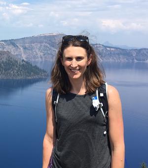
Dr. Teresa Melo is an Assistant Professor in the Department of Mineral and Energy Resources Engineering at the Instituto Superior Técnico (University of Lisbon). Her research focuses on hydrogeology, groundwater management, and environmental geochemistry, with a particular emphasis on climate change impacts and ecosystem sustainability. She is affiliated with the CERIS research unit, specializing in sustainable civil engineering innovations. Her teaching portfolio includes courses such as 'Hydrogeology,' 'Groundwater Pollution and Protection,' and 'Advanced Topics in Water Resources and Environment.' She actively contributes to the AQUADAPT project, addressing climate-resilient riverine ecosystems and groundwater-dependent vegetation mapping. Key research themes include groundwater-surface water interactions, natural background level assessments, and the socio-economic valuation of groundwater protection. She collaborates internationally on projects such as the FREEZE initiative, investigating submarine groundwater discharge and coastal aquifer dynamics. Her publications span over three decades, with recent work emphasizing wildfire impacts on groundwater recharge, microbial diversity in aquifers, and ethical dimensions of contaminated groundwater management. She has advised numerous interdisciplinary studies on environmental risk assessment and policy frameworks.
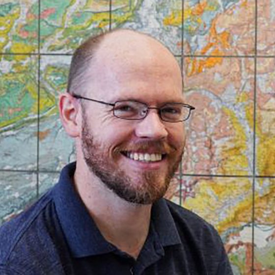
Frank Canters is a Professor of cartography, GIS, and remote sensing at the Department of Geography of Vrije Universiteit Brussel (VUB), leading the Cartography and GIS Research Group. His research focuses on urban remote sensing, spatial modeling of urban environments, and urban ecosystem services. He is renowned for pioneering the Canters projection, a minimum-error world map projection, and has contributed extensively to urban land-use mapping and decision-support systems for urban planning. His work spans over three decades, with 281+ publications and collaborations across multiple disciplines. Key areas include urban form dynamics, remote sensing applications for vegetation and land-use analysis, and spatial justice in green infrastructure distribution. He has supervised 83 students and developed tools like the Q-LavHA plugin for volcanic hazard modeling. Recent research highlights include integrating public perceptions into green space accessibility models, assessing allergenic potentials of urban greenery via LiDAR, and advancing machine learning approaches for urban vegetation mapping. His contributions bridge geospatial technologies with urban sustainability and policy.
Professor Victoria C. Smith is a leading volcanologist at the School of Archaeology, University of Oxford. Her research focuses on tephrochronology, using volcanic ash layers to date and correlate sedimentary and archaeological records. She manages Oxford's electron microprobe facilities and cryptotephra laboratory, supporting global research on explosive volcanism. Research Interests : Volcanology, tephrostratigraphy, magmatic processes, and paleoenvironmental reconstruction. Geographic Focus : Italy, Mexico, Japan, Azores, Canary Islands, Ethiopian Rift, Antarctica. Her recent publications highlight collaborations in geochronology, magma evolution modeling, and tephra applications in synchronizing climate-human records. She supervises MSc and doctoral students in Archaeological Science, focusing on volcanic ash as chronological tools.
Ramon Arrowsmith is a Professor at Arizona State University's School of Earth and Space Exploration (SESE). His research focuses on earthquake geology, tectonic geomorphology, and active faulting, with a particular emphasis on leveraging high-resolution topography through initiatives like OpenTopography. He has over 35 years of experience in paleoseismology, geomorphic mapping, and fault zone analysis. Arrowsmith has held administrative roles such as Deputy Director of SESE and associate directorships in graduate studies and geological sciences departments. His work integrates remote sensing, lidar technology, and robotics to address geological hazards and landscape evolution. Key projects include the QUAKES mission for topographic data collection and the development of low-cost seismic tools like ShakeBot. His research spans global regions, including the San Andreas Fault, Pamir-Tien Shan collision zone, and volcanic fields in Arizona and Mexico. Arrowsmith's recent publications highlight advancements in fault slip modeling, seismic hazard assessment, and open-access geospatial data platforms. His contributions to education include courses on field geology and computational methods in earth sciences. Collaborations with international teams and interdisciplinary projects underscore his commitment to advancing geoscience through innovation and accessibility.
Kyle Bradley is a research-focused academic affiliated with the College of Engineering at Cornell University, specifically within the Department of Earth and Atmospheric Sciences. His work centers on active tectonics, earthquake geology, and geodetic modeling, with extensive fieldwork and satellite-based analysis in Southeast Asia, particularly Indonesia and Myanmar. University: Cornell University School: College of Engineering Department: Department of Earth and Atmospheric Sciences Academic Rank: Research Professor His research interests lie primarily in understanding the mechanics of active fault systems, subduction zones, and their associated hazards. He investigates how tectonic and volcanic processes interact, particularly in regions like the Flores Thrust and Sumatran Fault Zone. His methodologies include GPS and InSAR geodesy, photogrammetry, drone-based mapping, and seismic source modeling to constrain fault geometries, slip rates, and rupture behaviors. The trends in his recent publications indicate a strong emphasis on interdisciplinary geophysics, combining structural geology, seismology, and geochemistry to assess seismic and tsunami hazards. His work often integrates high-resolution geospatial data with field observations to develop models of crustal deformation and earthquake cycles. Although no formal scientific awards are listed in the provided content, his consistent publication record in high-impact journals reflects significant scholarly contributions. There is no mention of formal grant funding, but his research scope suggests involvement in federally or institutionally supported projects. Kyle Bradley has not listed any students in the provided information, but his role as a research professor implies potential mentorship of graduate students and postdoctoral researchers. His work contributes to understanding earthquake triggering mechanisms, such as the role of wet rice cultivation in landslides during the 2018 Palu earthquake, demonstrating applied relevance to disaster risk reduction. He is actively involved in developing regional tectonic models using dense GNSS networks, focal mechanism catalogs, and bathymetric data. His research teams likely include collaborators from international institutions, particularly in Indonesia and Southeast Asia, given the geographic focus of his studies. Labs or research groups associated with his work may utilize geospatial analysis, satellite remote sensing, and computational modeling of tectonic processes.
Hermann M. Fritz is a full Professor at the Georgia Institute of Technology within the College of Engineering's School of Civil and Environmental Engineering. With expertise spanning tsunamis, coastal hazards, hurricane storm surges, landslides, and submarine volcanic eruptions, his research focuses on the fluid dynamics aspects of these natural hazards and their mitigation strategies. Dr. Fritz earned his Doctorate degree (Dr. sc. ETH Zurich) in 2002 from the Swiss Federal Institute of Technology in Zurich. His extensive field experience includes leading or participating in more than a dozen post-disaster reconnaissance campaigns across multiple continents, documenting tsunami events from the 2004 Indian Ocean tsunami through the 2017 Greenland event, and hurricane surveys from Hurricane Katrina (2005) to Hurricane Nate (2017). His research integrates physical modeling with field observations, with recent work focusing on tsunamis generated by submarine volcanic eruptions, as evidenced by his development of a unique volcanic tsunami generator for large-scale wave basin experiments. His publication record shows consistent high-impact research in natural hazard science, with a particular emphasis on understanding wave generation mechanisms, coastal inundation patterns, and sediment transport processes during extreme events. Among his notable recognitions is the Plinius Medal from the European Geosciences Union (2014), highlighting his significant contributions to natural hazard research. His work bridges fundamental fluid dynamics with practical applications for coastal protection and disaster risk reduction. Plinius Medal, EGU (European Geosciences Union) - 2014 Dr. Fritz has mentored numerous students through his research projects, though specific names aren't provided in the available information. His collaborative approach is evident through his extensive co-authorship network spanning multiple institutions worldwide. Current research directions include advanced physical modeling of tsunami generation mechanisms, particularly those related to volcanic activity and landslides, as well as improving coastal resilience against extreme events. His laboratory work at Georgia Tech involves sophisticated experimental setups including large three-dimensional wave basins and specialized generators for simulating complex natural phenomena under controlled conditions. This experimental approach complements his extensive field survey experience, creating a powerful research methodology that connects theoretical understanding with real-world observations.
Dr. Allison M. Macfarlane is Professor and Director of the School of Public Policy and Global Affairs within the Faculty of Arts at the University of British Columbia. She is a leading expert in energy and environmental policy, with a specialized focus on nuclear policy. Dr. Macfarlane has held significant positions in both academic and government sectors, including her notable role as the first geologist and third woman to chair the U.S. Nuclear Regulatory Commission from 2012-2014. Dr. Macfarlane earned her Ph.D. in Earth Science from MIT in 1992, with a thesis on metamorphism, deformation and plutonism in the Langtang region of the central Nepal Himalaya. She received a National Science Foundation Fellowship from 1988-1991. Her undergraduate degree is a B.Sc. with Summa Cum Laude from the University of Rochester (1986), where she received Highest Distinction in Geology for her work on strontium and neodymium isotopic studies of Bermuda's volcanic rocks. Her research expertise spans energy policy, science and technology policy, and sustainable resource policy, with particular emphasis on nuclear energy production, nuclear waste management and disposal, regulation, nuclear nonproliferation, and broader energy policy frameworks. Dr. Macfarlane's work bridges technical, social, and policy dimensions of nuclear issues, informed by her unique background as both a geologist and policy expert. Analysis of Dr. Macfarlane's recent publications reveals a consistent focus on nuclear waste management challenges, particularly regarding small modular reactors, deep borehole disposal, and long-term policy solutions. Her work demonstrates an interdisciplinary approach that combines geological knowledge with policy analysis, addressing both technical aspects of nuclear waste disposal and broader governance issues. She has increasingly focused on the relationship between nuclear energy and climate change mitigation efforts. Wilson Center Scholar, Woodrow Wilson Center for International Scholars (2019-2020) Fulbright Distinguished Chair, Flinders University and Carnegie Mellon University (2018) Member of the Board, American Institute of Physics (2018-present) Alumni Achievement Award, University of Rochester (2017) Chairman, U.S. Nuclear Regulatory Commission (2012-2014) Commissioner, U.S. Blue Ribbon Commission on America's Energy Future (2010-2012) Chair of the Science and Security Board, Bulletin of Atomic Scientists (2008-2012) Dr. Macfarlane has demonstrated leadership in numerous collaborative research initiatives and policy projects. During her tenure at the Nuclear Regulatory Commission, she pushed for greater public dialogue, international engagement among nuclear regulators, and stricter safety protocols following the Fukushima accident. She has also advocated for more family-friendly workplace policies. Her research supervision spans interdisciplinary projects connecting earth sciences with policy analysis, particularly in nuclear waste management contexts.
Sara Barsotti is a researcher at the National Institute of Geophysics and Volcanology (INGV) specializing in volcanology and volcanic hazard assessment. Her key roles include: Associate Editor for Volcanology at Frontiers in Earth Science Review Editor for Geohazards and Georisks at Frontiers in Earth Science Contributor to the EU Center of Excellence for Exascale in Solid Earth (ChEESE) Member of the EUROVOLC citizen-science initiative Collaborator with European volcano observatories Her research focuses on computational geophysics, volcanic hazard modeling, and operational monitoring systems. She investigates tephra dispersion dynamics, lava flow behavior, and probabilistic hazard assessment using high-performance computing. Her work emphasizes European volcanic systems—particularly Icelandic eruptions—and integrates multidisciplinary approaches to improve crisis management protocols and public safety during volcanic events. Analysis of her recent publications reveals a strong trend toward operationalizing advanced computational methods for real-time hazard assessment. Key developments include exascale computing applications for solid earth simulations, refinement of the Aviation Colour Code system for aviation safety, and citizen-science data integration for eruption monitoring. These efforts consistently target practical risk mitigation strategies during active volcanic crises like the 2021 Fagradalsfjall eruption. Scientific awards: None mentioned in the provided text. While specific advised students or individual grants aren't documented, her leadership in major European projects (ChEESE, EUROVOLC) demonstrates substantial involvement in funded research initiatives. These projects coordinate transnational collaborations involving observatories, research centers, and emergency management agencies across Europe. Barsotti actively participates in integrated European volcano infrastructure teams, contributing to standardized monitoring protocols, hazard communication frameworks, and crisis response systems. Her work bridges institutional observatories (e.g., Icelandic Meteorological Office, INGV sections) with community-based monitoring tools, enhancing data collection and public engagement during volcanic unrest.
Maria Christina Mariani is a Professor and Department Chair in the Department of Mathematical Sciences at the University of Texas at El Paso (UTEP). Her interdisciplinary research bridges mathematics with applications in public health, geophysics, physics, and finance, with a focus on developing novel mathematical models for complex data analysis. Dr. Mariani earned her Ph.D. in Mathematics from the University of Buenos Aires in 1992, where she received an Outstanding dissertation award. She also holds an M.S. in Physics (1996) and an M.S. in Mathematics (1987), both from the University of Buenos Aires with highest honors. Her research interests span Applied Mathematics, Nonlinear partial differential equations, Stochastic differential equations, Machine Learning techniques, Mathematical Finance, Mathematical Physics, and Numerical Methods. She has developed mathematical models for medical data analysis (particularly breast cancer, heart disease, and prostate cancer), seismic and explosive data, and financial markets. Her work emphasizes the development of mathematical models to enhance understanding of medical data and extreme events in various phenomena. Dr. Mariani's recent research focuses on applying machine learning and stochastic models to complex data sets across multiple domains. Her work demonstrates consistent innovation in developing novel algorithms for medical diagnosis and prognosis, analyzing seismic data, and modeling financial markets using Levy processes, Ornstein-Uhlenbeck models, and wavelet techniques. She has mentored numerous students throughout her career, including PhD candidates, MS students, and post-doctoral researchers, demonstrating her commitment to academic development and knowledge transfer. Dr. Mariani has served as Department Chair and holds the Shigeko K. Chan Distinguished Professor title in Mathematical Sciences, reflecting her significant contributions to the field and institution.
Cynthia J. Ebinger is a Professor and holder of the Marshall-Heape Chair in Geology at the Department of Earth and Environmental Sciences, Tulane University. She specializes in earthquake seismology, active tectonics, and crustal dynamics, with applications to volcanic hazards and hominin evolution paleoenvironments. Education: Ph.D. from MIT/Woods Hole Oceanographic Joint Program (1988), M.S. from MIT (1986), B.S. from Duke University (1982). Current research includes magma-fault interactions in the Taupo Volcanic Zone (New Zealand), tectonic controls on Lake Kivu rifting (DRC/Rwanda), and lithospheric structure of the Turkana Depression (Kenya/Ethiopia). Her work integrates seismic, geodetic, and potential field methods to study rift systems and mantle plume dynamics. Recent projects focus on dike intrusion mechanics, fault reactivation risks, and critical zone imaging for archaeology. She maintains a field network of seismometers and GPS systems for real-time deformation monitoring. Scientific awards include the Jefferson Science Fellowship. She leads the GATR (Geophysics and Active Tectonics Research) Group, which operates advanced geophysical equipment and computational resources for seismic data analysis.
Katerina Tsakiri serves as Associate Professor and Department Chair in the Department of Information Systems, Analytics and Supply Chain Management at Rider University, with her office located in Sweigart Hall. Her academic leadership spans business-focused quantitative disciplines within the university's professional programs. Her educational foundation includes: Ph.D. in Mathematics and Statistics from University at Albany, SUNY (2010) M.A. in Mathematics and Statistics from University at Albany, SUNY (2006) B.S. and M.S. in Applied Mathematics and Physical Sciences from National Technical University of Athens, Greece (2004) Dr. Tsakiri's research bridges Business Analytics and Management Sciences with environmental applications, specializing in statistical time-series methodologies for real-world hydrological and geological challenges. Her work demonstrates how business analytics frameworks can solve complex environmental problems through rigorous quantitative modeling. Analysis of her 2014-2020 publications reveals consistent innovation in environmental time-series analysis, particularly in flood forecasting systems for New York watersheds and volcanic monitoring in Greece. She integrates artificial neural networks, Markov chains, and GIS technologies to develop practical prediction models that serve both academic research and emergency management applications. Her professional recognition includes: Davis Fellowship from Rider University (2017-2018) As Department Chair, Dr. Tsakiri directs academic operations while maintaining an active research program supported by institutional fellowships. Her interdisciplinary collaborations with geoscientists demonstrate the expanding role of business analytics in environmental risk management, though specific student advising details remain unreported in available materials.
Professor Karl-Johan Lindholm is a prominent archaeologist at Uppsala University's Department of Archaeology, Ancient History and Cultural Preservation, specializing in Scandinavian prehistory and historical ecology. His research bridges archaeological theory with environmental science through extensive fieldwork across Northern Europe and Southern Africa. His research focuses on hunter-gatherer societies , biocultural heritage , and human-environment interactions across deep time. Key contributions include developing niche construction theory applications in boreal forest colonization, pioneering zooarchaeological studies of bear symbolism during the Viking Age transition, and establishing frameworks for biocultural heritage management. His work integrates pollen analysis, GIS, and ethnoarchaeological approaches to reconstruct past landscapes and societal responses to ecological uncertainty. Recent publications reveal strong trends in paleoclimatology-archaeology integration (notably volcanism impacts on Scandinavian societies), zooarchaeological studies of human-animal relationships , and theoretical advances in historical ecology . His research consistently addresses contemporary challenges like sustainable landscape management through deep-time perspectives, particularly evident in the TERRANOVA project policy frameworks. Research leadership includes directing long-term projects on Scandinavian boreal forest colonization and Viking Age transitions, with significant funding from European research councils supporting his interdisciplinary team's work on climate-human interactions and biocultural heritage conservation. His collaborations span archaeology, ecology, and social sciences across multiple continents. Professor Lindholm maintains active field research in Scandinavian river basins and boreal forests, with emerging work connecting historical resource management to modern sustainability challenges through his involvement in EU-funded landscape transformation initiatives.
Dr Jonatan Lassa is a researcher and lecturer specializing in disaster governance and climate resilience at the University of Sydney. His work focuses on political will for disaster risk reduction (DRR), climate change adaptation, and systemic risk management in Southeast Asia and the Pacific. He developed the concept of 'utopiability' to explore societal visions of resilience and has conducted global assessments of DRR policy reforms. Dr Lassa emphasizes interdisciplinary approaches, including object-oriented ontology in critical disaster studies. Research interests include crisis leadership, environmental migration, and community-based disaster management. He has pioneered studies on multi-hazard interactions in volcanic island communities and evaluates policy frameworks for food security and agrarian reform. His recent work addresses the impact of cascading crises (e.g., pandemics, climate disasters) on vulnerable populations. Publications analyze DRR integration in education curricula, emergency animal management in Indigenous communities, and pandemic responses in Indonesia. He advocates for child-centric disaster education and participatory approaches to resilience measurement. Dr Lassa supervises students interested in topics like humanitarian ecosystems, fire governance in Indonesia, and long-term climate adaptation practices. His research bridges academic inquiry with practical policy recommendations for governments and NGOs.
Frédérick Massin is a researcher at ETH Zürich's Swiss Seismological Service (SED), specializing in seismology, earthquake early warning systems, and volcanic monitoring. He is affiliated with the Bedretto Underground Lab (BULGG) and contributes to global seismic research. His work focuses on developing advanced algorithms for rapid earthquake rupture characterization (e.g., FinDer), improving earthquake early warning (EEW) systems in regions like Central America and New Zealand, and analyzing seismic data to enhance disaster preparedness. Key research areas include: Earthquake Source Physics and Real-Time Modeling Seismic Data Center Innovation and Global Networks Volcanic Seismicity and Lahar Detection Socio-Technical Aspects of EEW Systems Recent projects involve assessing EEW impacts in Central America, improving seismic catalogues (FEAR-1), and investigating lake ice seismicity. He collaborates internationally on initiatives such as the Nepal School Seismology Network and Yellowstone volcano-tectonic studies.
Luca Romagnoli is a University Researcher at Sapienza University of Rome, currently serving in the Department of Modern Literature and Culture within the Faculty of Letters and Philosophy. He has been in full-time academic service since May 27, 1994, with a distinguished career spanning geography research and teaching. His current teaching responsibilities include GIS Applications - GEOSTATICS for the Three-year degree course in Geographical sciences for the environment and health, and Methods for GEO-OCEANOGRAPHY research for the Master's Degree Course in Land Management and Enhancement. Romagnoli earned his PhD in Geography from Sapienza University of Rome in 1993 with a dissertation titled 'Geografia dell'area metropolitana di Roma: aspetti naturali e mobilità pendolare' (Geography of the Rome metropolitan area: natural aspects and commuter mobility). His academic journey includes significant international experience, including research at the University of Maputo (Mozambique) in 1991 and an Erasmus scholarship at Trinity College Dublin studying Irish-Italian migration patterns. Romagnoli's research spans multiple interconnected domains within geography. His primary focus areas include environmental geography (particularly oceanography and geostatistics), medical geography (with publications on health accessibility in Rome and malaria epidemiology), and geopolitical studies (especially water resources in the Mediterranean region). He has also made notable contributions to urban geography (focusing on the Rome metropolitan area), tourism geography, and renewable energy studies. His scholarly approach uniquely bridges physical and human geography, creating interdisciplinary connections between environmental systems and human activities. His recent publications demonstrate a growing emphasis on environmental and geopolitical issues related to oceans and water resources. The 2024 work on oceanographic research in Italian universities reflects his commitment to advancing ocean literacy within higher education. His 2022 publications on 'Blue Power' showcase expertise in Mediterranean water geopolitics, addressing conflicts from Israel-Palestine to the Nile Valley. Romagnoli maintains diverse scholarly interests, with publications ranging from tourism geography to recreational aviation studies, demonstrating remarkable versatility across geography's sub-disciplines. Romagnoli has significant experience in research collaboration, having worked with various public entities including the Ministry of Labor, Censis research institute, and the European Commission's TMR Summer School program. His international perspective was further developed during his tenure as a Member of the European Parliament (2004-2009), where he participated in 428 plenary interventions and submitted 853 parliamentary questions. His teaching methodology incorporates quantitative approaches to geographical analysis, with specializations in geostatistics and geo-oceanographic research methods.