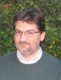
Professor Yanming Feng is a Professor in the School of Computer Science at Queensland University of Technology (QUT), Australia. He holds a PhD in satellite geodesy and spatial science from Wuhan Technical University of Surveying and Mapping (now Wuhan University). His research focuses on data science, GNSS algorithms, geodetic data analytics, IoT, vehicular networks, and machine learning applications. He has led major projects under ARC grants and CRC programs, including roles in the Cooperative Research Centre for Satellite Systems (CRCSS) and Automotive CRC. Education: PhD, MSc, BSc (Wuhan University) Teaching: Networks security, wireless mobile networks, spacecraft dynamics Key Research: GNSS positioning, space debris monitoring, IoT systems for environmental monitoring Leadership: Editor-in-Chief of Journal of Global Positioning Systems (2009-2013), Editorial Board member of 'Engineering' (Chinese Academy of Engineering) Industry Collaboration: Partnerships in spatial information, intelligent transport, and manufacturing sectors Research interests include millimetre-precision positioning, geodetic data analytics via machine learning, and vehicular safety applications. He has supervised ~24 HDR students and leads teams in projects like real-time satellite monitoring of river flows and IoT-based landslide detection. Major articles span GNSS time series modeling (2022), machine learning for orbit prediction (2020), and vehicular network synchronization (2018). His work bridges academic innovation with industrial needs in precision positioning and smart systems. Current Supervision: Projects include GNSS-based soil settlement analysis and satellite network controllers Completed Supervisions: Over 20 PhD topics in GNSS ambiguity resolution, vehicular safety, and deformation monitoring Labs/Teams: Active in QUT's Centre for Data Science and CRC initiatives for satellite systems and spatial information.