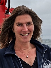
Dr. Elaine Spiller is a Professor in the Department of Mathematical and Statistical Sciences at Marquette University. Her expertise lies in mathematical geoscience, probabilistic hazard mapping, uncertainty quantification, stochastic processes, and data assimilation. She holds a Ph.D. in Applied Mathematics from Northwestern University (2005) and has been affiliated with Marquette since 2008, advancing from Assistant to Associate Professor before becoming a Full Professor in 2024. Her research focuses on developing statistical and computational methods to assess geophysical hazards, such as volcanic eruptions and post-fire debris flows. Notable grants include NSF-funded projects on hazard resilience and surrogate modeling for coupled systems. She has published extensively in journals like *Technometrics*, *Journal of Geophysical Research*, and *SIAM/ASA Journal on Uncertainty Quantification*. Dr. Spiller has received accolades including the Way Klingler Fellowship (2022) and the Project NExT Fellowship (2008–2009). She actively contributes to editorial roles at the *SIAM/ASA Journal on Uncertainty Quantification* and organizes workshops on uncertainty quantification and hazard assessment. Her teaching spans calculus, numerical analysis, and data science, with a focus on interdisciplinary applications. Grants: NSF CHIRRP (2024), NSF CDS&E (2021–2024), NERC Ixchel (2021–2024) Students: Advised 14 graduate students, including current Ph.D. candidates Josh Seidman and Joey Lyon Labs/Teams: Leads research groups in hazard modeling and surrogate-based forecasting
Dr. Baoxin Hu is a Professor in Geomatics Engineering at York University's ESSE department since 2003. She leads airborne LiDAR and hyperspectral missions, focusing on vegetation canopy characterization and wetland ecosystems. Her research integrates multi-source remote sensing data for environmental monitoring, including DEM generation and permafrost analysis. She directs the Earth Observation Laboratory located in Petrie Halls. Education background includes prior visiting fellowships at the Canadian Space Agency. Research emphasizes algorithm development for 3D scene reconstruction, forest succession stage analysis, and EAB infestation detection. Key areas include spatial-temporal modeling, InSAR technology applications, and machine learning integration with geospatial data. Publications span LiDAR-based methods (e.g., boundary adjustment algorithms, individual tree crown delineation) to multi-source data fusion for carbon modeling. Active in developing CNN frameworks for land cover classification and environmental impact assessments. Collaborates on projects involving RADARSAT-2 data and MODIS time-series analysis for northern Ontario ecosystems.
Dr. Yi Qiang is an Associate Professor in the School of Geosciences at the University of South Florida, where he leads the Laboratory of Computational Spatial Science for Sustainability (COMPASS Lab). His research integrates GIScience, spatial data science, and geocomputation to address disaster resilience, environmental justice, and community vulnerability. He holds a Ph.D. from Ghent University, an M.S. from the University of Edinburgh, and a B.S. from Beijing Normal University. Research interests focus on multi-scale spatio-temporal modeling, disaster management using geospatial analytics, and analyzing social disparities related to natural hazards. Key areas include: Developing spatial data models for resilience assessment AI/machine learning applications in geocomputation Nighttime light remote sensing for economic disturbance analysis His publications demonstrate strong emphasis on geospatial analysis techniques applied to flood exposure, infrastructure resilience, and community recovery patterns following disasters. Recent work utilizes crowdsourced data and machine learning for urban flood mapping and transportation network analysis. Dr. Qiang advises multiple graduate students and has secured significant research funding including NSF grants for projects on cross-scale spatiotemporal modeling and flood damage assessment. He directs the COMPASS Lab, focusing on computational approaches to sustainability challenges.
Antonietta Lanza is an Assistant Professor of Computer Science at the Department of Informatics, University of Bari, Italy. She earned her degree in Information Science from the same university in 1978 and has been a faculty member since 1984. Her research spans man-machine interaction, machine learning, and knowledge acquisition with applications in technical document processing and geospatial data interpretation. Education : Degree in Information Science (University of Bari, 1978) Affiliations : Department of Informatics, University of Bari Her research focuses on integrating machine learning with geospatial analysis, particularly for wind speed forecasting, topographic map interpretation, and cadastral data processing. She has developed algorithms for spatio-temporal modeling and spatial clustering of structured data. Recent publications primarily address wind power prediction, spatio-temporal lazy learning, and cluster-based time series modeling. Applications span renewable energy, environmental planning, and maritime AIS data analysis. She actively contributes to academic associations AI*IA (Italian Association for Artificial Intelligence) IAPR-IC (International Association of Pattern Recognition - Italian Chapter) and has created software like PS_package , a tool for line-drawing segmentation.
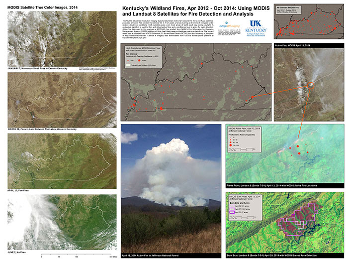
Boyd Shearer is Senior Lecturer in Geography at the University of Kentucky, specializing in cartographic design, geospatial technology, and public space mapping. His research develops innovative mapping techniques for landscape interpretation and outdoor recreation. Education includes: MA in Geography - University of Kentucky BA in Geography - Indiana University Research focuses on: Digital terrain visualization Lidar applications in geography Open-source geospatial tools Historical trail mapping Web-based cartography Public park documentation His publications demonstrate consistent innovation in terrain representation methods and geovisualization techniques. Awards recognize teaching excellence: Provost's Outstanding Teaching Award Finalist (2023-2024) Outstanding Geography Teacher Award (2014) He directs the outrageGIS mapping project creating navigational resources for public trails and wilderness areas, and coordinates GIS instruction across multiple academic programs.
Ralf Gründling is a Soil Scientist & Scientific Technician at the Helmholtz-Centre for Environmental Research (UFZ) in the Department of Soil System Science since 2015. His research spans multiple dimensions of soil science with strong technical expertise in geospatial technologies and precision agriculture. Dr. Gründling's primary research interests focus on soil genesis, processes, and functions , with specialized expertise in soil carbon dynamics, remote sensing of soil properties, UAV applications, 3D-Laser scanning, and spatial distribution of soils . His work integrates field measurements with advanced computational approaches to understand soil behavior across scales. His technical activities include soil mapping, database management, GNSS/GPS systems operation, UAV-based remote sensing, and 3D terrestrial laser scanning. Analysis of his recent publications (2016-2025) reveals a consistent focus on soil structure and function , with increasing emphasis on UAV technology and remote sensing applications. His research spans both fundamental soil processes and applied precision agriculture, with strong connections to climate science through his work on meteorological data and carbon dynamics. Notably, his 2025 publications demonstrate continued leadership in soil structure analysis and innovative UAV applications. Dr. Gründling is actively involved in technical support for meteorological observatories and lysimeter stations, contributing to long-term environmental monitoring infrastructure. His collaborative work extends across multiple projects examining river-floodplain ecosystems, carbon dynamics, and agricultural systems.
Christopher Mark Wessinger is a PartTime Lecturer in liberal arts at Savannah College of Art and Design (SCAD) eLearning. With a Ph.D. in neuroscience, he researches blindsight, auditory processing, and dyslexia. He has taught psychology/neuroscience at 10+ institutions since 2001, including Dartmouth College and University of Phoenix. Recent publications analyze student behavior and standardized stimuli for psychology research. Research trends: 40% of articles focus on visual neuroscience (blindsight, residual vision), 30% on auditory processing, and 20% on methodological contributions. Earlier work pioneered fMRI/PET studies of sensory systems.
David T. Sandwell is a Professor of Geophysics at the Institute of Geophysics and Planetary Physics within Scripps Institution of Oceanography, University of California, San Diego. His research integrates satellite remote sensing, geodesy, and marine geophysics to study Earth's dynamic processes. Research Interests: Sandwell specializes in marine gravity anomaly mapping from satellite altimetry, predicted and measured seafloor topography, synthetic aperture radar interferometry (InSAR), thermal and mechanical structure of the oceanic lithosphere, geodynamic applications of satellite altimetry, and tectonics on Venus. His work bridges planetary science with terrestrial geophysics, focusing on crustal deformation, earthquake mechanics, and ocean basin evolution. He teaches courses including Introduction to Geodynamics, Satellite Remote Sensing, and Physics of Surfing. His recent publications demonstrate a strong trend toward high-resolution seafloor mapping, interseismic deformation analysis, and advanced InSAR techniques for earthquake cycle studies. Key themes include satellite-derived bathymetry, fault creep monitoring along major plate boundaries like the San Andreas Fault, and tectonic applications of gravity field recovery. His research increasingly incorporates multi-satellite data fusion and computational geophysics for modeling lithospheric behavior. Scientific Awards: While specific awards aren't detailed in the source material, Sandwell's extensive publication record (over 200 papers) and leadership in major projects like the SRTM15+ global bathymetry model reflect significant recognition in geophysics. Advising and Grants: Sandwell has advised 17 Ph.D. students since 1988, with recent graduates (2016-2023) focusing on seafloor geodesy, InSAR applications, and lithospheric mechanics. His research is supported by NASA, NSF, and USGS grants targeting satellite geodesy, earthquake cycle modeling, and marine gravity field recovery. Current projects include meter-scale seafloor deformation monitoring and absolute phase recovery in InSAR processing. Labs and Teams: He leads research within Scripps' Institute of Geophysics and Planetary Physics, collaborating with the GPlates development team for 3D tectonic visualization and contributing to NASA's Earth Surface and Interior focus area. His group develops open-source radar interferometry software (GMTSAR) and maintains global gravity and bathymetry databases used worldwide.
Prof. Dr.-Ing. Christoph Holst is a Full Professor of Engineering Geodesy at the Technical University of Munich (TUM), leading the Chair of Engineering Geodesy since 2021. His academic journey includes a PhD from the University of Bonn (2015) and prior roles as research associate, lecturer, and group leader there. He specializes in geodetic monitoring using terrestrial laser scanning (TLS), focusing on infrastructure, industrial, and environmental applications. His research emphasizes high-precision static/mobile TLS automation, sensor calibration, and deformation analysis. Education: Bachelor and Master in Geodesy & Geoinformation, University of Bonn (Focus: Engineering Geodesy & Parameter Estimation) PhD in Geodesy, University of Bonn (2015, summa cum laude ) Research Interests: His work bridges engineering and environmental geodesy, with key areas: - Advanced TLS Methods : Calibration, registration, and error modeling for deformation analysis. - Interdisciplinary Applications : Monitoring radio telescopes, landslides, and agricultural systems. - Digitalization & Automation : AI integration, 3D point cloud processing, and real-time monitoring systems. His team develops innovative tools like the Simulation Tool for Point Accuracy , enhancing TLS reliability in complex environments. Publications & Awards: Over 100 peer-reviewed articles in journals like Remote Sensing and ISPRS Journal . Notable awards include the GKGM Prize (2019) for TLS calibration and the Teaching Award (2019) from the University of Bonn. His work has been recognized by the Bavarian Academy of Sciences and IEEE societies. Grants & Leadership: He leads TUM's Leonhard Obermeyer Center for Digital Methods and chairs the DVW Working Group on Mobile Sensor Systems. Active in national/international committees (DGK, IEEE, PhenoRob cluster). Labs & Teams: Runs the Geodetic Testing Laboratory with calibration fields and monitoring setups. Collaborates on projects like AImon5.0 for landslide AI monitoring and TUM2TWIN urban digital twin benchmarking.
Dr. Anne-Nina Lörz is a Postdoctoral Researcher in Marine Ecosystem Dynamics and Management at the University of Hamburg's Department of Biology, Faculty of Mathematics, Computer Science and Natural Sciences. She works at the Institute of Marine Ecosystem and Fisheries Sciences, focusing on deep-sea research within the Ice-AGE project funded by the German Science Foundation (DFG). Her primary research interests encompass marine biodiversity, ecology and evolutionary systematics of marine Amphipoda, with specialization in deep-sea environments and integrative taxonomy. Her work leverages both morphological and molecular approaches to study crustacean diversity, particularly focusing on how environmental variables drive benthic community composition and species distributions in climatically sensitive regions like the North Atlantic. Lörz's publication record demonstrates consistent research output with 15 recent publications (2021-2024) spanning taxonomic descriptions, biogeographic analyses, and ecological studies of deep-sea amphipods. Her work shows strong international collaboration patterns, with research spanning Iceland, New Zealand, Antarctica, and the Arctic, reflecting the global nature of marine biodiversity studies. Her research has particular relevance for understanding how climate change affects deep-sea ecosystems. Lörz leads the Ice-AGE Amphipoda component, which has collected over 100,000 amphipod specimens from depths between 120-4500m across the North Atlantic. This work establishes crucial taxonomic baselines for monitoring biodiversity changes in regions facing significant environmental transformations. Her academic trajectory shows progression from her PhD research on Antarctic amphipods at the University of Hamburg (2003) through extensive work at New Zealand's National Institute of Water & Atmospheric Research (2003-2015), to her current postdoctoral position. She completed her habilitation at the University of Hamburg in 2020 on the biodiversity of deep-sea amphipods.
JUHÁSZ Attila is an Associate Professor at the Department of Photogrammetry and Geoinformatics, Budapest University of Technology and Economics. His research focuses on geoinformatics, remote sensing, and GIS applications for military historical reconstruction, particularly using LiDAR data to detect World War II-era objects and landscapes. Department: Photogrammetry and Geoinformatics University: Budapest University of Technology and Economics Email: juhasz.attila@emk.bme.hu His research integrates LiDAR, photogrammetry, and GIS to analyze historical military sites, including bomb craters, defense lines, and battlefield topography. Key methodologies include spatial data fusion, digital surface modeling, and automated feature detection. JUHÁSZ Attila’s publications reveal trends in applying geospatial technologies to historical reconstruction, with a focus on World War II-era military objects, terrain analysis, and spatiotemporal data management. His work bridges digital archaeology and military history through advanced geospatial techniques.
Professor Darius Mottaghy serves at Aachen University of Applied Sciences within the Department of Energy Technology and is affiliated with the Solar Institute Jülich. His academic position focuses on teaching Mathematics and Applications in Engineering to students in technical disciplines. His research spans several critical areas in geothermal energy and computational modeling: Geothermal Energy Systems Development Heat Transfer and Flow in Porous Media Numerical Simulation of Geological Processes Climate Reconstruction from Subsurface Data Thermo-active Geotechnical Systems Planetary Heat Flow Analysis Professor Mottaghy's publication record demonstrates a consistent focus on advancing geothermal energy technologies through sophisticated numerical modeling approaches. His work bridges theoretical computational methods with practical engineering applications, particularly in developing simulation tools for heat and mass transport in geological formations. Recent research extends to lunar heat flow analysis while maintaining strong applications in terrestrial renewable energy systems. Based at the Solar Institute Jülich located at Heinrich-Mußmann-Str. 1, Room 01B19 in Jülich, he maintains office hours by email appointment and can be reached at +49.241.6009 53154.
Vitaliy Ogarko is a Research Fellow at The University of Western Australia's School of Earth and Oceans. He is affiliated with the Centre for Exploration Targeting where he joined in 2021 to work on the MinEx project. His expertise in computational geophysics and high-performance algorithms has established him as a key contributor to geoscience software development and geological modeling. Dr. Ogarko holds a PhD in Computational Physics. His academic background bridges applied mathematics with earth sciences, providing a strong foundation for his computational approach to geophysical problems. His research focuses on: Design and development of high-performance computational algorithms for geophysical inversion Computational geology and 3D geological modeling Open-source software development for geoscience applications Integration of geological and geophysical data for resource exploration Uncertainty quantification in geological interpretations Machine learning applications in earth sciences Recent publications reveal a growing emphasis on integrating machine learning techniques with traditional geophysical methods, particularly for urban geological modeling and stratigraphic data recovery from complex drillhole databases. His work demonstrates increasing sophistication in handling large-scale geophysical datasets with complex constraints. Dr. Ogarko was awarded the MinEx CRC 2019-2020 publication prize for collaborative research. He currently serves as Investigator 02 on the ARC Australian Research Council project 'Loop 3D Linkage-2' (2023-2026), which supports his ongoing research in geological modeling and inversion techniques. He leads the Tomofast-x software framework development, a powerful 3D parallel inversion platform for geophysical data, and contributes to the litho2strat project for automated stratigraphic data extraction. His work is integrated within the broader GeoMos community for collaborative geoscience modeling and simulation.
Matthew S. Lachniet is a Professor of Geoscience at the University of Nevada, Las Vegas (UNLV), where he has served as Department Chair (2020–2023) and directs the Las Vegas Isotope Science (LVIS) Laboratory since 2006. He holds a Ph.D. in Geology (2001, Syracuse University), an M.S. (1997, Michigan State University), and a B.A. (1995, Antioch College). His research integrates light stable and radiogenic isotope geochemistry with speleothem analysis to study paleoenvironmental and paleoclimatic changes, focusing on regions such as Costa Rica, Panama, Mexico, Alaska, and the Great Basin. Key questions include the stability of tropical climates, teleconnections between tropical and extratropical systems, and the impact of anthropogenic climate change on rainfall patterns. Dr. Lachniet has been recognized with prestigious awards, including the 2023 UNLV Barrick Distinguished Scholar Award and the 2023 College of Science’s Distinguished Researcher Award, as well as a 2024 Fulbright Scholar Award to New Zealand and a 1998–1999 Fulbright Student Scholar Award to Costa Rica. His research also explores the Urban Heat Island effect in Las Vegas and its contribution to local warming, alongside collaborations on projects like the Lake Izabal Basin Research Endeavor (LIBRE) drilling initiative. Lachniet’s teaching includes undergraduate courses on Global Warming, Paleoclimatology, and Quaternary Seminar, as well as graduate-level courses on Stable Isotope Geochemistry. He actively engages with public outreach, authoring blogs that contextualize paleoclimatic data for modern climate challenges and historical landscapes, such as reconstructing the location of 19th-century Indigenous photographs in Nevada. His work bridges geology and climate science, emphasizing interdisciplinary approaches to understanding Earth’s climate history and future trajectories. Education: Ph.D., Geology, Syracuse University, 2001 M.S., Geology, Michigan State University, 1997 B.A., Antioch College, 1995 High School, Interlochen Center for the Arts, 1991 Research Interests: Paleoclimatology and stable isotope geochemistry Tropical-extratropical climate teleconnections Speleothem-based rainfall history reconstruction Impacts of ENSO and ITCZ shifts Anthropogenic climate change adaptation Quaternary glacial and monsoonal dynamics Awards: UNLV Barrick Distinguished Scholar Award (2023) College of Science’s Distinguished Researcher Award (2023) Fulbright Scholar Award to New Zealand (2024) Fulbright Student Scholar Award to Costa Rica (1998–1999) UNLV Barrick Scholar Award (2007) Grants & Advising: His research has been supported by continuous National Science Foundation funding from 2003 to 2026. While no formal advisee names are listed, his roles as a professor and lab director suggest active involvement in mentoring graduate students and postdoctoral researchers. He collaborates with international institutions, including Ca’ Foscari University of Venice and the Smithsonian Tropical Research Institute, to advance interdisciplinary climate studies. Labs & Teams: Director, Las Vegas Isotope Science (LVIS) Lab Contributor to the SISAL global speleothem database and LIBRE drilling project
Jay Brodeur is the Director of Digital Scholarship Infrastructure & Services at the McMaster University Libraries, leading initiatives in research data management, digital curation, and interdisciplinary scholarship. His work integrates geospatial technologies, environmental science, and educational pedagogy. He has contributed to national frameworks for data curation networks and collaborates on projects addressing climate change impacts on forest ecosystems. Brodeur’s research spans topics such as carbon flux dynamics, historical map digitization, and the development of blended learning models for geospatial literacy. He holds a strong record of scholarly publications in journals like Ecological Processes , Biogeosciences , and Cartographica , focusing on ecosystems, geospatial analysis, and academic innovation. His leadership roles include overseeing the Sherman Centre for Digital Scholarship, which supports interdisciplinary research and teaching initiatives. Notable contributions include the Canadian Data Curation Guide and the SAPFLUXNET database for transpiration studies. Brodeur’s academic collaborations extend to institutions like the Portage Network and the Association of Canadian Map Libraries. His teaching spans interdisciplinary science courses, emphasizing digital tools and research ethics. He actively participates in policy discussions around data management standards and open science practices.