- Satellite Geodesy
- Remote Sensing
- Physical Geodesy
- +۶ مورد دیگر
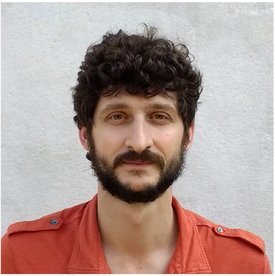
Mariia Usoltseva is a researcher at the Chair of Astronomical & Physical Geodesy at the Technical University of Munich (TUM), where she contributes to satellite geodesy and Earth observation research. She is actively involved in multiple international projects including ESA's MAGIC/Science, QSG4EMT, Baltic+, and the DFG Research Training Group UPLIFT. Her research focuses on satellite altimetry, gravity field modeling, and remote sensing applications in climate and environmental monitoring. Key areas include glacier dynamics, ice sheet mass change, ocean wave behavior near coral reefs, and coastal sea state observations. She utilizes data from satellite missions to study short-term geophysical processes and improve downscaling techniques for high-resolution environmental monitoring. The recent publications highlight a strong trend in using satellite-derived data to understand climate-related changes in both the cryosphere and ocean systems. Her work bridges geodesy with climate science, emphasizing the role of next-generation gravity missions and coastal altimetry in detecting sub-monthly mass and wave height variations. Scientific Contributions and Projects: ESA Project MAGIC/Science – Investigating short-term ice sheet processes ESA Project QSG4EMT – High-resolution gravity field modeling ESA Baltic+ Theme 5 – Coastal and regional geodetic applications DFG Research Unit NEROGRAV – Gravity field analysis for natural hazard assessment DFG Research Training Group UPLIFT – Training next-generation geodesists Mariia Usoltseva supervises student theses in geodetic and remote sensing topics, contributing to academic training within TUM's geosciences programs. She regularly presents at major scientific forums such as the ESA Living Planet Symposium and the European Geosciences Union General Assembly. While no specific grants are listed, her participation in funded ESA and DFG projects indicates active involvement in externally funded research. She is affiliated with the Engineering Institute for Astronomical and Physical Geodesy, working under the supervision of Prof. Roland Pail. The institute provides a collaborative environment for satellite geodesy and Earth system monitoring, supporting both theoretical and applied research.