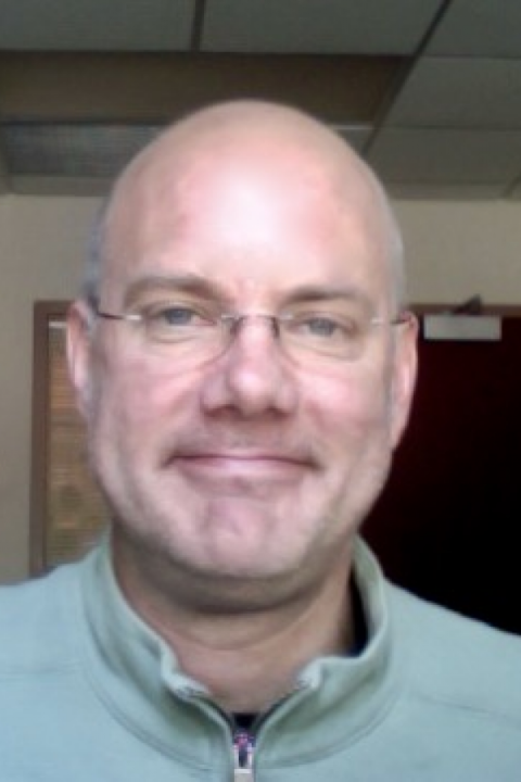
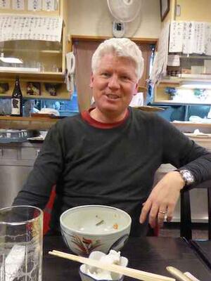
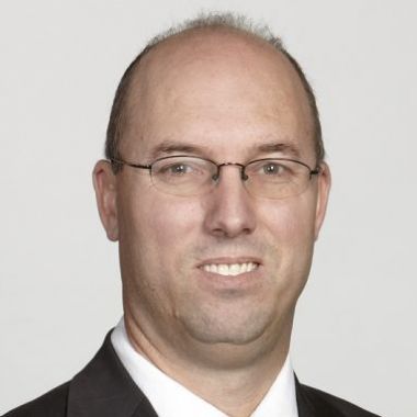
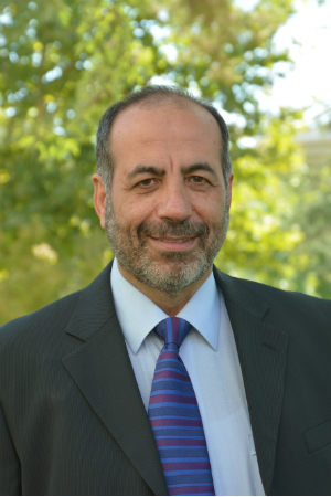
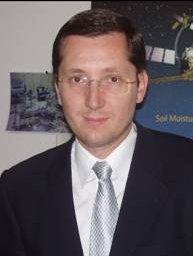
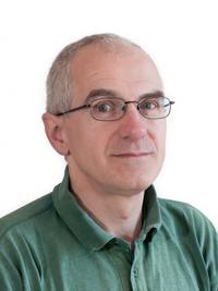
Prof Duncan Robertson is a Professorial Research Fellow at the School of Physics and Astronomy, University of St Andrews, Scotland. He holds a B.Sc. (Hons.) and Ph.D. in Physics from the same institution. His career has focused on millimeter-wave radar technologies with applications in environmental sensing, security systems, and battlefield systems. He leads the Millimetre Wave Group, specializing in radar imaging, radiometry, electron spin resonance instrumentation, and antenna design. Education: B.Sc. (Hons.) in Physics and Electronics, University of St Andrews (1991) Ph.D. in Millimetre Wave Physics, University of St Andrews (1991) Research Interests: Prof Robertson’s work spans millimeter-wave radar systems, including drone detection, glacier monitoring, sea clutter analysis, and holographic metasurfaces. His group develops technologies for security screening, environmental monitoring, and material characterization. Grants & Projects: Environmental Monitoring: Short Range Interferometric Synthetic Aperture Radar (InSAR) MuWMAS: Snowflake Scattering and Microstructure Analysis Drone Detection Radar Commercialization Labs/Teams: Leads the Millimetre Wave Group, collaborating on radar phenomenology and advanced sensor systems. Active in international radar conferences and experimental field trials.
Alexandra Konings is an Associate Professor of Earth System Science at Stanford University, a Senior Fellow at the Woods Institute for the Environment, and holds a courtesy appointment in Geophysics. She leads the Remote Sensing Ecohydrology Group, which investigates interactions between global carbon/water cycles using satellite remote sensing (especially microwave data) and model development. Her research spans plant hydraulics, wildfire dynamics, tropical ecosystems, and vegetation water content analysis. Education: Ph.D. in Hydrology, Massachusetts Institute of Technology (2015) M.S. in Environmental Science, Duke University (2011) S.B. in Environmental Engineering Science, Massachusetts Institute of Technology (2009) Research Interests: Her work integrates remote sensing with ecohydrology to study: Plant-water relationships and hydraulic traits at ecosystem scales Wildfire vulnerability linked to vegetation water stress Carbon-water feedbacks in tropical forests Microwave-derived vegetation water content for climate modeling Impacts of trait diversity on regional ecosystem behavior Publication Trends (2017–2023): Her recent articles focus on vegetation water content as a key indicator for drought impacts, wildfire risk, and ecosystem resilience. Dominant themes include microwave remote sensing validation, plant hydraulic trait mapping, tropical peatland hydrology, and machine learning applications for fuel moisture estimation. Leadership: She directs the Remote Sensing Ecohydrology Group at Stanford, advancing methodologies for satellite-based environmental monitoring and mentoring researchers in ecosystem-climate interactions.
Rosemary Willatt is a Lecturer in Experimental Ice and Rock Physics for the Environment at the University College London (UCL) Department of Earth Sciences. Her research focuses on sea ice dynamics in polar regions, combining laboratory experiments with fieldwork and remote sensing techniques. She leads projects involving satellite radar altimetry for monitoring snow and ice thickness, with a particular emphasis on advancing Earth Observation missions through the Polarimetric Synthetic Aperture Radar Altimeter (PoSARA) concept. She has been awarded the inaugural Konrad Steffen Award by ESA for her innovative work on snow depth estimation techniques. Willatt’s work integrates field campaigns (e.g., in the Arctic and Antarctic) with analysis of airborne, satellite, and ground-based radar data. She collaborates with space agencies to optimize satellite mission design and has pioneered novel methods for quantifying snow properties and their impacts on cryosphere processes. Her contributions include advancements in understanding brine migration in snow, L-band microwave scattering, and wind-driven snow redistribution effects on radar signatures. As Principal Investigator for the ESA-funded PoSARA project and Sea Ice Earth Observation at the Centre for Polar Observation and Modelling (CPOM), she bridges experimental physics with large-scale climate monitoring. Her research also emphasizes education, diversity, and sustainability initiatives within the scientific community.
Corina Nafornita is a Professor at the Department of Communications, Politehnica University of Timisoara. She holds a B.Sc., M.Sc., and Ph.D. in Electronics and Telecommunications from Politehnica University of Timisoara (2003) and Technical University of Cluj-Napoca (2008). She received her Habilitation certificate in 2015. Her research focuses on signal/image processing, radar systems, watermarking, wavelets, and GNSS localization. She is an IEEE Senior Member since 2020 and has held leadership roles in IEEE committees, including Chair of Humanitarian Activities (2021-2022) and Secretary of the IEEE Joint Chapter COM/SP/IT Romania (2019–present). Dr. Nafornita has authored numerous publications, led significant grants (e.g., SAMVA, IMFUSING), and advised multiple PhD students. Her work includes advancements in synthetic aperture radiometry, automotive radar calibration, and SAR image enhancement. She is affiliated with the Intelligent Signal Processing Research Centre and holds roles in organizing international conferences like IEEE ISETC and EHB. Research Interests: Statistical signal processing, radar technology, image denoising, watermarking, wavelet-based methods, and GNSS navigation. Her work bridges theoretical signal processing with practical applications in automotive safety, remote sensing, and secure communication systems. Grants & Leadership: Directed grants such as SAMVA (2022–2024) for multi-copter VTOL aircrafts and IMFUSING (2016–2019) for GNSS localization. Served as Publication Chair for IEEE ISETC since 2010 and TPC member for top conferences like ICASSP and EUSIPCO. Active in IEEE standards committees, including Synthetic Aperture Radiometry (SAR) working groups. Awards: Multiple UEFISCDI awards for research excellence (2015–2021), including recognition for her habilitation and publications on hyperanalytic wavelet edge detection and GNSS localization. Recognized for contributions to signal processing theory and applications. Labs/Teams: Member of the Intelligent Signal Processing Research Centre at UPT, steering committee member, and former Board member of the Communications Department (2017–2020). Collaborates internationally via partnerships with institutions like ENSEIRB Bordeaux, Thales Alenia Space, and ESA.
Douglas Vandemark is a Research Professor at the University of New Hampshire (UNH), affiliated with the Ocean Process Analysis Laboratory (OPAL) within the School of Earth, Oceans, & Space. His research focuses on air-sea interactions, ocean remote sensing, and the exchange of momentum, heat, and greenhouse gases between the ocean and atmosphere. Vandemark specializes in microwave remote sensing techniques, including altimetry, scatterometry, radiometry, and synthetic aperture radar (SAR), applied at regional and global scales. He also develops novel observation platforms and sensors to enhance marine measurements. Education: Ph.D. in Earth Science (Oceanography), University of New Hampshire M.S. in Engineering, University of Massachusetts - Amherst B.S., Hope College Research interests include carbon dioxide dynamics, satellite applications for ocean monitoring, electromagnetic propagation in the marine environment, and physical oceanography. Vandemark has led or contributed to NASA-funded projects involving SWOT, Ocean Surface Topography, Ocean Vector Wind, and other satellite missions. His work emphasizes improving observational tools and understanding ocean-atmosphere interfaces. Advising and Grants: Vandemark has served as Principal Investigator on multiple NASA science teams, including those focused on SWOT and GLIMR satellite missions. His grants support interdisciplinary efforts combining remote sensing, field measurements, and computational modeling to address climate and oceanographic challenges. Labs/Teams: Active in the Ocean Process Analysis Laboratory (OPAL), which develops advanced remote sensing methodologies and collaborates with global research networks.
Professor Richard Kelly is a faculty member in the Department of Geography and Environmental Management at the University of Waterloo. He joined the department in 2006 after serving as an associate research scientist at NASA. His research focuses on microwave remote sensing of snow and ice hydrology, with emphasis on Earth observation systems and global water budget analysis. Current affiliations: University of Waterloo Past affiliations: NASA, University of London His research interests include: Snow and ice hydrology Active/passive remote sensing Geospatial snow modelling Cryospheric response to climate change Water resource management Citizen science integration Professor Kelly's recent publications demonstrate expertise in microwave sensor calibration, snow water equivalent retrieval, and tundra/forest snow dynamics. His work spans Ku-band radar, passive microwave radiometry, and airborne synthetic aperture radar (CryoSAR) applications. Key funding sources include CFI, JAXA, NSERC, and CSA. He leads the Theoretical & Applied Earth Observation Science Lab, which houses the Cryospheric Remote Sensing Research Facility – Canada's only Ku-/X-band scatterometer infrastructure. His students have secured positions in Environment Canada, Teledyne Optech, and international research institutions.
Jeffrey Walker is a Research Fellow in the School of Civil Engineering at the University of New South Wales . His work focuses on soil moisture retrieval using advanced remote sensing technologies, including synthetic aperture radar (SAR), L-band and P-band radiometers, and GNSS-R systems. He integrates machine learning algorithms for spatial downscaling, multi-scale modeling, and time-series analysis to improve hydrological monitoring in agricultural, urban, and infrastructure contexts. Key Research Areas : Soil moisture remote sensing, microwave radiometry, machine learning applications in environmental data, geospatial modeling, sustainable construction, and eco-friendly pavement design. Notable Contributions : Development of LSTM neural networks for pavement moisture prediction, novel downscaling methods using optical trapezoid models, and assimilation frameworks for land surface models. Recent Trends : Emphasis on UAV-based radiometry, multi-frequency sensor fusion, and addressing over-optimism in SAR soil moisture modeling. Applications : Smart rehabilitation of pavements, flood model calibration with crowd-sourced data, and crop yield estimation via satellite imagery fusion.
Riadh Munjy serves as a Professor in Geomatics Engineering at California State University, Fresno's Lyles College of Engineering, where he teaches core courses including CE 205 (Computing in Engineering Analysis), GME 123 (Stereo-Photogrammetry), and GME 125 (Analytical Photogrammetry). His academic foundation includes a Ph.D. in Civil Engineering (1982), M.S. in Applied Mathematics (1981), and M.S.C.E. (1979) from the University of Washington, complemented by a B.S. in Civil Engineering from the University of Baghdad (1976). Ph.D., Civil Engineering, University of Washington (1979-1982) M.S., Applied Mathematics, University of Washington (1980-1981) M.S.C.E., Civil Engineering, University of Washington (1978-1979) B.S., Civil Engineering, University of Baghdad (1972-1976) Professor Munjy's research centers on advancing photogrammetric methodologies with particular emphasis on Unmanned Aircraft Systems (UAS) mapping accuracy, sensor calibration, and novel processing techniques for LIDAR and IFSAR data. His work bridges theoretical mathematics with practical applications in transportation infrastructure, disaster response, and terrain modeling, consistently addressing industry pain points like rolling shutter effects in UAV imagery and LIDAR strip adjustment challenges. He has pioneered standards for GPS-controlled photogrammetry adopted by Caltrans and contributed foundational chapters to the ASPRS Manual of Photogrammetry. Analysis of his 15 most recent publications (2010-2020) reveals a strategic evolution from traditional photogrammetric techniques toward UAS-centric workflows, with increasing focus on automated processing, accuracy validation, and integration of multi-sensor data. His research consistently targets real-world implementation barriers in transportation mapping and corridor projects, demonstrating strong industry relevance through Caltrans collaborations and ASPRS leadership. American Society of Photogrammetry and Remote Sensing Fellow Award (2020) ASPRS Fairchild Award (2014) Caltrans Research Innovation Award (2004) Five School of Engineering Research Excellence Awards (1992, 1996, 1998, 2002, 2003) ASPRS Meritorious Service Awards (1992, 1997) Halliburton Research Award (1992) Professor Munjy's research program has been consistently supported through Caltrans-funded projects including GPS Photogrammetry (2005), UAS Research (2018), and corridor mapping standards development. His advisory impact extends through co-authoring the ASPRS Manual of Photogrammetry and mentoring numerous conference presentations, though formal student lists aren't documented. Current initiatives focus on sUAS data accuracy validation and rolling shutter effect mitigation, positioning his work at the forefront of evolving UAV mapping regulations.
Othmar Frey is a Senior Scientist and Lecturer at ETH Zurich's Department of Civil, Environmental and Geomatic Engineering. He leads the research group on SAR Remote Sensing Technology and is associated with the Chair of Earth Observation and Remote Sensing. His work focuses on developing advanced radar systems and applications, including car-borne and UAV-based SAR for deformation monitoring, multi-static SAR constellations, and tomographic profiling of snow and forest structures. Frey holds a Ph.D. (2010) and M.Sc. (2002) from ETH Zurich and the University of Zurich. Education: Ph.D. (Hons.) in Science (2010) from the University of Zurich, Switzerland; M.Sc. (Hons.) in Geomatic Engineering (2002) from ETH Zurich. Research interests span Synthetic Aperture Radar (SAR) signal processing, interferometry, tomography, and remote sensing applications for environmental and civil engineering challenges. Notable projects include railway substructure monitoring via TerraSAR-X data, development of compact SAR systems (GLSAR/GSSAR), and the Alpine Measurement Lab for studying mass movements. His team collaborates with agencies like ESA, Innosuisse, and the Swiss Federal Office for the Environment. Advising: Supervises PhD students like Magnus Heimpel and Fanyun Xu, with former advisees now at EMPA, Leica Geosystems, and ITU. Research teams include the Earth Observation and Remote Sensing group at ETH Zurich.
Adriano Camps is a Full Professor at the Universitat Politècnica de Catalunya (UPC), leading the Remote Sensing Lab and UPC NanoSat Lab. He specializes in microwave remote sensing, GNSS-Reflectometry, and nanosatellite systems. His research contributed to ESA’s SMOS mission and innovative CubeSat projects like FSSCAT, the first CubeSat mission for the Copernicus System. Education and Career: Joined UPC in 1993 as Assistant Professor, promoted to Full Professor in 2007. Conducted sabbatical research at the University of Massachusetts (1999). Currently a Visiting Professor at UAE University since 2022. Research Interests: Focuses on microwave radiometry (e.g., MIRAS instrument), remote sensing using signals of opportunity, RFI mitigation, and nanosatellite applications. His work bridges academia and industry, with 12 patents and technology transfers to companies like BALAMIS and MITICS. Awards and Recognition: Holds an h-index of 58 with over 13,611 citations. Awarded IEEE Fellow (2011), ICREA Academia (2009/2015), and top 1% global researcher (Stanford, 2020). Recognized for educational innovation with the Jaume Vicens Vives Award (2012). Advising and Leadership: Advised 29 PhD students (9 ongoing) and over 150 engineering theses. Served as Scientific Coordinator of the CommSensLab (María de Maeztu Excellence Unit) and led major IEEE conferences like IGARSS 2020. Active in IEEE GRSS, serving as Chapter President and Editor of key journals. Labs and Projects: Directs the Remote Sensing Lab ( PRS Lab ) and UPC NanoSat Lab ( NanoSat ), overseeing CubeSat missions like 3Cat-1, 3Cat-2, 3Cat-4, and FSSCAT. These missions produced Arctic soil moisture maps and pioneered CubeSat-based Earth observation.
Associate Professor Brian Ng is an academic at the University of Adelaide, affiliated with the School of Electrical and Mechanical Engineering within the Faculty of Sciences, Engineering and Technology. His primary role is as an Associate Professor/Reader, focusing on teaching and research in electrical engineering and signal processing. He holds a position in the Department of Electrical and Electronic Engineering and is eligible to supervise Masters and PhD students in areas such as radar systems, signal processing, and terahertz technology. His research expertise includes digital signal processing, wavelet systems, pattern recognition, radar imaging (including 3D ISAR and maritime applications), and terahertz time-domain spectroscopy. He has led or co-investigated several grants, such as the SmartSat CRC Project (2021-22), DST Group-funded research on 3D ISAR classification, and terahertz sensing projects. His work spans defense applications, environmental monitoring, and material science. Ng teaches courses like Digital Signal Processing, Radar Principles, and Signal Processing Applications. He has contributed to educational initiatives, including e-learning projects and curriculum design. His professional activities include editorial roles in radar conferences and collaborations with defense and industry partners. Key facilities and labs include those supporting terahertz fiber optics and radar systems at the University of Adelaide's North Terrace campus. His research emphasizes practical applications of signal processing in aerospace, maritime, and biomedical contexts.
Professor Anthony Paul Doulgeris at the UiT The Arctic University of Norway leads research in Earth Observation within the Department of Physics and Technology . His work focuses on Interpreting satellite radar images for Arctic sea ice studies Developing automated algorithms for large-scale environmental data Advancing SAR (Synthetic Aperture Radar) methodologies His research interests span Remote Sensing , Sea Ice Dynamics , Machine Learning Applications , and Algorithm Optimization for polar environments. Current projects include Boosting Space Business and membership in the Earth Observation research group. Recent publications analyze High-resolution sea ice concentration using Sentinel-1 deep learning models Icberg detection via multiscale CFAR algorithms in L-band SAR Multidecadal SAR sea ice type analysis in the Atlantic Arctic Incidence angle compensation techniques for cross-platform consistency with keywords spanning Arctic Climate , Microwave Remote Sensing , Operational Ice Monitoring , and Data Processing Frameworks . Collaborations include international teams from Norway, China, and Canada, with fieldwork integration in expeditions like MOSAiC and N-ICE2015. His work bridges Satellite Data and Environmental Modeling to improve Arctic navigation and climate predictions.