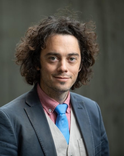
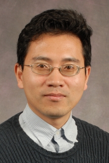
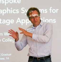
Jan Martin Nordbotten is a full-time Professor at the Department of Mathematics, University of Bergen (UiB), with adjunct positions at Princeton University and NORCE. His research focuses on applied mathematics, particularly in porous media, CO2 storage, fluid dynamics, and interdisciplinary applications in hydrology, biomedicine, and ecology. He completed his PhD at UiB in 2004 and became Norway's third youngest professor in 2007. His work emphasizes numerical methods, multiscale modeling, and experimental validation. Affiliations: UiB (full-time), Princeton (adjunct), NORCE (adjunct) Research Group: Center for Sustainable Subsurface Resources Research interests span mathematical modeling of subsurface processes, including flow in fractured media, geomechanics, and phase-field fracture. Notable contributions include analytical and numerical solutions for CO2 leakage, multiphase flow, and development of tools like DarSIA for image processing in porous media. Publications highlight advancements in mixed-dimensional models, finite element methods, and experimental validation of CO2 storage forecasts. His work bridges theoretical mathematics with practical applications in energy and environmental systems.
Dr. Zhigang Peng is a Professor in the School of Earth & Atmospheric Sciences at Georgia Institute of Technology, part of the College of Sciences. His research focuses on seismicity dynamics, fault zone imaging, and data science applications in geophysics. He holds a Ph.D. in Geological Sciences from the University of Southern California (2004), an M.S. in Electrical Engineering (2002), and a B.S. in Geophysics from the University of Science and Technology of China (1998). Dr. Peng’s work spans seismological studies of earthquake triggering mechanisms, fault zone structures, and deep-focus earthquakes. He has pioneered dense seismic array techniques to image fault systems and employs machine learning for event detection and phase picking. His recent projects include analyzing the 2023 Kahramanmaraş earthquake sequence in Türkiye and the 2024 Noto earthquake in Japan. He leads initiatives like the Center for Collective Impact in Earthquake Science (C-CIES), promoting inclusive scientific collaboration. Research Highlights: Fault zone imaging, dynamic triggering, AI-driven seismology Labs: ES&T 2235 (Seismology Lab), ES&T 2256 (Office) His awards include the 2002 AGU Outstanding Student Paper Award. He actively contributes to earthquake hazard assessment, nuclear explosion monitoring, and volcano-seismic interactions, with over 150 peer-reviewed publications.
Alan Hunter is a Professor in Autonomous Systems at the University of Bath's Department of Mechanical Engineering. He serves as Deputy Head of Department for Workload and Wellbeing and is affiliated with the Water Innovation & Research Centre (WIRC) and the UKRI CDT in Accountable, Responsible and Transparent AI. His research focuses on underwater acoustics, signal processing, imaging, and machine intelligence, with applications in sonar-based remote sensing and marine robotics. Education: B.E. (Hons I) in Electrical and Electronic Engineering from the University of Canterbury (2001), PhD in Synthetic Aperture Sonar (SAS) from the same institution (2006). Career highlights include roles at the University of Bristol (2007-2010), TNO Netherlands (2010-2014), and NATO CMRE (2014). He has led projects on sub-sediment imaging, autonomous mine-hunting systems, and precision navigation algorithms. Research Interests: • Underwater Acoustics & Sonar Imaging • Autonomous Underwater Vehicles • Machine Learning for Acoustic Data Analysis • Non-Destructive Inspection via Ultrasound • Sustainable Coastal Protection (via UN SDG contributions) Active Projects (2023-2025+): - Noise Network Plus : Engineering a Quieter Future (EPSRC) - TESSMEX SR 4 : Naval Mine-Hunting Technology (Defence Lab) - Decision-Making with Ambiguities : Legal AI for Robotics (EPSRC) Professional Affiliations: • Senior Member, IEEE • Associate Editor, IEEE Journal of Oceanic Engineering • Collaborations with NATO, TNO, and UK Defence Orgs. Labs & Teams: • Robotics and Autonomous Systems Lab • Centre for Space, Atmospheric and Oceanic Science • WIRC @ Bath (Water Innovation Hub)
Abdulkadir C. Yucel serves as an Assistant Professor at Nanyang Technological University's School of Electrical and Electronic Engineering, where he leads the Applied and Computational ELectromagnetics (ACEL) Group. His research spans applied electromagnetics, radar imaging, and AI-driven electromagnetic analysis with applications in smart cities, neurotechnology, and quantum systems. Education: Ph.D. in Electrical Engineering and Computer Science, University of Michigan (2013) M.S. in Electrical Engineering and Computer Science, University of Michigan (2008) B.S. in Electronics Engineering, Gebze Institute of Technology (2005, Summa Cum Laude) Yucel's research focuses on developing advanced computational techniques for electromagnetic analysis, particularly through machine learning applications in radar detection, uncertainty quantification, and integral equation solvers. His team pioneers innovations in tree radar systems for root imaging, through-wall sensing, and bio-electromagnetic analysis for MRI/TMS applications. Recent work integrates deep learning with tensor decomposition to accelerate EM simulations. Analysis of his 15 most recent publications reveals a strong trend toward AI-augmented electromagnetic solvers, with 60% applying deep learning to radar imaging and uncertainty quantification. Key domains include tree defect detection (24%), bio-electromagnetic dosimetry (16%), and accelerated computational methods (28%), demonstrating cross-cutting applications from forest health monitoring to medical safety. Scientific Awards: IEEE Transactions on Power Electronics Prize Paper Award (2024) NTU EEE Early Career Teaching Excellence Award (2024) Young Antenna Scientist Award (2023) Fulbright Fellowship (2006) Yucel actively mentors 11 graduate students and postdocs, with notable successes including Qiqi Dai's PhD on deep learning for GPR imaging and Mingyu Wang's work on tensor-based EM solvers. His research is supported by Singapore's National Research Foundation and industry partnerships, with recent grants focusing on standoff tree radar systems and neural network-accelerated EM analysis. The ACEL Group maintains collaborations with MIT, KAUST, and National Supercomputing Center Singapore. The ACEL Group operates advanced radar testbeds including custom tree radar systems and MRI safety validation platforms, with recent deployments highlighted in NTU's social media and National Supercomputing Center newsletters. Current projects focus on real-time tree health monitoring and AI-driven electromagnetic compatibility analysis for next-generation wireless systems.
Keith D. Koper is a Professor in the Department of Geology & Geophysics at the University of Utah and serves as Director of the University of Utah Seismograph Stations (UUSS). He is also the editor-in-chief of The Seismic Record . His work integrates academic research with operational seismic monitoring and public safety initiatives across Utah and the Intermountain West. Education: PhD in Geophysics, Washington University, 1998 BA in Math, Geology, and ISP, Northwestern University, 1993 Dr. Koper's research focuses on array seismology, forensic seismology, deep Earth structure (especially the inner core), earthquake rupture imaging, ambient seismic noise, and seismic hazards in the Intermountain West, including mining-induced and urban earthquakes. His work combines observational seismology with advanced signal processing and machine learning techniques to improve detection, discrimination, and imaging capabilities. He has led or contributed to major projects involving the Wasatch Front, Yellowstone, and regional seismic networks. His recent research emphasizes machine learning for earthquake detection, high-resolution relocation of aftershock sequences (e.g., Magna 2020, Bluffdale 2019), microseism generation in lakes, and fine-scale imaging of the Earth's inner core using seismic reflections. His studies often involve interdisciplinary collaboration, particularly with mining engineering and geodesy. Dr. Koper's research has been consistently funded by federal and state agencies, including the National Science Foundation (NSF), U.S. Geological Survey (USGS), Department of Energy (DOE), Air Force Research Laboratory (AFRL), and the Utah Department of Public Safety. His publications reflect a strong trend toward integrating computational methods with traditional seismological analysis to tackle complex problems in both natural and induced seismicity. Scientific Service and Leadership: Editor-in-Chief, The Seismic Record Director, University of Utah Seismograph Stations Secretary, U.S. Air Force Seismic Review Panel Former Chair and Vice-Chair, Utah Seismic Safety Commission Dr. Koper mentors graduate students in seismology and geophysics, including recent advisees Sean Hutchings and Alysha Armstrong. His research group actively engages in both fundamental and applied seismological research, with strong ties to national labs such as Sandia. The group is involved in deploying portable seismic arrays, analyzing large datasets, and developing new algorithms for event detection and classification. The University of Utah Seismograph Stations, under his leadership, plays a critical role in monitoring seismicity in Utah and Yellowstone, producing real-time earthquake information, ShakeMaps, and public outreach materials. The station also contributes to national and international efforts in nuclear test monitoring and volcanic hazard assessment.
Philip Dutré is a full professor at the Department of Computer Science , Faculty of Engineering Science , KU Leuven. He leads the Computer Graphics Research Group and chairs the Human-Computer Interaction division . His teaching portfolio includes courses on algorithms, data structures, and computer graphics fundamentals. Research Focus : Rendering algorithms, photo-realistic and image-based rendering, perceptual-based rendering, material models, and intuitive controls for computer animation. He explores deep learning applications in global illumination and uses quantum field theory for efficient light transport in participating media. Publications : Recent work includes advancements in temporal coherence for light transport (2017–2023), functional integrals for scattering models (2025), and optimization of spatial data structures (2019). Teaching Innovations : Advocate for ungrading (feedback-only assignments), flipped classroom techniques, and interactive learning. His approach emphasizes conceptual understanding over rote memorization, with structured, self-contained lessons and active student engagement. Leadership : Serves on multiple academic councils and committees including the Commission on Research Integrity and Student Services Council .
Dr. J. David Frost is the Elizabeth and Bill Higginbotham Professor of Civil Engineering at Georgia Institute of Technology and a Regents' Entrepreneur. He has held academic positions at Purdue University and Georgia Tech, with a focus on geotechnical engineering and disaster response. As founding director of Georgia Tech's Savannah campus and head of the Geosystems Engineering Group, Frost has shaped academic programs and research initiatives. Education: B.A.I and B.A. in Civil Engineering and Mathematics, Trinity College, Dublin (1980) M.S. and Ph.D. in Civil Engineering, Purdue University (1986, 1989) Research Interests span geotechnical engineering, bio-inspired design, and disaster resilience. His work emphasizes digital data collection systems for subsurface hazard assessment, soil-polymeric material interactions, and geotechnical responses to earthquakes, hurricanes, and anthropogenic disasters. Recent projects integrate ant nest geometry, plant root mechanics, and geosynthetic innovations into infrastructure solutions. Scientific Contributions include two U.S. patents for subsurface data systems, leadership in NSF-funded post-disaster reconnaissance missions (e.g., 9/11, Türkiye earthquakes), and co-founding the Geotechnical Extreme Events Reconnaissance (GEER) Association. His articles reflect expertise in bio-inspired geotechnics, machine learning for disaster modeling, and advanced computational simulations. Awards & Recognition: ASCE Huber Civil Engineering Research Prize NSF National Young Investigator Award Georgia Society of Professional Engineers Engineer of the Year in Education Coastal Business & Education Technology Alliance Leadership Innovation Award Professional Engagement includes chairing the Savannah Area GIS board, advising on ASCE Geo-Legislative Committees, and founding a software company serving 350+ global clients. His work bridges academia, policy, and industry innovation.
Professor Ali Yapar is a faculty member at Istanbul Technical University in the Electronics and Communication Engineering department. His research focuses on Electromagnetics , Microwave Engineering , and Antenna Technologies , with a particular emphasis on inverse scattering problems and microwave imaging for biomedical applications. He has supervised numerous graduate students and led projects related to breast cancer treatment and rough surface imaging. PhD in Electronics and Communication Engineering from Istanbul Technical University (1997) MSc in Electronics and Communication Engineering (1995) His recent publications analyze advanced techniques for microwave hyperthermia systems, reverse time migration methods, and Newton-based solutions for electromagnetic inverse scattering. Key projects include TUBITAK-funded initiatives on microwave tomography and brain stroke imaging. He serves as a project investigator and executive for electromagnetic research programs. Research areas span Electromagnetic Wave Propagation , Green's Function Applications , and Dielectric Material Analysis . Collaborations include IEEE members and international researchers in computational electromagnetics.
Prof. Flavio Anselmetti is a Full Professor of Quaternary Geology and Paleoclimatology at the University of Bern , where he has been employed since 2012. He also serves as the Managing Director of the Institute of Geological Sciences . Prior to this, he held significant roles at ETH Zurich, including SNSF Assistant Professor, and at EAWAG Dübendorf as Head of the Sedimentology Group, while remaining a Titular Professor at ETH Zurich until 2012. His academic training includes a Diploma in Geology (1990) from the University of Basel , followed by a PhD (1994) from ETH Zurich and University of Miami (USA) . He spent three years as a Postdoctoral Fellow and Research Associate at the University of Miami between 1994 and 1997. Paleoseismology : Using lacustrine and marine sediments to reconstruct earthquake and tsunami records Climate Change Studies : Investigating Holocene and Pleistocene climate shifts through sediment cores Sediment Dynamics : Analyzing source-to-sink systems and glacial sediment properties His recent publications focus on sedimentary archives in Science Advances , Quaternary Research , and Environmental Modelling and Software , with an emphasis on deep learning applications in sediment analysis , multi-proxy paleoenvironmental reconstructions , and human impact assessments over millennia. He has contributed to major projects in the Alpine foreland and Caribbean regions . Prof. Anselmetti leads the Quaternary Geology and Paleoclimatology Research Group and collaborates with international teams on ICDP-DOVE drilling campaigns and multibeam bathymetry mapping in Swiss lakes. His work extends to geohazard assessment , carbonate-siliciclastic shelf dynamics , and subaqueous fault analysis in active tectonic zones.
Steven Constable is a Professor of Geophysics at the Institute of Geophysics and Planetary Physics (IGPP) within the Scripps Institution of Oceanography at UC San Diego. He specializes in electrical conductivity studies of Earth’s crust and mantle, seafloor instrumentation development, and geophysical data analysis. His research focuses on understanding tectonic processes, subduction zone dynamics, and marine geohazards through electromagnetic methods. Education: B.S., University of Western Australia Ph.D., Australian National University Research Interests: Electrical conductivity of crust and mantle Seafloor instrumentation development Magnetotelluric and controlled-source electromagnetic (CSEM) methods Subduction zone fluid dynamics CO 2 sequestration monitoring Mid-ocean ridge magmatism Grants & Collaborations: NSF-NERC Collaborative Research: Magnetotelluric imaging of plume-ridge interactions (Galapagos) Magnetotelluric Investigation of the Salton Trough (MIST) Experiment PI-LAB Experiment at the Equatorial Mid-Atlantic Ridge Labs & Teams: He leads the Marine Electromagnetics Lab , developing cutting-edge instrumentation for marine geophysical surveys. His team collaborates globally on projects ranging from Arctic permafrost assessment to subduction zone imaging.
Professor Yanghua Wang is a leading academic in Geophysics at Imperial College London's Faculty of Engineering. He serves as Principal of the Resource Geophysics Academy and Director of the Centre for Reservoir Geophysics. His career spans over four decades, with roles including Research Manager at Robertson Research and a PhD from Imperial College London (1995–1997). He holds prestigious awards such as Fellow of the Royal Academy of Engineering (2021) and membership in the Chinese Academy of Engineering (2023). Education highlights include a BSc (1983) and MSc (1994) in Geophysics, followed by a PhD in Geophysics (1997). His research focuses on seismic inversion, reservoir geophysics, and time-frequency analysis, with notable monographs on seismic inversion and signal processing. He leads interdisciplinary projects combining machine learning with geophysical modeling, addressing challenges in reservoir characterization and seismic data processing. Research interests emphasize geophysical inversion techniques, anisotropic media analysis, and applications in energy exploration. He has pioneered methods like the W transform for seismic signal analysis and contributed to advancements in physics-informed neural networks. His work bridges theoretical geophysics with practical reservoir engineering solutions. Prof. Wang’s lab, the Resource Geophysics Academy, focuses on innovative geophysical methodologies for subsurface characterization. His recent projects include AI-driven data assimilation for large-scale systems and high-resolution seismic imaging techniques. Collaborations span academia and industry, addressing global energy and resource challenges.
Tim Weyrich is Professor of Visual Computing (part-time) at University College London and Professor of Digital Reality at Friedrich-Alexander University Erlangen-Nürnberg. He leads the Digital Reality Lab and has affiliations with the Virtual Environments and Computer Graphics group at UCL, Eurographics, and the EPSRC Doctoral Training Centre (SEAHA). Previously, he held a Postdoctoral Teaching Fellowship at Princeton University. Research Interests: Content creation and computational photography Appearance modeling and fabrication Point-based graphics and cultural heritage analysis Digital humanities and 3D printing Article Trends: Recent work focuses on neural radiance fields (FruitNeRF++), 3D Gaussian splatting, mmWave radar inverse rendering, and texture anomaly detection. Applications span autonomous systems, cultural heritage, and medical imaging. Scientific Awards: Best Paper Honourable Mention (BMVC 2022) Best Student Paper Award (EG Workshop on GCH 2014) Honorable Mention (Eurographics 2011) Best Student Paper Honourable Mention (BMVC 2018) ACM SIGCHI Best Paper Honourable Mention (CHI 2013)
Christopher Seminack is an Associate Professor at the Institute for Environmental & Spatial Analysis (IESA) within the University of North Georgia. His expertise lies in coastal geology, geomorphology, sedimentology, and stratigraphy, with a focus on barrier island systems and tidal inlet dynamics. He teaches courses including GEOL 4110K - Principles of Sedimentology and Stratigraphy , GEOL 3300K/GEOG 3300K - Process Geomorphology , and foundational geology topics. Education: Ph.D. in Environmental Science and Policy from George Mason University (2016), M.S. in Geology from Temple University (2011), and B.A. in Geology from La Salle University (2007) Dr. Seminack's research analyzes the geologic framework of coastal environments, particularly storm impacts on barrier islands and tidal inlet dynamics. He employs techniques such as aerial photography analysis, remote sensing, geophysical surveying, sediment coring, and geochronology. His work also intersects with climate change and sea-level change studies. Recent publications highlight his focus on wave-dominated tidal inlets, Holocene barrier-island geology, and GPR imaging of biogenic structures. His professional experience includes a Postdoctoral Scholar role with the National Park Service and George Mason University (2016), and prior field geologist work at Gould Environmental (2007-2009). He contributes to environmental education and outreach initiatives at IESA, aligning with his interest in ancient coastal environments preserved in the rock record.
Naren Naik is a Professor in the Department of Electrical Engineering at the Indian Institute of Technology (IIT) Kanpur, specializing in computational tomographic reconstructions and analysis for subsurface imaging and shape/target tracking. His educational background includes: PhD from the Indian Institute of Science (IISc) Bangalore in 2000 M.E. in Electronics and Communication Engineering from IISc Bangalore in 1992 B.Sc. from Bangalore in 1988 Professor Naik's research focuses on development and analysis of reconstruction algorithms for nonlinear tomography , with particular emphasis on shape-based and dynamic tomography, tracking and battlefield surveillance, and numerical solutions to partial differential equations in electromagnetics. His work spans multiple imaging modalities including subsurface imaging with Ground Penetrating Radar (GPR), fluorescence optics, electrical impedance tomography, and photoacoustic tomography. His research bridges theoretical mathematics with practical applications in electromagnetic imaging and target tracking systems, addressing complex inverse problems in computational imaging. His publication record shows a clear progression from electromagnetic tomography to advanced Kalman filtering techniques for target tracking applications. The most recent works focus on wireless sensor networks and maneuvering target tracking, demonstrating his ability to adapt theoretical frameworks to evolving technological contexts while maintaining mathematical rigor in solving inverse problems. His professional recognition includes: Invited presentation at the special session on advances in model based inversion at the 2011 IEEE AP-S International Symposium on Antennas and Propagation Professor Naik maintains an active research program with consistent publication output in high-impact journals and conferences. His work demonstrates strong interdisciplinary collaboration, particularly with researchers in electromagnetics, signal processing, and imaging sciences. His research has significant applications in defense technology (battlefield surveillance), medical imaging, and subsurface exploration systems, contributing to both theoretical advances and practical implementations in these fields. He is based in Office 303A ACES (Advanced Centre for Electronic Systems) at the Department of Electrical Engineering, IIT Kanpur, where he leads research activities in computational imaging and tomographic reconstruction.
Linda Bailey Hayden is a distinguished Professor and Associate Dean of Mathematics and Computer Science at Elizabeth City State University (ECSU), where she has made significant contributions to mathematics education and geoscience applications since 1980. Originally from Portsmouth, Virginia, she overcame segregation barriers to pursue her academic career, earning degrees from Virginia State University, University of Cincinnati, Old Dominion University, and American University. At ECSU, she founded the Center of Excellence in Remote Sensing Education and Research to increase minority participation in environmental science. Dr. Hayden's research interests span mathematics education, applications of mathematics in geoscience, remote sensing technologies, and environmental science. Her work uniquely bridges theoretical mathematics with practical applications in climate science, ice sheet monitoring, water quality assessment, and Antarctic research. She has pioneered educational approaches that connect mathematics with real-world environmental challenges, particularly through NASA-related programs and the GLOBE initiative. Her publication record reveals a strong focus on mentorship, educational outreach, and interdisciplinary research connecting mathematics with environmental science. The most recent publications demonstrate her ongoing commitment to developing innovative approaches for engaging students in scientific research, particularly through hackathons, remote sensing applications, and climate change education. Her work consistently emphasizes increasing participation of underrepresented groups in STEM fields. Presidential Award for Excellence in Science, Mathematics, and Engineering Mentoring (2003) Emerald Honors for Educational Leadership from US Black Engineer magazine Mathematically Gifted & Black Black History Month 2017 Honoree An Antarctic ice shelf was named after her institution by the Advisory Committee on Antarctic Names Dr. Hayden has dedicated her career to mentoring minorities and women in STEM fields through various programs including the Nurturing ECSU Research Talent (NERT) initiative, the Home-Institution Support Program, and numerous NASA-funded educational projects. Her grant history reflects strong partnerships with federal agencies to offer interdisciplinary training in remote sensing and environmental science. She has established multiple educational partnerships focused on enhancing undergraduate involvement in research, particularly for underrepresented students. As founder of the Center of Excellence in Remote Sensing Education and Research at ECSU, she has built a significant infrastructure for geoscience research and education, developing cyberinfrastructure for remote sensing of ice sheets and creating numerous educational programs from middle school through undergraduate levels. Her work has connected ECSU with major research institutions and federal agencies, establishing the university as a hub for remote sensing education in minority-serving institutions.