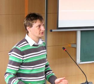
Assoc. Prof. Peter Labanc, PhD is a medieval historian at the Department of History, Faculty of Arts, Trnava University , Slovakia. His research focuses on medieval nobility , church hierarchy , and prosopography with regional expertise in Spiš and medieval Hungary/Slovakia . 2007 Mgr., 2011 PhD, 2022 Assoc. Prof. from Trnava University 2010 Jagiellonian University study, 2018 Vatican Archives research Research Specialties He investigates medieval social structures , toponymy , and Digital Humanities applications in historical sciences. His work includes GIS mapping for historical analysis and TEI encoding of medieval documents. Recent publications examine ecclesiastical boundary formation (2022) and Medieval Latin paleography (2016). Scientific Awards Queen Hedwig Scholarship (2010) for Central/Eastern European researchers Grants Project leader for VEGA 1/0610/13: Spiš Provostry transition studies VEGA 1/0162/16: Medieval toponymy corpus KEGA 013TTU-4/2020: Digital Humanities curriculum development
Jana Faixová Chalachanová is an Assistant Professor at the Department of Global Geodesy and Geoinformatics, Faculty of Civil Engineering, Slovak University of Technology in Bratislava. Since 1998, she has contributed to teaching and research in geospatial technologies, CAD systems, and data interoperability. Teaching Subjects: Geoinformatics, GIS in Building Sciences, Spatial Modeling in GIS, CAD Systems in Geodesy, Programming, Web Technologies in GIS Current Research Focus: Geographic Information Systems, spatial modeling of geoobjects, optimization of spatial analyses, and integration of heterogeneous geospatial data Her research spans applications in archaeology, solar radiation modeling, and environmental protection, leveraging LiDAR data and fuzzy logic frameworks. She has participated in multiple VEGA and APVV projects as a researcher and project leader. Scientific grants and projects she has participated in include: VEGA 1/0300/19 - 3D solar radiation modeling on tree vegetation APVV-0249-07 - Prediction of archaeological sites (project leader) VEGA 1/1035/04 - Standardization of geographic information (project leader) VEGA 1/5062/1998 - Geoinformation model of agricultural regions
Tünde Berta is a Lecturer at the Department of Pre-school and Elementary Education within the Faculty of Education at J. Selye University in Komárno, Slovakia. She has been employed at the university since 2004 and is currently pursuing her PhD in Pedagogy at J. Selye University (2024-). Her academic background includes a degree in Mathematics-Informatics from Comenius University's Faculty of Mathematics and Physics (1994-2000). Dr. Berta's educational journey began with her university studies in Mathematics-Informatics at Comenius University, followed by her current doctoral studies in Pedagogy at J. Selye University. Her professional development reflects a strong commitment to advancing educational practices, particularly in mathematics instruction and teacher development. Her research interests focus primarily on mathematics teaching methodology, with special emphasis on cooperative techniques and project methods in mathematics education. She has extensively explored continuing teacher education, adult education possibilities, teacher mentoring and its impact on classroom quality, and inclusive education approaches. Her work demonstrates a consistent dedication to improving teaching practices through evidence-based methodologies and innovative approaches that address the diverse needs of students in primary education settings. Analysis of Dr. Berta's publication record reveals a strong focus on practical applications of educational theory in mathematics instruction. Her recent work (2021-2024) shows increasing attention to teacher development, assessment methods, and the integration of technology in education. She frequently collaborates with colleagues like Zuzana Árki and Ladislav Jaruska, indicating active participation in research teams focused on improving mathematics education. Her publications span multiple languages (English, Hungarian, Slovak), reflecting her work within the Hungarian minority educational context in Slovakia. Her publications have received 5 citations according to institutional records 2 citations registered in citation indexes (Web of Science, Scopus) 3 citations in other databases Dr. Berta has been actively involved in developing educational materials and textbooks, including two versions of 'Project Teaching in School' (2022) in both Slovak and Hungarian. Her research often addresses the specific needs of Hungarian-speaking communities in Slovakia, particularly in the context of mathematics education and teacher development. She has participated in numerous international conferences, demonstrating her commitment to sharing knowledge across borders and engaging with the broader educational research community. Her work on cyberbullying during the pandemic period shows responsiveness to contemporary educational challenges.
Assoc. Prof. Renata Ďuračiová, PhD., serves as Associate Professor and Head of the Department of Global Geodesy and Geoinformatics at the Faculty of Civil Engineering, Slovak University of Technology in Bratislava. Her academic role centers on advancing geoinformatics through rigorous research in spatial data quality, uncertainty modeling, and mathematical GIS methodologies while leading departmental operations and curriculum development. Her research spans spatial databases, geospatial analyses, and environmental applications including Lidar processing, building footprint detection, and solar radiation modeling. Key contributions address bark beetle infestation prediction using satellite data and machine learning, alongside innovations in fuzzy logic for spatial database querying and heterogeneous data integration. Her work bridges theoretical geoinformatics with practical solutions for forest management and urban planning challenges. Analysis of her 2017-2025 publications reveals consistent focus on spatial data quality assessment, terrain parameter effects on environmental modeling, and algorithmic development for Lidar/satellite data processing. Recurring themes include uncertainty quantification in spatial analyses, cross-source data integration (e.g., OpenStreetMap/INSPIRE), and climate-driven ecological modeling. Her technical expertise manifests in specialized tools like point-cloud solar radiation calculators and predictive models for forest disturbances. Prof. Ďuračiová actively contributes to the geospatial community through leadership roles in the Cartographic Society of the Slovak Republic (Executive Committee since 2011) and Slovak Association for Geoinformatics (Presidency since 2011). Her professional engagement emphasizes advancing geoinformatics standards and applications within Central European contexts while mentoring through courses like Database Systems in GIS and Geodata Quality Analysis.