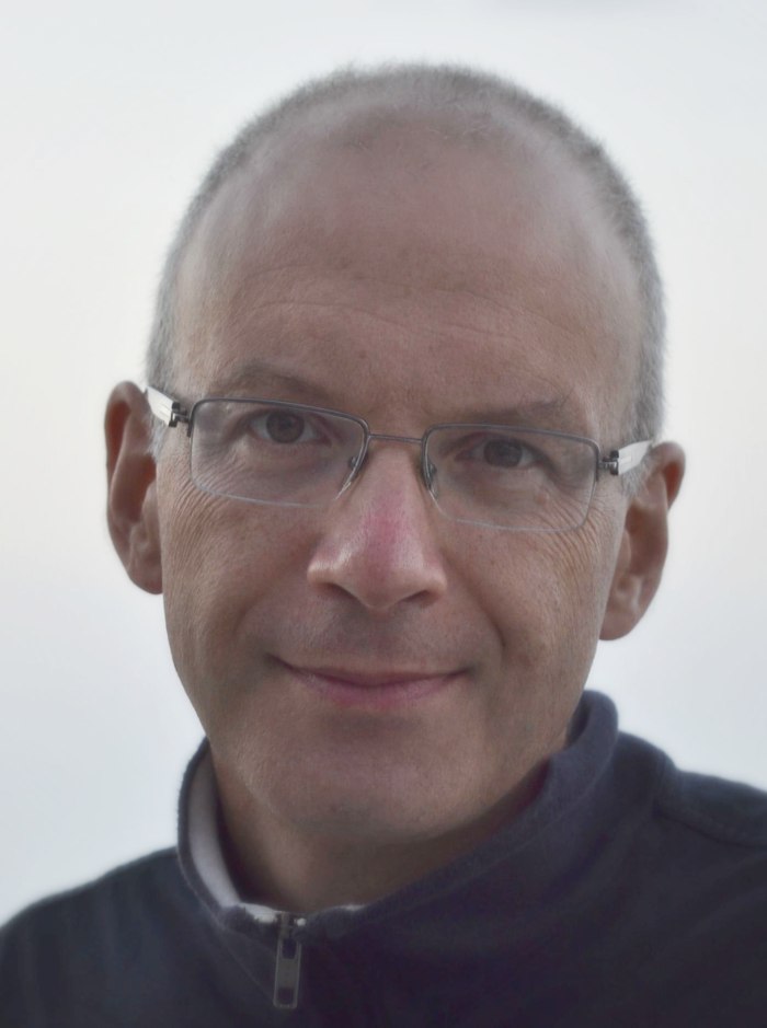
Yuki M. Asano is a full Professor at the University of Technology Nuremberg , leading the Fundamental AI (FunAI) Lab . Previously, he led the QUVA Lab at the University of Amsterdam and earned his PhD at the Visual Geometry Group (VGG) of the University of Oxford under Andrea Vedaldi and Christian Rupprecht. University of Technology Nuremberg (2024–present) University of Amsterdam (prior to 2024) University of Oxford (PhD, 2020) His research spans Artificial Intelligence , Machine Learning , and Computer Vision , with a focus on Causal Representation Learning , Self-Supervised Learning , and Efficient Model Adaptation . He pioneered techniques like BISCUIT (causal variable identification) and VeRA (parameter-efficient fine-tuning). His work extends to Medical Imaging and Environmental Monitoring through applications in fetal ultrasound analysis and marine debris detection. Recent publications (2023–2025) highlight advancements in Self-Supervised Learning , Vision-Language Models , and 3D Understanding . Notable papers include TWIST & SCOUT (multimodal LLM grounding), SIGMA (masked video modeling), and GeneralAD (anomaly detection). His ICCV 2023 work on Self-Ordering Point Clouds and MoSiC (optimal-transport motion trajectories) underscores his interdisciplinary approach. He received the JUPITER compute grant (2025) and an Outstanding Paper Award at ICLR 2024 . His collaborations span institutions like MIT-IBM Watson AI Lab, Qualcomm AI Research, and University of Amsterdam.
Clément Mallet is a Senior Researcher and Director of the LASTIG laboratory at Université Gustave Eiffel, IGN, and École Nationale des Sciences Géographiques (ENSG) in Champs-sur-Marne, France. He leads research in geospatial computer vision, focusing on the intersection of remote sensing, computer vision, and machine learning. His responsibilities include overseeing 75 laboratory members and directing the STRUDEL research team focused on spatio-temporal information modeling. Education: Habilitation (HDR) in Geographical Information Science, Université Paris-Est (2016) PhD in Image and Signal Processing, Télécom ParisTech (2010) Engineering Degree in Geographical Information Science, ENSG (2005) Master's in Remote Sensing, Université Paris 6 (2005) Research Interests: Dr. Mallet specializes in multi-modal land-cover mapping, change detection, geohistorical image analysis, and airborne lidar processing. His work integrates deep learning with geospatial data analysis to solve complex problems in environmental monitoring, urban studies, and historical geography. Current research explores foundation models for earth observation and semantic change detection using hybrid data generation techniques. Publication Trends: Mallet's recent articles (2021-2025) demonstrate strong focus on deep learning applications for geospatial challenges: 40% address land-cover mapping innovations, 30% develop novel change detection methodologies, 20% advance lidar data processing, and 10% explore historical map analysis. His work consistently bridges computer vision theory with operational remote sensing applications. Awards and Recognition: Schwidefsky Medal from ISPRS (2016) 5x Outstanding Reviewer awards (CVPR/ECCV/ICCV 2017-2024) Best Paper Awards at GEOBIA 2016 and ISPRS 2014 Young Researcher Award from GDR ISIS (2010) EuroSDR Best PhD Thesis supervision (2020) Research Leadership: Directs multiple national and international projects including MAESTRIA (ANR-funded multi-modal EO analysis) and HIATUS (historical image analysis). Supervised 14+ PhD students in geospatial AI topics. Secured funding from ANR, CNES, EU H2020 (VOLTA, LandSense), and industrial partners. Leads the STRUDEL team developing cutting-edge methods for territory dynamics analysis. Professional Service: Editor-in-Chief of ISPRS Journal of Photogrammetry and Remote Sensing (2021-present). Organized major conferences including ISPRS Congress (2020-2022 Program Chair) and JURSE events. Active in ISPRS working groups since 2008, currently leading initiatives in large-scale machine learning applications for geospatial data.
Hirokatsu Kataoka serves as Chief Senior Researcher at the National Institute of Advanced Industrial Science and Technology (AIST) in Japan, with multiple academic affiliations including Academic Visitor at the Visual Geometry Group (VGG) at University of Oxford, Visiting Associate Professor at Keio University, and Adjunct Associate Professor at Tokyo Denki University. He is Principal Investigator of both cvpaper.challenge and LIMIT.Lab, and serves as Research Advisor for SB Intuitions. Dr. Kataoka earned his Ph.D. in Engineering from Keio University (April 2011 - March 2014), where he received the Fujiwara Prize in 2014 as valedictorian equivalent. His research primarily focuses on innovative pre-training methodologies that eliminate dependency on natural image datasets, with his Formula-Driven Supervised Learning (FDSL) framework being particularly influential in the field. Kataoka's research interests center around representation learning with limited data resources, including zero-shot, unsupervised, and synthetic learning approaches. His work explores how visual/multimodal models can be effectively trained with minimal real-world data, addressing critical ethical concerns related to large-scale datasets. He has pioneered methods using fractal geometry, mathematical formulas, and procedural generation to create effective pre-training frameworks that rival traditional ImageNet-based approaches. His publication record shows a clear trajectory toward solving the challenges of learning with limited resources, with recent work expanding FDSL to audio processing, microfossil analysis, and visible-to-infrared translation. His papers consistently address the core challenge of building robust visual recognition systems without relying on massive annotated datasets, with increasing focus on practical applications across diverse domains. Scientific Awards & Recognition ACCV 2020 Best Paper Honorable Mention Award for 'Pre-training without Natural Images' AIST Best Paper Award (2019, 2022) BMVC 2023 Best Industry Paper Finalist Featured in MIT Technology Review His 3D ResNets paper ranks among the top 0.5% most-cited CVPR papers over a five-year period Dr. Kataoka actively advises numerous researchers across multiple institutions, with his research team comprising Ph.D. and Master's students from various universities. He has served as Area Chair for CVPR 2024 and 2025, will serve as IEEE TPAMI Associate Editor beginning in 2025, and organizes the LIMIT Workshop series at major computer vision conferences. His LIMIT.Lab, established in June 2025, serves as a collaboration hub focused on building multimodal AI models under constrained resources including compute, data, and labels.
Thomas Walter is a Professor at Mines ParisTech and Director of the Centre for Computational Biology (CBIO) , a research group affiliated with the Institut Curie and INSERM . His work focuses on applying Machine Learning and Computer Vision to biomedical image analysis, particularly in high-content screening and computational pathology . He also serves as Deputy Director of the Computational Oncology (U1331) unit and leads the Statistical Learning and Modeling of Biological Systems team. PhD in Medical Image Analysis (2003, Mines ParisTech) Postdoctoral work at EMBL (European Molecular Biology Laboratory) Director of CBIO since 2018 Holder of a PRAIRIE Chair (Paris Artificial Intelligence Research Institute) since 2019 Dr. Walter's research bridges biomedical imaging , machine learning , and cancer genomics . Key areas include: Statistical reconstruction of biological networks Prediction of tumor progression at genomic/transcriptomic levels Development of deep learning methods for cell cycle analysis Integration of multi-omics data for precision oncology Tools for spatial transcriptomics (e.g., autoFISH, RNA2seg) Recent publications highlight his work in spatial transcriptomics , immunotherapy outcome prediction , and deep learning for digital pathology . His team has developed open-source tools like FISH-quant and pyHiM for single-molecule RNA imaging analysis. Scientific Honors: PRAIRIE Chair (2019) for AI research in life sciences Dr. Walter actively contributes to teaching deep learning for image analysis in multiple graduate programs across France, including courses at Mines ParisTech , Université Paris-Saclay , and Institut Curie . His software tools (FISH-quant, pyHiM) and methodological frameworks (e.g., Cut-Detector, PointFISH) have become standard resources in bioimage informatics.
Thierry Badard is an Associate Professor at the Department of Geomatics Sciences , Université Laval, where he also serves as Director of the Center for Research in Geospatial Data and Intelligence (CRDIG) . With over 28 years of experience in geospatial science, he leads research initiatives at the intersection of GeoAI , LiDAR processing , and smart city technologies . Director, CRDIG (2016-2022) Steering Committee Member, Big Data Research Centre (CRDM) Researcher, Institute for Intelligence and Data (IID) Research Expertise spans geospatial big data, GeoNLP, and IoT applications for digital twins. His work addresses flood risk modeling , 3D urban analytics , and environmental monitoring through AI-driven solutions. Recent publications focus on contrastive learning for LiDAR segmentation and geospatial ontologies for early warning systems. Grant Leadership includes collaborative projects on smart insurance analytics (2018-2025), Arctic bioaerosol research (2019-2025), and Quebec-Morocco digital twin partnerships (2022-2023). He has advised 15+ graduate students in geomatics and related fields.
Pierre Alliez is a Senior Researcher and Team Leader at Inria Sophia Antipolis – Méditerranée, leading the TITANE project-team. He holds roles such as President of the Inria Evaluation Commission and Scientific Coordinator of the Inria-DFKI partnership. His research focuses on Geometry Processing, including mesh compression, surface reconstruction, and optimal transportation. Alliez has authored numerous scientific publications and book chapters, receiving accolades like the Eurographics Young Researcher Award (2005) and ERC grants (IRON, TITANIUM). His academic activities include supervising over 50 PhD students and postdoctoral researchers, and leading projects like GRAPES (Learning and Processing Shapes) and BIM2TWIN (digital twin construction). He has served on editorial boards for Computer Graphics Forum and ACM Transactions on Graphics , and organized major conferences like Pacific Graphics and Eurographics. His work bridges computational geometry, computer graphics, and applied mathematics, with practical applications in 3D printing, cultural heritage, and urban modeling. Education: No specific educational details provided, but has authored a textbook on Polygon Mesh Processing (AK Peters, 2010). Research Interests: Geometry Processing, Mesh Generation, Surface Reconstruction, Optimal Transport, and 3D Data Analysis. Grants & Projects: ANR Pisco, ERC IRON, BIM2TWIN, GRAPES, and collaborations with industries like Dassault Systèmes and Dorea Technology. Labs/Teams: Leads the TITANE team at Inria, contributing to software like CGAL and advancing open-source tools for geometric processing.
Laurent Caraffa is a Researcher at Université Gustave Eiffel, working at the LaSTIG laboratory of IGN (National Institute of Geographic and Forest Information). His research focuses on large-scale 3D data processing, including surface reconstruction from point clouds and images, leveraging triangulated structures and implicit methods. His work also covers indexing and searching within point clouds for large-scale place recognition, with applications in urban environments and navigation systems. Caraffa's research interests span 3D Data Processing, Surface Reconstruction, Point Cloud Processing, Large-scale Place Recognition, Indexing and Retrieval, Big Data, Cloud Computing, Mathematical Optimization, 3D Mapping, and Photogrammetry in degraded conditions. His work bridges theoretical computational geometry with practical applications in geographic information systems and autonomous navigation. His publication record demonstrates significant contributions to distributed 3D processing, particularly through advancements in Delaunay triangulation, watertight surface reconstruction, and neural radiance fields. Recent work shows a clear trajectory toward more efficient and scalable methods for processing massive 3D datasets, with growing emphasis on implicit representations and learning-based approaches for 3D reconstruction. Caraffa actively participates in the scientific community through organizing events like the Big Data Day 2023 at IGN and contributing to major research projects. His work has resulted in publications in top-tier conferences including ICLR, CVPR, ISPRS, and IEEE Big Data, establishing him as a significant contributor to the field of large-scale 3D data processing. As a research supervisor, Caraffa currently co-supervises four PhD students working on projects funded by AID, Criteo, and Huawei, focusing on large-scale place recognition, implicit representations for 3D reconstruction, and 3D reconstruction in degraded conditions. He is also the co-founder of ExtraLabs, a company developing distributed computing solutions for cooperative digital twins, demonstrating the practical impact of his research.
François Goulette is a Professor and Deputy Director of the Computer Science and Systems Engineering Unit (U2IS) at ENSTA Paris, part of Institut Polytechnique de Paris. His research focuses on 3D point cloud processing, LiDAR perception, and autonomous systems within the Robotics Center (CAOR). His primary research interests lie in 3D point cloud processing , LiDAR perception , and autonomous systems . His work spans fundamental algorithm development to practical applications in autonomous driving, cultural heritage digitization, and robotics. He has made significant contributions to domain generalization of LiDAR perception, semantic segmentation of 3D point clouds, and point cloud registration techniques. The analysis of his recent publications reveals a strong focus on domain generalization for LiDAR perception systems, with multiple papers addressing challenges in 3D semantic segmentation across different environments. His work combines multi-scale architectures , unsupervised learning , and dataset creation to advance the state-of-the-art in autonomous systems perception. The research spans both theoretical algorithm development and practical applications in urban environments. François Goulette leads research activities within the Robotics Center (CAOR) at ENSTA Paris. His team develops advanced techniques for 3D environment understanding, with applications in autonomous vehicles, cultural heritage preservation, and industrial robotics. The research combines computer vision, machine learning, and robotics to solve challenging problems in 3D perception and scene understanding.
El Mustapha Mouaddib is a Professor in the Perception and Robotics department at Universite de Picardie Jules Verne, affiliated with Laboratory Heudiasyc (UMR CNRS 7253). His research bridges advanced robotics with cultural heritage preservation, focusing on developing novel computer vision techniques for complex documentation challenges. His primary research interests include omnidirectional vision systems , hyperspectral imaging , and 3D reconstruction methodologies , with significant emphasis on applications for cultural heritage documentation. Mouaddib's work particularly addresses challenges in temporal illumination compensation , laser scanning registration , and multi-scale digitization of historical structures, as evidenced by his extensive Notre-Dame de Paris cathedral research. Analysis of his 15 most recent publications reveals a consistent trajectory toward heritage robotics - developing specialized computer vision algorithms for cultural preservation. His work demonstrates increasing sophistication in integrating multi-modal sensor data (TLS, hyperspectral, RGB-D) solving illumination challenges in historical documentation developing adaptive robotic systems for complex environments Notably, his Notre-Dame research forms a cohesive body of work examining structural changes through advanced 3D analysis. Mouaddib actively participates in major interdisciplinary projects including SAMURAI , ASSIDUITAS , SCANBOT , ADAPT , and SUMUM , which focus on heritage digitization and robotic exploration. His collaborative approach is evident through extensive co-authorship with institutions like CNRS and international partners in Japan and Italy. His laboratory work centers on the E-Cathedrale initiative, creating comprehensive digital twins of Gothic cathedrals through multi-temporal and multi-scale documentation. This involves developing specialized hardware (like the HDROmni camera system) alongside novel algorithms for processing challenging heritage environments.
Mathieu Brédif is a Permanent Researcher at LASTIG, Gustave Eiffel University, affiliated with the National School of Geographic Sciences (ENSG) and IGN. He serves as co-chair of ISPRS Working Group II/3 on Point Cloud Processing (2016-2020) and chaired ISPRS Working Group III/5 on Graphics and Remote Sensing (2012-2016). His academic appointments include Assistant Professor at École Polytechnique teaching Image Analysis and Computer Vision (INF573) and 3D Computer Graphics (INF443) since 2019-2020. Telecom ParisTech PhD (2005-2010) Stanford University Master in Computer Science (2004) École Polytechnique Engineering Degree (2000-2005) Brédif's research focuses on Lidar processing, 3D reconstruction, and geovisualization , with significant contributions to point cloud analysis, urban scene modeling, and historical image integration. His work bridges computer vision, photogrammetry, and geographic information systems, emphasizing practical applications in urban planning and cultural heritage. He has developed novel algorithms for point cloud inpainting, visibility estimation, and distributed 3D reconstruction. His publications reveal consistent focus on urban modeling through point cloud processing (58% of works), image-based rendering techniques (22%), and geovisualization systems (15%). The research trajectory shows increasing emphasis on deep learning applications for LiDAR data since 2016, alongside continued development of geometric algorithms for photogrammetric processing. ANR project leadership in geospatial data valorization (structurAtion et vaLorisation du patrimoinE géoGraphique - 9) iSpace&Time 4D web GIS development (5) European project participation in high-volume point cloud analysis (8) Brédif actively mentors doctoral candidates, currently supervising Melvin Hersent, Alexane Nghien, and Florent Geniet, with 8 completed PhDs including Pierre Biasutti and Murat Yirci. His laboratory work centers on the GEOVIS research team , developing the iTowns open-source framework for 3D geospatial visualization, which powers the Géoportail's 3D data engine and supports multiple ANR projects in cultural heritage visualization.
Ewelina Rupnik is a prominent researcher in photogrammetry and remote sensing, currently holding a researcher position at the Laboratory on Geographic Information Science (LaSTIG) at the French National Institute of Geographic and Forest Information (IGN) since 2017. She also serves as an associate researcher at the Paris Institute of Earth Physics (IPGP). Rupnik has established herself as a leading expert in historical imagery processing, neural radiance fields, and bundle adjustment techniques. Her educational background includes a PhD in photogrammetry from the Vienna University of Technology (2015), an MSc in Engineering in Photogrammetry from AGH University of Science and Technology, Poland (2005-2010), and an Erasmus exchange at the Technische Universitaet Muenchen, Germany (2009/2010). She recently completed her Habilitation from Université Gustave Eiffel in June 2025. Rupnik's research focuses on advancing photogrammetric techniques for processing historical imagery, developing novel neural radiance field approaches for satellite imagery, and improving bundle adjustment methodologies. Her work bridges traditional photogrammetry with modern deep learning techniques, particularly in the context of sparse satellite views and historical multi-epoch imagery. She has made significant contributions to the open-source MicMac photogrammetry software project. Her recent publications demonstrate a strong trend toward integrating deep learning with traditional photogrammetric methods, with a particular emphasis on satellite and historical imagery analysis. The research spans from fundamental algorithm development (like SparseSat-NeRF and Pointless Global Bundle Adjustment) to practical applications in earth sciences (landslide, earthquake, and glacier volume mapping). 2022 EuroSDR PhD Award for Corona satellite imagery processing Best Paper Award for BRDF-NeRF research Outstanding Reviewer at CVPR 2025 Rupnik actively contributes to the academic community through editorial and leadership roles, including serving as Editor-in-Chief of the French Journal for Photogrammetry and Remote Sensing (2021-2025), Advisory Board Member of the International Journal of Photogrammetry and Remote Sensing (2024-present), and Co-chair of the ISPRS Working Group on Image Orientation and Sensor Fusion (2022-2026). She regularly teaches at Université Paris Cité & ENSG (~30 hours/year since 2015) and has conducted numerous workshops worldwide on photogrammetry with historical images and MicMac software.
Ahed Alboody is a Professor and Researcher at HESAM University Group, specifically affiliated with CESI and the Digital Innovation Laboratory for Businesses and Learning to Support Territorial Competitiveness (LINEACT) in Nice, France. He holds a specialized doctorate in computer science from the University of Toulouse 3 Paul Sabatier and has extensive experience in deep learning, computer vision, and remote sensing applications. His work bridges academic research with practical applications in environmental monitoring, human-computer interaction, and spatial reasoning systems. Education: Specialized Doctorate in Computer Science, University of Toulouse 3 Paul Sabatier (IRIT), 2011 Master 2 Research in Electronics, Automation and Systems Engineering, National Polytechnic Institute of Toulouse (INPT-ENSEEIHT), National School of Civil Aviation (ENAC), ISAE-SUPAERO, and University of Toulouse III, 2006 Engineering Diploma in Electronics and Telecommunications, University of Tishreen (Techrine), Lattakia, Syria, 2002-2003 Undergraduate studies in Electronics and Telecommunications, University of Tishreen (Techrine), Lattakia, Syria, 2002 Alboody's research focuses on advanced applications of deep learning and computer vision, particularly in the areas of 3D hand gesture recognition, hyperspectral and multispectral image processing, and semantic segmentation. His work combines theoretical advancements in mixture-of-experts architectures with practical applications in remote sensing and environmental monitoring. He has pioneered approaches in frugal learning and zero-shot learning for image segmentation tasks, with applications in digital twins and collaborative robot environments. His publication record demonstrates a clear evolution from foundational work in spatial reasoning systems (2008-2012) to current cutting-edge research in deep learning architectures for 3D gesture recognition and hyperspectral image analysis. Recent publications (2022-2024) show a strong focus on mixture-of-experts transformers, parallel architectures for efficient computation, and applications in environmental monitoring with drones and satellite imagery. Alboody actively supervises Master's level research projects (two M2 level projects mentioned) and serves as a reviewer for prestigious journals including IEEE Transactions on Neural Networks and Learning Systems and IEEE Transactions on Geoscience and Remote Sensing. He has also been a member of the Technical Program Committee for international conferences on databases and knowledge applications. His laboratory work centers around the Digital Innovation Laboratory for Businesses and Learning to Support Territorial Competitiveness (LINEACT), where he leads research in engineering and digital tools. Current projects include developing graph neural networks for 3D hand gesture recognition using depth and skeleton data, and implementing frugal learning approaches for semantic image segmentation in collaborative robot environments.
National Institute of Applied Sciences of StrasbourgFrance
Tania Landes is a Professor at the University of Strasbourg (Unistra) affiliated with the ICube Laboratory UMR 7357 CNRS/Unistra and the PAGE Group (Architectural Photogrammetry and Geomatics). Her work focuses on integrating advanced 3D modeling and geomatics techniques for urban applications. Academic Rank: Professor Institution: University of Strasbourg Research Affiliation: ICube Laboratory UMR 7357 CNRS/Unistra Research Interests : Indoor and outdoor 3D modeling with RGB-D sensors and LiDAR Semantic segmentation of point clouds for BIM (Building Information Modeling) Thermal imaging integration for urban microclimate studies Historical and cultural heritage documentation via photogrammetry Urban tree modeling and vegetation impact on thermal comfort Scan-to-BIM workflows and automation Key Projects include the TIR4sTREEt thermal infrared studies of street trees in Strasbourg and COOLTREES for quantifying urban cooling benefits from vegetation. Her publications emphasize improving 3D reconstruction workflows and modeling accuracy across domains. Scientific Contributions span 15+ years with over 50 publications, covering: Urban heat island mapping (2022 onwards) Historical building modeling (2014-2017) Mobile laser scanning applications (2020 onwards) Kinect sensor calibration for 3D modeling (2015) Microclimate simulation via LASER/F (2016) Archaeological documentation (2011)
Catherine Achard is a full Professor at Sorbonne University, affiliated with the RPI-Bio team under Polytech Sorbonne. She has served as Deputy Director at Polytech Sorbonne since 2020 and has been actively involved in research and teaching in artificial intelligence and computer vision. Research Focus: Artificial Intelligence, Deep Learning, Action/Gesture Recognition, Multi-modal Interaction, Person Re-identification Teaching: AI courses at Sorbonne University (M1/M2) and Polytech Sorbonne, Image Processing for L3. Her recent publications (2023-2025) demonstrate expertise in 3D point cloud registration, adaptive virtual agents, and multimodal interaction analysis. Key trends include geometric constraint handling, deep reinforcement learning for action spotting, and biomedical applications of AI. Technical Contributions: Development of RoCNet++ for point cloud registration, ASAP framework for agent adaptation, and SALAD for action detection. Collaborations span robotics, medical imaging, and human-computer interaction projects across international conferences.
George Drettakis is a Senior Researcher at INRIA Sophia-Antipolis and leads the GRAPHDECO research group. He has held professorial roles at institutions including MIT, University of Reims, University of Toronto, and École Normale Supérieure. His research focuses on rendering for computer graphics and sound, with emphasis on image-based rendering, perceptual rendering, and audio-visual cross-modal effects. He has also explored interactive illumination, shadows, relighting, and generative models. Current Students: G. Kopanas (Neural Rendering), N. Violante (Generative Models), A. Petitjean (co-supervised), Y. Poirier-Ginter (co-supervised), P. Panantonakis (starting fall 2023). Postdoctoral Researchers: A. Gauthier at INRIA. His recent work includes 3D Gaussian Splatting , Diffusion-based Relighting , and Neural Radiance Fields . He has received the Eurographics Outstanding Technical Contributions Award (2007) and was named an Eurographics Fellow . He manages projects like ERC Advanced Grant FUNGRAPH and has participated in H2020 EMOTIVE , ANR SEMAPOLIS , and CROSSMOD . His group collaborates internationally and has hosted researchers from institutions such as UC Berkeley, Imperial College London, and TU Wien.