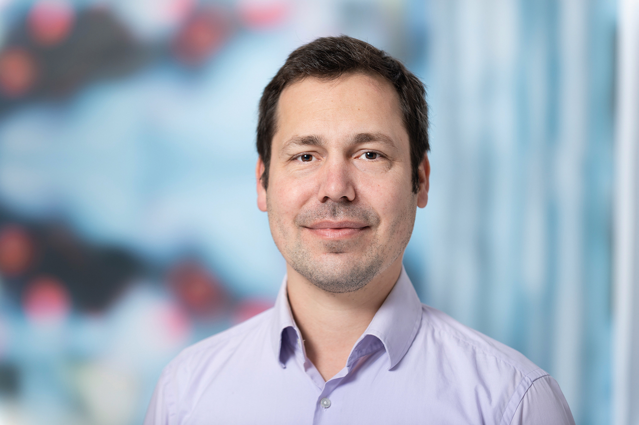
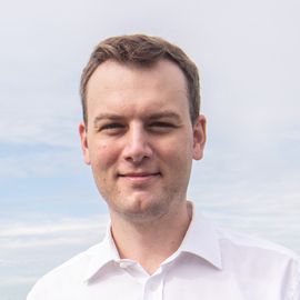
Prof. Dr. Thomas Brinkhoff is Chair of the Institute Board and Chair of Geoinformatics at Oldenburg University of Applied Sciences. He leads the Institute for Applied Photogrammetry and Geoinformatics (IAPG) and contributes to institutions like the Association for the Promotion of Geoinformatics in Northern Germany (GiN e.V.) and the Oldenburg Research and Development Institute for Computer Science (OFFIS e.V.). Education: Diploma in Computer Science (Informatik), Universität Bremen (1990) Doctorate in Computer Science (Dr. rer. nat.), Ludwig Maximilian University of Munich (1994) Brinkhoff's research spans geodatabase systems, spatiotemporal data processing, geosensor analytics, and location-based services. His work addresses Volunteered Geographic Information (VGI), web-based geospatial visualization, and mobile data integration, with applications in traffic management and forensic science. Recent projects include ProSaDi (Digital Provenance and Collection Research) and contributions to the Laboratory for optical 3D metrology . He has served on program committees for ACM SIGSPATIAL (2002-2019), AGILE conferences (2010-2025), and editorial boards of journals like GeoInformatica and TGIS. Notable Lectures: 2024: Forensic applications of tachograph data 2023: Geoinformatics in homicide investigations 2022: Spatiotemporal analysis for sustainability projects 2015: Open geodata standards at FOSSGIS 2014: Mobile sensor data processing
Dr. Stan Ahalt serves as the inaugural Dean of the UNC School of Data Science and Society (SDSS) and holds a professorship in the Department of Computer Science at UNC-Chapel Hill. He previously directed the Renaissance Computing Institute (RENCI) and currently acts as its executive advisor. Additionally, he is the associate director of informatics and data science at NC TraCS, the translational research institute at UNC. His academic journey includes a 22-year tenure as professor of electrical and computer engineering at Ohio State University and leadership roles at the Ohio Supercomputer Center. Ahalt’s research focuses on applying data science to societal challenges such as healthcare, climate, and judicial reform. Key initiatives include the National Consortium for Data Science and the iRODS project, which advanced enterprise data management systems. Ahalt has secured over $34.5M in grants to lead high-impact projects like the NHLBI BioData Catalyst (unifying biomedical data), the NCATS Translator (accelerating clinical discovery), and the NIH HEAL Initiative (ensuring FAIR data standards). He mentors students across doctoral and master’s programs, teaching data science fundamentals in courses like COMP 116: Introduction to Scientific Programming. His work emphasizes interdisciplinary collaboration, evidenced by roles in RENCI, NC TraCS, and the SDSS. Ahalt’s contributions span cyberinfrastructure development, educational innovation, and translational research, positioning UNC as a national leader in data science.
Michael Baldea is an Associate Professor in the Department of Chemical Engineering at the University of Texas at Austin . He holds a Ph.D. in Chemical Engineering from the University of Minnesota (2006), with prior degrees from 'Babeş-Bolyai' University in Romania (M.Sc. 2001, Diploma 2000). His research group develops theoretical and computational methods for Process and Energy Systems Engineering , focusing on integrated decision-making, performance optimization, and process intensification with industrial validation. Education: Ph.D., Chemical Engineering, University of Minnesota (2006) M.Sc., Interface Process Engineering, 'Babeş-Bolyai' University (2001) Diploma, Chemical Engineering, 'Babeş-Bolyai' University (2000) Research Thrusts: Integrated decision-making in chemical/energy supply chains Process performance monitoring and optimization Process integration and intensification Key applications include grid-responsive chemical plants, intensified distillation/column designs, and renewable energy integration for building systems. Scientific Awards: Frank A. Liddell, Jr. Fellowship NSF CAREER Award (2015-2020) Moncrief Grand Challenges Faculty Award (2014) AIChE Outstanding Young Researcher Award (2017) Implementation : His group has translated research into commercial tools through partnerships with industrial test beds and is working to integrate methods into commercial simulators. They explore predictive approaches for building energy management and strategic capital investment analysis in next-generation energy systems.
Dr. Jeremy Guest is the Levenick Professor in Civil and Environmental Engineering (and courtesy appointment in Chemical & Biomolecular Engineering) at the University of Illinois Urbana-Champaign (UIUC). He serves as Associate Director for Research at the Institute for Sustainability, Energy, and Environment (iSEE) and leads the Center for Advanced Bioenergy and Bioproducts Innovation (CABBI). His research focuses on advancing circular bioeconomies through sustainable sanitation systems, resource recovery from wastewater, and biofuel/bioproduct development from lignocellulosic biomass. Guest's work emphasizes Quantitative Sustainable Design (QSD) methodologies to bridge engineering innovation with policy and investment decisions. Education: PhD in Environmental Engineering (University of Michigan, 2012); MS (Virginia Tech, 2007); BS (Bucknell University, 2005). Research interests include wastewater treatment innovation, nutrient recovery, bioenergy systems design, and sustainable agriculture practices. Key contributions include the EcoRecover phosphorus recovery process, the QSDsan modeling platform, and leadership in CABBI's $262.5M DOE-funded initiative. Guest has secured funding from NSF, US EPA, USDA, and the Bill & Melinda Gates Foundation. Recognitions include the NSF CAREER Award, 2021 James J. Morgan Early Career Award, and the Paul L. Busch Award. He advises over 15 graduate students and leads multiple high-impact projects like the NEWgenerator sanitation system and oilcane biorefinery integration. Lab/Group: Guest Research Group focuses on experimental, computational, and policy-oriented research to solve global sustainability challenges. Current projects address algae-based wastewater treatment, fecal sludge management in low-income regions, and precision fermentation systems development.
Associate Professor Mohsen Kalantari is a Geospatial Engineering academic at the University of New South Wales (UNSW) School of Civil and Environmental Engineering , with concurrent roles as co-founder of the startup Faramoon . His career spans roles at the University of Melbourne's Department of Infrastructure Engineering and Victorian government's land administration initiatives through DELWP. Education : PhD in Geomatics Engineering (2008, University of Melbourne), Master of GIS Engineering (2004), Bachelor of Surveying Engineering (2001) His research bridges geospatial engineering with construction automation , focusing on 3D cadastre , BIM-GIS integration , and smart cities . Recent publications show trends in underground land administration , digital twins , and LADM standard implementations . Scientific Awards : National educational recognition (2019), Victorian educational grants (2018), and prestigious fellowships (2012) As a supervisor , he guides PhD candidates in topics ranging from BIM for waste management to underground cadastral systems . His industry engagement includes partnerships with the United Nations , Open Geospatial Consortium , and Singapore Land Authority .
Anil Madhavapeddy serves as Professor of Planetary Computing at the University of Cambridge's Department of Computer Science and Technology and directs the Cambridge Centre for Carbon Credits (4C). A Fellow of Pembroke College, he integrates systems research with environmental conservation through the Computer Laboratory's Environment and Energy Group. His career spans industry leadership (NetApp, Citrix, Intel), academic appointments (Cambridge, Imperial, UCLA), and entrepreneurial ventures (XenSource, Unikernel Systems, Docker). Madhavapeddy earned his PhD at Cambridge's Computer Laboratory in 2006. His research bridges computational systems and planetary-scale environmental challenges, with deep expertise in open-source development (OCaml, Xen, Docker, OpenBSD) and technology strategy advising for organizations including Zededa, Tezos Foundation, and Tarides. His work centers on environmental computing and climate informatics, leveraging distributed systems and functional programming to develop sensing infrastructure for conservation. Recent projects focus on carbon credit systems, AI-driven biodiversity monitoring, and sustainable computing architectures that minimize ecological footprints while maximizing analytical capability. Analysis of his 2025 publications reveals a concentrated effort on AI-integrated conservation tools, privacy-preserving carbon accounting, and energy-efficient computing. Key themes include spatial networking for ecological data, LLM-enhanced evidence retrieval in conservation science, and novel metrics for extinction risk assessment—demonstrating computational innovation applied to urgent planetary boundaries. No scientific awards were documented in the source material. Madhavapeddy advises multiple technology firms on strategic development while leading the Cambridge Centre for Carbon Credits, though specific grant funding details remain unreported. He actively contributes to the Environment and Energy Group at Cambridge's Computer Laboratory and directs the interdisciplinary Cambridge Centre for Carbon Credits (4C). His open-source leadership spans critical infrastructure projects including OCaml, Xen, and Docker, fostering collaborative development communities that underpin modern cloud and container technologies.
Jan Dirk Wegner is an Associate Professor at the University of Zurich, holding the chair in 'Data Science for Sciences' and leading the EcoVision Lab. He previously served as a Postdoc (2012–2016) and senior scientist (2017–2020) at ETH Zurich's Photogrammetry and Remote Sensing Group, following his PhD (with distinction) from Leibniz University Hannover (2011). His research bridges machine learning, computer vision, and remote sensing to address environmental and geoscience challenges, focusing on large-scale environmental data analysis, vegetation monitoring, and climate change mitigation. Education: PhD (with distinction) in Geodesy, Leibniz University Hannover (2011) Postdoc, ETH Zurich (2012–2016) Senior Scientist, ETH Zurich (2017–2020) Research Interests: Machine Learning, Computer Vision, Remote Sensing, Environmental Science, Climate Science, Geosciences, Explainable AI, Uncertainty Quantification, and Applications in Sustainability. The EcoVision Lab develops data-driven methods for global-scale environmental monitoring, including vegetation parameter mapping, flood prediction, forest degradation detection, and AI-driven ecological modeling. Awards: ETH Postdoctoral Fellowship (2012–2016) Science Prize of the German Geodetic Commission WEF Young Scientist Class 2020 (Top 25 globally under 40) Advising & Leadership: Director of the University of Zurich's Doctoral School in Data Science, leading the EcoVision Lab, and coordinating the CVPR EarthVision Workshops. His roles include Vice President of ISPRS Technical Commission II, member of the ETH AI Center, ELLIS, and UN-ETH Partnership. Labs/Teams: EcoVision Lab focuses on interdisciplinary AI applications for environmental challenges, collaborating with NGOs, governments, and industry to translate research into societal impact.
Dr James Herbert-Read is an Associate Professor and Whitten Lecturer in Marine Biology at the Department of Zoology, University of Cambridge. He serves as Deputy Head of Department (Postgraduate Education) and leads the Marine Behavioural Ecology Group. His research focuses on understanding how animals, particularly marine organisms, collect and process information from their environments to make behavioral decisions, with emphasis on social interactions, adaptation mechanisms, and ecological constraints. His group employs theoretical frameworks, controlled experiments, and quantitative field studies to investigate behavioral diversity in marine species. Key themes include collective behavior, predator-prey dynamics, camouflage strategies, and the impacts of environmental stressors on animal decision-making. Recent publications highlight work on lionfish vocalization mechanisms, cuttlefish camouflage, citizen science applications in marine research, and behavioral responses to visual and acoustic noise. Scientific awards and affiliations include: Whitten Lecturer in Marine Biology Associate Professor, University of Cambridge He has supervised research projects on topics such as: Social attraction in invasive fish species Evolution of coordinated movement Neurophysiological basis for leadership in shoals Maternal effects on offspring exploration
Luc Anselin is the Stein-Freiler Distinguished Service Professor of Sociology and the College at the University of Chicago. He serves as Director of the Center for Spatial Data Science and Senior Fellow at NORC, with affiliations in the Department of Sociology and the Committee on Quantitative Research Methods in Social, Behavioral, and Health Sciences. B.S., Vrije Universiteit Brussel, 1975 M.S., Vrije Universiteit Brussel, 1976 M.A., Cornell University, 1979 Ph.D., Cornell University, 1980 Anselin is a pioneer in spatial data science, spatial econometrics, and computational social science. His work bridges quantitative geography, regional science, and computer science, with applications in urban studies, economic analysis, and health research. His recent publications focus on spatial regimes, software ecosystems like GeoDa and PySAL, stigma analysis in public health, and computational methods for urban equity. These reflect interdisciplinary trends in spatial statistical modeling, open-source development, and geospatial policy evaluation. Scientific recognition includes: Fellow, Regional Science Association International (2004) Walter Isard Prize (2005) William Alonso Memorial Prize (2006) National Academy of Sciences (2008) American Academy of Arts and Sciences (2011) Anselin has led major grants and directed institutions like the GeoDa Center for Geospatial Analysis and Computation at Arizona State University. He has mentored interdisciplinary collaborations across sociology, economics, and data science. His laboratories and teams include the Center for Spatial Data Science at the University of Chicago and the GeoDa Center at Arizona State University, fostering innovation in geospatial computation and open-source spatial analytics.
Dr. Dennis Buckmaster is a Professor in Agricultural & Biological Engineering at Purdue University, serving as Dean's Fellow for Digital Agriculture. He holds a B.S. from Purdue University and M.S./Ph.D. from Michigan State University. His research focuses on digital agriculture, machine systems engineering, and data science applications in farming. He co-coordinates the Agricultural Systems Management program and teaches courses like Computing Technology with Applications and Ag Tech and Innovation. He leads the Open Ag Technology and Systems Center (OATS Center), advancing open-source solutions for agriculture through platforms like ISOBlue and OADA. His work integrates IoT, robotics, and machine learning to optimize crop production, livestock management, and farm decision-making. He has authored over 150 publications on precision agriculture technologies. Professional memberships include American Society of Agricultural and Biological Engineers and Fluid Power Society. He emphasizes data interoperability, edge computing, and bridging engineering with agricultural practices through collaborative frameworks like LATTICE and Meta Ag.
Patrick Kastner is an Assistant Professor at the School of Architecture and holds an adjunct appointment at the H. Milton Stewart School of Industrial and Systems Engineering at Georgia Tech. He directs the Sustainable Urban Systems Lab, focusing on environmental performance simulation and urban decarbonization. His work emphasizes software tools for sustainable urban decision-making, such as Eddy3D, a microclimate modeling toolkit widely adopted in academia and practice. Education: Ph.D. and M.S. in Systems Science and Engineering, Cornell University (2022, 2021) M.S. in Sustainable Building Science, Technical University of Munich (2017) B.S. in Energy Engineering, University of Erlangen–Nuremberg (2012) Research Interests: Environmental performance simulation, urban decarbonization, machine learning applications in urban systems, spatial analysis, and software development for sustainability. His work integrates computational fluid dynamics (CFD), surrogate modeling, and data-driven approaches to address urban climate challenges. Key Projects: Leads the Vertically Integrated Project SMUR (Surrogate Modeling for Urban Regeneration), fostering interdisciplinary collaboration across Georgia Tech. Developed Eddy3D, which streamlines microclimate simulations for architects and urban planners. Grants & Advising: Engages students from sophomore to graduate levels in sustainability research. Teaches at Cornell and UPenn previously. Advises on projects blending engineering, urban design, and climate science. Labs & Teams: Director of the Sustainable Urban Systems Lab, focusing on software tools for sustainable urban transformation. Collaborates with industry partners and global institutions on decarbonization strategies.
Filip Biljecki is an Assistant Professor jointly appointed at the Department of Architecture within the College of Design and Engineering and the Department of Real Estate at the NUS Business School, National University of Singapore. He is the founder and principal investigator of the NUS Urban Analytics Lab and was awarded the prestigious NUS Presidential Young Professorship in 2020. With over 150 peer-reviewed publications, his research bridges geomatic engineering, geospatial technologies, and urban data science to advance digital twins and data-driven urban planning. Dr. Biljecki's educational background includes: PhD in 3D GIS (cum laude), Delft University of Technology, Netherlands (2017) MSc in Geomatics, Delft University of Technology, Netherlands (2010) BSc in Geodesy and Geoinformatics, University of Zagreb, Croatia (2008) His research interests focus on emerging urban data sources, particularly urban imagery, and their application in 3D city modeling, digital twins, and GeoAI. He explores how crowdsourcing and open science can inform cutting-edge techniques for urban sensing and analytics at city-scale. His work significantly contributes to establishing smart cities through innovative methods that integrate recent advancements in computer science, geomatics, and urban data science. Analysis of his recent publications reveals a strong focus on street view imagery applications for urban analytics, digital twin development, and geospatial AI. His research spans multiple domains including urban morphology, environmental assessment, public health applications, and urban comfort analysis. The interdisciplinary nature of his work is evident in collaborations with researchers from diverse fields, producing impactful studies that address complex urban challenges through innovative methodological approaches. His notable scientific achievements include: Annual Teaching Excellence Award (ATEA), 2025 College Educator Award AY2023/2024, 2025 Urban Informatics Paper of the Year Award, 2023 Top 2% scientists worldwide (Stanford University), 2021 Presidential Young Professorship (NUS), 2020 As an educator, Dr. Biljecki has supervised dozens of students leading to publications in leading journals and placements at top universities and organizations. He has delivered talks at over 120 universities and organizations worldwide including MIT, Stanford, Harvard, and ETH Zurich. His research is supported through various grants and affiliations including his role as Principal Investigator at the Future Cities Lab Global at the Singapore-ETH Centre. The NUS Urban Analytics Lab, which he established, brings together scholars from diverse disciplines to drive research on making cities smarter and more data-driven. The lab has developed innovative tools like ZenSVI for street view imagery analysis and has produced influential research on urban digital twins, urban morphology, and GeoAI applications. Through his leadership, the lab continues to pioneer methods that advance data-driven urban planning and smart city development.
Amanda Giang serves as Assistant Professor at the University of British Columbia's Faculty of Applied Science, Department of Mechanical Engineering, holding a Canada Research Chair in Environmental Modelling for Policy. She maintains a joint appointment with the Institute for Resources, Environment and Sustainability (IRES). Her educational background includes a B.A.Sc. from the University of Toronto, followed by M.S. and Ph.D. degrees from MIT, with postdoctoral training at MIT and Harvard. Dr. Giang's research employs interdisciplinary approaches to develop modeling tools for environmental policy analysis, focusing on pollution assessment, environmental injustice, and the intersection of air quality, decarbonization, and equity. Her work emphasizes action-oriented partnerships with community organizations and government health/environment agencies. Current projects address freight transport decarbonization equity, cumulative impact assessment methodologies for overburdened communities, and holistic environmental impact evaluation in technology design. Her recent publications demonstrate expertise across environmental modeling, policy analysis, and justice frameworks, with significant contributions to understanding spatial inequities in environmental risk distribution and developing community-engaged research methodologies. UBC Killam Research Prize, 2023 Dr. Giang actively collaborates with community groups and government authorities through her LEAP (Learning, Environmental Assessment, and Policy) research group. Her work integrates technical modeling with real-world policy applications, particularly in urban environmental planning contexts where equity considerations are paramount. She has developed innovative frameworks for cumulative impact assessment and environmental justice analysis that directly inform regulatory decision-making processes. Her research laboratory focuses on developing open-source modeling tools for environmental policy analysis while maintaining strong community partnerships that ensure research addresses pressing local environmental justice concerns.
Beata Csatho PhD is a Professor in the Department of Earth Sciences at the University at Buffalo, affiliated with the College of Arts and Sciences. Her research focuses on remote sensing, glaciology, climate change, and geophysics. She holds a PhD in Geophysics from the University of Miskolc, Hungary (1993). Her work integrates geophysical, remote sensing, and climatic data to study ice sheet dynamics and cryospheric changes. She leads the Remote Sensing lab and teaches courses like GLY 465/565 (Environmental Remote Sensing) and GLY 325 (Geophysics). Recent research emphasizes Greenland and Antarctic ice dynamics, ICESat-2 validation, and developing tools like Ghub for collaborative glaciology. She advises PhD and Master's students and collaborates on major projects like ISMIP7 and IceBridge. Her lab focuses on advancing laser altimetry, DEM correction, and cryosphere observation techniques.
Gabriele Facciolo is a Professor at the Centre Borelli, ENS Paris-Saclay, France. He is a Senior Member of the Institut Universitaire de France (IUF) and holds an Innovation Chair (2025). His research focuses on image and video processing, remote sensing, and super-resolution techniques. Current affiliations: Centre Borelli (ENS Paris-Saclay), Institut Universitaire de France His research explores advanced algorithms for satellite stereo pipelines, real-time deblurring, denoising, and explainable AI systems for legal evidence enhancement. He coordinates projects like ANR SURECAVI (Super-resolution for visible camera systems) and ANR IMPROVED (video enhancement for judicial use), with recent work on Gaussian Splatting for Earth Observation and multi-date satellite super-resolution. Notable scientific achievements include the IGARSS 2025 Top 10 Student Paper Award and leadership in projects funded by ANR (€890k) and Prime Minister's entities (SGDSN/ANSSI). His work bridges computational imaging, defense applications, and digital forensics. Project leadership: SURECAVI, IMPROVED, BOFOR Key technologies: GPU acceleration, real-time processing, optical flow estimation, RPC refinement Gabriele actively contributes to open-source tools like S2P (Satellite Stereo Pipeline), MGM (MultiGlobal Matching), and OMNIflip. He teaches in the Master MVA program and collaborates across institutions (ENPC, UPF).