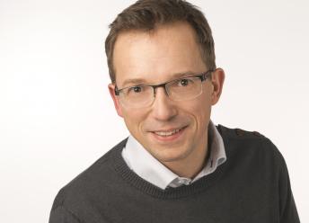
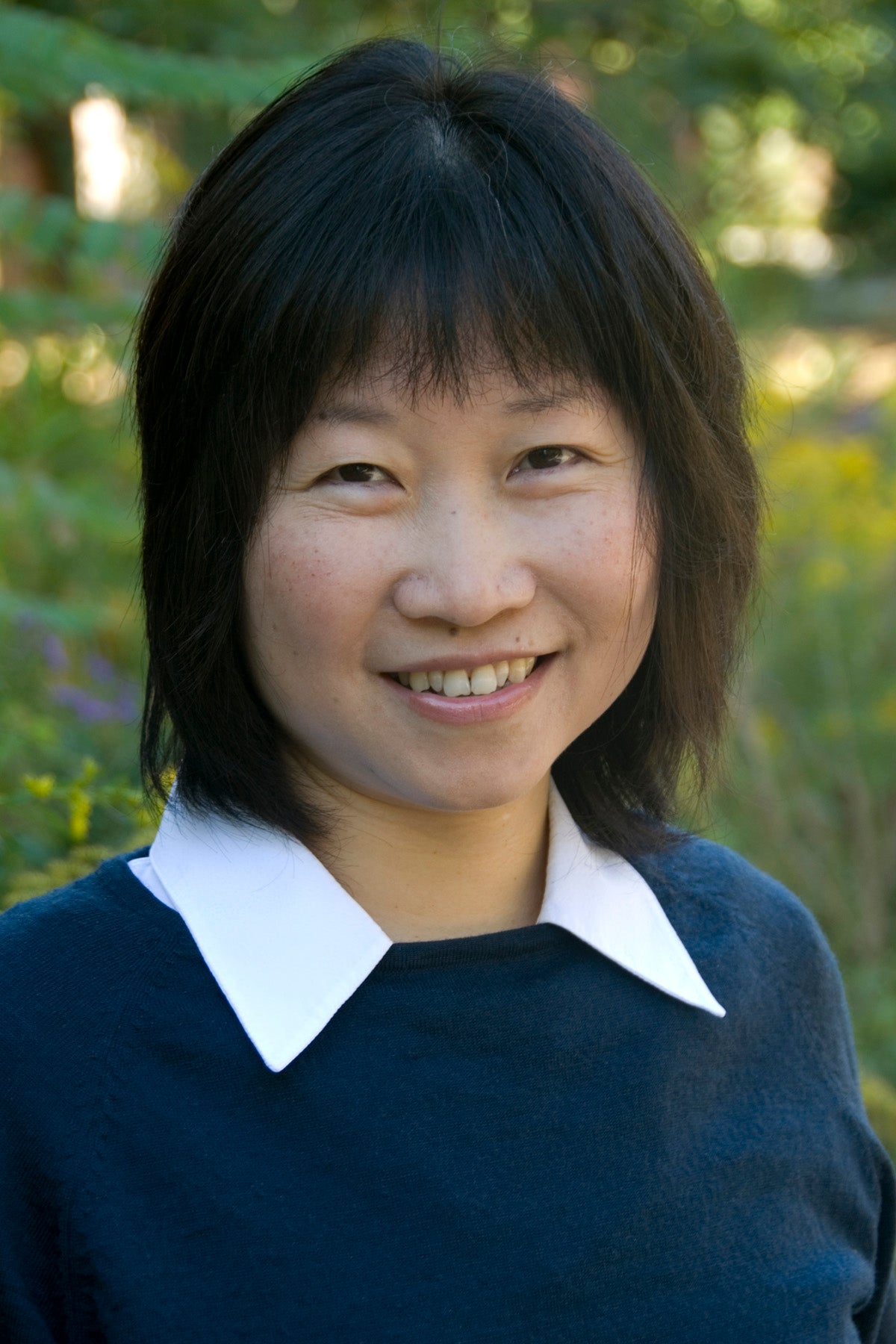
Professor Alex Klein-Paste is affiliated with NTNU's Department of Civil and Environmental Engineering, focusing on winter operations of roads and airports. His research emphasizes snow and ice engineering, anti-icing strategies, and friction dynamics. He leads the NTNU SnowLab, a specialized facility supporting education and research in snow engineering. Klein-Paste teaches courses on road planning, maintenance in cold climates, and infrastructure management. His research spans experimental studies on de-icing chemicals, snow compaction, and winter maintenance optimization. Key contributions include developing regression models for maintenance efforts and analyzing cross-country ski friction mechanics. He collaborates widely, with recent work addressing automated vehicle infrastructure needs and bicycle rolling resistance in winter conditions. Labs/Teams: Director of NTNU SnowLab, part of the roads, railways, and transport research group. His work bridges experimental engineering and real-world applications, influencing both academic and industrial sectors.
Prof. Dr. Bernd Möller is a faculty member at Europa-Universität Flensburg, specializing in sustainable energy systems management for developing countries. His research focuses on renewable energy integration, spatial analysis, and environmental planning, leveraging GIS tools for energy system transformation. Current position: Professor at Department Energy and Environmental Management Alumni of Flensburg University of Applied Sciences and Aalborg University (PhD in Energy Planning) Research interests encompass wind/solar/biomass systems, energy atlas development, and climate-resilient infrastructure. His work bridges technology, economics, and spatial planning in renewable transitions. Publications highlight trends in offshore wind modeling, biomass logistics, district heating expansion, and GIS-driven energy solutions. Key themes include decarbonization, resource constraints, and regional energy equity. Teaching involves applied GIS science, energy planning frameworks, and development cooperation. He leads the PhD program in Energy and Environmental Management for Developing Countries.
Jane Law is an Associate Professor at the University of Waterloo, located in EV3 3251. She holds a Ph.D. in Geodesy and Geomatics Engineering from the University of New Brunswick (2000), a University Teaching Diploma from the same institution (1999), an M.Sc. in Land Information Systems from Hong Kong Polytechnic University (1994), and a B.Sc. in Survey and Mapping Sciences from North East London Polytechnic (1985). Her research integrates spatial analysis with public health and criminology, employing Bayesian methodologies to examine neighborhood effects on health outcomes and crime patterns. Law's research focuses on geographic information systems, Bayesian spatial modeling, spatial epidemiology, environmental criminology, and health-oriented urban planning. She explores how built environments influence community health outcomes and crime distribution using advanced statistical geospatial techniques. Her publications demonstrate consistent focus on Bayesian spatial modeling applications in public health and crime analysis, with recent work emphasizing mental health spatial patterns, nutrition environments, and temporal crime trends. Research consistently integrates GIS with statistical innovation for policy-relevant insights. Law has supervised 43 Master's and 5 PhD students to completion and currently advises 2 Master's and 1 PhD candidate. She secured a long-term research grant as Principal Investigator for 'Advancing spatial analysis methodologies using a Bayesian approach' (2009-2022).
Christine Bauer is a Professor of Interactive Intelligent Systems at the Department of Artificial Intelligence and Human Interfaces (AIHI), University of Salzburg, Austria. She is also Co-Lead of the interdisciplinary focus area InterMediation. Music—Effect—Analysis at the inter-university organization Wissenschaft & Kunst. Her research lies at the intersection of artificial intelligence, human-computer interaction, and human-centered computing, with a strong emphasis on fairness, context-awareness, and multi-method evaluation in recommender systems. Doctoral degree in Social and Economic Sciences (Business Informatics), 2009, University of Vienna MSc in Business Informatics, 2011, TU Wien Diploma in International Business Administration, 2002, University of Vienna Study of Jazz Saxophone, Konservatorium der Stadt Wien Her research interests center on interactive intelligent systems , particularly recommender systems in music and media, with a human-centered approach. She investigates how technology can align with societal and individual needs, focusing on fairness in algorithms , culture-aware recommendation , and multi-stakeholder evaluation . Her work often integrates interdisciplinary methods and real-world impact. The recent publications highlight a consistent trend in fairness and diversity in music and news recommendation, cross-cultural user behavior , and evaluation frameworks . Her research bridges technical rigor with ethical considerations, particularly in algorithmic bias and artist equity. She has made significant contributions to understanding gender imbalance , cultural granularity , and user conformity in digital music ecosystems. Elise Richter laureate (FWF) 6 best paper awards, 5 nominations Women in RecSys Journal Paper of the Year Award (2023, 2024) 5 awards and 6 recognitions for reviewing excellence Christine Bauer has supervised over 70 theses and taught at 17 institutions worldwide. She is deeply involved in academic service, including editorial roles (AE at TOIS, TORS, JITT), conference organization (RecSys, CHI, CIKM), and mentoring initiatives (WiMIR, LEA, Allyship at CHI). She leads impactful projects such as FairRecKit and SpART: Spotlight on Artists in Recommender Systems , aiming to create more equitable and transparent recommendation technologies. She frequently engages in public outreach through keynotes, media appearances, and policy discussions. She is affiliated with the University of Salzburg as her primary institution and was previously associated with JKU Linz and the University of Klagenfurt. Her labs and research teams focus on interactive intelligent systems , music recommenders , and fair AI , often in collaboration with interdisciplinary partners in arts and social sciences.
Dave Bennett is a Professor in the Department of Geography at the University of Iowa, within the College of Liberal Arts and Sciences. His work bridges geographic information science, environmental policy, and complex systems theory, with a strong emphasis on interdisciplinary research. He is actively involved in teaching and mentoring graduate students, offering courses in GIS, field methods, and environmental applications. Research Interests: His research lies at the intersection of technology, policy, and science, focusing on geographic information science (GIScience) and environmental decision-making. He is particularly interested in human-environment interactions and how complex, nonlinear responses emerge from system interactions. Much of his work is framed within complexity theory and employs agent-based modeling, evolutionary algorithms, and cyberinfrastructure to study land use change, watershed management, and disaster response. Publication Trends: His most recent publications (2010–2016) demonstrate a consistent focus on agent-based modeling, parallel computing, land use dynamics, and socio-environmental systems. These works often integrate high-performance computing and service-oriented architectures to simulate complex spatial processes. Key themes include resilience, opinion diffusion, mobility, and provenance in geosimulation. Scientific Awards: No specific awards or fellowships are mentioned in the provided text. Advising and Grants: Dave Bennett has advised numerous PhD and Master’s students, including current advisees Patrick Bitterman, Haoyi Xiong, Shuang Xu, and James Madden. He has served as principal investigator or senior personnel on multiple major grants from the NSF, USDA, NIH, and NGA, totaling millions of dollars. Key projects include 'People, Water, and Climate,' 'Geoinformatics for Environmental and Energy Modeling and Prediction (GEEMaP),' and 'Understanding Water-Human Dynamics with Intelligent Digital Watersheds.' Labs and Teams: While no specific lab name is mentioned, his research is conducted within multidisciplinary teams and leverages cyberinfrastructure platforms at the University of Iowa. His work often involves collaboration with engineers, ecologists, and social scientists, particularly through NSF-funded interdisciplinary programs.
Claudia Hanson is a Senior Lecturer (Docent) at Karolinska Institutet and Professor of Implementation Science and Perinatal Epidemiology at the London School of Hygiene and Tropical Medicine. She is also a visiting researcher at the Aga Khan University in Nairobi. Her career integrates clinical expertise in obstetrics/gynecology, epidemiology, and implementation science. MD, MSc in International Health (Charité, Germany), MSc in Epidemiology, and PhD in Epidemiology (LSHTM) Specializes in maternal and newborn health in LMICs, with fieldwork in East Africa Principal Investigator for ALERT, QUALI-DEC, and SISTer’s Care projects Her research focuses on implementation science, health systems strengthening, quality of maternal care, and perinatal mortality reduction. Recent publications address vaccine confidence, stillbirth prevention, anaemia management, and climate change impacts on birth outcomes. Scientific awards include the SIGHT award (2019), WHO and FIGO advisory roles, and leadership in the Doctoral Programme in Biology of Infections and Global Health (BIGH). She has supervised 10 PhD students (4 main, 8 co-supervised) and leads the Sweden–Tanzania PhD training program in reproductive health.
Samsung Lim serves as an Associate Professor of geographic information systems (GIS) in the School of Civil and Environmental Engineering at the University of New South Wales (UNSW) Sydney. With expertise spanning data science, artificial intelligence, and machine learning, Lim applies geospatial technologies to critical real-world challenges in natural disaster management and public health research. Lim's interdisciplinary work bridges engineering, computer science, and public health domains to develop practical decision-making tools for emergency response and disease surveillance. Ph.D. in Aerospace Engineering and Engineering Mechanics, University of Texas, Austin, TX, USA M.A. in Mathematics, Seoul National University, Seoul, South Korea B.A. in Mathematics, Seoul National University, Seoul, South Korea Lim's research focuses on applying GIS to natural disaster management and public health challenges. Key areas include machine learning methods for bushfire susceptibility mapping, spatial clustering for landslide susceptibility analysis, city-scale evacuation management in flood scenarios, and social media-based natural disaster assessment. In public health, Lim investigates geo-correlations between environmental factors and asthma occurrence, computational approaches to avian influenza outbreaks, emerging hot spot analysis of COVID-19, and early detection systems for emerging infectious diseases. This work combines advanced spatial analytics with machine learning to address complex environmental and health challenges. The recent publication record demonstrates a clear interdisciplinary trajectory where geospatial science intersects with public health emergency response and natural hazard management. Lim's work consistently applies machine learning techniques to geospatial data, with particular emphasis on disaster susceptibility mapping, disease outbreak detection, and infrastructure monitoring. The research spans multiple continents and addresses both immediate emergency response needs and long-term environmental health challenges, reflecting a commitment to practical applications of geospatial science. Associate Editor of Geospatial Information Science National Delegate of Commission 3 of International Federation of Surveyors (FIG) National Representative of the International Cartographic Association (ICA) Commission on Sensor-driven Mapping Senior Member of Institute of Electrical and Electronics Engineers (IEEE) Lim actively contributes to the development of early warning systems for emerging infectious diseases through collaborations with public health researchers. The work on EPIWATCH demonstrates how AI can enhance surveillance capabilities for outbreak detection. Lim's research on cruise ship transmission of diseases and the spread of avian influenza through bird migration patterns and poultry trade networks shows strong engagement with real-world public health challenges. These projects often involve multidisciplinary teams spanning engineering, computer science, epidemiology, and veterinary medicine. Lim's work integrates multiple geospatial data sources and analytical techniques to address complex environmental and public health challenges. This includes developing frameworks for performance analysis of OpenStreetMap data, creating specialized road datasets for pedestrian navigation, and applying Persistent Scatterer Interferometry for land motion monitoring. The research combines traditional geospatial methods with cutting-edge machine learning approaches to extract meaningful insights from complex spatial datasets.
Dr. Erik Linstead is an Associate Professor and Senior Associate Dean at Chapman University, affiliated with the Fowler School of Engineering, School of Pharmacy, and George L. Argyros College of Business and Economics. His expertise spans Machine Learning, GPU Programming, Autism Spectrum Disorder, Assistive Technologies, Predictive Analytics, and Virtual Reality. Education: Bachelor of Science, Chapman University Master of Science, Stanford University Ph.D., University of California, Irvine Dr. Linstead's research integrates machine learning with diverse domains, including autism treatment, environmental monitoring, and software engineering. His recent publications focus on coral reef health, land surface temperature trends, and embedded machine learning systems. His scholarly work includes collaborations in remote sensing, medical informatics, and neurodiversity support. Articles highlight his interdisciplinary approach, applying AI to ecological challenges (e.g., Red Sea coral reefs, Nile Basin droughts) and human-centered technologies (e.g., VR therapy for autism, medication adherence analysis).
Marcus Gary is a Research Associate Professor at the Bureau of Economic Geology, Jackson School of Geosciences, The University of Texas at Austin, and Principal Geoscientist at the Edwards Aquifer Authority. His expertise lies in karst hydrogeology, focusing on karst processes and their implications for natural resource management. He holds a Ph.D. in Hydrogeology (UT Austin, 2009) and a B.S. from the same institution (2001). His doctoral work on Sistema Zacatón, a deep underwater cave system in Mexico, integrated geophysics, geochemistry, and NASA-funded DEPTHX AUV technology to map cave structures. Education: Ph.D. in Hydrogeology, UT Austin (2009) B.S., UT Austin (2001) A.S. in Marine Technology, College of Oceaneering (1994) Research Interests: Karst aquifer dynamics Groundwater-surface water interactions Volcanogenic speleogenesis Edwards and Trinity Aquifer management Geophysical and geospatial techniques in hydrogeology His work spans academic research, government service (USGS), and consulting. He teaches Applied Karst Hydrogeology at UT Austin and leads field operations for the Edwards Aquifer Authority. Notable projects include dye tracing studies in Central Texas, springhead delineation, and volcanic influences on karst systems. His research often emphasizes environmental policy and sustainable groundwater management. Labs/Teams: Edwards Aquifer Authority Field Operations, DEPTHX AUV Project Team, Jackson School of Geosciences Hydrogeology Group.
Harvey Miller is a Professor and Reusche Chair in Geographic Information Science at The Ohio State University's Department of Geography, College of Arts and Sciences. He serves as Director of the Center for Urban and Regional Analysis (CURA). His research focuses on GIScience, mobility science, and sustainable transportation, particularly integrating geospatial techniques with transportation equity, time geography, and urban sustainability. He teaches courses in geospatial databases, spatial modeling, and sustainable transportation. Education: Ph.D. (Geography), The Ohio State University, 1991 M.A. (Geography), Kent State University, 1987 B.A. (Geography), Kent State University, 1985 Research Interests: His work explores geospatial analysis of urban mobility, accessibility equity, and smart city technologies. Notable projects include the Ghost Neighborhoods initiative (3D modeling of historic Black neighborhoods), analysis of public transit reliability, and environmental justice tool development. He co-authored a National Academies report on geospatial tools for environmental justice. Achievements: Co-chair of National Academies consensus study on environmental justice tools Lead on Columbus Smart City Operating System project Recipient of U.S. Department of Transportation funding Labs/Teams: Director of CURA, collaborating with institutions like the Ohio History Connection on urban heritage projects. Affiliated with the Sustainability Institute and Translational Data Analytics Institute at OSU.
Dr. Emily Burchfield is an Assistant Professor in the Department of Environmental Sciences at Emory University, where she leads the FACES (Food, Agriculture, Climate, Environment, and Sustainability) Lab. Her research integrates social and environmental data to study agricultural sustainability, with projects focused on land use change, climate adaptation, and rural livelihoods. She holds a PhD in Environmental Engineering from Vanderbilt University and MA in Economics from the University of Louvain. Her work examines how agricultural systems adapt to climate change, the characteristics of productive and resilient farming, and drivers of cultivation and conservation behavior. Dr. Burchfield's research combines geospatial analysis with qualitative methods to understand agricultural transitions at multiple scales. Recent publications explore crop diversification, agricultural data practices, and rural livelihoods. Her group develops computational tools for agricultural analysis and collaborates with farming communities to support sustainable transitions.
Elvin Wyly is a Professor in the Department of Geography within the Faculty of Arts at the University of British Columbia. His research focuses on the relations between market processes and state policy in producing and reinforcing urban social inequalities, blending critical social theory, legal and policy analysis, and multivariate quantitative methods. Wyly earned his PhD (1995) and MA from the University of Minnesota, Minneapolis, and his BSc from The Pennsylvania State University. His academic journey reflects a deep engagement with geographical thought and methodology. His research interests span urban geography, housing policy and finance, gentrification and displacement, urban inequality, spatial analysis, critical social theory, digital geographies, GIS, and race, class, and gender studies. Wyly's approach combines critical theory with empirical analysis to examine how market forces and public policy interact to create spatial inequalities in urban environments. Analysis of Wyly's recent publications (2019-2024) reveals consistent engagement with themes of urban transformation, housing finance, and spatial inequality. His work increasingly addresses the digital turn in urban studies, examining smart cities, datafication of urban space, and the evolving nature of gentrification in the 21st century. There's a clear trajectory from studying traditional urban processes toward examining how digital technologies reshape urban inequalities and governance. Wyly's research demonstrates significant contributions to understanding the financialization of urban space, particularly through his work on subprime mortgage markets, housing discrimination, and the racial dimensions of urban development. His publications in leading geography and urban studies journals establish him as a significant voice in critical urban scholarship. His teaching appears to focus on urban geography, with courses covering topics related to cities, economies, transnational flows, digital geographies, and issues of gender, race, and class. His research website serves as a resource for students and colleagues interested in advanced urban geographical analysis.
Li Li is a Professor in the Department of Civil and Environmental Engineering at Pennsylvania State University. She leads the Li Reactive Water research group, focusing on the Critical Zone and its response to climate change and human activities. Her work examines interactions between water, soils, rocks, roots, and microbes, with implications for water quality and sustainability. Research interests include reactive transport modeling, stream chemistry dynamics, and the impacts of climate extremes on hydrological systems. She has contributed to high-profile studies such as the discovery of ancient carbon release via rivers and the effects of extreme rainfall on nutrient loss in American soils. Recent recognitions include dual awards from the Earth and Space Association (2024) and being named an Institute of Energy and the Environment Fellow. Her lab actively collaborates on projects like the BioRT-HBV model and applications of deep learning in hydrological data analysis. Key projects: Facilitating environmental investigations with single-column models, maximizing CO₂ trapping in geological formations Leadership roles: IEE Fellow, Principal Investigator of NSF-funded research
Louisa M. Holmes serves as Associate Professor of Geography and Demography at The Pennsylvania State University, with additional appointments as Associate Faculty in the Consortium on Substance Use and Addiction (CSUA), Social Science Research Institute (SSRI), and Population Research Institute (PRI), plus a courtesy appointment in the Demography Unit. Her academic trajectory includes a Ph.D. in Geography from the University of Southern California (2013), a postdoctoral fellowship at the University of California San Francisco (2013-2016), and prior service as Assistant Professor of Geography at SUNY Binghamton (2016-2020). Dr. Holmes specializes in health geography and demography, investigating how place-based inequities perpetuate health disparities through social environments, built infrastructure, and policy systems. Her dual research focus examines neighborhood stress mitigation via urban planning strategies and substance use landscapes using demographic/geospatial methodologies. She implements primary data collection through household surveys of hard-to-reach populations, ecological momentary assessment, and community-based participatory research. Current projects include the Bay Area Young Adult Health Panel Study (2014-2020), geographic analysis of opioid use disorder and treatment access, longitudinal evaluation of Pennsylvania's 2022 Opioid Settlement Funding impacts, and Monongahela Valley community environmental assessments. Her work receives funding from the National Cancer Institute, CDC, FDA Tobacco Centers of Regulatory Science, and California-based health research programs. Actively recruiting graduate students for research in substance use prevention, health inequity within the exposome framework, and climate-health disparity intersections, she maintains the Spatial and Community Health Lab (SCHLab) and contributes to the university's Food Security and Human Health and Population, Environment, and Governance research clusters.
Parker VanValkenburgh is an Associate Professor of Anthropology and Associate Professor of Archaeology and the Ancient World at Brown University. His research employs archaeological methods to address anthropological questions, focusing on colonialism and imperialism's impacts on Indigenous people and environments in the Peruvian Andes. He directs the Brown Digital Archaeology Laboratory and co-directs several major projects including the Paisajes Arqueológicos de Chachapoyas (PACha) project and GeoPACHA (Geospatial Platform for Andean Culture, History and Archaeology). His educational background includes: PhD from Harvard University (2012) MA from University of London (2005) MPhil from University of Cambridge (2004) BA from Stanford University (2003) VanValkenburgh's research focuses on the long-term impacts of colonialism and imperialism on Indigenous people and environments in the Peruvian Andes. Through studying architecture, ceramics, environmental datasets, and archival documents, he explores how relationships between people, institutions, and environments transform during imperial histories. His work emphasizes how survival and resilience strategies developed by communities dealing with empires are passed down across generations. He applies digital methodologies, particularly GIS, to map and analyze social, political, and environmental change in space and time, while also critically examining how digital mediation transforms archaeological practice. His recent publications reveal a strong trend toward integrating advanced computational methods with archaeological research. There's a clear emphasis on using AI, machine learning, and remote sensing technologies to enhance archaeological survey and analysis in the Andes. His work spans traditional archaeological topics like landscape, ceramics, and colonial architecture with cutting-edge digital approaches including vision foundation models, point cloud processing, and semi-supervised learning for identifying ancient urbanization patterns. His scientific achievements have been recognized with numerous awards: John Carter Brown Faculty Fellow (2023-24) Meenakshi Narain Excellence in Research Mentoring Award (Brown University, 2023) William G. McLoughlin Award for Excellence in Teaching in the Social Sciences (2021) Cogut Center for the Humanities Faculty Fellowship (2018) American Council of Learned Societies Fellowship (2017) VanValkenburgh has successfully secured substantial research funding for multiple projects. His Paisajes Arqueológicos de Chachapoyas (PACha) project has received NSF funding through 2025, while his GeoPACHA initiative has garnered support from ACLS and SPARC grants. He also co-directs the 'Mapping Historical Trauma in Tulsa, 1921-2021' project. His teaching portfolio includes courses on Geographic Information Systems, cartography, critical digital archaeology, and the archaeology of the Andean region, for which he received Brown's prestigious teaching award. He directs the Brown Digital Archaeology Laboratory, which serves as a hub for integrating digital methodologies with archaeological research. His collaborative network includes scholars from institutions like Vanderbilt University (Steven Wernke) and the University of Tulsa (Alicia Odewale), reflecting his commitment to interdisciplinary research that bridges archaeology, anthropology, and digital humanities.