Zahra Gharineiat is an Associate Professor at the University of Southern Queensland , affiliated with the School of Surveying and Built Environment . She has over 8 years of tertiary teaching experience and 11 years of administrative responsibilities. Bachelor of Surveying (BSurv), University of Tabriz Master of Engineering Management (MEngMgt), University of Melbourne PhD, University of Newcastle Research Interests : Zahra specializes in Geomatic Engineering and Machine Learning , with a focus on applications like Unmanned Aerial Vehicles (UAVs) , LiDAR , Digital Twins , and Remote Sensing . Her work spans Earth Science Observations , Satellite altimetry , and Geodetic data capturing , integrating Computational Modelling and Geoinformatics for innovative solutions. Professional Affiliations : She is a member of the Surveying and Spatial Sciences Institute (SSSI) and the International Union of Geodesy and Geophysics (IUGG) . Her research affiliations include the Centre for Future Materials (CFM) , Institute for Advanced Engineering and Space Sciences (IAESS) , and Centre for Astrophysics (CA) .
Dr Duncan Smith is an Associate Professor in GIS and Visualisation at the Centre for Advanced Spatial Analysis (CASA) at University College London (UCL). He serves as Programme Co-Director for the MSc Urban Spatial Science, focusing on digital visualisation and Geographical Information Systems (GIS) education. His research emphasizes urban sustainability, transport accessibility, and interactive urban visualisation, with a particular interest in global mega-cities like London, Singapore, and São Paulo. Dr Smith holds a PhD from UCL (2011), an MSc from the University of Edinburgh (2005), and a BA (2003). His recent projects include leading the ESRC-funded Driving Urban Transitions project (2024) exploring sustainable travel in small cities and outer metropolitan areas. Previously, he was Co-Investigator on the SIMETRI project (NSFC JPI Urban Europe) analyzing urban sustainability in London, the Randstad, and China's Greater Bay Area. His research interests span urban visualisation techniques, transport equity analysis, and polycentric urban development. Key areas include GIS-driven urban modelling, accessibility metrics, and the intersection of housing policy with sustainable urban form. His interactive visualisations, available on citygeographics.org , showcase innovative approaches to spatial data presentation. Dr Smith's work consistently addresses global sustainability challenges through geospatial methodologies. Recent studies highlight inequalities in transport accessibility and the spatial implications of urban policies. Upcoming projects will further investigate small-city mobility dynamics using multi-national collaborations with Amsterdam and Lisbon researchers.
Ross Brown is an Associate Professor at Queensland University of Technology (QUT) in the School of Computer Science, specializing in virtual and augmented reality technologies. His academic journey includes a PhD from QUT and extensive contributions to immersive technology research and education. Position: Associate Professor Institution: Queensland University of Technology School: School of Computer Science Education: PhD (Queensland University of Technology) Professor Brown's research focuses on Virtual Reality, Augmented Reality, Data Visualisation, Process Visualisation, Information Visualisation, Computer Graphics, and Games Technology within the broader field of Artificial Intelligence and Information and Computing Sciences. His work spans applications in healthcare, education, environmental monitoring, urban planning, and industrial training, demonstrating the versatility of immersive technologies across multiple domains. His recent publications reveal a strong emphasis on practical applications of immersive technologies, with research spanning healthcare rehabilitation, geological education, urban engagement, surgical applications, and environmental monitoring. The interdisciplinary nature of his work is evident in collaborations with researchers from diverse fields including medicine, environmental science, urban planning, and education. Augmented Reality applications in surgery and rehabilitation Virtual Reality systems for geological education and training Immersive environments for industrial process training VR/AR applications for environmental monitoring Location-based VR for esports and social interaction Professor Brown has received significant recognition for his expertise, including multiple keynote invitations to international conferences such as BPM2017 in Lisbon, Assurance webinars on trusted autonomous systems, and Engage2 conferences. He has served as an International Researcher of Note for ARC funding assessments and has been a regular speaker at Microsoft Tech Ed since 2006. His academic service includes reviewing for major conferences including MSRA Gaming & Graphics, Graphite, AVI, and BPM, as well as serving as a reviewer for journals such as Future Generation Computer Systems and Knowledge and Information Systems. Professor Brown has supervised numerous doctoral and master's students, with completed projects focusing on visual immersion, collaborative business process modeling, and 3D virtual environment validation.
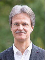
Dr. Stefan Thiemann is a faculty-level researcher at the University of Hamburg, serving since 2017 as head of the Center for Sustainable Research Data Management and since 2016 as the university’s Open-Access officer. He represents Hamburg in the National Research-Data Infrastructure (NFDI) and is a principal investigator in the Cluster of Excellence "Understanding Written Artefacts" (Research Field F: Data Linking). Education: Diplom in Meteorology & Computer Science, University of Hamburg (1990) Dr. rer. nat. in Geosciences, University of Hamburg (1996, dissertation on Arctic boundary-layer convection) Research interests: Thiemann’s work sits at the intersection of digital infrastructure and the humanities. He designs sustainable research-data repositories, federated information systems and on-demand transformer models that allow scholars to re-use humanities data at scale. Current themes include FAIR data implementation, AI-assisted transcription & annotation of manuscripts, and open-science policy development. His recent articles (2023-2025) cluster around two trajectories: building reusable, AI-ready data infrastructures (federated repositories, sustainable viewers, chatbots fine-tuned for humanities queries) and fostering humanities-centred AI workflows (automatic linking of manuscript metadata, large-scale text mining, and user-friendly annotation tools such as the TAMAR platform). Service & awards: Member, University of Hamburg Research Infrastructure Council (2020-) Member, Steering Group on Digitalisation in Research (2020-) Open-Access Officer, University of Hamburg (2016-) Former Faculty Information Officer, Faculty of Humanities (2012-2017) Teaching & grants: He regularly teaches Bachelor seminars on digital research-data management and Internet competence. He leads or co-leads major third-party projects including the DFG-funded SFB 950 “Manuscript Cultures”, the Hamburg Open Science initiative, and infrastructure grants that established the university’s research-data repository and DOI services. Labs & teams: Thiemann heads the Center for Sustainable Research Data Management and is a core member of the Data Linking Research Unit within the UWA Cluster of Excellence. He coordinates interdisciplinary teams developing the UHH research-data repository, FUNDus! collection portal, and manuscript-culture databases hosted at the CSMC.
Dr. Angela Tintrup gen. Suntrup is a permanent scientific staff member (Wissenschaftliche Mitarbeiterin) at the Chair of Geomorphology, Institute of Geography and Geology, University of Würzburg since 2002. She holds a Diplom (equivalent to M.Sc.) in Applied Physical Geography from the University of Trier (2001) and has since specialized in geomorphological and remote-sensing analyses of landscape change. Education 1994–2001: Studies in Applied Physical Geography (major), Remote Sensing & Soil Science (minors), University of Trier 2001: Diplomarbeit on current and sub-recent morphodynamics on the southern slope of Sierra del Gigante, SE Spain Research Interests Her research integrates geomorphology , remote sensing and GIS to quantify landscape change driven by natural processes and human activities. A major strand focuses on land-use/land-cover change and its geomorphological consequences in semi-arid Spain, especially around the Conde de Guadalhorce reservoir. She couples field-based sedimentology, soil surveys and detailed GIS analyses with multi-decadal satellite data to reconstruct sedimentation histories and model future landscape scenarios. Another innovative axis involves extended-reality (VR/AR) visualisation of slow geomorphic processes (river-terrace formation, marshland desiccation) for both research and university teaching within the “WUEDIVE – Digital Innovation in Teaching” initiative. Scientific Awards & Grants No specific awards or grants are listed in the provided text. Advising & Teaching Dr. Suntrup advises final theses within the M.Sc. “Applied Physical Geography” and offers an academic advisory service on Wednesdays 10:00–12:00 (by appointment). She has previously served as a tutor for GIS courses at the University of Trier and leads interdisciplinary field practicals linking physical geography and remote sensing. Labs & Teams She is an integral member of the Geomorphology working group led by Univ.-Prof. Dr. Roland Baumhauer at the University of Würzburg, participating in several collaborative projects including the SFB 1211 – C02 “Transport and Deposition” and the GEO-XR project for immersive geographical spatial analyses.
Anne-Catherine A.M. Dieudonné, holding the title Dr.ir., is a faculty researcher at the Faculty of Civil Engineering and Geosciences, Delft University of Technology , within the Section of Geo-Engineering . Her work bridges fundamental geomechanics with pressing energy and environmental challenges, focusing on clays, bentonites, bio-cemented sands, geothermal systems, nuclear waste disposal, and CO₂ geological storage. Education & Training: Doctor of Engineering (Dr.ir.) – advanced doctoral degree in civil engineering/geosciences, exact institution and dates not stated in the source. Research Interests: Anne-Catherine’s research is organised around four pillars: Energy Geotechnics: thermo-hydro-mechanical (THM) modelling of geothermal systems in deep mines, cold-water injection-induced fracturing, optimisation under uncertainty. Environmental Geotechnics: long-term performance of clay barriers for nuclear waste repositories, gas and fluid transport in saturated clays, self-healing of rock-salt fractures. Bio-mediated Ground Improvement: micro-scale mechanics of bio-cemented sands, influence of carbonate distribution on stiffness and strength, DEM and experimental characterisation. Advanced Experimental & Numerical Techniques: development of novel visualisation devices for fluid-driven cracks, constitutive modelling of expansive clays, zero-thickness interface elements for fracture simulation. Publication Trends: Since 2020 she has authored or co-authored more than 25 peer-reviewed articles and conference contributions. The 2025 corpus shows a strong emphasis on geothermal reservoir engineering , bio-cemented geomaterials , and deep geological disposal , with methodological advances in coupled THM modelling, discrete-element simulation, and experimental validation. Scientific Awards & Honours: ABTUS Scientific Prize – Belgian Association for Underground Techniques and Urbanism (2012) C.B.R. Heidelberg Prize (2011) Bright Spark Lecture Award (2025) Ioannis Vardoulakis PhD Prize (2017) NWO Veni Grant (2019) Supervision & Grants: Anne-Catherine has supervised at least one doctoral student, A. Zhang , on bio-cemented sands. She is principal investigator on the NWO Veni project focusing on clay fracture mechanics and participates in the European EURAD consortium for radioactive waste management research. Laboratory & Teams: She is affiliated with the Geo-Engineering Section laboratories at TU Delft, which host advanced triaxial, oedometer, and bespoke visualisation rigs for clay and sand testing. Collaborative networks span TU Delft, KU Leuven, University of Liège, and multiple European institutions within EURAD.
Jennika Hammar is a researcher at the Alfred Wegener Institute, Helmholtz Centre for Polar and Marine Research in Potsdam, Germany. She is part of the Permafrost Research group under the institute's polar terrestrial environmental systems program. Her work focuses on Remote Sensing , Geoinformation Systems , and Visualisation , with emphasis on understanding permafrost dynamics and cryosphere-climate interactions. Recent research includes studies on ice wedge dating in Siberia, hydrological monitoring of rock glaciers in the Alps, and paleoenvironmental reconstructions in Lake Victoria. She contributes to open science via data publishing platforms like PANGAEA, ensuring accessibility of georeferenced datasets. Her 2025 publications highlight methodological advancements in paleoclimatology and cryosphere analysis.
Mohammad Taleai is a Professor in Geoinformatics at the Faculty of Geomatics, K.N.Toosi University of Technology and an Adjunct Professor at the Geospatial Research Innovation and Development (GRID) group within the School of Built Environment, University of New South Wales (UNSW) . Research Focus: Deep Learning & Artificial Intelligence for Geospatial Applications, Urban planning/resilience, Volunteered Geographic Information (VGI), Location-Based Social Networks (LBSNs), 3D city modeling for Smart Cities, Digital Twins, and Urban Policy-Making. Leadership: Founder of the Iranian Center of Excellence in Geospatial Information Technology (GIT), former CEO of a GIS-focused private company, and director of the Spatial Decision Making & Smart Cities Lab . Collaborations: Built partnerships with University of Twente , University of Hanover , University of Berlin , University of Wuhan , and Hiroshima University for international grants and student co-supervision. Impact: Led over 10 funded research/industry projects, supervised PhD/MSc students (names not listed), and authored 180+ refereed papers and two books on GIS and Geo-Visualization.
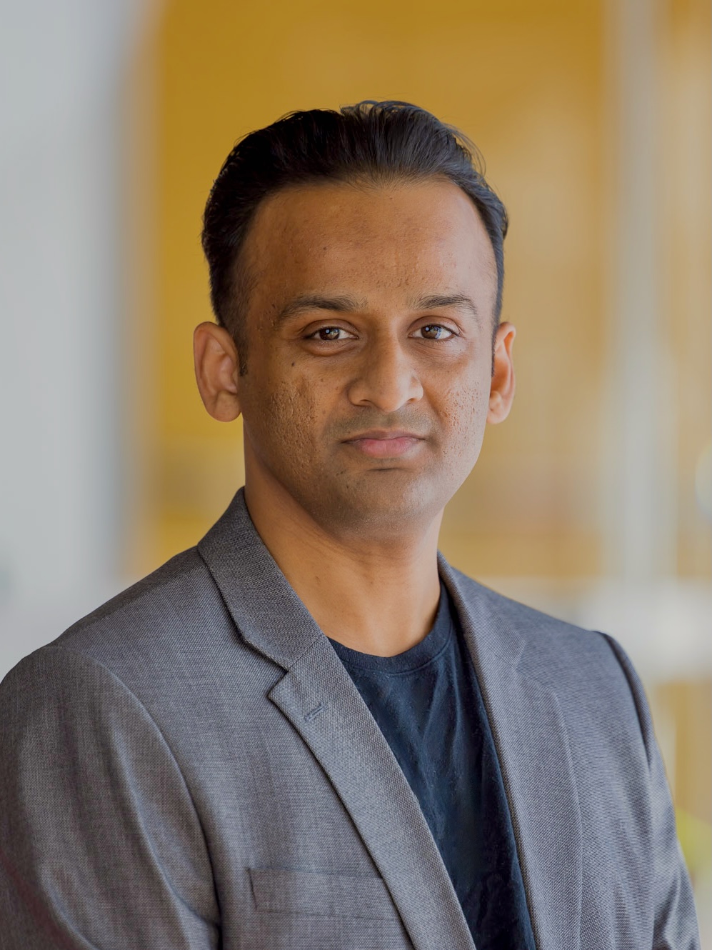
Dr. Balamurugan Soundararaj is a Research Fellow at the City Futures Research Centre, University of New South Wales (UNSW), specializing in geospatial analysis, urban planning, and data visualization. With 8 years of experience in academia and industry, he contributes cutting-edge research to digital valuation models, predictive analytics, and spatio-temporal urban studies. His work integrates machine learning and geospatial technologies to address property market dynamics, transportation systems, and smart city challenges. Fields of Interest: Urban and Regional Planning Geospatial Data Modeling Information Visualization Spatial Statistics Human Geography Grants: 2021: API Australian Property Research and Education Fund Grant for 'Towards understanding regional property markets' 2021: ADA Faculty Research Partnership Scheme Grant for Steiner/Montessori school system research 2018: UCL Yusuf Ali Travel Grant for Complex Systems Conference presentation Scientific Recognition: 2019: Best Paper (Early Career Researcher), GIS Research UK 2015: Best Paper, Construction Track, RICS Annual Conference His research employs advanced analytical methods to visualize and model large-scale spatial data, focusing on transparent communication of complex urban systems. Key publications analyze bikeability improvements, property market tools, and footfall dynamics using Wi-Fi signals.
Leonardo Portes dos Santos is an Adjunct Senior Research Fellow at The University of Western Australia (UWA), affiliated with the School of Earth and Oceans and the Department of Mathematics and Statistics. He holds a PhD in Sport Sciences from Universidade Federal de Minas Gerais (Brazil), complemented by a Master’s and Bachelor’s in Physics. His interdisciplinary research merges statistical physics, complex systems, and data analytics to address challenges in geosciences, sports, and biomedical fields. He leads data science initiatives for industries like Rio Tinto and Woodside, and develops geophysical visualization tools for decision-making. He mentors HDR students in Python and data science. Education: PhD in Sport Sciences (2014), UFMG MSc in Physics (1999), UFMG Bachelor’s in Physics (1996), UFMG Research Interests: Complex systems applied to data science, nonlinear time series analysis, network science, and multidisciplinary collaborations in geosciences (oil/gas reservoirs), human motor learning (EEG and behavioral data), and cancer immunotherapy. His work emphasizes bigdata visualization, risk assessment, and fusion of geophysical responses. Grants & Projects: Led the Subsurface Big Data Visualisation and Analysis: Oil/Gas Reservoirs project (2018–2019), funded by Woodside. His research contributes to UN SDGs related to sustainable resource management and innovation. Awards: 2016 Honorary Award at the 6th International Conference on Nonlinear Science and Complexity 1994 Junior Researcher Award in Exact Sciences (Earth Sciences and Engineering) Labs & Teams: Involved with UWA’s Centre for Exploration Targeting and the ITTC Data Analytics for Resources and Environments (DARE) group. His work integrates machine learning and network science for industry-relevant problems.
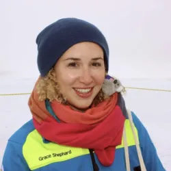
Dr. Grace Shephard is an Honorary Senior Lecturer at the Research School of Earth Sciences (RSES) at the Australian National University (ANU), hosted within the Geophysics-Geodynamics groups. She received her PhD from the University of Sydney's EarthByte Group and has held postdoctoral and research roles at Norwegian Centres of Excellence, including the Centre for Earth Evolution and Dynamics (CEED) and the Centre for Planetary Habitability (PHAB). Currently, she leads the POLARIS project, funded by the Norwegian Research Council, investigating the Arctic's evolution in deep time. Her research focuses on plate tectonics, mantle dynamics, and paleogeography, utilizing digital Earth models to explore geological processes over millions of years. Education: BSc (Adv.) (Honours I) and PhD from the University of Sydney Research Interests: Plate tectonics, paleogeography, mantle structure, GPlates software, science communication, and STEM education initiatives Dr. Shephard is actively involved in science communication, advocating for accessible data visualization through initiatives like the Batlow color scheme and promoting STEM engagement through programs such as Curious Minds and STEMPals. Her work bridges computational geodynamics and observational geology, with contributions to understanding Arctic geology and mantle processes. Notable projects include the Tasmanide Geodynamics and Mineral Systems and collaborations on the SVALGEOL project. She is affiliated with the University of Oslo as a Senior Researcher and contributes to open data and figure-sharing platforms like S-ink.org.
Dr. Michael Roach is an Adjunct Researcher in Earth Sciences at the University of Tasmania's School of Natural Sciences. His research focuses on geophysics, structural geology, and electromagnetic methods applied to mineral exploration, mine waste management, and environmental geoscience. He has collaborated on projects involving Tasmania's geological structure, tailings dam stability, and geophysical imaging of subsurface features. Education: Doctoral training in geophysics and exploration methods, with expertise in integrating geophysical data with geological mapping and machine learning. Research Interests: Geophysical exploration methods (electromagnetic and gravity/magnetic), structural analysis of ore deposits, geotechnical assessment of mine tailings, and environmental applications of geophysics. His work bridges academic research with industry needs in mineral exploration and environmental remediation. Key Projects: Geophysical characterization of mine tailings dams for stability assessment 3D modeling of granite intrusions in Tasmania Immersive visualisation tools for field-based geoscience education Environmental monitoring of legacy mine sites using geophysical techniques Supervision & Teaching: Advised over 15 PhD and MSc students on topics ranging from mineral exploration methods to geophysical inversion techniques. Contributed to educational grants advancing geoscience visualization and fieldwork pedagogy. Labs/Teams: Collaborates with the ARC Centre of Excellence in Ore Deposit Research and industry partners like GHD Pty Ltd on tailings management and geophysical innovation.
Dr. Bonnie Boyana Buyuklieva is a Lecturer in Data Science for Society at University College London's Department of Information Studies. With a background in architecture and computation, including professional experience at Foster and Partners and academic work at Bauhaus University Weimar, she holds a PhD from the Bartlett Centre for Advanced Spatial Analysis (CASA, UCL). Her educational background includes: PhD from the Bartlett Centre for Advanced Spatial Analysis (CASA, UCL) Studies at Bauhaus University Weimar Professional experience at Foster and Partners Dr. Buyuklieva's research focuses on the intersection of the built environment and population studies through computational methods. Her interests span sustainability, data for policy, and household health outcomes, with particular emphasis on women's health. She applies spatial data analysis and visualization techniques to understand urban and regional planning challenges, population geography, and geoscience applications. Her work connects computational approaches with real-world societal issues, particularly in the domains of housing, energy efficiency, and urban sustainability. Her recent publications demonstrate a strong focus on urban sustainability challenges, housing markets, and energy transitions. She has published extensively on residential infrastructure, net-zero transitions, and advanced spatial analysis methods like Geographically Weighted Regression. Her research shows consistent interdisciplinary work bridging technical methods with social science questions, particularly examining spatial patterns in energy efficiency, housing markets, and demographic changes. Dr. Buyuklieva has received recognition through professional fellowships: Fellow of the Higher Education Academy (FHEA) Fellow of the Royal Geographical Society (FRGS) With nearly a decade of teaching experience across Russell Group universities, Dr. Buyuklieva has taught modules to groups ranging from one-on-one supervision to cohorts of 120 students. She has served as Department Course Director for UCL's BSc in Information Studies and currently leads the 'Internet Technologies' module. Her pedagogical approach emphasizes creating 'a safe environment of rigour and refuge where students and collaborators can be met 'where they are'', focusing on individual development and leveraging technology to scale personalized learning experiences. Dr. Buyuklieva's work connects with the UN Sustainable Development Goals, particularly Good Health and Well-Being (SDG 3), Sustainable Cities and Communities (SDG 11), and Life on Land (SDG 15), demonstrating her commitment to research with tangible societal impact.