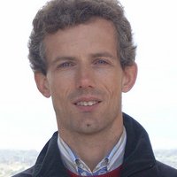
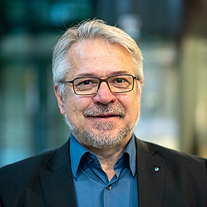
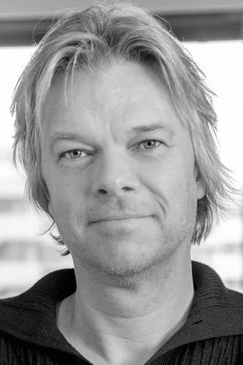
Vinícius Falchi Bernardo is a Researcher in the Department of Hydrogeology at the Helmholtz Centre for Environmental Research (UFZ) in Leipzig, Germany. His work focuses on groundwater management, reactive transport modeling, and site restoration, particularly in contaminated aquifer systems. He holds a BSc in Geology from Universidade Estadual Paulista (UNESP, Brazil) and an MSc in Environmental Remediation involving nanometric zero-valent iron (nZVI) applications. Professional experience includes roles as a geologist at firms like Golder Associates and Arcadis, alongside consultancy in hydrogeology. His research integrates numerical modeling with field data to address challenges in aquifer remediation and hydrogeochemical processes. Key projects include the NitratLurch initiative, exploring microbial nitrate purification in pore aquifers. He contributes to interdisciplinary teams within the UFZ’s Hydrogeology group, collaborating on catchment-scale hydrology and water resources sustainability.
Dr. Thomas Gruber is an Academic Director at the Institute for Astronomical and Physical Geodesy, Technische Universität München (TUM), where he leads research in high-resolution Earth gravity field modeling and satellite gravimetry. He is actively involved in major international projects including ESA’s GOCE, MAGIC, and QSG4EMT, as well as DFG-funded initiatives like NEROGRAV and UPLIFT. His work bridges theoretical geodesy with practical Earth observation applications. His primary research interests include: High-resolution gravity field modeling Satellite and quantum gravimetry Time-variable gravity and geophysical mass transport Sea level studies and altimetry Geodetic SAR for height system unification Future gravity mission concepts His recent publications focus on next-generation satellite missions, quantum sensors, and the integration of satellite and terrestrial gravity data. Trends indicate a strong emphasis on improving temporal and spatial resolution of gravity field models, with applications in climate monitoring, hydrology, and oceanography. He plays a key role in defining Essential Geodetic Variables (EGVs) and advancing global geodetic infrastructure through GGOS. Scientific contributions include leadership in: Development of global gravity models (e.g., XGM, GOCO) GOCE mission data processing and validation ESA and DFG project coordination International collaboration through IAG and GGOS He advises doctoral and master’s students and participates in national and international grant-funded research. He leads or contributes to teams working on: Gravity field combination and error modeling Quantum sensor simulation (CARIOQA-PMP) Geodetic SAR applications Sea level and mass transport analysis
Dr. Thomas Kalbacher serves as Deputy Head of Department and Workgroup Leader of Hydroinformatics at the Department of Environmental Informatics, Helmholtz Centre for Environmental Research - UFZ in Leipzig, Germany. With extensive experience in environmental modeling and software development, he leads critical research initiatives focused on groundwater systems and environmental informatics. His research spans Earth Science - Hydrogeology and Computer Science - Simulator & Workflows, with particular emphasis on the development of OpenGeoSys (OGS) software and related analysis tools. Kalbacher's work addresses sustainable use and protection of natural groundwater systems, examining their quantitative and qualitative impact on surface waters. He investigates how digital twins and near real-world models can help tackle water management challenges in the face of climate change, with a focus on creating robust future projections to preserve landscape multifunctionality. Analysis of his recent publications reveals strong trends in hydrogeological modeling, spectral analysis of groundwater level fluctuations, and development of digital tools for environmental monitoring. His work increasingly focuses on large-scale modeling of groundwater systems, particularly in the Danube catchment area, while also advancing data infrastructure through projects like Digital Earth. A significant portion of his recent research examines methodological approaches to hydrologic modeling, particularly comparative assessments of Richards equation versus infiltration capacity approaches. As leader of the Hydroinformatics workgroup, Kalbacher plays a pivotal role in the OpenGeoSys open-source project, which has become a significant platform for computational hydrology and environmental modeling. His team develops software solutions for regional groundwater quantity modeling (LandTrans) in cooperation with the Research Software Engineering and Visualization group. The Hydroinformatics group under his leadership contributes to advancing environmental modeling capabilities through robust software development practices and integration of high-resolution observation data from modern monitoring stations and satellite observations.
Abdelhak M. Zoubir is a Professor of Signal Processing and Head of the Signal Processing Group at Technische Universität Darmstadt, Germany. He has held leadership roles including Head of the Department of Electrical Engineering and Information Technology (2012–2014 and 2020–2022), and President of the European Association for Signal Processing (EURASIP, 2017–2018). His research focuses on statistical signal processing with applications in radar imaging, biomedical engineering, and automotive systems. Zoubir has authored over 500 publications and is a Fellow of IEEE and EURASIP. He currently leads projects on radar communication integration, robust signal processing algorithms, and radiation-hardened sensor development. Education: Dipl.-Ing. (BSc/MSc) from Fachhochschule Niederrhein and Ruhr-Universität Bochum, followed by a Dr.-Ing. (PhD) in Electrical Engineering from Ruhr-Universität Bochum (1992). Research Interests: Bootstrap techniques, robust detection/estimation, cooperative sensor networks, radar for landmine detection, and automotive safety systems. He has pioneered methods in robust statistical signal processing, including low-rank matrix completion and sparsity-aware algorithms. Recognition: Recipient of the IEEE Meritorious Service Award (2018), IEEE Signal Processing Magazine Best Paper Award (2017), and the M. Barry Carlton Award (2014). He has been a keynote speaker at major conferences such as ICASSP and EUSIPCO, and served as Editor-in-Chief of the IEEE Signal Processing Magazine (2012–2014). Current Projects: Focus on automotive radar signal processing, radiation-hardened sensors (MALTA), and distributed learning robustness. His work bridges theoretical advancements with practical applications in defense, healthcare, and automotive industries.
Virginia Toy is a Professor in the Department of Geosciences at Johannes Gutenberg University Mainz, leading the Tectonics and Structural Geology research team. Her work focuses on understanding fault zone dynamics, crustal deformation, and the mechanics of active tectonic systems. She is deeply involved in interdisciplinary projects such as the Deep Fault Drilling Project (DFDP) and the DIVE initiative, which explore fault zone architecture and seismic processes in regions like the Alpine Fault (New Zealand) and the Ivrea-Verbano Zone (Italy). Her research interests span structural geology, geophysics, and earthquake mechanics. Key areas include fault zone rheology, pseudotachylyte formation, fluid-rock interactions, and the application of advanced imaging techniques (e.g., X-ray tomography) to study rock properties at multiple scales. She has contributed to understanding the geothermal conditions and fluid dynamics within active plate boundaries, such as the Alpine Fault, which is a critical site for studying earthquake processes. Virginia Toy’s recent publications highlight her focus on resolving the structural and mechanical complexities of crustal faults, including studies of ultramafic rocks, carbonation processes, and the integration of laboratory experiments with field observations. Her work bridges traditional field geology with cutting-edge analytical methods, offering insights into how deformation localizes and propagates within the Earth’s crust. Her educational contributions include advancing virtual field trip methodologies and digital tools for structural geology education, emphasizing the use of gamification and GIS databases to enhance data accessibility and collaboration.
Prof. Dr. Derya Gürer is affiliated with the Institute of Geosciences at Heidelberg University , where she focuses on tectonic processes, paleomagnetism, and geodynamic reconstructions. Her research spans from the Mediterranean to the Agulhas Plateau, integrating fieldwork and geochemical analysis. Research Themes : Tectonic evolution of Anatolia, paleomagnetic constraints on plate motions, subduction zone dynamics, and Cretaceous climate studies via oceanic plateau investigations. Methodologies : Utilizes paleomagnetic data, U-Pb geochronology, clumped isotope thermometry, and structural analysis of ophiolites and sedimentary basins. Scientific Engagement : Actively contributes to diversity initiatives in geosciences and science communication through digital platforms. Her recent work emphasizes the interplay between Arabia-Eurasia convergence and Anatolian tectonics, while advancing polar wander resolution techniques through uncertainty quantification. She participates in international collaborations like IODP Expedition 392.
Dr. Philipp Balling is a Researcher at the Institute of Geosciences, Friedrich-Schiller-Universität Jena , Germany. His work focuses on the tectonic evolution of mountain ranges, particularly the Dinarides , with additional studies on the Iranian Plateau and Appenines . He employs balanced cross-sections, fieldwork, structural analyses, and 3D modeling in his research, specializing in MOVE software. Education : PhD (2023) in Geosciences at Jena University, MSc (2014) and BSc (2011) in Geosciences from Universität Potsdam (with international fieldwork experience at University of Montana). Research Interests : Tectonic processes driving mountain building, active tectonics influencing landscape evolution, and geodynamic modeling of collisional belts. Scientific Awards : Best Student Paper Award, GeoUtrecht 2020 2008 Student exchange scholarship (€12,000) to University of Montana Teaching : Leads field courses, geological mapping fundamentals, and balanced cross-section workshops. Publications : His recent work explores the Dinarides' deformation mechanisms, exhumation dynamics, and thermal history of rift basins, with a focus on integrating structural analysis with geochronological data.
Dr. John O'Connor is a Research Associate at the Chair of Endogenous Geodynamics within GeoZentrum Nordbayern at Friedrich-Alexander-Universität Erlangen-Nürnberg (FAU). His work focuses on mantle geodynamics, intraplate magmatism, and the interplay between mantle plumes and plate tectonics. Institution: FAU Erlangen-Nürnberg Department: Chair of Endogenous Geodynamics (Prof. Dr. Haase) Email: jmoconnor@vu.nl O'Connor's research investigates: Temporal and chemical evolution of intraplate magmatism and large igneous provinces Interaction between hotspots, lithospheric plates, asthenosphere, and continental rifting Mantle convection dynamics and plume-plate coupling Volcanic flux variations across Pacific and Atlantic hotspot tracks His recent publications address mantle plume behavior, plate motion influences on volcanic activity, and geodynamic reconstructions of the South Atlantic and Pacific regions.
Dr Johannes Leinauer is a post-doctoral researcher and lecturer at the Chair of Landslide Research (Chair of Slope Movements), Technical University of Munich (TUM) . Since completing his PhD in 2024 he has continued at TUM as postdoc (from 2025) and serves as project manager, lecturer and supervisor within the Landslide Research Group. Education & Career 2024 – present: Postdoctoral researcher, Landslide Research Group, TUM 2018 – 2024: PhD candidate, Landslide Research Group, TUM Thesis: Early warning of rock slope failures – real-time monitoring, process analysis and failure time forecasting 2015 – 2017: M.Sc. Engineering Geology & Hydrogeology, TUM 2011 – 2015: B.Sc. Geosciences (Geology focus), TUM & Ludwig-Maximilians-Universität München 2013 – 2014: ERASMUS+ exchange, University of Bergen, Norway Research Interests Dr Leinauer’s work centres on early-warning systems for rock-slope failures , integrating real-time monitoring , process-analysis and failure-time forecasting . He focuses on climate-induced alpine hazards , permafrost-related rock instabilities , and cascading sediment transport . Multi-method monitoring—including seismic, thermal, geodetic and geophysical techniques—underpins his investigations into the preparatory phase of large rock-slope collapses. Teaching & Supervision He contributes to a broad portfolio of taught courses: GIS for Geologists, Slope-movement mapping, Alpine Hazards, Engineering Geomorphology, Earth-system science, field classes . He supervises numerous bachelor and master theses on rainfall-triggered fracture dynamics, acceleration models, early-warning reliability and cascading-risk scenarios. Publications & Impact His recent articles demonstrate a strong trajectory in process-oriented geomorphology , permafrost engineering and hazard forecasting , with field campaigns at iconic sites such as the Hochvogel (DE/AT) and the Matterhorn (CH). Collaborative outputs integrate field observations, laboratory experiments and mechanical modelling to advance predictive capabilities.
Felix Schneider is a Researcher at the Chair of Structural Mechanics at Technical University of Munich since 2018. He holds an M.Sc. in Civil Engineering from TU Munich (2018) and completed a semester abroad at the Norwegian University of Science and Technology. His research focuses on uncertainty analysis in structural and acoustic models, Bayesian updating techniques, and stochastic reduction methods in the frequency domain. He has contributed to advancements in rational polynomial chaos expansions and sparse Bayesian learning for structural dynamics applications. Education: 2011-2018: Study of Civil Engineering at Technical University of Munich 2018: Master of Science (M.Sc.) in Civil Engineering 2016: Semester abroad at Norwegian University of Science and Technology 2009: Abitur at Humboldtgymnasium Solingen Research emphasizes computational methods for structural dynamics, including: Bayesian parameter estimation for linear systems Rational surrogate models for uncertainty quantification Frequency-domain stochastic reduction techniques Applications in seismic risk assessment and vibroacoustic simulations Key contributions include a Maurer Söhne Prize for his Master's thesis and a published MATLAB toolbox for rational polynomial chaos expansions on the LRZ Git repository. Teaching responsibilities include courses on random vibrations, structural dynamics, and continuum mechanics. He has participated in research stays at ETH Zurich (2023) and collaborates with international institutions on uncertainty quantification projects.
Marco Giorgetta is a Researcher and Group Leader at the Max Planck Institute for Meteorology in Hamburg, Germany. He leads the Wave Driven Circulations group within the Climate Physics department. His work focuses on understanding atmospheric dynamics, particularly the Quasi-Biennial Oscillation (QBO), wave-mean flow interactions, and global climate modeling. He has been a core contributor to the development of the ICON atmospheric model and has coordinated major projects like QUBICC and COMBINE. Education: PhD in Natural Sciences (1996), Universität Hamburg Diploma in Physics (1991), ETH Zürich Research Interests: Marco’s research integrates advanced modeling techniques with observational data to study climate variability and atmospheric processes. Key areas include the QBO, gravity waves, tropical dynamics, and the impact of climate change on stratospheric processes. His work emphasizes high-resolution simulations and machine learning applications in climate modeling. Key Projects: Coordinator of ROMIC-2 QUBICC (2020–2023) and FP7 COMBINE (2009–2013) ICON model development lead from 2004–2020 Executive board member of the International Max Planck Research School on Earth System Modelling (2001–2014) Labs/Teams: He leads the Wave Driven Circulations group, collaborating on projects like the Barbados Cloud Observatory and Destination Earth initiatives. His work contributes to the broader ICON Earth System Model framework.
Professor Jan Vanderborght serves as Director of the Agrosphere Institute (IBG-3) at Forschungszentrum Jülich, Germany, while maintaining a professorship in Soil Physics at KU Leuven, Belgium. His research focuses on fundamental soil physical processes with direct applications in agricultural and environmental management. His educational background includes an MSc (1993) and PhD (1997) in Bio-engineering from KU Leuven, followed by post-doctoral research at ETH Zurich (1998-1999). Vanderborght's research centers on solute transport in soils, pesticide fate modeling, hydrogeophysics, soil evaporation processes, and plant water/nutrient uptake mechanisms. His work bridges fundamental soil physics with practical agricultural applications, particularly in irrigation management and contaminant transport. His recent publications reveal strong focus on advanced soil moisture monitoring techniques, root water uptake modeling, and the application of digital twin technology (SWIM²) for precision agriculture. The research spans multiple scales from pore-level processes to field-scale hydrological modeling. As an editorial leader in the field, Vanderborght serves as Co-Editor of Vadose Zone Journal and Associate Editor for both Journal of Hydrology and SOIL, reflecting his significant contributions to soil and water science literature. His research group develops innovative approaches combining field measurements, advanced imaging techniques (like MRI and GPR), and sophisticated modeling frameworks to address critical challenges in soil-water-plant systems, particularly under changing climate conditions.
Prof. Dr. Peter Dietrich is a University Professor of Environmental and Engineering Geophysics at the Eberhard Karls University of Tübingen and Head of the Department of Monitoring and Exploration Technologies at the Helmholtz Centre for Environmental Research (UFZ) in Leipzig, Germany. He holds a joint appointment between the university and UFZ, reflecting his dual role in academic teaching and applied environmental research. Institution: Helmholtz Centre for Environmental Research - UFZ Department: Monitoring and Exploration Technologies Academic Affiliation: University of Tübingen Email: peter.dietrich@ufz.de His research spans environmental and engineering geophysics , with a focus on hydrogeophysics, geophysical monitoring, and exploration technologies for soil and groundwater systems. He applies methods such as electrical resistivity tomography, seismic techniques, and direct push sensing to study subsurface processes in ecological, archaeological, and environmental contexts. His work supports sustainable water management, pollution monitoring, and landscape preservation. The 15 most recent publications highlight a consistent trend in applied geophysics , particularly in non-invasive subsurface characterization , groundwater dynamics , and interdisciplinary environmental monitoring . These studies integrate field experiments, sensor networks, and modeling to address challenges in hydrology, geoarchaeology, and contaminant transport. Keywords across these works include geophysics, hydrogeology, remote sensing, and environmental monitoring, with subfields such as GPR imaging, nitrate plume analysis, peatland carbon storage, and 3D subsurface modeling. No specific scientific awards are listed in the provided text. Prof. Dietrich leads a research team and collaborates extensively with scientists across disciplines, including environmental engineers, hydrologists, and archaeologists. His leadership in the UFZ’s Department of Monitoring and Exploration Technologies underscores his role in advancing smart models and monitoring systems within the broader Helmholtz Research Program 'Changing Earth – Sustaining our Future'.
Prof. Frank Postberg is a University Professor for Planetary Sciences at Freie Universität Berlin, leading the Planetary Sciences and Remote Sensing group. He specializes in astrobiology and the exploration of icy ocean worlds such as Enceladus and Europa, using data from missions like Cassini-Huygens and Europa Clipper. Education: PhD (2007) in Physics from Heidelberg University, followed by postdoctoral research at the Max Planck Institute and University of Stuttgart. He habilitated in cosmochemistry (2012) and received a Heisenberg Fellowship (2014). Research focuses on the composition of plumes and subsurface oceans of icy moons, with projects like Habitat-OASIS exploring habitability. He co-leads experiments on interstellar dust (Destiny+ mission) and serves on ESA’s strategic mission teams. Awards include the ERC Consolidator Grant (2017) for studying ocean world habitability. His lab develops advanced instrumentation like SUDA for compositional analysis of planetary materials.
Constanza Rodriguez Piceda is a researcher at the Deutsches GeoForschungsZentrum (GFZ) in Potsdam, Germany, affiliated with the Department of Basin Modelling. She holds a PhD in Geophysics from Universität Potsdam (2022) and is associated with University of Plymouth (email: constanza.rodriguez@plymouth.ac.uk ). Her research focuses on geodynamics, lithospheric modeling, subduction zone processes, and paleomagnetism. Education: PhD in Geophysics (Universität Potsdam, 2022) Research Areas: Southern Central Andes geodynamics, 3D gravity/rheological modeling, lithospheric strength analysis, mantle hydration, Cambrian paleogeography, and tectonic evolution. Publications: 15+ peer-reviewed articles on lithospheric-scale modeling, seismicity distribution, paleomagnetic constraints, and geodynamic simulations of subduction zones. Key collaborations include institutions like Universidad de Buenos Aires, Technical University of Munich, and GFZ.