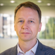
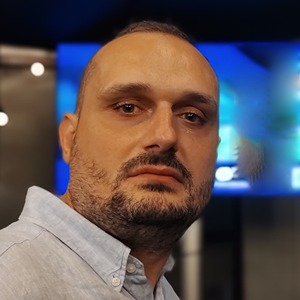
Kazuhiko Tamesue is an Associate Professor at the Faculty of Science and Engineering , Waseda University , with a focus on Terahertz Communication , Artificial Intelligence , and IoT Network Security . His academic journey spans academia and industry, including long-term roles at Panasonic Corporation (1991–2009) and current leadership in advanced wireless systems since 2022. Research Areas : Telecommunications, Wireless Hardware, Data Science, Machine Learning, Atmospheric Sensing Key Contributions : Pioneering 300GHz OFDM transceivers, AI-driven GNSS spoofing detection, and dual-frequency THz radar for cloud physics Projects : NICT-funded terahertz networks (2023–2024), ultra-low-latency systems (2022–2024), and security-enhancing radar technologies His 15 most recent publications (2024–2008) demonstrate expertise in (1) terahertz propagation for NTN/HAPS platforms, (2) machine learning for security (LSTM, GANs), and (3) next-generation IoT protocols (LPWAN, distributed ledger). He holds 20+ patents in antenna design, direct-conversion receivers, and power line communication. As an IEEE and IEICE member, he contributes to standards in 5G/6G and EMC.
Prof. Dr.-Ing. Alberto Moreira is the Director of the Microwaves and Radar Institute at the German Aerospace Center (DLR) and a Full Professor in Microwave Remote Sensing at Karlsruhe Institute of Technology (KIT) . He leads pioneering work in synthetic aperture radar (SAR) systems, including the TanDEM-X and TerraSAR-X missions. Born in São José dos Campos, Brazil B.Sc./M.Sc. in Electrical Engineering (Aeronautical Technological Institute, 1984/1986) Ph.D. (summa cum laude, Technical University of Munich, 1993) Research Focus : Innovative SAR system design (polarimetric interferometry, tomography) Digital beamforming and multi-static radar architectures Global Earth observation through TanDEM-X and Tandem-L missions Quantum annealing applications in SAR processing Planetary radar systems for Venus exploration (EnVision, VERITAS) Scientific Impact : Author/co-author of >500 peer-reviewed publications H-index: 66 (Google Scholar) Holder of >40 patents in radar and antenna technology Awards & Leadership : IEEE Dennis J. Picard Medal (2023) IEEE GRSS Distinguished Achievement Award (2014) President of IEEE GRSS (2010) Founding Chair of IEEE GRSS German Chapter Principal Investigator for Helmholtz Alliance Earth System Dynamics (2012-2018) Collaborations : Works with ETH Zurich, TU Delft, and ESA on missions like Sentinel-1, BIOMASS, Harmony, and VERITAS. His institute develops cutting-edge technologies for spaceborne SAR systems.
Francesco Nex is an Associate Professor at the University of Twente in the Department of Earth Observation Science , where he holds the chair of real-time analytics for ubiquitous geo-sensors. He earned a Master's in Environmental Engineering (2006) and a PhD (2010) from TU Turin. His career spans roles at Italy's FBK institute (2011-2015) and the University of Twente (2015-present). His research integrates photogrammetry , deep learning , and robotics to enable automated UAV-based solutions for applications like disaster management , infrastructure monitoring , and precision farming . Key projects include EU-funded initiatives (Ingenious, Panoptis, RECONASS) and leadership roles in the ISPRS (Chairman of ICWG II/Ia). He has supervised 12 PhD students directly and co-supervised others at institutions like Politecnico Milano and Politecnico Torino. Recent publications highlight advancements in glacier monitoring using low-cost UAV systems, real-time 3D reconstruction , and autonomous drone navigation . Awards include the ISPRS President’s Honorary Citation (2021) and the E.H. Thomson award (2020). His work aligns with UN Sustainable Development Goals for Smart Industry , Climate Action , and Robotic Mobility .
Dr hab. inż. Michał Michna is an Associate Professor and Head of the Department of Power Electronics and Electrical Machines at Gdańsk University of Technology's Faculty of Electrical and Control Engineering. He joined the university in 2004 and served as Deputy Head of Department from 2010 to 2015. His research spans electrical machines, piezoelectric actuators, and renewable energy systems, with a strong emphasis on industrial applications. Research interests include: Design and modeling of transformers, generators, and motors Finite element analysis (FEM) for electromechanical systems Piezoelectric actuator technology Railway infrastructure diagnostics and IIoT monitoring He has contributed to key projects like the InfraNoise railway environmental impact system and EU initiatives such as MOET-FP6. Awards include: Medal of the National Education Commission (2021) Bronze Medal for Long Service (2015) Multiple Rector's Awards for teaching and research excellence His recent publications (2023–2025) focus on renewable energy integration, railway diagnostics, and advanced motor designs. He teaches courses in electromechanical systems and supervises departmental research infrastructure, including power electronics testbeds.
Professor Haluk Özener is a distinguished geodesy expert at Boğaziçi University's Kandilli Observatory and Earthquake Research Institute in Istanbul, Turkey. With over two decades of research experience, he specializes in monitoring crustal deformation and earthquake hazards along Turkey's major fault systems, particularly the North Anatolian Fault Zone. His research spans geodesy, space geodesy, GPS applications in earth sciences, and geodynamics. Özener has made significant contributions to understanding seismic risks in the Marmara region and has developed methodologies for rapid earthquake hazard assessment. His work combines terrestrial and satellite-based geodetic techniques to monitor crustal movements and fault behavior. Analysis of his recent publications reveals a strong focus on seismic hazard assessment, particularly through GPS-derived strain rates and velocity fields. His research has evolved to incorporate advanced geospatial technologies, machine learning applications, and multi-hazard vulnerability assessments including nuclear accident risks and tsunami warning systems. Best Paper Award at TIEMS 2009 16th Annual Conference Extensive collaboration with international research networks including WEGENER Key contributor to European strong-motion data initiatives Professor Özener has supervised numerous research projects related to crustal deformation monitoring and has been instrumental in establishing geodetic networks across Turkey. His work with the KOERI seismic network has significantly advanced Turkey's earthquake monitoring capabilities. Recent research has expanded into social vulnerability mapping and nuclear accident risk assessment, demonstrating the interdisciplinary nature of his scientific contributions.
Dr. Andrei ILIE serves as an Assistant Professor at the Technical University of Civil Engineering Bucharest (UTCB), specializing in geodesy and geospatial engineering. His expertise spans satellite and classical geodetic network design, GNSS data processing, and 3D modeling for construction monitoring and topographic surveys. His core research domains include: Geodetic network optimization and statistical analysis GNSS/cloud computing integration for land monitoring Coordinate transformation systems and (quasi)geoid modeling Multi-sensor fusion (GNSS/IMU) for consumer devices AI-driven 3D modeling using neural networks Digital terrain model quality verification Dr. ILIE develops Python/Matlab software solutions for geodetic applications, manages research projects in geodesy, and provides specialized training courses. His work bridges theoretical geodesy with practical implementations in civil engineering contexts.
Georges Stienne is a researcher at the LISIC laboratory (University of the Littoral Opal Coast) specializing in Bayesian dynamic estimation for GNSS positioning and reflectometry. He is defending his Habilitation to Supervise Research (HDR) on September 10, 2024, qualifying him to lead doctoral research. His research focuses on: Bayesian statistical approaches for dynamic parameter estimation GNSS signal processing and reflectometry applications Break detection in temporal signal evolution Multiple linear-circular regression for multi-sensor data fusion His work achieves millimeter-level accuracy in differential positioning through innovative phase-amplitude coherence analysis, with applications in water body detection and sediment transport metrology. Current research explores joint processing of remote sensing signals for reflector characterization. He is actively involved in LISIC laboratory initiatives including EUR MAIA (Artificial Intelligence applications) and regional drone technology projects. His HDR defense jury comprised professors from University of Bordeaux, University of Technology of Troyes, INRAE Bordeaux, Polytechnic University of Catalonia, and University of Paris-Nanterre.
Eufemia Tarantino is Full Professor of Geomatics at the Polytechnic University of Bari, working within the Department of Civil, Environmental, Land, Building Engineering and Chemistry (DICATECh). She has held academic positions at the university since 2002, progressing from Assistant Professor to Associate Professor and achieving Full Professor status in 2019. Professor Tarantino serves as Coordinator of the MSc Course of Environmental and Territorial Engineering, is a Member of the Executive Council, and oversees the student career fair. Her research expertise spans cartography, GIS, remote sensing, and geomatics, with particular focus on: Analysis of metric characteristics and extraction of 2D/3D geometric primitives from satellite/aerial/UAV data Multi-temporal analysis and change detection for environmental and cultural heritage monitoring Development of web-based GIS for interactive geospatial analysis Professor Tarantino's publication record includes over 180 scientific contributions in international databases. Her recent work (2023-2026) demonstrates continued productivity with numerous book chapters and journal articles focused on soil sealing dynamics, precision viticulture, marine pollution monitoring, urban growth analysis, and advanced remote sensing techniques. Her research shows strong application to environmental monitoring, cultural heritage preservation, and sustainable spatial planning. As an active member of the international geospatial community, she serves on the editorial boards of 'Remote Sensing' and 'ISPRS International Journal of Geo-Information' and reviews for approximately 18 international journals. Her teaching responsibilities include Cartography, GIS, and Remote Sensing courses at undergraduate and graduate levels, as well as Advances in Geomatic Engineering at the PhD level. Professor Tarantino's work demonstrates strong international collaboration and application to real-world environmental challenges, with recent projects addressing soil sealing, marine plastic pollution, precision agriculture, and climate-related phenomena using advanced geospatial technologies.
Professor Mieczysław Jessa is a distinguished faculty member at Poznań University of Technology, serving in the Faculty of Information Technology and Telecommunications within the Institute of Multimedia Telecommunications. With a scientific discipline focused 100% on Information and Communication Technology, he has established himself as a leading researcher in random number generation, signal synchronization systems, and spectrum sensing techniques. His research interests center around hardware-based random number generators for cryptographic applications, precise synchronization of oscillators using GNSS signals, and advanced spectrum sensing methodologies. Professor Jessa's work bridges theoretical foundations with practical implementations, particularly in telecommunications security and precision timing systems. His recent publications demonstrate continued innovation in applying machine learning to spectrum sensing and developing low-complexity random number generation solutions for FPGAs. Professor Jessa maintains an active publication record with multiple articles in 2024-2025, reflecting his ongoing research contributions. His work spans both theoretical aspects of stochastic processes and practical implementations in measurement systems and secure communications. As an academic supervisor, Professor Jessa has guided doctoral research in areas including FPGA-based random sequence generation and spectrum sensing techniques, with documented supervision of three doctoral students through 2019. His technical contributions include the development of synchronization systems like the DST-16 clock distributors and SP-4000 measurement systems, demonstrating the practical application of his research in real-world telecommunications infrastructure.
Myriam Servières is a Professor of Computer Science at Centrale Nantes, where she has taught since 2006. She currently serves as Director of AAU-CRENAU and Deputy Director of the AAU Laboratory. Her academic journey includes a PhD in Applied Computer Science from the University of Nantes (2002-2005) and an engineering diploma from École Centrale de Nantes (1999-2002). Her research explores the intersection of digital technology and urban environments, with key interests in: Geolocation : Developing advanced positioning systems for urban navigation Augmented/Virtual Reality : Creating multisensory urban simulations 3D Modeling : Reconstructing and analyzing urban spaces Citizen Sensing : Engaging communities in environmental monitoring Her recent publications demonstrate strong focus on VR-based urban perception analysis, pedestrian navigation systems, and geospatial data processing. Work frequently appears in premier journals like ISPRS and IEEE Transactions . She leads significant initiatives including the IRSTV 'Urban Tomography' research axis and the '3D geospatial data' prospective action. Her teaching spans core computer science courses and specialized programs in digital cities. At AAU-CRENAU, she directs research on computational urban analysis, collaborating across disciplines to develop new methods for understanding and designing urban spaces through digital mediation.
Dr. Jerzy Demkowicz serves as an Assistant Professor at the Department of Geoinformation Systems within the Faculty of Electronics, Telecommunications and Informatics at Gdańsk University of Technology. His academic work centers on geospatial information systems with emphasis on sensor network development and navigation technologies. His research spans wireless environmental monitoring systems, inertial navigation algorithms, and machine learning applications for remote sensing. Key contributions include solar-powered LoRa-based distributed sensor networks, IMU tilt measurement techniques for drone stabilization, MEMS modeling for underwater navigation, and novel GNSS positioning algorithms for urban environments. His Mars terrain analysis using convolutional neural networks demonstrates cross-domain application of deep learning. Recent publications (2022-2025) reveal consistent focus on algorithmic innovation for challenging environments—underwater, urban canyons, and extraterrestrial surfaces—through sensor fusion and numerical methods that improve accuracy without historical data dependencies. Scientific Awards: No awards documented in source material. Advising and Grants: Graduate student supervision and research funding details were not provided in available documentation. Laboratories: Specific laboratory affiliations or research teams were not specified in the source text.
Dr. Przemysław Falkowski-Gilski serves as an Assistant Professor at the Department of Geoinformation Systems within the Faculty of Electronics, Telecommunications and Informatics at Gdańsk University of Technology. His research bridges geospatial engineering with computational intelligence, focusing on real-world applications in urban environments and sensor networks. His primary research domains include: Geoinformatics and GNSS positioning systems IoT infrastructure for smart cities Swarm intelligence optimization algorithms Edge computing resource allocation AI-driven data analysis for urban mobility Recent publications (2024-2025) reveal a cohesive research trajectory addressing critical challenges in smart city resource management through UAV-assisted edge computing, Android-based urban navigation, and sensor ontology integration. His work consistently applies advanced optimization techniques—such as Golden Jackal and Beetle Swarm algorithms—to solve practical problems in geospatial data processing and IoT systems, demonstrating strong interdisciplinary methodology.
Dr. Vicente Alarcon-Aquino is a Professor in the Department of Computing, Electronics, and Mechatronics at Universidad de las Americas Puebla (UDLAP), Mexico. He received his Ph.D. and D.I.C. degrees in Electrical and Electronic Engineering from Imperial College London in 2003. He previously served as department head from October 2012 to June 2018 and spent a research stay at King's College London in 2017. Dr. Alarcon-Aquino is a Senior Member of IEEE, a Level I member of the Mexican National System of Researchers (SNI), and a Fellow of the Mexican Academy of Sciences. His educational background includes: Ph.D. and D.I.C. in Electrical and Electronic Engineering, Imperial College London, UK (2003) Dr. Alarcon-Aquino's research focuses on cybersecurity, network monitoring, anomaly detection, wavelet analysis, and machine learning. His work spans theoretical foundations to practical applications in network security, with significant contributions to intrusion detection systems, cryptographic techniques, and machine learning approaches for security applications. He has developed innovative methods combining wavelet transforms with neural networks for various security and signal processing applications. His scholarly contributions include over 180 research articles in refereed journals and conference proceedings, a book on MPLS networks, and numerous citations. As an editor, he serves as Associate Editor for IEEE Access Journal and as Academic & Section Editor for PeerJ Computer Science, focusing on Security & Privacy. Notable professional recognitions include: Senior Member of IEEE Mexican National System of Researchers (SNI Level I) Member of the Mexican Academy of Sciences Dr. Alarcon-Aquino has supervised over 70 theses, including 8 Ph.D. dissertations, 15 Master's theses, and more than 37 Bachelor's theses. His supervision spans topics including network intrusion detection, information security, encryption algorithms, wavelet-based signal processing, neural networks, EEG signal processing, and biometric cryptosystems. He has hosted international research students from institutions including the Polytechnic University of Madrid and Kiel University of Applied Sciences. His research group at UDLAP focuses on developing advanced security solutions for modern network environments, with particular emphasis on applying machine learning techniques to cybersecurity challenges. Current projects include blockchain-based security solutions, federated learning approaches for intrusion detection, and advanced anomaly detection systems for IoT environments.
Dr. Amiri Simkooei is a Professor in the Faculty of Aerospace Engineering at Delft University of Technology, specializing in Operations & Environment. His research spans the application of aerospace engineering principles to environmental monitoring and geospatial analysis, with strong connections to both theoretical and practical aspects of remote sensing and GNSS technologies. Dr. Simkooei's research interests focus on the intersection of aerospace engineering and environmental science, particularly in developing advanced methods for data analysis. His work in least squares variance component estimation has provided significant contributions to GNSS time series processing, while his environmental applications include aircraft noise monitoring systems and marine habitat characterization using remote sensing technologies. His recent publications (2025-2026) demonstrate a strong research trajectory with applications spanning from airport environmental management to marine ecosystem monitoring. The research shows a consistent theme of applying rigorous mathematical and statistical methods to solve practical environmental monitoring challenges using aerospace-derived technologies. Dr. Simkooei actively supervises graduate students, as evidenced by thesis-related datasets, and collaborates extensively within TU Delft and with external partners on environmental monitoring projects. His work bridges theoretical geodetic methods with practical environmental applications, making significant contributions to both aerospace engineering and environmental science communities. His research group focuses on GNSS and remote sensing applications, with particular expertise in data processing algorithms, environmental monitoring systems, and marine habitat mapping. The group maintains strong connections with Dutch environmental agencies and aerospace industry partners, facilitating the translation of research into practical applications.
Sjouke Mauw is a full professor in "Security and Trust of Software Systems" at the University of Luxembourg , leading the Department of Computer Science and the SaToSS research group. His work bridges formal methods with real-world security and trust challenges. Current affiliation: University of Luxembourg (Faculty of Science, Technology and Communication) Previous roles: Associate Professor at Eindhoven University of Technology, Senior Researcher at CWI Research Focus Security protocols and their formal verification Attack trees and defense trees for structured threat analysis Privacy in voting systems and digital exchange Trust management frameworks and risk assessment RFID and e-voting security Cyber-physical socio-technical systems Recent Article Trends (2023-2025) include applications of deep learning to privacy risks, formal verification of distance-bounding protocols, and anomaly detection in resource-constrained environments like cubesats. These works span machine learning, cryptography, and aerospace engineering. Academic Contributions include over 50 refereed publications, supervision of 15+ PhD students, and leadership in European research projects (e.g., Meteor, Concur). He has developed formal methods for security protocols, attack-defense trees, and GNSS signal integrity frameworks.