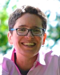
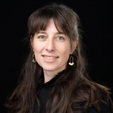
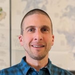
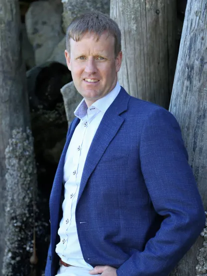
Sarah Elwood is Professor and Chair of Geography at the University of Washington with affiliations in the West Coast Poverty Center, Center for Studies in Demography and Ecology, and Certificate in Public Scholarship. She co-directs the Relational Poverty Network (RPN), developing transnational frameworks for poverty research. Research examines: Creative activism around homelessness Feminist and critical race perspectives in digital geographies Visual methodologies for poverty politics Community-engaged mapping practices Honors include: University of Washington Distinguished Teaching Award Departmental Student Award for Faculty Excellence Sustainable Seattle's Sustainable Community Outstanding Leadership Award Richard Morrill Public Outreach Award Her collaborative projects like Mapping Youth Journeys and Community-Based GIS transform spatial knowledge into community action through participatory methodologies.
Dr. Maggie Sugg is an Associate Professor & Department Honors Director in the Department of Geography and Planning at Appalachian State University . She holds a PhD, M.A., and B.S. in Geography and Biology from the University of North Carolina at Chapel Hill. Her research focuses on spatiotemporal health patterns linked to environmental, socioeconomic, and climatic factors, with emphases on mental health, disaster vulnerability, and GIScience applications. Key roles include: Recipient of the prestigious NSF CAREER Award Leading studies on maternal mental health, greenspace impacts, and climate-health linkages Principal investigator of projects funded by NSF, NIEHS, and AFSP Research highlights: Examines climate-driven health risks (heatwaves, hurricanes, wildfires) Develops GIS-based tools to map health vulnerabilities Analyzes pandemic impacts on essential workers and youth mental health Awards: NSF CAREER Award (2021) Emerging Scholar Award (AAG, 2021) EPA STAR Fellowship (2020) Provost Award for Excellence in Research (2022) Teaching: Global Health, GIScience, Climate and Society, Advanced Quantitative Methods. Grants: Over $413,000 in NSF funding, plus support from NIH, Gulf Research Program, and AFSP. Collaborates with North Carolina Institute for Climate Studies, HGAPS, and local health agencies. Labs/Teams: Directs climate-health research initiatives, mentors 10+ graduate students annually, and co-leads interdisciplinary projects on disaster resilience and environmental justice.
Paul L. Robinson, PhD, is an Assistant Professor in the Department of Surgery at Charles R. Drew University of Medicine and Science. He also serves as Director of the Charles Drew Medical GIS Lab (http://medgis.cdrewu.edu), focusing on the intersection of time, space, place, and health through GIScience theory and methods. Medical Geography Public Health GIScience Health Disparities Environmental Health His research explores how spatial and social factors influence health outcomes, including cardiovascular disease, metabolic syndrome, respiratory conditions, and substance use disparities. Articles from 2005-2021 demonstrate trends in urban health, accessibility modeling, and social determinants of well-being. Networks show collaborations with co-authors like Cheryl Wisseh and Mohsen Bazargan, alongside institutional connections in the Department of Surgery and physical neighbors at Charles R. Drew University.
Joseph Holler is an Assistant Professor of Geography at Middlebury College, specializing in human geography and geographic information science (GIS). His research focuses on open science, reproducibility, climate change adaptation, hazards, and social vulnerability. He teaches courses such as Human Geography of Hazards, Open GIScience, and Climate Change Adaptation and Development. Holler holds a PhD from the University at Buffalo and has conducted fieldwork in Tanzania, including work with the Jane Goodall Institute. He emphasizes interdisciplinary approaches combining critical theory with technical methods, and has developed QGIS plugins like MiMiGIS and contributed to QNEAT3. His recent projects include workshops on reproducibility in geographical sciences and a field course on landscape restoration in Tanzania. Holler previously served as a Peace Corps volunteer in Tanzanian secondary schools, inspiring his academic trajectory in geography.
Professor Robert Legg is a faculty member at Northern Michigan University (NMU) in the Earth, Environmental and Geographical Sciences department since August 2006. His academic rank is Professor, and he specializes in Geographic Information Systems (GIS), Computer Cartography, Spatial Analysis, Quantitative Methods, Geoarchaeology, and Paleo-environments. Academic Affiliation: Northern Michigan University Education: MSc from University of Aberdeen, Ph.D. from Trinity College Dublin Specializations: GIS, Spatial Statistics, Archaeological Predictive Modeling, Remote Sensing Professor Legg’s research focuses on GIScience and Geomatics, particularly their applications in geoarchaeology and paleo-environmental studies. He has contributed to projects involving Ground Penetrating Radar (GPR), predictive modeling of archaeological sites, and integration of climate data with settlement patterns in both the Great Lakes and Early Medieval Ireland. His work bridges geography, computer science, and environmental research. His recent publications (2023–2010) span digital environmental humanities, maritime geography, archaeometry, and cultural studies. Trends include GIS applications in historical fishery analysis, coffeehouse culture, and paleoindian site location modeling. He frequently employs GPR, remote sensing, and spatial statistics to explore environmental and archaeological questions. Scientific awards include: GISP Certification International Fellowship Grant (AAUW, 2024) NMU Academic Service-Learning Award (2007) Faculty Reassigned Time Awards (2016, 2017) Professor Legg has mentored numerous students who now work in GIS across private and public sectors. His grants include collaborations with the European Research Council, National Science Foundation, and the National Park Service. He is involved in the NorFish Project and Centre for Environmental Humanities at Trinity College Dublin.
Jon W. Carroll is an Associate Professor of Anthropology at Oakland University, serving as Principal Investigator for the Midwest Archaeological Field School (MAFS) and Coordinator of the Applied GIScience Minor. His primary affiliations include the Department of Sociology, Anthropology, Social Work, and Criminal Justice. He holds a Registered Professional Archaeologist (RPA) certification and is an FAA-licensed drone pilot. His research focuses on cultural transmission, political organization, and the application of GIS/remote sensing technologies in archaeology and agriculture. Carroll’s work spans multiple regions including the Near East, Europe, Africa, and North America. He has conducted fieldwork at sites like Lachish (Israel) and Château de Balleroy (France), emphasizing photogrammetry and drone-based surveys. His recent projects include precision agriculture studies in Malawi using multispectral imagery. He teaches courses ranging from cultural anthropology to advanced GIS methodologies. Carroll has advised numerous undergraduate and graduate students through field schools and laboratory projects. He coordinates scholarships and awards for departmental programs and actively engages in community outreach through the Midwest Archaeological Field School. His research has been published in journals like Oxford Journal of Archaeology and Remote Sensing Letters , with a focus on integrating technological innovation with traditional archaeological methods.
Jochen Albrecht is a Professor of Computational and Theoretical Geography in the Department of Geography at Hunter College, City University of New York. He also serves as Doctoral Faculty in the Earth and Environmental Sciences Program at The Graduate Center, CUNY. Previously, he held academic positions at the University of Maryland, University of Wisconsin-Milwaukee, and the University of Auckland in New Zealand. His academic journey reflects a strong commitment to advancing geographic information science through both teaching and research. Albrecht earned his PhD in GIScience from the University of Vechta, Germany in 1995, following an MSc (1986) and BSc (1983) in Geography from the University of Hamburg. His educational background provided the foundation for his interdisciplinary approach that bridges human and environmental geography with computational methods. His research focuses on three main areas: spatial regression modeling of drivers of global greenhouse gas emissions, neighborhood-level behavioral modeling of environmental stressors in New York City, and GIS program management. Albrecht takes a holistic geographical perspective that rejects the traditional separation between Human Geography and Environmental/Geological Sciences. His work on GHG emissions examines spatially and path-dependent causes to identify regionally varying factors that can inform effective policy measures. The NYC stressor modeling investigates how locally differing exposure to social, environmental, economic and structural stressors explains varying degrees of aberrant behaviors. His publication record shows a consistent focus on geospatial analysis methods, urban environmental impacts, and theoretical GIS development. The most recent works demonstrate increasing attention to urban greenhouse gas emissions across global contexts (Europe, Asia, India), while maintaining his foundational interest in GIS theory and methodology. His research combines sophisticated spatial analysis with practical applications for urban policy and environmental management. 2015 Hunter College Assessment Fellow 2008 Barbara Hirsch URISA Service Award 2001 Intergraph UCGIS Young Scholars Award 1996 NSF/ESF International Young Scholar in Geographic Information Albrecht has advised numerous PhD and Master's students, with thesis topics ranging from transportation analysis to environmental modeling. His research has been supported by significant grants including NSF funding for geospatial technology education, NYC Department of Sanitation projects, and transportation research funded by the New York Metropolitan Transportation Council. He has established himself as a leader in both academic geography and professional GIS communities through his editorial work, professional service, and development of standards for GIS management.
Rafael Moreno-Sanchez serves as an Associate Professor in the Department of Geography and Environmental Sciences at the University of Colorado Denver's College of Liberal Arts and Sciences, teaching courses in GIScience, environmental science, land use planning, and sustainability. His educational qualifications include: B.S. in Forestry from Universidad Autonoma Chapingo, Mexico (1982) M.S. in Natural Resources Management from Colorado State University (1987) Ph.D. in Natural Resources Management from Colorado State University (1992) Dr. Moreno's research expertise spans Geographic Information Science and Technology with emphasis on Open Source Software for Geospatial Applications (FOSS4G). His work addresses natural resources management, sustainable development, and forestry/land use planning in Latin America. Current projects focus on analyzing forest fragmentation patterns, anthropogenic pressure impacts on forest ecosystems, developing Decision Support Systems for sustainable forest management, and implementing FOSS4G solutions for local and web-based spatial information systems.
Dr. Songnian Li is a Professor and Associate Chair of Graduate Studies in the Department of Civil Engineering at Toronto Metropolitan University. His expertise spans geocollaboration systems, big geospatial data analytics, and digital twins for smart cities. He holds a PhD from the University of New Brunswick and a BEng from Wuhan Technical University of Surveying and Mapping. Dr. Li's research focuses on human mobility patterns, spatio-temporal dynamics, and geosocial media analysis. He has pioneered techniques for extracting real-time traffic insights from social media data and developed frameworks for urban solar energy mapping. His work emphasizes leveraging geospatial technologies for societal decision-making. Education: PhD (2002, UNB), BEng (1983, Wuhan) Professional Memberships: ISPRS Fellow, Editor-in-Chief of Canadian Journal of Remote Sensing Key achievements include the 2023 Career Achievement Award and 2020 ISPRS Fellowship. He supervises PhD and MASc students in geomatics, data science, and environmental management programs. His GIS and GeoCollaboration Lab explores cutting-edge applications like 3D urban modeling and cultural heritage preservation through point cloud analysis. Dr. Li advocates for student-driven research, evidenced by a supervisee's ultra-prestigious award-winning paper.
Huang Qunying is a Professor in the Department of Geography at the University of Wisconsin–Madison, where she directs the Spatial Computing and Data Mining Lab . She holds a PhD in Earth Systems and Geoinformation Sciences from George Mason University (2011), an MS in Cartography and GIScience from Peking University (2007), and a BS in Survey and Mapping Engineering from Central South University (2004). Her research integrates GeoAI, spatial big data analytics, and remote sensing to address challenges in disaster management, environmental justice, and urban informatics. Key domains include real-time flood/wildfire mapping, human mobility modeling, and social inequality quantification using multimodal data (e.g., satellite imagery, social media). Her publications (2022–2025) demonstrate a strong focus on deep learning applications for geospatial problems , including transformer networks for mobility prediction, self-supervised building damage assessment, and multimodal land use mapping. Recurring themes include disaster resilience, computer vision, and scalable computing for Earth observation. Awards & Honors: Vilas Associates Award (2020) Microsoft AI for Earth Award (2020) Madison Teaching and Learning Excellence Fellow (2016) NSF Hazards & Disasters Researcher (2014) She advises PhD/MS students on topics like flood mapping, GeoAI, and social sensing. Major grants include NSF funding for disaster analytics ($299K) and USDA projects for crop yield prediction ($650K). Her lab collaborates with NOAA, NASA, and Microsoft to develop cloud-based geospatial tools.
Dr. Luo Wei is an Assistant Professor at the National University of Singapore (NUS), holding joint appointments in the Department of Geography (Faculty of Arts & Social Sciences) and the Saw Swee Hock School of Public Health. His research focuses on spatial epidemiology, infectious disease modeling, phylogeography, and health inequality. He leads a multidisciplinary team combining expertise in geography, public health, computational biology, statistics, and environmental sciences. Dr. Luo's educational background includes a PhD and Master’s in Geography from The Pennsylvania State University and University at Buffalo, respectively. His work bridges geospatial analytics with public health challenges, particularly in understanding disease transmission dynamics and intervention strategies for pathogens like COVID-19, influenza, dengue, and HIV. Research interests include spatiotemporal disease surveillance, geo-social interaction patterns, and the application of big data and machine learning in health systems. Key contributions include pandemic modeling during the global health crisis and exploring vaccine efficacy and public opinion using social media analysis. Awarded the Waldo-Tobler Young Researcher Award for GIScience contributions, his research has been published in high-impact journals such as Physics Reports and JMIR Public Health and Surveillance . His career includes a Research Associate role at Boston Children’s Hospital and Harvard Medical School (2019–2020). Dr. Luo actively collaborates across disciplines, advancing geovisual analytics tools and frameworks like MapReader. He teaches courses in spatial big data, geocomputation, and GIScience.
Dr. Laura Thomson is an Assistant Professor in the Department of Geography and Planning at Queen's University (Faculty of Arts and Science). Her research focuses on Arctic landscape evolution and glacier monitoring using geospatial, geophysical, and climate models. She leads the Queen’s Glaciology Group, integrating remote sensing and in-situ monitoring to study Arctic ice dynamics. Education: Ph.D. in Glaciology (University of Ottawa, 2016) M.Sc. in Geophysics and Planetary Science (University of Western Ontario, 2011) B.Sc. in Geophysics (University of Western Ontario, 2009) Research Interests: Dr. Thomson investigates glacier run-off dynamics, sea-level rise prediction, and the impacts of climate change on Arctic ecosystems. Her fieldwork focuses on Axel Heiberg Island, Nunavut, leveraging a 50+ year monitoring dataset. Techniques include remote sensing, GIScience, and climate-coupled modeling to identify geomorphological processes. Awards: Canada Research Chair (Tier 2) in Integrated Glacier Monitoring Practices Advising & Grants: She supports graduate/undergraduate research projects and has held fellowships with the Western Canada Cryospheric Network and the European Space Agency. Her postdoctoral work at Simon Fraser University explored ice temperature impacts on glacier stability. Labs/Teams: Leads the Queen’s Glaciology Group, collaborating internationally through affiliations like the World Glacier Monitoring Service (WGMS).
Elizabeth Wentz is Vice Provost and Dean of the Graduate College at Arizona State University (ASU), holding dual appointments in the School of Geographical Sciences and Urban Planning. She leads the Knowledge Exchange for Resilience initiative, supporting Maricopa County’s community resilience through knowledge sharing, and formerly directed ASU ADVANCE promoting institutional diversity. Her research focuses on geographic technologies (GIS, remote sensing, spatial analysis) applied to urban environments, water resource management, and urban climate resilience. Education: Ph.D. Geography, Pennsylvania State University (1997) M.A. Geography, The Ohio State University (1989) B.S. Mathematics, The Ohio State University (1987) Research Interests: Urban climate dynamics, geospatial technology integration, water conservation strategies, spatial pattern analysis, and community resilience frameworks. Her work bridges theoretical GIScience with applied urban sustainability challenges, emphasizing data-driven solutions for heat mitigation, resource management, and disaster preparedness. Recent Research Focus: Publications highlight urban heat island mitigation via tree shade optimization, geodesign for Indigenous flood resilience, and spatial modeling of energy consumption patterns. Her studies often combine multi-source geospatial data with interdisciplinary collaborations. Grants & Projects: NSF-funded Decision Center for a Desert City (DCDC) addressing climate uncertainty Urban Environmental Modeling (UEM) Project analyzing 100 global cities WaterSim model development for Phoenix water planning Labs/Teams: Director of the Urban Climate Research Center and Senior Global Futures Scientist, collaborating with interdisciplinary teams on sustainability challenges. Teaches courses on geospatial technologies and graduate research design.
Terje Midtbø is a Professor in the Department of Civil and Environmental Engineering at NTNU, part of the Faculty of Engineering. His research focuses on Cartography, Geographical Information Science (GIS), and spatio-temporal visualization. He leads the 5-year Master's Programme in Engineering and ICT at NTNU and holds leadership roles in organizations like GeoForum (Norwegian Association for Geomatics) and the International Cartographic Association (ICA). His work explores map animations, web-based geographic information distribution, and indoor positioning systems. Notable contributions include studies on hazard map intuitiveness, cartographic terminology standardization, and uncertainty visualization in geoscience contexts. He frequently publishes in journals like Cartography and Geographic Information Science and Journal of Geovisualization and Spatial Analysis . Midtbø has organized and participated in international cartographic events, contributing to the development of the Cartographic Body of Knowledge. His recent work emphasizes digital innovation in mapping, including applications of machine learning in remote sensing and VR/AR interfaces for spatial data.
John Paul Wilson is an Associate Professor of Psychology at Montclair State University, affiliated with the College of Humanities and Social Sciences. He holds a PhD in Social Psychology from Miami University and has conducted postdoctoral research at the University of Toronto. His research focuses on person perception, including how social factors influence judgments of others and their implications for criminal justice and societal issues. Key interests include facial trustworthiness, racial bias in size perception, and eyewitness identification accuracy. Education: PhD, Social Psychology, Miami University (2013) BS, Psychology, Birmingham-Southern College (2006) Postdoctoral Fellow, University of Toronto (2013–2016) Dr. Wilson’s research has explored topics such as the role of facial features in sentencing outcomes, cross-race recognition biases, and the psychological underpinnings of social rejection. He has secured grants from the NSF and SSHRC, and his work has been published in top journals like Psychological Science and Social Psychological and Personality Science . His teaching includes courses on cultural psychology and social psychology. He has received multiple awards, including the NSF Graduate Research Fellowship Honorable Mention and the Commendation for Teaching Impact. His lab focuses on applied social psychology, bridging basic research with real-world applications in criminal justice and public health.