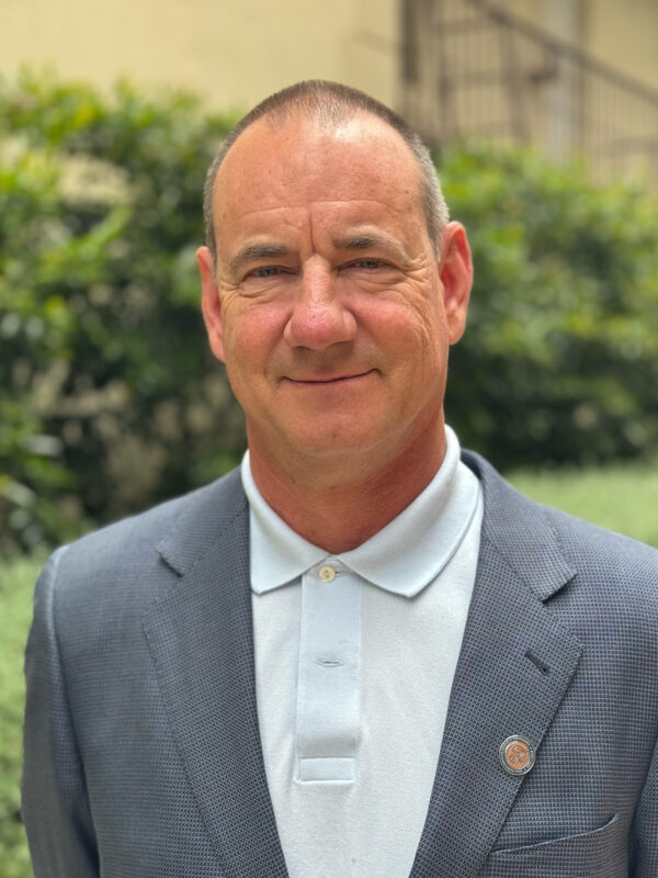
Dr. Leanne Archer is a Researcher in the School of Geographical Sciences at the University of Bristol, specializing in hydrology and climate change impacts. Her work focuses on flood risk assessment in Small Island Developing States, extreme rainfall events, and the application of convection-permitting climate models. She collaborates with experts like Prof. Paul Bates and Dr. Jonty Rougier on interdisciplinary projects addressing tropical cyclone hazards and climate adaptation strategies. Her research interests include analyzing flood exposure in vulnerable regions, soil moisture dynamics in urban flooding, and improving global flood forecasts for humanitarian operations. Archer’s publications emphasize the implications of climate change on rainfall-driven disasters, particularly in Puerto Rico and East Africa, using high-resolution climate projections to evaluate future risks under 1.5° C and 2° C warming scenarios. Recent work explores innovations like the Surface Water Ocean Topography Mission for flood modeling and evaluates the suitability of TanDEM-X data for inundation studies in island nations. Her contributions bridge environmental science with policy, aiming to enhance disaster preparedness and resilience in climate-sensitive regions.
Diane E. Austin is a Professor and Director of the School of Anthropology at the University of Arizona. She also serves as a Research Anthropologist at the Bureau of Applied Research in Anthropology (BARA). Her work focuses on environmental anthropology, particularly community dynamics in industrial and environmental contexts, with a strong emphasis on social justice and collaborative research. She has over 25 years of experience leading interdisciplinary projects in the U.S., Mexico, and Gulf Coast regions. Austin's research spans diverse areas including Native American communities, U.S.-Mexico border sustainability, Gulf Coast oil industry impacts, and urban food systems in arid regions. She has pioneered long-term partnerships with tribal organizations, federal agencies, and community groups, earning recognition such as the University Distinguished Outreach Professor (2008) and Distinguished Director (2023). Her recent work highlights longitudinal studies on the Deepwater Horizon oil spill's social effects, binational environmental initiatives in Nogales, and community-based approaches to disaster resilience. She coordinates BARA's internship and post-baccalaureate programs, supporting hundreds of students in applied anthropological research. Awards: Partners in Conservation Award (2010), Border Research Partnership Award Finalist (2012) Leadership Roles: Chair of the Good Neighbor Environmental Board, Member of the Gulf Research Program Advisory Board Key Projects: Southern Paiute cultural preservation, Gulf Coast oil industry studies, Nogales reforestation initiatives Austin’s teaching includes courses on ethnographic methods, data analysis, and mixed-methods research. She actively engages in policy advocacy, contributing expert testimony in legal proceedings related to environmental disasters and labor rights.
Professor Haijiang Li is a Chair in BIM for Smart Engineering at Cardiff University's School of Engineering. His roles include leading the Computational Mechanics and Engineering AI Research Group, directing the BIM for Smart Engineering Centre, and overseeing the BIM MSc programme. He holds editorial roles for journals like Construction Innovation and Automation in Construction , and chairs the European Group of Intelligent Computing in Engineering (EG-ICE). Research focuses on smart computational engineering platforms integrating BIM, AI, and big data for sustainable infrastructure. Key areas include digital twins, disaster management, and resilient urban systems. He has secured £40M in research funding, including £9M as PI, and led over 70 research staff and students. Prof. Li is a Standards Committee Technical Executive at buildingSMART, driving international BIM standards. His work includes co-authoring a book on BIM standards across China, the US, and the UK. Awards include Fellowships from the British Computer Society (FBCS) and the Higher Education Academy (FHEA). His research outputs span over 250 publications, covering topics like AI-driven bridge maintenance, ontology-based decision-making, and energy-efficient urban systems. Collaborations with industry and global partners emphasize practical applications of BIM and smart technologies.
Christopher D.P. Baxter is a Professor and Department Chair of Civil and Environmental Engineering at the College of Engineering, University of Rhode Island , with expertise in geotechnical engineering, offshore wind energy, and coastal resilience. He holds a Ph.D. in Civil Engineering from Virginia Tech (1999), an M.S. from Purdue University (1994), and a B.S. from Tufts University (1990). Research Focus: Geotechnical characterization of marine sediments, liquefaction resistance analysis, fiber-optic sensing for infrastructure monitoring, and coastal protection systems. Recent Publications: 15+ articles (2011–2025) covering topics like shear wave velocity, offshore wind foundation dynamics, and tsunami hazard modeling. Grants: Led projects on offshore wind monitoring (2019–2024) and fiber-optic seismic sensing (2021–2023). Key Collaborations: Work with teams on submarine landslide analysis, coastal dune reinforcement, and Rhode Island infrastructure resilience. His work bridges experimental geomechanics with practical coastal engineering solutions.
Dr. Farha Sattar is a Lecturer in Education (Mathematics) at the Faculty of Arts and Society, Charles Darwin University. With over thirty years of teaching experience in Mathematics, Science education, GIS, Remote Sensing, and e-Learning technologies at undergraduate and postgraduate levels, Dr. Sattar brings extensive expertise to her academic role. She holds a PhD in Geospatial Science from Charles Darwin University, focusing on Spatial Mathematical Modelling for 3D Gully Mapping and Erosion Quantification. Her educational background includes: PhD in Geospatial Science (Three Dimensional Gully Mapping and Erosion Quantification within a Geoinformatics Framework), Charles Darwin University (2012) Prior academic experience at several Asian and European universities Dr. Sattar's research spans multiple interdisciplinary fields with a strong focus on the intersection of education and technology. Her primary research interests include Mathematics Education, STEM Education, Geoscience Education, Spatial Mathematical Modelling, Drone Technology, Remote Sensing, Geographic Information Systems, and Innovative Pedagogies such as experiential learning and inquiry-based approaches. She has developed expertise in cognitive development, particularly in fostering critical and creative thinking skills through iSTEM approaches. An analysis of Dr. Sattar's recent publications reveals a consistent trajectory toward integrating emerging technologies like drones, augmented reality, and geospatial artificial intelligence into educational contexts. Her work demonstrates a progression from foundational geospatial research on erosion mapping to innovative applications in STEM education. Recent publications increasingly focus on drone technology for educational purposes, spatial data infrastructure for policy development, and computational thinking development through technology-enhanced learning. Dr. Sattar has received numerous accolades for her contributions to education and research: NT Science Week Awards – Inspired NT STEM Hero of the Year award (2021) Long Service Recognition Award (2023) Finalist, CDU Alumni Award (2023) Multiple Best Presentation Awards (2008, 2010, 2017) Australian College of Educators - 2021 College Medal Nominee As a supervisor, Dr. Sattar mentors postgraduate research students including Ayesha Farhan, who is working on "A Framework for Cognitive Development: Fostering Critical and Creative Thinking Skills, Using iSTEM Approach." She actively secures research funding through various projects such as "DBELaSTEM: Drone-Based Experiential Learning and STEM Education," "STEM_D & VR: Youth STEM Learning and Empowerment with Drones and VR," and "CodProg Drone Lab." Her research is supported by grants from NT Government projects and other external funding sources. Dr. Sattar leads the CodProg Drone Lab, an innovative research space exploring drone technology applications in education. She is a certified drone pilot and aeronautical radio operator, which enables her to bridge theoretical knowledge with practical applications. Her work with the "Flying Forward: Drones, STEM Equity, and Indigenous Empowerment" initiative demonstrates her commitment to community engagement and addressing educational disparities through technology.
Dr. Anthony Filippi is an Associate Professor and Director of Graduate Programs at Texas A&M University. His research focuses on remote sensing, geographic information systems (GIS), and machine learning applied to aquatic and terrestrial environments. He leads the Fluvial-GEOS Lab, studying riverine/floodplain systems using remote sensing and GIS technologies. Educational Background: Ph.D. in Geography, University of South Carolina (2003) M.S. in Geography, University of South Carolina B.A. in Geography, Kansas State University Research Interests: Imaging spectroscopy, hyperspectral remote sensing of rivers and coastal oceans, GIS-based modeling, data fusion, aquatic optics, and machine learning. His work addresses coastal ocean bathymetry estimation, floodplain dynamics, and applications in environmental monitoring, including hazardous waste site tracking and agricultural studies. Recent Research Trends: Recent publications highlight advancements in UAS-based image analysis, LSTM networks for floodplain classification, and environmental policy impacts on forest resources. His work integrates machine learning with remote sensing to improve ecological and geomorphological understanding. Labs/Teams: Director of the Fluvial-GEOS Lab, focusing on remote sensing and GIS applications in riverine environments.
Prof. Christian Heipke is a distinguished academic serving as Dean of the Faculty of Civil Engineering and Geodetic Science at Leibniz University Hannover, Germany. He also holds the position of Executive Director at the Institute of Photogrammetry and GeoInformation (IPI), one of the leading research institutions in geospatial sciences within the faculty. His leadership extends across multiple committees including the Curriculum and Teaching Committee, Admissions and Examination Boards for Geodetic Science and Geoinformatics, and Navigation and Environmental Robotics. As a Professor at IPI, he maintains active research while overseeing significant academic and administrative responsibilities at the university. Professor Heipke's research spans multiple domains within geospatial sciences, with particular emphasis on: Advanced photogrammetric techniques and algorithms Remote sensing applications for environmental monitoring Computer vision approaches for geospatial data analysis Urban development monitoring using satellite imagery Machine learning applications in geoinformatics Disaster prediction and management systems His recent scholarly output reveals a strong focus on integrating cutting-edge computer vision and deep learning techniques with traditional photogrammetric methods. Analysis of his 15 most recent publications shows a clear trajectory toward more sophisticated AI-driven approaches for processing geospatial data, with particular attention to time-series analysis, uncertainty quantification, and multi-view systems. His work bridges theoretical advancements with practical applications in flood forecasting, deforestation monitoring, urban planning, and construction materials analysis. The geographic scope of his research has expanded significantly, with recent projects focusing on international case studies in the Philippines and tropical regions. Professor Heipke leads the Institute of Photogrammetry and GeoInformation, a major research hub that has celebrated 75 years of contributions to the field. His leadership extends to the Graduiertenkolleg 2159: "Integrity and Collaboration in Dynamic Sensor Networks," where he serves as a professor overseeing doctoral research. The institute maintains state-of-the-art facilities for processing satellite imagery, aerial photography, and developing novel algorithms for geospatial data analysis. Under his direction, the institute has strengthened its international collaborations and interdisciplinary research approaches, particularly in addressing Sustainable Development Goals through geospatial technologies.
Fabio Miranda is an Assistant Professor at the Department of Computer Science, University of Illinois at Chicago (UIC) . His research bridges visualization , machine learning , data management , and computer graphics to enable interactive visual analysis of large-scale urban datasets . He has developed systems like UrbanRama (for VR navigation) and The Urban Toolkit (a grammar-based framework), which have been deployed in academia, industry, and government agencies. Education: Ph.D., Computer Science , New York University (2018) M.S., Computer Science , Pontifical Catholic University of Rio de Janeiro (2011) B.S., Computer Science , Federal University of Minas Gerais (2009) Research Interests center on urban visual analytics , 3D analytics , and machine learning for accessibility . His work addresses challenges like sunlight access , sidewalk quality assessment , and commuting flow modeling , often collaborating with urban planners, climate scientists, and occupational therapists. Scientific Recognition includes awards at IEEE VIS , SIBGRAPI , and SIGMOD . His research is funded by NSF , NIH , DOT , and DPI , with media coverage in The New York Times , The Economist , and Architectural Digest . Teaching includes courses like CS 524: Big Data Visualization and Analytics and CS 424: Visualization and Visual Analytics . He emphasizes web-based systems, dataflow frameworks, and interdisciplinary collaboration, with open positions for PhD , MSc , and undergraduate researchers .
Dr. Kevin Kochersberger is an Associate Professor in the Department of Mechanical Engineering at Virginia Tech , with a career spanning academic research, technical innovation, and educational leadership. His work focuses on autonomous aerial systems , robotic control , and applied aerodynamics , particularly through the Uncrewed Systems Laboratory . Kochersberger's research has pioneered UAV-based radiation detection , 3D terrain mapping , and low-resource drone applications , including establishing the African Drone and Data Academy in Malawi . Education: Ph.D., Mechanical Engineering, Virginia Tech (1994) M.S., Mechanical Engineering, Virginia Tech (1984) B.S., Mechanical Engineering, Virginia Tech (1983) A.S., Engineering Science, Jamestown Community College (1981) Kochersberger's publications demonstrate expertise in UAV path planning , smart material actuation , and radiation source localization , with over $9M in research funding. His scientific awards include AIAA Associate Fellow (2009) and Aviation Week Aerospace Laureate (2003). Notable projects involve helicopter-deployable robotic systems and urban canyon navigation without GPS. Recent articles highlight BVLOS drone simulators , 2.5D terrain mapping , and autonomous negative obstacle traversal , reflecting his focus on real-time adaptive control and heterogeneous robotic systems . He teaches Drone Technology and Flight Operations and Advanced Design Projects , emphasizing student-driven innovation and industry collaboration .
Jérôme Picard is a Researcher at the French National Center for Scientific Research (CNRS) affiliated with UMR 8586 - PRODIG at Campus Condorcet. His work focuses on Geomatics, Remote Sensing, Cartography , and Environmental Changes . His research involves GIS project management Linguistic and ethnic cartography Land use and territorial dynamics in Central Africa and the Himalayas Recent publications include cartographic contributions to linguistic studies in Africa, Asia, and the Himalayas (2016-2021), with methods integrating GIS and remote sensing for analyzing environmental and societal issues . Scientific awards include Award at Pastoralism and Wide Open Spaces festival for 'The Waters of Discord' He has collaborated with institutions like the University of Bangui, ENSG-Marne la Vallée, and the French Society of Photogrammetry and Remote Sensing (SFPT), and contributed to GIS training programs for doctoral students and researchers.
Jim Thatcher is an Assistant Professor at the College of Earth, Ocean, and Atmospheric Sciences (CEOAS) at Oregon State University. He serves as editor of Cartographic Perspectives , a leading journal in cartography. His research focuses on the intersection of technology, society, and environment, particularly examining how data and spatial technologies operate within capitalist systems. Key areas include Critical GIS, Critical Cartography, and Digital Political Ecology. Thatcher's current projects explore equitable coastal flood risk modeling using topological data analysis, mapping infrastructural legacies of slavery in the Pacific Northwest, and creating accessible disaster response maps for non-English speakers in Oregon. He also investigates spectral governance for rural internet access, cartography's societal role, climate education through board games, and geographic influences on electoral districting. His research emphasizes critical approaches to spatial data, questioning representational practices and power dynamics embedded in geospatial technologies. Recent work includes analyzing Bitcoin mining's environmental impacts on hydropower systems and examining the World Bank's renewable energy mapping through Critical Data Studies. Thatcher actively mentors graduate students and encourages interdisciplinary inquiries blending critical social theory with computational methods. Thatcher has authored numerous articles and co-authored Data Power (Pluto Press, 2022), an open-access exploration of data's role in societal control and resistance. His scholarship bridges critical geography with emerging technologies, advocating for ethical and equitable spatial practices in an increasingly data-driven world.
Mike Willis is an Associate Professor of Cryospheric Science, Geodesy & Remote Sensing at the Department of Geosciences, Virginia Tech's College of Science. His research focuses on advancing remote sensing techniques to study Earth's cryosphere, coastal environments, and natural hazards. He leads projects on glacial dynamics, sea level rise impacts, landslide monitoring, and the application of GNSS and InSAR technologies. His work combines field instrumentation (e.g., OrangePi-GNSS systems) with satellite data analysis to address climate and geohazard challenges in polar regions and coastal communities. Education background: Not explicitly stated in provided text. Research interests include cryospheric science, geodetic monitoring, and environmental remote sensing applications. His lab group maintains a dedicated website at https://sites.google.com/view/4datvt/ . Key research themes include: Glacier and ice shelf mass balance Coastal vulnerability to sea level rise Disaster monitoring using GNSS-IR and InSAR High-resolution digital terrain modeling Recent projects highlight work in Greenland (landslide monitoring, sea level measurements), the Pacific Northwest (subduction zone hazards), and the Dominican Republic (coastal inundation modeling). His interdisciplinary approach bridges geophysical observations with computational geospatial analysis.
Deborah Balk is a Professor at the Marxe School of Public and International Affairs at Baruch College, part of the City University of New York (CUNY). She also serves as Director of the CUNY Institute for Demographic Research and holds appointments in the CUNY Graduate Center's Sociology and Economics programs, as well as the CUNY School of Public Health's Epidemiology Program. Her expertise lies in spatial demography, integrating earth and social science data to address policy challenges related to urbanization, climate change, and population dynamics. Dr. Balk has led significant roles in climate assessments, including Co-Chair of the New York City Panel on Climate Change’s 4th Assessment (2019–2024) and membership in the U.S. National Climate Assessment’s 6th Health Chapter (2025). She holds a PhD in Demography from UC Berkeley and degrees from the University of Michigan (MPP and AB in International Relations). Her research focuses on urbanization, migration, poverty, health, and environmental interactions, particularly climate adaptation and equity. Notable projects include analyzing population vulnerability in coastal zones and developing spatial demographic tools for global health and policy. Awards include the Andrew Carnegie Fellowship (2016–2018) and the William and Flora Hewlett Foundation Fellowship (1991). Dr. Balk has secured grants exceeding $6 million from NSF, NASA, and others, supporting work on urbanization, climate justice, and demographic data integration. She advises multiple institutions, including the U.S. Census Bureau and National Academy of Sciences. Her teaching spans spatial demography, urban policy, and statistical methods, reflecting her commitment to bridging demographic science and real-world applications.
Thomas Gillespie is a Professor and Co-Chair of the Environmental Science and Engineering (D.Env.) Program at the Department of Geography, University of California, Los Angeles (UCLA). His research integrates Geographic Information Systems (GIS), remote sensing, and biogeography to study tropical dry forests in biodiversity hotspots and develop predictive models for species distribution and conservation. Education: Ph.D. in Geography, UCLA (1998) M.A. in Geography and Planning, California State University, Chico (1994) B.A. in International Affairs, University of Colorado, Boulder (1990) Research Interests: Gillespie’s work focuses on field-based floristic surveys and remote sensing analysis of tropical dry forests across the Pacific, Caribbean, and California. He combines GIS with ecological data to model biodiversity patterns, anthropogenic disturbance impacts, and climate change scenarios. His research spans biogeography, conservation science, and environmental policy. Scientific Awards: NASA Earth and Space Science Fellowship Grants: Gillespie has secured major grants from the National Science Foundation (NSF), Environmental Protection Agency (EPA), National Institutes of Health (NIA, NICHD), and MacArthur Foundation for projects on urban greening, disaster recovery, and tropical forest conservation.
Christophe Viavattene is an Associate Professor of Environmental Sustainability at Middlesex University , specializing in flood risk management and urban resilience. He has spent 17 years at the Flood Hazard Research Centre , leading interdisciplinary research across economic and physical sciences in water and flood risk. Research Focus: Flood vulnerability (coastal, urban, fluvial), GIS tools (INDRA model), Multi-Coloured Manual (MCM) methodology, mental health impacts of flooding, groundwater flood risk in arid regions, and air quality risk assessment. Teaching: Programme Leader for the MSc Sustainability and Environmental Management , teaching problem-based sustainability, GIS, and environmental monitoring. Key Collaborations: EU FP7 RISC-KIT, EU CONHAZ, Environment Agency UK projects. Recent Publications: Bayesian flood models, coastal hotspots analysis, and groundwater flood damage methodologies. His work bridges academic research with practical applications, including flood storage compensation frameworks and vulnerability indicator libraries.