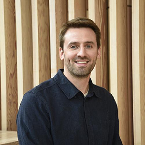
Dr Olly Bartlett is a Senior Lecturer in Remote Sensing and Geography at the University of Hertfordshire , affiliated with the Department of Psychology, Sport and Geography within the School of Life and Medical Sciences. His work focuses on planetary-scale remote sensing analysis of the cryosphere, with field campaigns in Greenland, Nepal, Svalbard, and the Peruvian Andes. Education: PhD in Physical Geography (University of Exeter, 2020); MSc in Polar and Alpine Change (University of Sheffield, 2016); BSc in Physical Geography (University of Sheffield, 2015) Dr Bartlett specializes in UAV-based remote sensing and Google Earth Engine , holding a UK GVC for UAV operations. His research tracks environmental changes in polar and alpine regions, including quantifying Antarctic Peninsula greening (1986–2021) and glacier dynamics in the Himalayas and Canadian Arctic. Recent publications highlight his methodological innovations in radar surveying and supraglacial hummock morphology studies. His work bridges glaciology and geospatial analysis , focusing on climate-induced glacial retreat impacts. He supervises PhD student Lottie Pearson on pan-Arctic permafrost thaw projects and collaborates internationally on cryospheric studies.
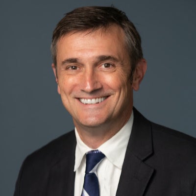
Jacob Bukoski is Assistant Professor and Director of the Forests and Climate Change graduate certificate at Oregon State University's College of Forestry. His research examines forest carbon dynamics, climate mitigation, and international forestry. Education includes: PhD in Environmental Science from UC Berkeley MS in Environmental Science from Yale University BA in Environmental Studies from UNC Chapel Hill Research focuses on carbon accumulation in forests, mangrove conservation, and climate policy integration. Teaches interdisciplinary courses on social-ecological systems and forest carbon analysis. Recent publications quantify carbon storage in global plantations and mangrove ecosystems. Current projects investigate albedo impacts on reforestation protocols and coastal conservation synergies. Directs graduate studies in Forests and Climate Change.
Christopher D.P. Baxter is a Professor and Department Chair of Civil and Environmental Engineering at the College of Engineering, University of Rhode Island , with expertise in geotechnical engineering, offshore wind energy, and coastal resilience. He holds a Ph.D. in Civil Engineering from Virginia Tech (1999), an M.S. from Purdue University (1994), and a B.S. from Tufts University (1990). Research Focus: Geotechnical characterization of marine sediments, liquefaction resistance analysis, fiber-optic sensing for infrastructure monitoring, and coastal protection systems. Recent Publications: 15+ articles (2011–2025) covering topics like shear wave velocity, offshore wind foundation dynamics, and tsunami hazard modeling. Grants: Led projects on offshore wind monitoring (2019–2024) and fiber-optic seismic sensing (2021–2023). Key Collaborations: Work with teams on submarine landslide analysis, coastal dune reinforcement, and Rhode Island infrastructure resilience. His work bridges experimental geomechanics with practical coastal engineering solutions.
Xi Gong is an Associate Professor in the Department of Biobehavioral Health and the Institute of Computing and Data Sciences at Pennsylvania State University, where he leads the Gong Lab. His research focuses on Geospatial Data Science, integrating GIScience, computational methods, and statistical analysis to study environmental health and social dynamics. He holds a PhD in Geographic Information Science from Texas State University, an M.Sc. from the University of Chinese Academy of Sciences, and a B.Eng. from Wuhan University. Dr. Gong's research interests include spatio-temporal data mining, environmental exposure modeling, and visual analytics for big data. His work bridges Environmental Health Science (EHS) and Spatially Integrated Social Science (SISS), addressing public health concerns through geospatial modeling and interdisciplinary collaboration. He currently accepts graduate students and postdoctoral scholars for projects in Geospatial Data Science and EHS. Education: PhD (2016, Texas State University), M.Sc. (2011, University of Chinese Academy of Sciences), B.Eng. (2008, Wuhan University) Labs/Teams: Director of Gong Lab, focused on geospatial big data analysis for health and environmental studies Advising: Mentors PhD and MS students in Biobehavioral Health and related fields
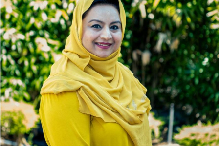
Dr. Farha Sattar is a Lecturer in Education (Mathematics) at the Faculty of Arts and Society, Charles Darwin University. With over thirty years of teaching experience in Mathematics, Science education, GIS, Remote Sensing, and e-Learning technologies at undergraduate and postgraduate levels, Dr. Sattar brings extensive expertise to her academic role. She holds a PhD in Geospatial Science from Charles Darwin University, focusing on Spatial Mathematical Modelling for 3D Gully Mapping and Erosion Quantification. Her educational background includes: PhD in Geospatial Science (Three Dimensional Gully Mapping and Erosion Quantification within a Geoinformatics Framework), Charles Darwin University (2012) Prior academic experience at several Asian and European universities Dr. Sattar's research spans multiple interdisciplinary fields with a strong focus on the intersection of education and technology. Her primary research interests include Mathematics Education, STEM Education, Geoscience Education, Spatial Mathematical Modelling, Drone Technology, Remote Sensing, Geographic Information Systems, and Innovative Pedagogies such as experiential learning and inquiry-based approaches. She has developed expertise in cognitive development, particularly in fostering critical and creative thinking skills through iSTEM approaches. An analysis of Dr. Sattar's recent publications reveals a consistent trajectory toward integrating emerging technologies like drones, augmented reality, and geospatial artificial intelligence into educational contexts. Her work demonstrates a progression from foundational geospatial research on erosion mapping to innovative applications in STEM education. Recent publications increasingly focus on drone technology for educational purposes, spatial data infrastructure for policy development, and computational thinking development through technology-enhanced learning. Dr. Sattar has received numerous accolades for her contributions to education and research: NT Science Week Awards – Inspired NT STEM Hero of the Year award (2021) Long Service Recognition Award (2023) Finalist, CDU Alumni Award (2023) Multiple Best Presentation Awards (2008, 2010, 2017) Australian College of Educators - 2021 College Medal Nominee As a supervisor, Dr. Sattar mentors postgraduate research students including Ayesha Farhan, who is working on "A Framework for Cognitive Development: Fostering Critical and Creative Thinking Skills, Using iSTEM Approach." She actively secures research funding through various projects such as "DBELaSTEM: Drone-Based Experiential Learning and STEM Education," "STEM_D & VR: Youth STEM Learning and Empowerment with Drones and VR," and "CodProg Drone Lab." Her research is supported by grants from NT Government projects and other external funding sources. Dr. Sattar leads the CodProg Drone Lab, an innovative research space exploring drone technology applications in education. She is a certified drone pilot and aeronautical radio operator, which enables her to bridge theoretical knowledge with practical applications. Her work with the "Flying Forward: Drones, STEM Equity, and Indigenous Empowerment" initiative demonstrates her commitment to community engagement and addressing educational disparities through technology.
Dr. Anthony Filippi is an Associate Professor and Director of Graduate Programs at Texas A&M University. His research focuses on remote sensing, geographic information systems (GIS), and machine learning applied to aquatic and terrestrial environments. He leads the Fluvial-GEOS Lab, studying riverine/floodplain systems using remote sensing and GIS technologies. Educational Background: Ph.D. in Geography, University of South Carolina (2003) M.S. in Geography, University of South Carolina B.A. in Geography, Kansas State University Research Interests: Imaging spectroscopy, hyperspectral remote sensing of rivers and coastal oceans, GIS-based modeling, data fusion, aquatic optics, and machine learning. His work addresses coastal ocean bathymetry estimation, floodplain dynamics, and applications in environmental monitoring, including hazardous waste site tracking and agricultural studies. Recent Research Trends: Recent publications highlight advancements in UAS-based image analysis, LSTM networks for floodplain classification, and environmental policy impacts on forest resources. His work integrates machine learning with remote sensing to improve ecological and geomorphological understanding. Labs/Teams: Director of the Fluvial-GEOS Lab, focusing on remote sensing and GIS applications in riverine environments.
Claudia R. Binder is Full Professor at EPFL's School of Architecture, Civil and Environmental Engineering, leading the Laboratory for Human-Environment Relations in Urban Systems (HERUS) since 2016. Previously, she held professorships at the University of Munich (2011-2016), University of Graz (2009-2011), and University of Zurich (2006-2009). She served as Dean of EPFL's ENAC School from 2020-2023 and holds advisory roles with Swiss federal institutions including the Mercator Foundation since 2024. Her academic foundation includes a Biochemistry degree and PhD in Environmental Sciences from ETH Zurich, followed by postdoctoral research at the University of Maryland. This interdisciplinary background underpins her research approach spanning natural and social sciences. Professor Binder's work centers on urban sustainability transitions, examining urban metabolism dynamics through systems science frameworks. She investigates energy-food-transport interdependencies in cities using transdisciplinary methods that integrate material flow analysis, spatial modeling, and socio-technical assessments. Her research particularly emphasizes regulatory mechanisms and transformation drivers in human-environment systems, with case studies across Swiss and global urban contexts. Recent publications reveal evolving focus from foundational urban metabolism studies toward actionable transition strategies. Her 2024-2025 work increasingly addresses social tipping dynamics, circular decarbonization, and spatially explicit waste management, demonstrating methodological innovation through geo-referenced material flow analysis and participatory backcasting frameworks. Key thematic clusters include energy innovation diffusion, plastic waste governance, and demand-side flexibility in residential systems. She actively mentors 7 current PhD candidates while supervising 11 graduates since 2018, with research spanning urban metabolism modeling, sustainability assessment, and transition governance. Her leadership extends to Swiss National Science Foundation committees and National Research Program 71 on energy consumption management. At EPFL, she directs the HERUS laboratory which develops the Sustainability Solution Space methodology for urban assessment. The lab operates at the intersection of data science, environmental engineering, and social theory, maintaining strong field connections in Switzerland, Indonesia, and Germany for empirical validation of transition models.
Prof. Christian Heipke is a distinguished academic serving as Dean of the Faculty of Civil Engineering and Geodetic Science at Leibniz University Hannover, Germany. He also holds the position of Executive Director at the Institute of Photogrammetry and GeoInformation (IPI), one of the leading research institutions in geospatial sciences within the faculty. His leadership extends across multiple committees including the Curriculum and Teaching Committee, Admissions and Examination Boards for Geodetic Science and Geoinformatics, and Navigation and Environmental Robotics. As a Professor at IPI, he maintains active research while overseeing significant academic and administrative responsibilities at the university. Professor Heipke's research spans multiple domains within geospatial sciences, with particular emphasis on: Advanced photogrammetric techniques and algorithms Remote sensing applications for environmental monitoring Computer vision approaches for geospatial data analysis Urban development monitoring using satellite imagery Machine learning applications in geoinformatics Disaster prediction and management systems His recent scholarly output reveals a strong focus on integrating cutting-edge computer vision and deep learning techniques with traditional photogrammetric methods. Analysis of his 15 most recent publications shows a clear trajectory toward more sophisticated AI-driven approaches for processing geospatial data, with particular attention to time-series analysis, uncertainty quantification, and multi-view systems. His work bridges theoretical advancements with practical applications in flood forecasting, deforestation monitoring, urban planning, and construction materials analysis. The geographic scope of his research has expanded significantly, with recent projects focusing on international case studies in the Philippines and tropical regions. Professor Heipke leads the Institute of Photogrammetry and GeoInformation, a major research hub that has celebrated 75 years of contributions to the field. His leadership extends to the Graduiertenkolleg 2159: "Integrity and Collaboration in Dynamic Sensor Networks," where he serves as a professor overseeing doctoral research. The institute maintains state-of-the-art facilities for processing satellite imagery, aerial photography, and developing novel algorithms for geospatial data analysis. Under his direction, the institute has strengthened its international collaborations and interdisciplinary research approaches, particularly in addressing Sustainable Development Goals through geospatial technologies.
Matthew D. Potts is the S.J. Hall Chair in Forest Economics and Professor at UC Berkeley's Department of Environmental Science, Policy, & Management. He also serves as Associate Director for Sustainable Development at the Blum Center for Developing Economies. With interdisciplinary training in mathematics, ecology, and economics, his research focuses on nature-based climate solutions and ecosystem service co-production. Research addresses carbon sequestration through forest management, biodiversity conservation, land use planning, and sustainable development in tropical ecosystems. Recent work examines cost-effectiveness of reforestation, climate-driven migration patterns, and plantation carbon modeling. Publications demonstrate strong focus on quantitative analysis of land-use impacts, with methodological innovations in remote sensing applications and spatial modeling for carbon accounting. Awards include recognition for young faculty research and leadership in international environmental assessments. Leads the Potts Research Group, mentoring graduate students working on tropical ecology, restoration, and climate adaptation projects.
Associate Professor Mohsen Kalantari is a Geospatial Engineering academic at the University of New South Wales (UNSW) School of Civil and Environmental Engineering , with concurrent roles as co-founder of the startup Faramoon . His career spans roles at the University of Melbourne's Department of Infrastructure Engineering and Victorian government's land administration initiatives through DELWP. Education : PhD in Geomatics Engineering (2008, University of Melbourne), Master of GIS Engineering (2004), Bachelor of Surveying Engineering (2001) His research bridges geospatial engineering with construction automation , focusing on 3D cadastre , BIM-GIS integration , and smart cities . Recent publications show trends in underground land administration , digital twins , and LADM standard implementations . Scientific Awards : National educational recognition (2019), Victorian educational grants (2018), and prestigious fellowships (2012) As a supervisor , he guides PhD candidates in topics ranging from BIM for waste management to underground cadastral systems . His industry engagement includes partnerships with the United Nations , Open Geospatial Consortium , and Singapore Land Authority .
Fabio Miranda is an Assistant Professor at the Department of Computer Science, University of Illinois at Chicago (UIC) . His research bridges visualization , machine learning , data management , and computer graphics to enable interactive visual analysis of large-scale urban datasets . He has developed systems like UrbanRama (for VR navigation) and The Urban Toolkit (a grammar-based framework), which have been deployed in academia, industry, and government agencies. Education: Ph.D., Computer Science , New York University (2018) M.S., Computer Science , Pontifical Catholic University of Rio de Janeiro (2011) B.S., Computer Science , Federal University of Minas Gerais (2009) Research Interests center on urban visual analytics , 3D analytics , and machine learning for accessibility . His work addresses challenges like sunlight access , sidewalk quality assessment , and commuting flow modeling , often collaborating with urban planners, climate scientists, and occupational therapists. Scientific Recognition includes awards at IEEE VIS , SIBGRAPI , and SIGMOD . His research is funded by NSF , NIH , DOT , and DPI , with media coverage in The New York Times , The Economist , and Architectural Digest . Teaching includes courses like CS 524: Big Data Visualization and Analytics and CS 424: Visualization and Visual Analytics . He emphasizes web-based systems, dataflow frameworks, and interdisciplinary collaboration, with open positions for PhD , MSc , and undergraduate researchers .
Jan Oliver Borchers is a full professor of computer science and head of the Media Computing Group at RWTH Aachen University, where he holds the endowed Chair in Media Informatics and Human-Computer Interaction (Computer Science 10). He established his research group in 2003 and pioneered modern HCI academic research and teaching in Germany, becoming a leading lab in terms of archival publications at CHI, the top international conference in HCI. Before joining RWTH, he held faculty positions at Stanford University and ETH Zurich. His research focuses on Human-Computer Interaction with particular interest in new user interfaces for soft robotics, textile user interfaces, 3D printing and personal fabrication, augmented reality, wearable and tangible computing, interfaces for software development, deceptive patterns, and interactive guides and exhibits. He opened Germany's first Fab Lab in 2009 and has been instrumental in advancing digital fabrication and maker culture in academia. His work bridges theoretical HCI research with practical applications, as evidenced by his consulting for major companies including AirBus, Apple, ARD, Bayer, Children's Museum Boston, Daimler, Handelsblatt, OTIS, Scout24, TEDx, and Deutsche Telekom. His recent publications show a strong focus on deceptive patterns in UI design, textile interfaces, and the intersection of AI with human interaction. The research demonstrates consistent innovation in tactile interaction techniques, with numerous honorable mentions at top conferences like CHI. His lab has produced significant contributions to eyes-free interaction, textile computing, and the ethical implications of dark patterns, particularly regarding children's experiences with deceptive designs. IDC 2025 Best Work in Progress for research on children's assessment of deceptive designs CHI'25 Student Games Competition Winner for The Deceptive Dungeon RWTH-Wissenschaftsnacht 2024 Best Science Slam for Usability: 4 Prinzipien guter User Interfaces Multiple CHI Honorable Mentions spanning from 2008-2021 Best Note and Best Demo awards at ITS and UIST conferences Borchers has served in numerous leadership roles including heading the Computer Science Department's Examination Board (2015-2025), coordinating the department's public relations since 2010, and organizing the weekly Faculty Lunch since 2003. He is an active member of the ACM, SIGCHI, SIGCHI Germany, and GI, and introduced the Interactivity format to the CHI conference in 2005. His PhD thesis, A Pattern Approach to Interaction Design, became the first book to bring design patterns to HCI. The Media Computing Group under his leadership has developed significant expertise in physical computing, textile interfaces, and fabrication technologies, with a strong emphasis on both theoretical contributions and practical applications. His lab continues to push boundaries in interactive technologies while maintaining a strong ethical stance on user experience, particularly regarding deceptive design patterns.
Gustavo Valverde Mora is a Lecturer at ETH Zurich's Power Systems Laboratory in the Department of Information Technology and Electrical Engineering. His research focuses on distributed energy resources, smart grid technologies, and power system control, with expertise in behind-the-meter DER integration and hosting capacity analysis. His recent work addresses key challenges in renewable energy integration, including voltage control coordination between transmission and distribution networks, data-driven local control schemes for active distribution grids, and unsupervised load disaggregation techniques using smart meter data. He has developed novel methods for DER modeling, GIS-based system analysis, and distribution network planning. Recognized with multiple awards including the 2022 Costa Rican National Technology Award, he actively contributes to IEEE Task Forces on DER integration. His research demonstrates strong emphasis on practical grid applications, combining theoretical power systems knowledge with advanced data analytics. Dr. Valverde teaches Power System Analysis (227-0526-00L) and maintains collaborations with utilities worldwide on renewable integration challenges.
Sidi Wu is a Researcher affiliated with ETH Zürich's Institute of Cartography and Geoinformatics. Their primary role is as Staff of the Professorship for Cartography, contributing to academic research and technical operations within the department. They are based at HIL G 23.2, Stefano-Franscini-Platz 5 in Zürich, Switzerland, and can be reached at sidiwu@ethz.ch. Research interests center on advancing AI-driven cartographic methods, historical map analysis, and environmental spatial dynamics. Specific focuses include generative AI applications in map-making, semantic segmentation of historical documents, and leveraging digitized maps for ecosystem studies. They also explore steganography in image translation and cross-domain adaptation techniques for geospatial data. Recent work emphasizes innovations in automated map storytelling systems, spatio-temporal context modeling using transformers, and weakly supervised learning approaches for map segmentation. Their studies frequently bridge cartography with environmental science disciplines like hydrology and urban morphology. No scientific awards or grants are explicitly listed in the provided information. While no advisees are documented here, their research collaborations likely involve student contributions. They are part of the core team at the Institute of Cartography and Geoinformatics, contributing to cutting-edge projects in geomatics and computational cartography.
Professor Guy Williams is a leading academic at the University of Cambridge with a focus on imaging science and clinical neurosciences, affiliated with Downing College and the Wolfson Brain Imaging Centre . Holding a PhD in Physics from his initial Natural Sciences degree, he specializes in nuclear magnetic resonance (NMR) and MRI techniques for brain imaging. Education: BA, PhD in Physics His research centers on non-invasive imaging of brain structure and function, particularly in traumatic brain injury (TBI) and dementia. His work involves developing novel MRI pulse sequences and advanced data analysis algorithms, including AI-based diagnostic tools. He leads studies on white matter integrity post-trauma, longitudinal dementia assessment, and applications of MRI in disorders of consciousness and addiction. Recent publications highlight collaborations in traumatic brain injury outcomes, AI-guided dementia prediction, and neuroimaging of post-COVID cognitive deficits. His team's work on ultra-high field laminar fMRI and distortion correction methods has advanced clinical neuroscience applications. Key techniques include diffusion tensor imaging (DTI), 7 Tesla MRI, and positron emission tomography (PET/MR). His research spans from basic NMR physics to clinical translation, with a strong emphasis on multi-site studies and real-world diagnostic implementation.