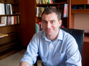
Michael Baldea is an Associate Professor in the Department of Chemical Engineering at the University of Texas at Austin . He holds a Ph.D. in Chemical Engineering from the University of Minnesota (2006), with prior degrees from 'Babeş-Bolyai' University in Romania (M.Sc. 2001, Diploma 2000). His research group develops theoretical and computational methods for Process and Energy Systems Engineering , focusing on integrated decision-making, performance optimization, and process intensification with industrial validation. Education: Ph.D., Chemical Engineering, University of Minnesota (2006) M.Sc., Interface Process Engineering, 'Babeş-Bolyai' University (2001) Diploma, Chemical Engineering, 'Babeş-Bolyai' University (2000) Research Thrusts: Integrated decision-making in chemical/energy supply chains Process performance monitoring and optimization Process integration and intensification Key applications include grid-responsive chemical plants, intensified distillation/column designs, and renewable energy integration for building systems. Scientific Awards: Frank A. Liddell, Jr. Fellowship NSF CAREER Award (2015-2020) Moncrief Grand Challenges Faculty Award (2014) AIChE Outstanding Young Researcher Award (2017) Implementation : His group has translated research into commercial tools through partnerships with industrial test beds and is working to integrate methods into commercial simulators. They explore predictive approaches for building energy management and strategic capital investment analysis in next-generation energy systems.
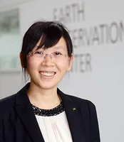
Xiaoxiang Zhu is a Professor for Data Science in Earth Observation at the Technical University of Munich (TUM) and serves as the Director of the International AI Future Lab - AI4EO. She is also on the Board of Directors of the Munich Data Science Institute (MDSI) and has held various leadership positions in research institutions including as Spokesperson for Helmholtz AI Research Field "Aeronautics, Space and Transport" (MASTr). Her educational background includes a doctorate (Dr.-Ing.) and habilitation from TUM. She has held positions as Private Dozent at TUM (2013-2015), TUM Junior Fellow (2013-2015), and Research Group Leader for "SparsEO" at Munich Aerospace (2011-2016). Professor Zhu's research focuses on the intersection of remote sensing, artificial intelligence, and data science. Her work primarily addresses global urban mapping, sustainable development goals, and climate change monitoring through Earth observation technologies. She develops advanced signal processing techniques and machine learning algorithms specifically tailored for satellite imagery and geospatial data analysis. Her research has significant applications in urban planning, environmental monitoring, and disaster management. Her team has pioneered approaches that combine synthetic aperture radar (SAR) with deep learning for improved Earth observation capabilities. Professor Zhu has received numerous prestigious awards including being named an IEEE Fellow (2021), receiving the Geodesy Award of the Nico Rüpke Foundation (2020), and being awarded an ERC Proof of Concept Grant (2020, 2022). She is also a Fellow of the Academia Europaea (2024) and AAIA Fellow (2024). Her publication record includes highly cited works such as "Deep Learning in Remote Sensing: A Comprehensive Review and List of Resources" (2017). She leads a substantial research team comprising numerous PhD students and postdoctoral researchers working on various projects including Horizon Europe - ThinkingEarth, EarthCare, and AI4TWINNING. Her research group, the Chair of Data Science in Earth Observation, is actively involved in multiple large-scale European and German research initiatives focused on Earth observation and AI applications.
Huamin Qu is a Chair Professor in the Department of Computer Science and Engineering at the Hong Kong University of Science and Technology (HKUST). He serves as the Founding Dean of the Academy of Interdisciplinary Studies (AIS), Founding Head of the Division of Emerging Interdisciplinary Areas (EMIA), and was the Founding Acting Head of Computational Media and Arts (CMA) at HKUST(GZ). Qu directs the VisLab and coordinates the Human-Computer Interaction (HCI) group. He obtained his BS in Mathematics from Xi'an Jiaotong University and MS/PhD in Computer Science from Stony Brook University. Qu's research integrates Data Visualization , Human-Computer Interaction , and Human-Centered AI , with applications in urban informatics, social networks, and explainable AI. His work focuses on developing interactive systems for big data analytics, visual storytelling, and AI-driven decision support. Research extends to multimodal communication, fintech, and augmented reality applications. His publications emphasize visual analytics for complex datasets (mobility, social media, financial), interaction techniques for immersive environments, and AI-enhanced visualization tools. Recent works explore explainable AI interfaces and large-scale data communication frameworks. IEEE Visualization Academy (2020) IEEE VGTC Technical Achievement Award AI 2000 Most Influential Scholar (2019, 2023, 2024) 21 Best Paper/Honorable Mention awards IBM Faculty Award (2009) APICTA Merit Award (2015) Yelp Dataset Grand Prize (2018) Qu has advised 48 PhD graduates (21 now faculty at institutions like UC Davis, University of Minnesota, Texas A&M) and 30 MPhil students. He secured major grants including RGC theme-based projects (digital citizenship, air pollution), UGC AoE (slope safety), and China's 973 Program. As VisLab director, he leads 20+ researchers in visualization/HCI projects adopted by Microsoft, IBM, Huawei, and Tencent.
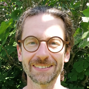
Kåre Synnes is a Professor in Pervasive and Mobile Computing at Luleå University of Technology, where he is affiliated with the Department of Computer Science, Electrical and Space Engineering. He is an active researcher and educator, recognized as an "Excellent lärare" (Excellent Teacher) and maintains his office in Luleå at location A3305a. Professor Synnes conducts research in pervasive computing and multimedia communication, with significant applications in eHealth. His work bridges theoretical computer science with practical implementations in distributed systems. He is also an affiliated researcher at the Centre for Distance-spanning Technology (CDT), focusing on technologies that enable communication across geographical boundaries. His recent publications demonstrate a clear trajectory toward sustainable computing solutions, with emphasis on circular economy applications, supply chain management, and environmental impact assessment. His research integrates computer science with economic and sustainability principles, showing how digital technologies can address contemporary environmental challenges through innovative auction systems, behavior analytics, and resource management frameworks. IST Prize winner as co-founder of Marratech AB Synnes has been deeply involved in European research projects since 1995, including multiple Framework Programme projects (FP4 through FP7). His work as an expert/reviewer for European projects since 2009 demonstrates his standing in the research community. His entrepreneurial success with Marratech AB, which was acquired by Google to form the basis for Google+ Hangouts, shows his ability to translate research into impactful commercial applications. Professor Synnes maintains strong connections with industry through his European project work and his entrepreneurial experience. His research group likely focuses on pervasive computing applications with real-world implementations, particularly in eHealth contexts, though specific lab details aren't provided in the available information.
Prof. dr. Nico Van de Weghe is a full Professor of GIScience at the University of Ghent (UGent), affiliated with the CartoGIS research unit. His work bridges computer science, social science, and natural science through geospatial information studies, focusing on enabling machines to reason spatially (GeoAI). Since 2004, he has specialized in knowledge-based AI, particularly spatiotemporal reasoning and moving object analysis, with applications in animal behavior, criminology, healthcare, mobility, and sports. Van de Weghe's research emphasizes hybrid GeoAI systems combining knowledge-driven and data-driven approaches. Keywords include GeoAI, GIScience, Spatiotemporal Analysis, Moving Objects, and Data Mining. Recent publications highlight urban road network analysis, hybrid trajectory modeling, BIM semantic enrichment, and cycling safety studies using virtual reality.
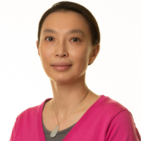
Rong Zheng is a Professor in the Department of Computing and Software and a member of the School of Biomedical Engineering at McMaster University, Canada. She holds a Tier-1 Canada Research Chair in Mobile Computing and serves as Acting Chair of the Computing and Software department from July to December 2025. She is also an Associate Member of the Electrical & Computer Engineering department. Education: Ph.D. in Computer Science, University of Illinois, Urbana-Champaign, USA Master of Engineering (thesis) in Electrical Engineering, Tsinghua University, Beijing, China Bachelor of Engineering in Electrical Engineering, Tsinghua University, Beijing, China Dr. Zheng's research lies at the intersection of mobile computing, wireless networking, and machine learning, with a strong focus on applications for aging populations. She directs the NSERC Smart Mobility for the Aging Population CREATE program. Her work encompasses sensor development, wireless network design, and mobile data analytics to address real-world challenges in healthcare, mobility, and data center monitoring. She has developed innovative solutions like the MacQuest campus navigation app and has captured first prize in indoor localization competitions. Her recent publications demonstrate a clear trajectory toward applying wireless sensing technologies (particularly acoustic, Wi-Fi, and mmWave) to health monitoring and mobility assessment for older adults. There's a strong emphasis on developing efficient edge computing solutions that can process data in real-time on resource-constrained devices, as exemplified by her TeamNet framework for collaborative inference on the edge. Her work bridges theoretical advances with practical applications that have social impact. Scientific Awards: Tier-1 Canada Research Chair in Mobile Computing US National Science Foundation CAREER Award (2006) Joseph Ip Distinguished Engineering Fellow (2015-2018) Dr. Zheng leads the Wireless System Research Group (WiSeR) at McMaster University, which has secured significant funding including a $1.65M NSERC CREATE grant for smart mobility research for older adults. Her research has been supported by multiple funding agencies including NSERC, NSF, UH GEAR, and DURIP. She actively mentors graduate students and has developed specialized courses including CAS 772 (Mobile Data Analytics) and CAS 781 (Mobility in the Aging Population). The WiSeR group conducts impactful research on communication, networking, and data analytics issues in Cyber Physical Systems, with applications spanning healthcare, smart infrastructure, and data center monitoring. Their work on data center infrastructure monitoring networks has been featured in EurekAlert and Data Center Dynamics, and they've made significant contributions to indoor localization technology.
Dr. Farha Sattar is a Lecturer in Education (Mathematics) at the Faculty of Arts and Society, Charles Darwin University. With over thirty years of teaching experience in Mathematics, Science education, GIS, Remote Sensing, and e-Learning technologies at undergraduate and postgraduate levels, Dr. Sattar brings extensive expertise to her academic role. She holds a PhD in Geospatial Science from Charles Darwin University, focusing on Spatial Mathematical Modelling for 3D Gully Mapping and Erosion Quantification. Her educational background includes: PhD in Geospatial Science (Three Dimensional Gully Mapping and Erosion Quantification within a Geoinformatics Framework), Charles Darwin University (2012) Prior academic experience at several Asian and European universities Dr. Sattar's research spans multiple interdisciplinary fields with a strong focus on the intersection of education and technology. Her primary research interests include Mathematics Education, STEM Education, Geoscience Education, Spatial Mathematical Modelling, Drone Technology, Remote Sensing, Geographic Information Systems, and Innovative Pedagogies such as experiential learning and inquiry-based approaches. She has developed expertise in cognitive development, particularly in fostering critical and creative thinking skills through iSTEM approaches. An analysis of Dr. Sattar's recent publications reveals a consistent trajectory toward integrating emerging technologies like drones, augmented reality, and geospatial artificial intelligence into educational contexts. Her work demonstrates a progression from foundational geospatial research on erosion mapping to innovative applications in STEM education. Recent publications increasingly focus on drone technology for educational purposes, spatial data infrastructure for policy development, and computational thinking development through technology-enhanced learning. Dr. Sattar has received numerous accolades for her contributions to education and research: NT Science Week Awards – Inspired NT STEM Hero of the Year award (2021) Long Service Recognition Award (2023) Finalist, CDU Alumni Award (2023) Multiple Best Presentation Awards (2008, 2010, 2017) Australian College of Educators - 2021 College Medal Nominee As a supervisor, Dr. Sattar mentors postgraduate research students including Ayesha Farhan, who is working on "A Framework for Cognitive Development: Fostering Critical and Creative Thinking Skills, Using iSTEM Approach." She actively secures research funding through various projects such as "DBELaSTEM: Drone-Based Experiential Learning and STEM Education," "STEM_D & VR: Youth STEM Learning and Empowerment with Drones and VR," and "CodProg Drone Lab." Her research is supported by grants from NT Government projects and other external funding sources. Dr. Sattar leads the CodProg Drone Lab, an innovative research space exploring drone technology applications in education. She is a certified drone pilot and aeronautical radio operator, which enables her to bridge theoretical knowledge with practical applications. Her work with the "Flying Forward: Drones, STEM Equity, and Indigenous Empowerment" initiative demonstrates her commitment to community engagement and addressing educational disparities through technology.
Clark Olson is a Professor in the Division of Computing & Software Systems at the University of Washington Bothell, part of the School of Science, Technology, Engineering & Mathematics. He earned his Ph.D. in Computer Science from UC Berkeley (1994), M.S. in Electrical Engineering (1990), and B.S. in Computer Engineering (1989) from the University of Washington, Seattle. Education: Ph.D. in Computer Science (2017) from University of California, Berkeley M.S. in Electrical Engineering (1990) from University of Washington, Seattle B.S. in Computer Engineering (1989) from University of Washington, Seattle His research focuses on computer vision, robot navigation, and clustering algorithms. He has developed techniques for Mars rover terrain mapping, subspace clustering, and geometric feature matching. His work bridges theory and application in autonomous systems and image analysis. Analysis of his publications reveals expertise in computer vision (8 papers), clustering algorithms (4 papers), and robotics (5 papers). Key subtopics include Mars exploration (3 papers), Hough transforms (3 papers), and probabilistic methods (3 papers). Professor Olson teaches courses ranging from introductory programming (CSS 161-162) to advanced topics in computer vision (CSS 487-587) and algorithm design (CSS 549). He also advises on the CSSE Capstone (CSS 497) projects requiring rigorous prerequisites and structured evaluation criteria.
Bharat Lohani is a Professor at the Department of Civil Engineering in Indian Institute of Technology Kanpur . His work focuses on Geoinformatics , utilizing LiDAR and GIS for 3D modeling and spatial analysis. Education : PhD (University of Reading, UK), ME (IIT Roorkee), BE (MMM Engineering College Gorakhpur) Research Interests : LiDAR simulation, motion correction in scanning, flood propagation modeling, historical urban mapping, GPS signal analysis, agricultural land consolidation Article Trends : His publications emphasize LiDAR data processing , sensor integration , and optimization algorithms for geospatial applications. Scientific Awards : ISRS National Award (2012), Best Paper at INCA Congress (2012), Silver Award at ISPRS (2008) Advising : Mentored 8+ students in LiDAR and spatial data analysis Labs/Teams : Leads a research group at IITK including Aswani Kumar Munnangi and Salil Goel, affiliated with the Wadhwani School of AI & Intelligent Systems .
Prof. Christian Heipke is a distinguished academic serving as Dean of the Faculty of Civil Engineering and Geodetic Science at Leibniz University Hannover, Germany. He also holds the position of Executive Director at the Institute of Photogrammetry and GeoInformation (IPI), one of the leading research institutions in geospatial sciences within the faculty. His leadership extends across multiple committees including the Curriculum and Teaching Committee, Admissions and Examination Boards for Geodetic Science and Geoinformatics, and Navigation and Environmental Robotics. As a Professor at IPI, he maintains active research while overseeing significant academic and administrative responsibilities at the university. Professor Heipke's research spans multiple domains within geospatial sciences, with particular emphasis on: Advanced photogrammetric techniques and algorithms Remote sensing applications for environmental monitoring Computer vision approaches for geospatial data analysis Urban development monitoring using satellite imagery Machine learning applications in geoinformatics Disaster prediction and management systems His recent scholarly output reveals a strong focus on integrating cutting-edge computer vision and deep learning techniques with traditional photogrammetric methods. Analysis of his 15 most recent publications shows a clear trajectory toward more sophisticated AI-driven approaches for processing geospatial data, with particular attention to time-series analysis, uncertainty quantification, and multi-view systems. His work bridges theoretical advancements with practical applications in flood forecasting, deforestation monitoring, urban planning, and construction materials analysis. The geographic scope of his research has expanded significantly, with recent projects focusing on international case studies in the Philippines and tropical regions. Professor Heipke leads the Institute of Photogrammetry and GeoInformation, a major research hub that has celebrated 75 years of contributions to the field. His leadership extends to the Graduiertenkolleg 2159: "Integrity and Collaboration in Dynamic Sensor Networks," where he serves as a professor overseeing doctoral research. The institute maintains state-of-the-art facilities for processing satellite imagery, aerial photography, and developing novel algorithms for geospatial data analysis. Under his direction, the institute has strengthened its international collaborations and interdisciplinary research approaches, particularly in addressing Sustainable Development Goals through geospatial technologies.
Associate Professor Mohsen Kalantari is a Geospatial Engineering academic at the University of New South Wales (UNSW) School of Civil and Environmental Engineering , with concurrent roles as co-founder of the startup Faramoon . His career spans roles at the University of Melbourne's Department of Infrastructure Engineering and Victorian government's land administration initiatives through DELWP. Education : PhD in Geomatics Engineering (2008, University of Melbourne), Master of GIS Engineering (2004), Bachelor of Surveying Engineering (2001) His research bridges geospatial engineering with construction automation , focusing on 3D cadastre , BIM-GIS integration , and smart cities . Recent publications show trends in underground land administration , digital twins , and LADM standard implementations . Scientific Awards : National educational recognition (2019), Victorian educational grants (2018), and prestigious fellowships (2012) As a supervisor , he guides PhD candidates in topics ranging from BIM for waste management to underground cadastral systems . His industry engagement includes partnerships with the United Nations , Open Geospatial Consortium , and Singapore Land Authority .
Fabio Miranda is an Assistant Professor at the Department of Computer Science, University of Illinois at Chicago (UIC) . His research bridges visualization , machine learning , data management , and computer graphics to enable interactive visual analysis of large-scale urban datasets . He has developed systems like UrbanRama (for VR navigation) and The Urban Toolkit (a grammar-based framework), which have been deployed in academia, industry, and government agencies. Education: Ph.D., Computer Science , New York University (2018) M.S., Computer Science , Pontifical Catholic University of Rio de Janeiro (2011) B.S., Computer Science , Federal University of Minas Gerais (2009) Research Interests center on urban visual analytics , 3D analytics , and machine learning for accessibility . His work addresses challenges like sunlight access , sidewalk quality assessment , and commuting flow modeling , often collaborating with urban planners, climate scientists, and occupational therapists. Scientific Recognition includes awards at IEEE VIS , SIBGRAPI , and SIGMOD . His research is funded by NSF , NIH , DOT , and DPI , with media coverage in The New York Times , The Economist , and Architectural Digest . Teaching includes courses like CS 524: Big Data Visualization and Analytics and CS 424: Visualization and Visual Analytics . He emphasizes web-based systems, dataflow frameworks, and interdisciplinary collaboration, with open positions for PhD , MSc , and undergraduate researchers .
Matthew B. Blaschko is a Professor in the Department of Electrical Engineering at KU Leuven, Belgium. He serves as director of the KU Leuven ELLIS unit and is a fellow in the ELLIS Health program. He is a Core PI in the Flanders AI Research Program, working as a workpackage lead for Decision Support Systems and Medical Imaging. Blaschko is also a member of the KU Leuven Institute for Artificial Intelligence and one of the leaders of the working group on Machine Learning and Data Science. Professor Blaschko received his B.S. from Columbia University, M.S. from the University of Massachusetts Amherst, and Dr. rer. nat. from Technische Universität Berlin (awarded for work at Max Planck Institutes Tübingen). He was a Newton International Fellow at the University of Oxford and received his Habilitation (HDR) from École Normale Supérieure de Cachan. Prior to joining KU Leuven, he was a Permanent Research Scientist in the INRIA Saclay Research Center and a Faculty Member at Ecole Centrale Paris. His research focuses on machine learning techniques applied to visual data, with particular emphasis on calibration in deep learning, medical image analysis, and federated learning. Blaschko's work bridges theoretical foundations with practical applications, as evidenced by technology developed in his research being incorporated into MONA, software for ophthalmic image analysis. His research group has made significant contributions to the fields of model calibration, uncertainty estimation, and medical imaging analysis, with recent publications showing strong trends toward improving reliability of AI systems in medical contexts and advancing theoretical understanding of calibration metrics. Professor Blaschko has been recognized with several awards including the Université Paris-Saclay STIC Doctoral School Best Scientific Contribution Award, Best Paper Award at CVPR 2008, Main Award at DAGM 2008, and Best Student Paper Award at ECCV 2008. Professor Blaschko has supervised numerous PhD and Master's students, with current and former students including Deniz Soysal, Claire Marchal, Dongli Xu, Sebastian Gruber, Jiameng Li, Marco Mezzina, and many others working on diverse topics from Alzheimer's disease analysis to surgical phase recognition. His research has been supported by various funding sources including the Flanders AI Research Program. He has co-organized several influential workshops including the "Another Brick in the AI Wall: Building Practical Solutions from Theoretical Foundations" at CVPR 2025, Commands 4 Autonomous Vehicles workshop at ECCV 2020, and the Learning from Limited Labeled Data workshop series at NIPS 2017 and ICLR 2019. His laboratory focuses on machine learning for medical image analysis, with applications in ophthalmology, neurology, and surgical robotics. The group maintains active collaborations with medical institutions and participates in international challenges such as the KNee OsteoArthritis Prediction (KNOAP2020) challenge.
Sidi Wu is a Researcher affiliated with ETH Zürich's Institute of Cartography and Geoinformatics. Their primary role is as Staff of the Professorship for Cartography, contributing to academic research and technical operations within the department. They are based at HIL G 23.2, Stefano-Franscini-Platz 5 in Zürich, Switzerland, and can be reached at sidiwu@ethz.ch. Research interests center on advancing AI-driven cartographic methods, historical map analysis, and environmental spatial dynamics. Specific focuses include generative AI applications in map-making, semantic segmentation of historical documents, and leveraging digitized maps for ecosystem studies. They also explore steganography in image translation and cross-domain adaptation techniques for geospatial data. Recent work emphasizes innovations in automated map storytelling systems, spatio-temporal context modeling using transformers, and weakly supervised learning approaches for map segmentation. Their studies frequently bridge cartography with environmental science disciplines like hydrology and urban morphology. No scientific awards or grants are explicitly listed in the provided information. While no advisees are documented here, their research collaborations likely involve student contributions. They are part of the core team at the Institute of Cartography and Geoinformatics, contributing to cutting-edge projects in geomatics and computational cartography.
Dr. Baijian "Justin" Yang serves as the Associate Dean for Research at Purdue Polytechnic Institute and is a Professor in the Department of Computer and Information Technology at Purdue University. He earned his Ph.D. in Computer Science from Michigan State University, with Master's and Bachelor's degrees in Automation (EECS) from Tsinghua University. Dr. Yang has established himself as a leader in multiple interdisciplinary research domains. Dr. Yang's educational background includes: PhD in Computer Science, Michigan State University (2002) MS in Automation (EECS), Tsinghua University (1998) BS in Automation (EECS), Tsinghua University (1995) His research interests span multiple cutting-edge domains with practical applications: Cybersecurity : Developing novel approaches for threat intelligence, security education, and network defense Big Data : Creating innovative algorithms for dimension reduction, regression with categorical variables, and tensor decomposition Applied Machine Learning : Implementing AI solutions in healthcare, manufacturing, and forestry applications Digital Forestry : Using UAV imagery and remote sensing for forest management and tree species classification Dr. Yang's publication record demonstrates significant impact across multiple disciplines, with recent work focusing on spatial transcriptomics analysis (SiGra), delirium detection using limited-lead EEG, and visual localization technologies. His research bridges theoretical advances with practical applications in healthcare, manufacturing quality control, and environmental monitoring. The interdisciplinary nature of his work is evident in collaborations spanning computer science, healthcare, forestry, and manufacturing domains. His scientific achievements have been recognized with numerous awards: 2023 HRSA Building Bridges to Better Health Competition Winner (Phase 1) and 2nd place ($100,000 prize) in Phase 3 2023 Outstanding Faculty Award in Engagement, Department of Computer and Information Technology, Purdue University 2021 Leadership in Manufacturing Award, Manufacturing Times Digital (MxD) 2021 Good to Great Award, Purdue Polytechnic 2020 Outstanding Faculty Award in Discovery, Department of Computer and Information Technology 2019 University Faculty Scholars, Purdue University As an educator and mentor, Dr. Yang has advised numerous graduate students through their PhD and Master's research. His leadership extends to significant service roles including serving as Faculty Champion for the Holistic Safety and Security research impact area at Purdue Polytechnic from 2018 to 2021, board membership with ATMAE (2014-2016), and participation in the IEEE Cybersecurity Initiative Steering Committee (2015-2017). He holds valuable industry certifications including CISSP, MCSE, and Six Sigma Black Belt, demonstrating his commitment to bridging academic research with industry practice. Dr. Yang leads multiple research projects including "Digital Forestry" for developing tools to quantify forest function, "CHEESE" (Cyber Human Ecosystem of Engaged Security Education), and "CICI" (Supporting Controlled Unclassified Information with a Campus Awareness and Risk Management Framework). His work on "Applied Machine Learning" focuses on solving real-world problems, while his "Dimension Reduction and Memory Amnestic Big Data Regression" project innovates computational algorithms for large-scale data analysis.