معرفی
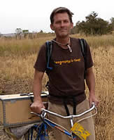
Suzanne P. Wechsler is a Professor and Department Chair in the Department of Geography at California State University, Long Beach (CSULB). She also directs the Masters of Science in Geographic Information Science (MSGISci) program. Her expertise lies in geospatial science, environmental sciences, and the application of remote sensing technologies such as UAVs. She holds a PhD from the State University of New York College of Environmental Science and Forestry (2000), an MS from the same institution (1995), and a BA from Tufts University (1989).
Her research focuses on geospatial data uncertainty, remote sensing applications, and environmental spatial analysis. Notable projects include quantifying spatial data uncertainty, analyzing fire regimes in West African savannas, and using UAVs for archaeological documentation. She has collaborated on NSF-funded projects, including studies on fire emissions in Mali and geospatial research on Easter Island.
Dr. Wechsler teaches courses such as Introduction to Geospatial Techniques, GIS for Natural Sciences, and GIS Professionalism. She has advised numerous graduate students on topics ranging from UAV platform development to trail degradation assessment. Her work emphasizes bridging geospatial technology with practical environmental and archaeological applications.
Her contributions to education include rethinking graduate GIS curricula and promoting open-source tools. She has published widely on geospatial methodologies and their interdisciplinary applications.