معرفی
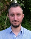
Prof. Steven de Jong is a Vice Dean of Research and Professor of Physical Geography at Utrecht University’s Faculty of Geosciences. His research focuses on Geohazards, Land Degradation, Earth Observation, and Remote Sensing applications. He leads projects on landslide displacement modeling, drought impacts, and environmental monitoring using satellite imagery and geospatial technologies. His work integrates field studies (e.g., Nepal, Ethiopia, France) with computational methods, including machine learning for ecological analysis and disaster risk reduction.
- Education: PhD in Physical Geography (Utrecht University, 1994), MSc in Soil Physics/Remote Sensing (Wageningen University).
- Key Roles: Chair in Physical Geography (since 2001), Head of Department of Physical Geography (2015–2021), Visiting Scientist at NASA JPL (1995–1996).
Research interests include spatio-dynamic modeling of land degradation, hydrology, and geo-computation. He pioneered the use of drones and imaging spectroscopy for environmental assessment, with fieldwork in arid and alpine regions. His work spans international collaborations, addressing issues like Aral Sea desertification and plague mapping in Kazakhstan.
Publications emphasize satellite remote sensing applications in landslide monitoring, coastal dynamics, and vegetation analysis. Awards include the NWO Talent Stipend and Teacher of the Year (1993). He co-edited books on remote sensing image analysis and imaging spectroscopy, contributing to both academic and applied geoscience domains.