معرفی
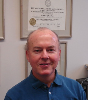
Ray Hintz is a Professor and Program Coordinator in the Surveying Engineering Technology program at the University of Maine, College of Engineering. He is based at Boardman Hall in Orono, Maine, and can be reached at ray.hintz@maine.edu or by phone at 207.581.2340.
Education:
- B.S. in Civil & Environmental Engineering, University of Wisconsin, 1978
- M.S. in Civil & Environmental Engineering (Surveying & Mapping Emphasis), University of Wisconsin, 1980
- Ph.D. in Civil & Environmental Engineering (Surveying & Mapping Emphasis), University of Wisconsin, 1983
Dr. Hintz is a licensed professional land surveyor in Florida and Maine, with a primary focus on geospatial data collection and the development of specialized surveying software. His research and professional practice integrate engineering principles with advanced surveying technologies. He teaches courses ranging from introductory surveying to photogrammetry, contributing significantly to the technical training of students in the field.
His professional affiliations include the American Society for Photogrammetry and Remote Sensing, the Maine Society of Land Surveyors, and the Massachusetts Association of Land Surveyors and Civil Engineers. He also serves as a reviewer for several professional publications and supports the development of photogrammetry certification exams.
While no specific awards or publications are listed, his software tools are widely used by approximately 25 state departments of transportation and their consultants, indicating strong applied impact in the field.
Dr. Hintz advises students as part of his role in the Surveying Engineering Technology program, though specific advisees are not named. He does not appear to hold any part-time or emeritus status and remains an active faculty member contributing to education, research, and professional service in surveying engineering.