
معرفی
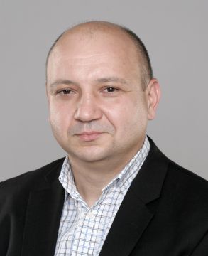
Paweł Cebrykow is an active Assistant Professor in the Department of Geomatics and Cartography at the Faculty of Earth Sciences and Spatial Management, Maria Curie-Skłodowska University in Lublin. With habilitated doctorate status (dr hab.), he conducts research in cartographic methodology and spatial data visualization while teaching cartography-related courses. His current consultations for the 2024/25 winter semester are held remotely on Tuesdays from 10:00-11:30 via Microsoft Teams.
His educational background includes:
- Master of Science in Geography (Cartography specialization) - 1995, Faculty of Biology and Earth Sciences, UMCS
- Doctor of Earth Sciences in Geography - 2003, Faculty of Biology and Earth Sciences, UMCS
- Habilitated Doctor of Earth Sciences in Geography - 2018, Faculty of Earth Sciences and Spatial Management, UMCS
Dr. Cebrykow's research focuses on cartographic presentation methodology, cartographic generalization techniques, and the application of Geographic Information Systems. His work bridges theoretical cartography with practical applications in statistical mapping, historical map analysis, and spatial data representation. He has particular expertise in developing methodologies for isopleth mapping and choropleth smoothing procedures as evidenced by his habilitation monograph "Generalization of statistical maps".
His publication record shows consistent output primarily in cartographic journals, with recent work emphasizing forest representation on topographic maps, statistical map generalization, and the integration of historical cartographic sources. His research demonstrates strong connections between theoretical cartographic principles and practical applications in spatial data management.
Currently, Dr. Cebrykow leads research on dictionary development for spatial databases as part of the Polkart project "Nowatorska linia technologiczna do automatycznego generowania map online" (Innovative technological line for automatic online map generation), focusing on multilingual terminology for OpenStreetMap®. This project aims to develop conceptual hierarchies for 12 languages to enable automated cartographic symbolization and scale-based generalization.
His professional activities include participation in cartographic associations and editorial work for academic publications, contributing to the advancement of cartographic science through both theoretical contributions and practical applications in spatial data management systems.
Paweł Cebrykow در جاهای دیگر
جستجوهای مرتبط
شاید اینها هم به کارتان بیاید
- KKrzysztof Leszek KałamuckiMaria Curie-Sklodowska University · استاد آموزشی
 Ningchuan XiaoOhio State University · استاد
- BBeata KonopskaMaria Curie-Sklodowska University · استاد
- MMirosław KrukowskiMaria Curie-Sklodowska University · استادیار
- MMateusz Paweł ZawadzkiMaria Curie-Sklodowska University · استادیار
- JJakub KunaMaria Curie-Sklodowska University · استادیار