
معرفی
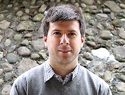
Nicholas Tate is an Associate Professor at the University of Leicester's School of Geography, Geology and the Environment. His work bridges Geographic Information Science (GIS), remote sensing, and spatial analysis with a focus on education innovation and environmental applications. He has contributed significantly to GIS education through textbooks like Teaching Geographic Information Science and Technology in Higher Education (2011) and Modelling Scale in Geographical Information Science (2001).
His research explores urban form modeling via AI, spatial interpolation techniques, and geodemographic classification. Notable projects include radar interferometry for land displacement in the Swiss Alps, SAR-based forest mapping in the Congo Basin, and VGI analysis using fuzzy clustering. He has led international collaborations on GIS pedagogy during the pandemic, emphasizing resilient teaching strategies.
Publications span Journal of Geography in Higher Education, Remote Sensing of Environment, and Climate. His work frequently addresses methodological rigor in spatial data analysis and interdisciplinary applications in ecology, hydrology, and urban policy. Recent trends focus on AI-driven geospatial modeling and crisis-responsive education frameworks.
While no specific grants or awards are listed, his prolific publication record underscores sustained academic engagement. Collaborations with institutions globally highlight his role in advancing both theoretical GIScience and practical environmental monitoring.
Nicholas Tate در سایتهای دیگر
جستوجوهای مرتبط
شاید اینها هم برایتان مناسب باشند
 Tessio NovackUniversity of Warwick · استادیار
 XiaoHang LiuSan Francisco State University · استاد
 Jed LongWestern University · دانشیار
- NNigel WalfordKingston University · استاد
- JJohn WilsonUniversity of Southern California · استاد
 Fangzheng LyuVirginia Polytechnic Institute and State University · استادیار