معرفی
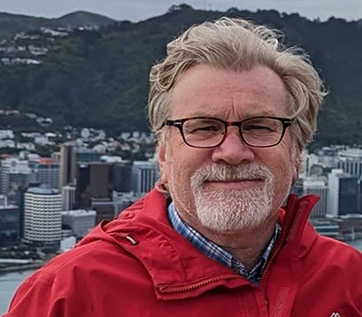
John Duncan is a Research Fellow at the UWA School of Agriculture and Environment and the Centre for Water and Spatial Science at The University of Western Australia. His expertise spans geospatial software development, remote sensing, satellite image analysis, and machine learning applications in environmental science. He focuses on monitoring climatic and environmental changes and their societal impacts, particularly in Pacific Island Countries, South Asia, and Sub-Saharan Africa.
He coordinates the Advanced Spatial Analysis unit, teaching undergraduate students geospatial data science skills. His work emphasizes cross-sector collaboration, including government, NGOs, and private sectors. Key contributions include developing the Livelihoods and Landscapes initiative for mapping agricultural landscapes in the Pacific, and pioneering cloud masking algorithms for Sentinel-2 imagery (e.g., CloudS2Mask and OmniCloudMask).
Research interests include climate resilience, land use mapping, disaster theology in volcanic/earthquake contexts, and urban vegetation's impact on child health. Notable projects include Fiji's cropland flood mapping and the BEACHES study linking built environments to children's physical activity.
He has secured 8 grants, including the FruitSense project on tree crop resilience andshade colour impacts in urban greening. His work aligns with UN SDGs, particularly 13 (Climate Action), 15 (Life on Land), and 11 (Sustainable Cities).
Publications emphasize sensor-agnostic deep learning models, land use comparisons in Fiji, and religious responses to natural disasters. Training programs focus on GIS for government officials and university education.