معرفی
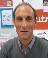
Ionel Haidu is a University Professor of Geography at the University of Lorraine since 2011, affiliated with the LOTERR-EA7304 Laboratory. His research focuses on hydro-climatic systems with international collaborations across France, Romania, Morocco, and the European Commission.
Academic Background:
- Doctorate in Geography (1991, Alexandru Ioan Cuza University Iaşi)
- Master of Sciences in Hydrology (1992, Vrije Universiteit Brussels)
- Postgraduate Diploma in Water Resources Engineering (1994, Technical University of Bucharest)
- GIS Certification (1995, Clark University & Hungarian College)
Haidu's research integrates hydrology, climatology, and remote sensing to address climate change impacts, particularly in Mediterranean and Eastern European regions. His work emphasizes probabilistic risk assessment, time-series analysis of hydro-climatic data, and technical geography applications for environmental management. Recent projects analyze drought trends in Morocco, lake dynamics using satellite imagery, and air pollution variations during/post-pandemic.
His publication trends reveal three dominant themes: (1) Climate change adaptation in water resources (40% of recent work), (2) Remote sensing applications for environmental monitoring (35%), and (3) Spatial analysis of hydro-climatic risks (25%). Key methodologies include Kalman filters, LSTM networks, and principal component analysis applied to satellite data.
Scientific Recognition:
- Annual Prize of the Romanian Academy for Geography (1995)
Haidu supervises four doctoral students researching Moroccan water resources, European air pollution, Romanian geotourism, and Eastern European climate risks. His grant portfolio includes EU-funded projects like FOREST@RISK (JRC) on forest climate risks, REGE regional environmental network, and RECRET historical hydrological reconstruction. Previous grants covered Romanian mountain settlements (2006-2010) and France-Romania-Madagascar climate impact studies (2008-2010).
As core faculty in LOTERR Laboratory, he contributes to three thematic axes: Water/Environments, Landscape Transitions, and Territorial Planning. His technical platform utilizes hydrometry, drone imaging, and online databases like the 30,000-image LOTERR aerial archive and IKARE karst mapping system.