معرفی
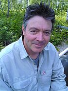
Ian O'Connell is a Teaching Professor in the Department of Geography within the Faculty of Social Sciences at the University of Victoria (UVic). He also serves as an undergraduate advisor, contributing to student mentorship and academic guidance. His work bridges geography and computational methods, with a strong focus on geomatics and GIS applications.
Research Interests: Ian's research centers on geomatics, particularly the application of GIS and spatial technologies in historical geography, land valuation, and coastal zone management. His work explores how digital tools can transform historical data into spatial narratives and support collaborative planning through web-based decision systems. He has investigated the integration of diverse datasets for environmental modeling and developed systems enabling stakeholder engagement in land-use decisions.
Publication Trends: His publications from 1997 to 2013 reflect a consistent trajectory in geospatial innovation—spanning coastal data modeling, collaborative land valuation frameworks, and large-scale hydrological analysis. These works demonstrate interdisciplinary engagement with environmental science, urban planning, and geophysics, emphasizing data integration, modeling, and participatory design.
- Scientific Awards: No awards or fellowships are mentioned in the provided text.
Advising and Grants: Ian serves as an undergraduate advisor, supporting student development in geography and geomatics. While no specific grants are listed, his doctoral work was supported by a three-year doctoral fellowship at UVic, and he previously worked on a European-funded GIS and Coastal Zone Management project, indicating experience with competitive research funding.
Labs and Research Teams: While no formal lab or research group name is mentioned, his work suggests collaboration with interdisciplinary teams in geomatics, environmental planning, and coastal research. His involvement in funded projects and co-authored publications indicates active participation in research consortia focused on geospatial solutions for environmental and societal challenges.