معرفی
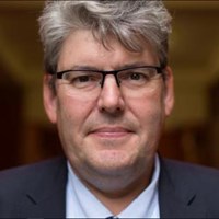
Professor Heiko Balzter is a Professor of Physical Geography and Director of the Institute for Environmental Futures at the University of Leicester's School of Geography, Geology & the Environment. He chairs the UKRI Landscape Decisions Programme, coordinating 70 projects, and is a leading member of the National Centre for Earth Observation. His research focuses on earth observation techniques for environmental monitoring, deforestation, climate change, and land use dynamics. He has received notable awards including the Royal Society Wolfson Research Merit Award (2011), Royal Geographical Society’s Cuthbert Peek Award (2015), Copernicus Masters Award (2017), and Leicestershire Live Innovation Award (2023). His work integrates satellite data with ecological models to address global challenges like carbon sequestration, biodiversity conservation, and sustainable land management.
Research interests include remote sensing of biomass, forest degradation, and environmental vulnerability. He collaborates internationally on projects such as the LULUCF Scientific Steering Committee for the UK National Greenhouse Gas Account. His recent work emphasizes interdisciplinary approaches to landscape decisions, balancing ecological, agricultural, and energy demands while advancing net-zero strategies. Key contributions include developing tools like Pyeo for near-real-time forest monitoring and frameworks for deforestation-free supply chains using Copernicus data.
- Awards:
- Royal Society Wolfson Research Merit Award (2011)
- Royal Geographical Society’s Cuthbert Peek Award (2015)
- Copernicus Masters Award (2017)
- Leicestershire Live Innovation Award (2023)
Advising and grants focus on interdisciplinary landscape solutions, with grants from UKRI and EU programs. His work with the Institute for Environmental Futures and National Centre for Earth Observation drives innovative applications of Earth observation to address climate and biodiversity crises. Ongoing projects include analyzing biomass dynamics in African savannahs, oil spill detection via SAR imagery, and modeling climate impacts on disease spread.