

معرفی
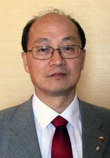
Eugene Levin is an Adjunct Associate Professor at Michigan Technological University's College of Engineering, specializing in Civil, Environmental, and Geospatial Engineering. With expertise in photogrammetry, geospatial technologies, and human-computer symbiosis, he has developed UAV-based photogrammetric systems and contributed to homeland security applications through data fusion methodologies.
- PhD in Photogrammetry from State Land Organization University, Moscow
- MS in Astro-Geodesy from Academy of Engineers in Geodesy, Novosibirsk
His research spans cognitive GIS, SAR/LIDAR remote sensing, 3D visualization, and geosensor networks. Recent publications focus on human-centric data fusion and visual perception in geospatial analysis. He actively collaborates internationally and contributes to spatial database maintenance.
Scientific awards include REF Grant, Fulbright Grants, and certifications from ASPRS, SELA, and Sovinfiomsputnik. His teaching emphasizes Earth observation systems, photogrammetry, and spatial decision support tools.
Eugene Levin در سایتهای دیگر
جستوجوهای مرتبط
شاید اینها هم برایتان مناسب باشند
 Riadh MunjyCalifornia State University, Fresno · استاد
 Jae Sung KimMichigan Technological University · استادیار
 Bashar Saleem Abbas AlsadikUniversity of Twente · استادیار
 Andreas WichmannJade University of Applied Sciences · استاد
 Mila N. KoevaUniversity of Twente · دانشیار
 Yun ZhangUniversity of New Brunswick · استاد