معرفی
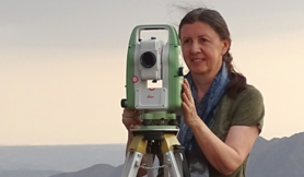
Dr. Bashar Saleem Abbas Alsadik is an Assistant Professor in the Department of Earth Observation Science at the Faculty of Geo-Information Science and Earth Observation (ITC), University of Twente, the Netherlands. He earned his PhD in 2014 from the same university with research on close-range photogrammetry for 3-D heritage modelling and holds a B.Sc. in Surveying Engineering (University of Baghdad, 1995). Before joining ITC he served as a faculty member at the University of Baghdad (1999-2014) and later as R&D Specialist Engineer at CycloMedia Technology (2015-2019).
Education:
- PhD, University of Twente, 2014 – Guided Close-range Photogrammetry for 3D Modeling of Cultural Heritage Sites
- B.Sc., University of Baghdad, 1995 – Surveying Engineering
Research interests centre on photogrammetry, geometric computer vision, UAV-based autonomous navigation and mapping exploiting SLAM and Next-Best-View methodologies, mobile mapping & LiDAR systems, adjustment computations, and heritage 3-D documentation. He actively develops educational material for ITC’s UAV centre and contributes to capacity-building projects.
His publication record (h-index 11, 371 citations) demonstrates a clear trajectory from cultural-heritage photogrammetry toward real-time UAV autonomy, safety-critical infrastructure monitoring (e.g., Mosul dam), and multi-sensor geospatial datasets, reflecting interdisciplinary integration of computer vision, geodesy and robotics.
Professional service: member of ISPRS, CIPA and the Iraqi Engineers Syndicate; reviewer for leading journals such as ISPRS J., Remote Sensing, IEEE T-GRS, Drones, Journal of Cultural Heritage, Photogrammetric Record, and several conferences.
حوزههای پژوهشی