معرفی
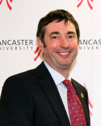
Professor Duncan Whyatt is a distinguished academic at Lancaster University's Lancaster Environment Centre. With a background in Geography & Computer Science, he has established himself as a leading researcher in Geographical Information Systems (GIS) applied across various environmental and social domains.
His research interests span Human and Physical Geography, Ecology, and Environmental Science, with a particular focus on using GIS to visualize, integrate, and analyze spatial data. Professor Whyatt has published over 110 peer-reviewed journal papers, with one of his PhD publications recognized as one of the 16 most influential papers in the British Cartographic Journal over the last 50 years. His recent work demonstrates a strong trend toward interdisciplinary applications of geospatial analysis, particularly in renewable energy systems, urban segregation patterns, air pollution monitoring, and precision agriculture. His publications span journals including Applied Geography, Transactions in GIS, Remote Sensing of the Environment, and air pollution journals such as Atmospheric Environment.
- ESRC funded 'Belfast Mobility Project: Intergroup contact, segregation and the time-geography of sectarian relations in Belfast'
- Environment Agency funded 'Breathe Easier: Resolving critical air quality problems with directional passive sampling'
- BBSRC funded 'CROPFALL: Crop Failure Assessment due to Lodging Losses'
Professor Whyatt has supervised PhD students across diverse fields including coastal management, urban development, landscape ecology, renewable energy, and social media mapping. His research has been supported by major funding bodies including BBSRC, ESRC, EPSRC, NERC, and the Environment Agency.
He is affiliated with several research groups including the Centre for Global Eco-innovation, Geospatial Data Science, and the Lancaster Intelligent, Robotic and Autonomous Systems Centre.