معرفی
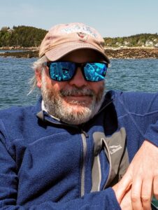
Anthony Guay is a Remote Sensing Specialist at the University of Maine, affiliated with the Wheatland Geospatial Lab within the School of Forest Resources. He specializes in remote sensing and geospatial technologies, providing training to Maine’s forest sector stakeholders, including industry professionals and conservation groups. His work includes supporting geospatial education and research, coordinating statewide outreach, and managing collaborations through the Maine Geospatial Institute (MGI), which he co-founded and chairs.
Previously, Guay spent 18 years at the US Forest Service’s Remote Sensing Applications Center (RSAC), where he led national post-fire vegetation severity mapping programs and trained Forest Service personnel in remote sensing techniques. He holds a B.S. (1994) and M.S. (1997) in Forest Resources from the University of Maine.
His research focuses on applying remote sensing and GIS to forest inventory, land cover analysis, and environmental monitoring. He teaches courses including Introduction to Forest Land Navigation, Applied GIS, and Remote Sensing of Forest Environments, emphasizing hands-on fieldwork and software proficiency (e.g., ArcGIS, LIDAR).