
معرفی
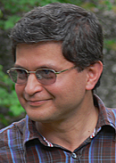
Amir Abolghasem is a Lecturer and Senior Scientist at the Department of Earth and Environmental Sciences, Ludwig-Maximilians-Universität München (LMU Munich). He specializes in tectonic geodesy, with a focus on satellite positioning, GNSS monitoring, and high-resolution topography modeling using terrestrial laser scanning and UAV photogrammetry. He manages the Tectonic Geodesy Facility and teaches courses in geodetic-geological observations, drone mapping, and tectonic geodesy for both bachelor's and master's programs.
- Bachelor in Surveying Engineering, K.N.Toosi University of Technology (1988)
- MSc in Geodesy, K.N.Toosi University of Technology (1995)
- PhD in Geodesy, Stuttgart University (2000)
His research involves precise observation and modeling of surface displacements in seismic cycles, application of GNSS to study tectonic deformation, evaluation of isostatic behavior in mountain ranges, and high-resolution topography modeling. Key keywords include geodesy, seismology, earthquake deformation, and computational geophysics.
His publications demonstrate expertise in post-seismic displacement modeling, GNSS-based deformation analysis, and satellite geodesy applications. He has presented at international conferences including ISPRS (2019) and workshops in Chile and Germany.
Contact: amir.a@lmu.de | Tectonic Geodesy Website
Amir Abolghasem در سایتهای دیگر
جستوجوهای مرتبط
شاید اینها هم برایتان مناسب باشند
 Herb McQueenAustralian National University (ANU) · پژوهشگر
 Timothy MelbourneCentral Washington University · استاد
 Barry ParsonsUniversity of Oxford · استاد
- KKathryn MaternaUniversity of Colorado · استادیار
 Corné KreemerUniversity of Nevada, Reno · استاد پژوهشی
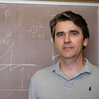 Yuri FialkoUniversity of California, San Diego · استاد