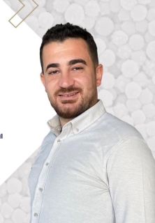
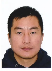
Prof. Jaume Sanz Subirana is a Tenure Full Professor of Mathematics at the Universitat Politècnica de Catalunya (UPC), BarcelonaTECH, and a Senior GNSS Scientific Researcher. He has been affiliated with the Department of Mathematics since 1983. His primary research focuses on GNSS data processing algorithms, ionospheric sounding, and high-accuracy navigation systems like WARTK and Fast-PPP. He co-founded the spin-off company gAGE-NAV S.L. in 2009 and served on the European Space Agency's GNSS Scientific Advisory Group (2018-2022). Prof. Sanz Subirana holds a Physics degree (1982) and a PhD in Galactic Dynamics (1987) from the Universitat de Barcelona. He has authored over 100 peer-reviewed papers (50+ in top JCR journals), 200 conference works, five books (including ESA-commissioned volumes), and holds four patents. His work has earned four best paper awards and UPC's Merit Recognition for teaching excellence. His research group, gAGE/UPC, specializes in GNSS navigation algorithms, ionospheric monitoring, and SBAS/GBAS systems. Key contributions include ionospheric gradient monitoring, real-time kinematic positioning, and mitigation of space weather effects on navigation signals.
Patrick Henkel is a Professor at the Technical University of Munich (TUM) affiliated with the TUM School of Engineering and Design and the Chair of Communication and Navigation. He holds a professorship in Satellite Geodesy under Prof. Hugentobler. His research focuses on advanced positioning technologies, including Global Navigation Satellite Systems (GNSS), autonomous systems, and sensor fusion. He develops algorithms for precise positioning in challenging environments such as urban areas, alpine regions, and indoor spaces. His work also extends to environmental applications, such as snow hydrology and climate monitoring using GNSS signals. Henkel’s contributions include innovations in real-time kinematic (RTK) positioning, UAV navigation, and multi-sensor integration for robotics and autonomous vehicles. His research is supported by collaborations with industry and academic partners, addressing both theoretical and applied challenges in geodesy and navigation. Henkel leads projects on GNSS signal processing, satellite-based environmental monitoring, and autonomous driving technologies. He has contributed to the Galileo HAS service and developed methodologies for snow water equivalent estimation using multi-frequency GNSS signals. His expertise spans hardware-software co-design for navigation systems and algorithm optimization for high-precision positioning in dynamic environments. He actively publishes in top-tier journals and conferences, with a focus on advancing the reliability and accuracy of navigation systems across various domains. His advising and grants include funding for projects on sensor fusion, UAV-based measurements, and satellite receiver development. He collaborates with teams at TUM’s Navigation Lab and the Professur für Satellitengeodäsie, contributing to both academic and industrial applications. His work on low-bandwidth RTK dissemination and laser-tracker verified UAV positioning highlights his commitment to bridging theoretical advancements with real-world implementation.
Dr. Shaojun Feng is an Honorary Principal (Professorial) Research Fellow at the Centre for Transport Studies within the Department of Civil and Environmental Engineering, Faculty of Engineering, Imperial College London. He is a leading expert in Global Navigation Satellite Systems (GNSS), with over thirty years of research experience focusing on GNSS integrity, high-accuracy positioning, augmentation systems, and functional safety for autonomous and safety-critical applications. His research interests span a wide range of topics including GNSS integrity monitoring, precise point positioning (PPP), real-time kinematic (RTK), ionospheric modeling, spoofing detection, software-defined receivers, and integrated navigation systems. He has made pioneering contributions to the development of GNSS correction services with integrity, enabling lane-level navigation in smartphones and certified use in autonomous vehicles. His work bridges theoretical advances with real-world deployment, notably through a commercial service benefiting over 1.5 billion users. The recent publications highlight a strong focus on ionospheric modeling and correction using machine learning (e.g., LSTM, ConvLSTM), sparse reconstruction techniques in tomography, and integrity-aware positioning for autonomous systems. There is a clear trend toward integrating AI with GNSS, improving real-time accuracy, and ensuring safety through robust integrity monitoring—especially in multi-constellation environments (GPS, Galileo, BeiDou). Dr. Feng has been recognized with several prestigious honors: Michael Richey Medal, Royal Institute of Navigation ESA certification for leading Galileo receiver development Recognition by UK Space Agency for UK leadership in Galileo adoption SGS certification for safety-critical GNSS correction service He is actively involved in the academic and standards communities, serving as Associate Editor for the Journal of Navigation and GPS Solutions , and as Chairman of WG3 in RTCM Special Committee 134, which develops international standards for GNSS integrity monitoring. He is a Chartered Engineer (CEng) and Fellow of both the Institution of Engineering and Technology (FIET) and the Royal Institute of Navigation (FRIN), the latter presented by HRH Prince Philip. His leadership in research, editorial roles, and standardization underscores his significant impact on the field of navigation and positioning. Dr. Feng leads research initiatives at Imperial College London with strong industry and agency collaborations, including with the European Space Agency and SGS. His work on integrity-certified GNSS services represents a major advancement in positioning for autonomous systems, with implications for future smart mobility, transportation safety, and resilient navigation infrastructure.
Dr. Ahmed El-Rabbany is a Professor in the Department of Civil Engineering at Toronto Metropolitan University, part of the Faculty of Engineering and Architecture Science. His expertise spans Geomatics Engineering, Satellite Positioning, and multi-sensor integration for autonomous systems. He holds a PhD from the University of New Brunswick and earlier degrees from Alexandria University. Education: BSc in Civil Engineering, Alexandria University (1984) MSc in Satellite Positioning, Alexandria University (1988) PhD in Geomatics Engineering, University of New Brunswick (1994) Research Interests: El-Rabbany focuses on advancing GPS and GNSS technologies, multi-sensor integration for autonomous vehicles and drones, hydrographic surveying, and applications of LiDAR in urban mapping. His work emphasizes practical solutions for navigation, environmental monitoring, and smart infrastructure. Publications: His research spans GPS theory, multi-constellation GNSS analysis, and sensor fusion. A key contribution is his textbook Introduction to GPS , widely recognized in the field. Awards: Service Recognition Awards (2017, 2013) Merit Award (2009) Certificate of Appreciation from FIG (2006) Professional Contributions: El-Rabbany leads the Satellite Navigation Lab and serves on editorial boards for journals like Geomatica and Journal of Navigation . He has organized major international conferences and held leadership roles in professional organizations such as the Canadian Institute of Geomatics and the International Federation of Surveyors (FIG). Labs/Teams: Director of the Satellite Navigation Lab, focusing on cutting-edge GPS/GNSS research and applications.
Jarosław Bosy is a Full Professor at the Institute of Geodesy and Geoinformatics at Wrocław University of Environmental and Life Sciences (WUELS), Poland. He served as Vice-Rector for Research and International Relations (2016–2020) and Rector (2020–2024). Since June 2024, he chairs the Committee on Geodesy of the Polish Academy of Sciences. He holds a PhD in Geodesy and Cartography (1996) and habilitation from AGH University of Science and Technology, Kraków. Awarded the Professor title in Technical Sciences by the Polish President in 2014. His research focuses on three core areas: GNSS-based reference frame realization at global/regional scales, GNSS meteorology (atmospheric state analysis via satellite signals), and GNSS applications in geodynamics. Key contributions include real-time troposphere delay models, integration of GNSS and numerical weather prediction (NWP), and development of the ASG-EUPOS positioning system in Poland. Bosy has authored 286 publications, supervised 23 PhD theses, and led 7 projects. His work bridges geodesy, meteorology, and geodynamics, with applications in climate monitoring, real-time positioning, and Earth system observation. He collaborates internationally, contributing to initiatives like GGOS and EPOS. His lab, GNSS&Meteo, develops services like real-time ZTD estimation and MSTID mitigation for precise positioning.
Michael Bevis is a Professor and Ohio Eminent Scholar in the Division of Geodetic Science at The Ohio State University, where he leads the Geodesy and Geodynamics (G2) group. A space geodesist since the late 1980s, he holds a Ph.D. from Cornell University (1982) and has established geodetic networks across the South Pacific, Andes, Greenland, and Antarctica to study Earth system dynamics. Ph.D. in Geophysics, Cornell University, 1982 Bevis specializes in crustal motion geodesy, GPS meteorology, and reference frame realization, with research spanning plate tectonics, earthquake deformation cycles, mountain building, postglacial rebound, and sea-level change. His work integrates GNSS, GRACE, and terrestrial gravity data to investigate ice mass dynamics, elastic loading phenomena, and water vapor climatology, emphasizing the coupling between geophysical processes and climate systems. His recent publications (2023-2025) reveal a dominant focus on Antarctic and Greenland ice mass loss through elastic deformation modeling, alongside innovations in GNSS network applications for climate hazard monitoring and gravitational field theory. Key trends include joint inversions of multi-sensor geodetic data, advanced algorithms for satellite image processing, and theoretical refinements to spherical harmonic expansions for global gravity modeling. Ohio Eminent Scholar Bevis has secured extensive research funding for global geodetic network deployments, including the Polar Earth Observing Network (POLENET) in Antarctica and the Greenland Network (GNET). His projects involve major international collaborations with NASA, NSF, and global geodetic initiatives, supporting infrastructure for real-time crustal motion monitoring and climate impact assessment. While specific student names aren't listed in source materials, his leadership of the G2 group implies significant graduate mentorship in geodetic science. The Geodesy and Geodynamics (G2) group operates under the Division of Geodetic Science, maintaining specialized laboratories for GPS data processing, gravity measurements, and satellite geodesy. Bevis directs field teams conducting terrestrial gravity surveys in mountain chains and coordinates Antarctic network operations through the ANET GNSS array, with recent expansions into equatorial satellite constellations for climate hazard tracking.
Markus Heinze is a researcher at the Chair of Astronomical & Physical Geodesy, Technical University of Munich, actively contributing to satellite geodesy, gravimetry, and GNSS data processing. He is involved in major ESA and DFG-funded projects including GOCE, GETRIS, NEROGRAV, and UPLIFT, focusing on precise orbit determination, geodetic monitoring, and Earth observation. His research interests span Satellite Geodesy , Precise Orbit Determination , Gravimetry , GNSS Data Processing , Remote Sensing , and Geophysical Monitoring . His work integrates advanced geodetic techniques for monitoring alpine environments, permafrost dynamics, hydrological changes, and urban subsurface structures using relative gravimetry, SAR imaging, and electronic corner reflectors. The 15 most recent publications highlight a strong trend towards geodetic monitoring of environmental changes, particularly in high-alpine and permafrost-affected regions, leveraging satellite and ground-based sensors. There is a clear evolution from early work on GOCE orbit determination and GNSS clock modeling to current applications in climate impact assessment and infrastructure monitoring. Scientific contributions include: Development of methods for precise intersatellite ranging Improvements in GNSS data processing with Galileo integration Validation of GOCE gravity field models and orbits Innovative use of SAR and electronic corner reflectors for long-term deformation monitoring Application of relative gravimetry to detect hydrostatic pressure changes in alpine tunnels and rock slopes Markus Heinze advises bachelor's students in geodetic and environmental research topics. His supervised theses cover cavity detection in urban areas, meteorological correlations with gravimetric signals, and instrument tilt effects on gravimeter accuracy. He is part of collaborative research teams in DFG Research Units NEROGRAV and UPLIFT, and participates in ESA projects MAGIC, QSG4EMT, and Baltic+, contributing to satellite applications and geodetic infrastructure development. He is associated with the Engineering Institute for Astronomical and Physical Geodesy and works under the supervision of Prof. Dr. Roland Pail and Prof. Dr. Urs Hugentobler. The research environment emphasizes interdisciplinary collaboration, innovation in geodetic instrumentation, and application-driven science for Earth system monitoring.
Prof. Urs Hugentobler is a full professor at the Institute for Astronomical and Physical Geodesy at Technische Universität München (TUM), leading the Satellite Geodesy Department and the Forschungseinrichtung Satellitengeodäsie (FESG). His work focuses on precise geodetic applications of GNSS systems, satellite orbit determination, and Earth rotation studies. He holds a doctorate in astronomy from the University of Bern (1997) and has extensive experience with the ESA and international geodetic networks. Education: Master’s in theoretical physics (University of Bern, 1989), PhD in astronomy (University of Bern, 1997). Professional roles include leadership at the Bernese GPS Software group and the Wettzell Geodetic Observatory collaboration. His research emphasizes satellite gravimetry, solar radiation pressure modeling, and multi-technique geodetic observations. Research interests span satellite geodesy, GNSS applications, time/frequency transfer, and Earth system monitoring. Key contributions include advancements in Galileo and BeiDou satellite modeling, and the development of the Bernese GNSS Software. His work bridges geodesy with space science, addressing challenges in precision positioning and global reference frames. Publications highlight innovations in multi-GNSS analysis, satellite orbit determination, and Earth rotation parameters. His lab, FESG, supports TUM’s geodetic research and operational activities at Wettzell. Ongoing projects include the ESA Baltic+ and NEROGRAV initiatives, focusing on gravimetry and Earth dynamics.
Mert GÜRTÜRK is a Researcher at Adiyaman University's Faculty of Engineering, specializing in geospatial technologies and UAV applications. He holds a Doctorate in Geodesy and Photogrammetry Engineering from Yildiz Technical University (2016-2019), along with a Master's degree (2014-2016) and Bachelor's degree (2007-2012) in related fields from the same institution. His research focuses on cutting-edge geospatial technologies including UAV photogrammetry, precise positioning systems, LiDAR applications, and machine learning integration in geospatial data processing. His work spans various applications from transportation infrastructure assessment to public health monitoring through geospatial analysis. GÜRTÜRK's recent publications demonstrate a strong trend toward integrating advanced computational methods with traditional geospatial techniques, particularly in UAV-based mapping systems and precise positioning technologies. His work shows significant contributions to accuracy assessment methodologies in GNSS processing and UAV georeferencing. 2016-2019: Doctorate in Geodesy and Photogrammetry Engineering, Yildiz Technical University 2014-2016: Master's in Geodesy and Photogrammetry Engineering, Yildiz Technical University 2007-2012: Bachelor's in Surveying Engineering, Yildiz Technical University His current research projects include the DEVELOPMENT OF DOMESTIC SOFTWARE FOR SWARM UAV DEMONSTRATIONS (2024-present) and SWARM UAV SYSTEM AND SOFTWARE FOR DEMONSTRATION PURPOSES (2021-2023). GÜRTÜRK has also contributed to the analysis of university campus digitalization processes and precise kinematic point positioning research. His technical expertise spans English language proficiency and extensive experience with geospatial software systems.
Bilal Mutlu is a Research Assistant at Istanbul Technical University, Faculty of Civil Engineering, Department of Geomatics Engineering. His work focuses on satellite geodesy, GNSS positioning techniques, and natural hazard monitoring using geosensors. He has published extensively on real-time precise point positioning (RT-PPP) in polar regions, Antarctic geodetic studies, and multi-GNSS applications. Education: PhD (Geomatics Engineering, ongoing), MSc (2022), BSc (2019) all from Istanbul Technical University. Research Themes: Real-time GNSS positioning, polar region geodesy, earthquake monitoring, multi-resolution remote sensing for urban infrastructure, and integration of GNSS with AI models for meteorological predictions. Publication Trends: Primarily in Earth Sciences, Geodesy, and Remote Sensing journals, with emphasis on Antarctic positioning systems, PPP-AR performance, GNSS reflectometry, and disaster monitoring. Technical Skills: Python, LaTeX, GNSS software (RTKLIB, GAMIT, Trimble Business Center), and Bash scripting.
Bingbing Duan is a researcher at the Institute for Astronomical and Physical Geodesy at the Technical University of Munich (TUM), working under Prof. Dr. Urs Hugentobler. He is actively involved in satellite geodesy, focusing on GNSS orbit modeling, precise orbit determination, and multi-technique geodetic analysis. Research Interests: His work centers on GNSS orbit and clock determination, solar radiation pressure modeling, ambiguity resolution, and the integration of GNSS, DORIS, and SLR data. He plays a key role in the Copernicus Precise Orbit Determination (CPOD) Quality Working Group as the lead of the TUM Sentinel satellite orbit analysis center. His research supports Earth observation missions like Sentinel-3 and Sentinel-6A. Publication Trends: His recent publications (2018–2025) show a strong focus on improving GNSS satellite models, particularly for Galileo and BeiDou systems, using multi-frequency data and advanced bias estimation techniques. Themes include phase bias quality assessment, antenna calibration, thermal effects, and precise orbit prediction. Scientific Awards: No awards are mentioned in the provided text. Advising and Grants: Dr. Duan supervises Master’s and Bachelor’s students in topics related to GNSS, orbit modeling, and signal processing. He contributes to major research projects funded by ESA and DFG, including the UPLIFT Research Training Group and NEROGRAV Research Unit, indicating involvement in grant-supported research. Labs and Teams: He is part of the Satellite Geodesy research group at TUM, contributing to the MGEX (Multi-GNSS Experiment) initiative and the CPOD QWG. His work involves collaboration with international agencies such as ESA and IGS, emphasizing teamwork in large-scale geodetic data analysis.
Dr. Okuary Osechas is a researcher at the ZHAW Zurich University of Applied Sciences , affiliated with the School of Engineering's Aviation Infrastructure group. His work focuses on resilient navigation systems for aviation, particularly addressing GNSS vulnerabilities through alternative technologies like DME, LDACS, and RFI localization. Current projects include leadership roles in EGNSS DFMC for GBAS operations (ongoing) and DME Integrity Monitoring Enhancements (completed). Past projects involve LDACS-based navigation, tropospheric delay modeling, and multipath error detection. His research spans terrestrial navigation alternatives , GNSS jamming/spoofing mitigation , and unpiloted airspace requirements , with publications in venues like IEEE and Institute of Navigation conferences. Collaborations include Gary McGraw, Michael Felux, and Martin Strohmeier. Contact: okuary.osechas@zhaw.ch .
Daniel Haugård Olesen is an Associate Professor at DTU Space, Technical University of Denmark, within the Department of Space Research and Technology, specializing in Geodesy and Earth Observation. He leads the GNSS research group, which focuses on advanced navigation technologies, including interference detection, precise positioning, and sensor fusion for drones and robots. Institution: Technical University of Denmark (DTU) School: DTU Space Department: Department of Space Research and Technology Research Division: Geodesy and Earth Observation (GEO) Role: Associate Professor and Head of GNSS Research Group His research interests span GNSS signal integrity, space weather impacts, RTK/PPP positioning, multi-sensor fusion, and applications in environmental monitoring using unmanned systems. He actively contributes to hydrological studies through drone-based river monitoring, leveraging LiDAR, sonar, radar, and GNSS-R techniques. The recent publication trends reflect a strong focus on applying UAS and GNSS technologies to solve real-world environmental challenges, particularly in river hydraulics, surface water dynamics, and soil moisture sensing. His work integrates space-based observation with autonomous platforms, emphasizing reliability, precision, and scalability. Keywords across articles include Earth Observation, Remote Sensing, Hydrology, Navigation, and Signal Processing, with specific subfields such as GNSS interference mitigation, Doppler radar velocimetry, and ionospheric scintillation analysis. Daniel Olesen supervises several PhD projects, indicating an active mentoring role in training next-generation researchers. Notable projects include GNSS-R from UAS, semi-autonomous navigation for river monitoring, and ionospheric effects on GNSS signals. While no specific scientific awards are listed in the provided text, his sustained research output and leadership in key projects suggest recognition within the scientific community. GNSS Reflectometry (GNSS-R) from Unmanned Aerial Systems (2024–2027) Semi-autonomous navigation of UAS for river monitoring (2023–2026) Ionospheric effects on GNSS signals (2020–2024) GNSS Jamming Detection and Localization (2019–2024) Relative positioning and attitude from UAVs (2017–2021) He leads the GNSS research group at DTU Space, which operates multiple state-of-the-art GNSS CORS networks and develops cutting-edge methods for reliable positioning in challenging environments. The team works at the intersection of geodesy, space science, and robotics, fostering interdisciplinary collaboration to advance autonomous navigation and Earth observation capabilities.
Jacek Paziewski is a Professor at the Department of Geodesy and Construction within the Faculty of Geoinzynierii at the University of Warmia and Mazury in Olsztyn, Poland. He is actively engaged in research and doctoral supervision, with a strong publication record and significant citation metrics. His primary research interests include: Smartphone and low-cost GNSS positioning Algorithm development for high-rate GNSS processing GNSS precise point positioning Based on his publication and citation data (53/54 WoS/Scopus publications, over 1,400 Google Scholar citations, h-index of 20), his work is well-recognized in the geodesy and GNSS communities. His research output focuses on advancing accessible and high-precision satellite navigation technologies. He currently supervises one doctoral student as an additional supervisor and is open to supervising both Polish and international PhD candidates. Research funding and adequate laboratory infrastructure are available for doctoral projects under his guidance. He maintains a personal research website and is listed on ResearchGate, reflecting his active engagement in the academic community.