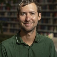
Michael Leitner is a part-time Professor at the Department of Geoinformatics (Z_GIS) within the Faculty of Digital and Analytical Sciences at the University of Salzburg. His work bridges geospatial technology with interdisciplinary applications in criminology and health geography. Research Focus: Geographic Information Systems (GIS), spatial analysis/modeling/mapping of crime and health geographies. Current Projects: Spatiotemporal crime forecasting, geospatial privacy, and fine-scale data collection using video geonarratives and physiological measurements. Interdisciplinary Reach: Collaborative studies in biology, chemistry, and urban studies demonstrate his cross-domain impact. His recent publications highlight trends in crime modeling , health geography , and molecular biology , with keywords spanning Geography , Criminology , Biology , and Physics . Sub-fields include Crime Forecasting , Vector-Borne Diseases , and Urban Safety .
Peter Wetz is a researcher affiliated with the Institute of Software Technology and Interactive Systems at TU Wien. His work focuses on semantic data processing, environmental data systems, and interactive data exploration. He has contributed to frameworks like YABench for RDF stream processing and StatSpace for statistical data integration. His research integrates Linked Data, real-time environmental monitoring, and user-friendly data visualization tools. Notable projects include Linked Widgets and Open Mashup Platform, aiming to lower barriers for data exploration. He has authored over 20 publications between 2013–2017, emphasizing interdisciplinary approaches to data management and semantic technologies. Key Areas: Semantic Web, Environmental Data, Stream Processing Tools Developed: YABench, StatSpace, Linked Widgets Platform
Pierluigi Claps is a Full Professor in the Department of Environmental, Land and Infrastructure Engineering (DIATI) at the Polytechnic University of Turin. He serves as a member of the Coordinating Committee of the Politecnico University Centre for Social Affairs and the Interdepartmental Center SISCON for Safety of Infrastructures and Constructions. He is also the Spoke Leader for research and innovation activities in the RETURN Foundation and leads major research initiatives including LIFE IP CLIMAX PO and the RETURN project under PNRR. He has held visiting researcher positions at the University of Melbourne and the University of Virginia. His research interests include climate change adaptation , dams safety , extreme events , flood hydrology , probabilistic risk assessment , and water resources . His work spans both theoretical and applied hydrology, with a strong emphasis on regional flood frequency analysis, climate-hydrology interactions, and the development of tools for risk assessment and infrastructure resilience. He has led numerous national (PRIN) and international (Interreg, LIFE) research projects and has contributed to major initiatives such as FLORA, RENERFOR, and CUBIST. The recent publications (2024–2025) highlight a strong focus on rainfall extremes , flood modeling , citizen science (SIREN project) , and the development of national databases such as FOCA (Flood and Catchment Atlas) and TILDE (Italian Large Dams dataset) . These works employ advanced statistical methods, GIS, and data integration techniques to address climate change impacts on hydrological extremes and infrastructure vulnerability. He has supervised multiple PhD students and serves on the doctoral college committees of both Politecnico di Torino and Università degli Studi di Catania across programs in Civil and Environmental Engineering and Defense Against Natural Risks. His teaching portfolio includes courses such as Climatology and Hydrology , Civil Protection , Water Resources Planning , and Evidence, Models, and Perceptions of Climate Change . He has also taught advanced statistical methods for climate variability assessment. He has held leadership roles in professional organizations, including President of the Italian Hydraulics Group (2012–2016), and has organized major conferences such as the EGU Leonardo Conference on Hydrology and Society (2012) and the Plinius Conference on Mediterranean Storms. He has also served on scientific committees of EGU, IAHS, and STAHY workshops.
Prof. Dr.-Ing. Ingo Neumann is a Professor of Engineering Geodesy and Geodetic Analysis Methods at Leibniz University Hannover's Faculty of Civil Engineering and Geodetic Science. He serves as Executive Director of the Geodetic Institute and leads research in geodetic sensor systems, structural monitoring, and multi-sensor fusion. His work focuses on advancing terrestrial laser scanning (TLS), UAV-based calibration, and machine learning applications in civil infrastructure analysis. Research interests include deformation monitoring, sensor calibration, and geospatial data processing. Notable projects involve fusion of SAR/InSAR data with TLS for ground movement analysis, and development of automated damage detection algorithms for port and marine structures. He teaches courses on sensor technology, geodetic measurement methods, and industrial surveying. Publications span 2006–2025, with recent emphasis on robust outlier detection, Kalman filter applications, and B-spline modeling for structural analysis. His work integrates geodesy with computer vision and machine learning to enhance infrastructure monitoring precision.
apl. Prof. Dr.-Ing. Claus Brenner is an Adjunct Professor at the Institute of Cartography and Geoinformatics within the Faculty of Civil Engineering and Geodetic Science at Leibniz University Hannover. His research focuses on LiDAR mapping, point cloud processing, and robust estimation, with applications in autonomous systems, urban mapping, and disaster risk assessment. He leads the Graduiertenkolleg 2159 research group on integrity and collaboration in dynamic sensor networks. Key research areas include 3D reconstruction, SLAM (Simultaneous Localization and Mapping), semantic segmentation of mobile mapping data, and cooperative perception systems. His work integrates advanced machine learning techniques with geospatial data analysis, addressing challenges in sensor fusion, uncertainty modeling, and real-time localization. Recent publications span topics like voxel-based point cloud localization for smart spaces, flood risk mapping using LiDAR, and adversarial shape completion. Brenner has contributed to benchmark datasets such as LuCoop and LUMPI, advancing research in cooperative perception and urban navigation. His methods emphasize robustness and scalability, often leveraging generative models and statistical frameworks for urban environment analysis. Notable projects include the development of high-definition mapping using LiDAR, trajectory-based road network reconstruction, and semantic annotation from user trajectories. His work bridges theoretical advancements in computer vision with practical applications in autonomous systems and smart infrastructure.
David Maddison is a Professor of Economics in the Department of Economics at the University of Birmingham's Birmingham Business School. He serves as Director of the Energy Institute and the Birmingham Centre for Environmental and Energy Economics and Management (BCEEEM), reflecting his leadership in energy and environmental research. He is also co-editor of the journal Climate Change Economics . PhD in Economics, University of Strathclyde David Maddison's research focuses on environmental and natural resource economics, with significant contributions to applied econometrics, development economics, and agricultural and transport economics. His work often explores the economic valuation of environmental impacts, including climate change, flooding, solar farms, and landfills. He employs empirical methods such as hedonic pricing and repeat-sales models to assess how environmental factors influence property values and individual well-being. His recent publications reveal a consistent trend in analyzing sustainability challenges through rigorous econometric frameworks. Key themes include eco-innovation and green employment, climate impacts on life satisfaction, and the economic dimensions of climate policy and carbon emissions. His involvement in interdisciplinary initiatives like the Birmingham Plastics Network—comprising chemists, environmental scientists, economists, and legal experts—demonstrates his commitment to holistic solutions for global environmental problems. David Maddison has not been publicly recognized with scientific awards in the provided texts. He contributes to academic training as a module leader for Environmental Economics (LI and LM levels) and as a contributor to the Global Issues module. He is actively involved in research groups focused on Environment, Trade, and Energy, and leads a significant research center dedicated to environmental and energy economics. There is no indication of grant funding, student advising, or part-time status in the available information.
Dr. Sarah Goodwin is a Senior Lecturer at Monash University's Department of Human Centred Computing, specializing in geospatial analysis and information visualization. She leads the Embodied Visualisation research group and holds roles as Director of Engagement for Human-Centred Computing and co-Director of the Monash Grid Innovation Hub. Her work focuses on creating visual solutions for complex data, including energy grid analysis, cancer prevalence visualization, and urban data exploration. Dr. Goodwin has over 20 years of experience in academic and professional roles, collaborating globally with institutions like the giCentre (City University London) and RMIT University. Education: She holds a PhD in Geographical Information Science (City University London, 2015), MSc in Geographical Information Systems (City University London, 2007), and BSc (Honours) in Geography (University of Manchester, 2003). Research Interests: Geovisualization, energy data analytics, urban data visualization, HCI, and geostatistical modeling. She has developed tools like Gazealytics and led projects such as the Australian Cancer Atlas and the Australia's Discourse Explorer. Teaching: She teaches Data Exploration and Visualisation (FIT5147) and Research Methods at Monash, impacting over 1000 students annually. She has also taught at RMIT University. Grants & Awards: Recipient of the IEEE InfoVis Best Paper Honorable Mention (2016). Active in conferences like IEEE VIS (General Chair, 2023) and organizes workshops on EnergyVis and CityVis. Labs & Teams: Involved with the Immersive Analytics Lab and collaborates with Monash Energy Institute and Data Futures Institute. Her work aligns with UN SDGs on sustainable cities and energy systems.
Sarah Gergel is a Professor in the Department of Forest and Conservation Sciences at the University of British Columbia (UBC) Faculty of Forestry. As Associate Dean, Academic, she bridges landscape ecology with applied conservation science and technology innovation. Her research focuses on understanding human impacts on terrestrial and aquatic landscapes, with projects spanning from the Arctic to the Tropics. Research areas include: Ecosystem services mapping and quantification Historical dynamics of river-floodplains High-resolution remote sensing (satellite/aerial imagery) Participatory mapping with Indigenous communities Social-ecological resilience Notable scientific awards: 2021 Gender Diversity and Inclusion Award (Canadian Institute of Forestry) 2020 Distinguished Landscape Practitioner (IALE-North America) 2018 AAAS Fellow Her lab integrates fieldwork, modeling, and local knowledge to address long-term landscape change, with applications in environmental assessment, land use planning, and sustainable development.
Francis Lee is an Associate Professor at Södertörn University's Department of Natural Sciences, Environment and Technology, and holds a joint appointment at Chalmers University of Technology in both the Division of Media Technology and Division for Science, Technology, and Society. PhD in Technology and Social Change (Linköping University, 2010) Docent qualification (2016) Previously affiliated with Uppsala University and Linköping University His research, grounded in Science and Technology Studies (STS), examines: Algorithmic power dynamics in knowledge production Digital transformation of biomedical research Classification and valuation practices in epidemic surveillance Sociotechnical infrastructures shaping societal understanding Recent publications analyze: Ontological overflows in STS methodology (2022) Value disjunctures in fetal research history (2022) Classification egress strategies in congenital malformation tracking (2022) Scientific leadership: Management team member, Wallenberg AI program (WASP-HS) Board member, European Association for STS (EASST) since 2025 Founding member, Algorithm Studies Network His teaching emphasizes embodied learning through methods like: Algorithm Walks Epistemic Black Box analysis Interactive critical thinking frameworks
Anthony C. Robinson is Professor of Geography and the E. Willard and Ruby S. Miller Professor at The Pennsylvania State University. He serves as Director of Online Geospatial Education Programs through the John A. Dutton e-Education Institute and Director of the GeoGraphics Lab within the Department of Geography in the College of Earth and Mineral Sciences. Robinson also holds leadership positions as Vice Chair of the International Cartographic Association Commission on Geovisualization and Chair of the AAG Cartography & Mapping Specialty Group. Dr. Robinson earned his B.S. in Applied Geography from East Carolina University (2002), followed by his M.S. (2005) and Ph.D. (2008) in Geography from Penn State. His academic career at Penn State has progressed from Research Assistant (2003-2008) to his current position as full Professor (2024-present), with previous appointments as Assistant Professor (2015-2019) and Associate Professor (2019-2024). Robinson's research focuses on designing and evaluating geovisualization tools to improve geographic information utility and usability across multiple domains including epidemiology, crisis management, national security, and higher education. His key contributions include characterizing how users assemble analytical results, studying visualization tools through eye-tracking methodologies, and exploring map symbol standardization for emergency management. Recent innovative work examines viral cartography in social media, techniques for visualizing the 'presence of absence' in big spatial data, and geographic dimensions of learner engagement in educational analytics. His publication record demonstrates a consistent trajectory toward increasingly complex geospatial challenges, with early work focused on foundational geovisual analytics methods evolving into current research addressing big data cartography, social media geovisualization, and educational applications of geographic information science. Robinson's scholarly output bridges theoretical cartographic principles with practical applications across diverse domains, particularly emphasizing user-centered design approaches. E. Willard and Ruby S. Miller Professor in Geography Past President of the North American Cartographic Information Society (NACIS) Co-Chair of the International Cartographic Association Commission on Visual Analytics Co-Director of GeoGraphics Lab Director of Online Geospatial Education Programs since 2014 As an advisor, Robinson has mentored doctoral students including Tim Prestby (recent PhD graduate) and currently supervises PhD candidate Lily Houtman. He actively seeks graduate students interested in cartography and geovisualization, user-centered design and evaluation, and health and ecological informatics. His research has been supported through institutional positions at Penn State including leadership of online geospatial education programs serving thousands of students globally. Robinson directs the GeoGraphics Lab, which serves as an incubator for innovative geospatial projects including community mapping initiatives and geospatial storytelling devices focused on community resilience and climate action. The lab recently hosted its inaugural Community Mapping Day at Penn State, engaging students, faculty, and community members in mapping pollinator pathways. Through the John A. Dutton e-Education Institute, he leads Penn State's GIS Certificate, Master of GIS, and Master of Spatial Data Science programs, which have educated thousands of professionals worldwide.
Tetsuhiko Yoshimura is a Professor at the Faculty of Agriculture and Life Sciences, Shimane University , with a career spanning over 30 years in forestry engineering and environmental informatics. His work focuses on mechanized logging systems in mountainous regions, GNSS/GPS applications in forest surveying, and sustainable forest management under climate change. PhD in Forestry from Kyoto University Developed innovative models for forest road network optimization Pioneer in integrating information technology with traditional forestry practices His research emphasizes: Forest Harvesting Systems - Analyzing productivity in steep terrain GNSS Accuracy - Improving positioning under tree canopies Environmental Education - Developing technology-based learning systems Recent publications demonstrate: Advancements in light cable logging technology Climate change adaptation strategies for East Asian forests Comparative studies of Japanese and European cable systems Economic analysis of small-scale biomass utilization He teaches courses in: Forest Informatics Timber Harvesting Methods Geospatial Surveying Forestry Statistics Professional affiliations: Japanese Forest Society (since 1994) Forest Utilization Society (since 1994) Forest Economics Society (since 2024)
Dr. Eugene Mohareb is an Associate Professor in Sustainable Urban Systems at the University of Reading, where he leads the Sustainable & Equitable Resource Consumption (SERC) group. His research focuses on quantitative sustainability assessments of urban systems, specializing in life cycle analysis of energy and food systems, greenhouse gas mitigation strategies, and adoption of low-carbon technologies. He directs multiple courses including Statistical Analysis, Sustainable Built Environments, and Carbon Management. Dr. Mohareb holds a PhD in Civil (Environmental) Engineering from the University of Toronto, an MSc in Biological (Food) Engineering from the University of Guelph, and a BSc in Biological (Food) Engineering from the same institution. He is affiliated with the International Society for Industrial Ecology. His research examines urban sustainability through three primary lenses: life cycle sustainability assessment of built environments, domestic retrofit adoption patterns, and sustainability metrics for food systems. Key projects include FoodSEqual, HiFi Bread, and BBSRC-funded assessments of biobased food system transitions. His work with Toast Brewing exemplifies industry collaborations to quantify carbon benefits of circular economy approaches. Mohareb's publications demonstrate strong thematic coherence around urban decarbonization, with recent expansions into social dimensions of sustainability in developing contexts. His 15 most recent articles (2022-2025) cluster around six domains: waste management innovations, energy retrofit behavior, urban metabolism modeling, climate adaptation strategies, food-energy systems, and renewable technology adoption in rural areas. This reflects an evolution from foundational urban GHG accounting toward applied socio-technical transitions. He leads the SERC research group, collaborating with academic and industry partners to develop evidence for low-carbon societies. Current projects investigate decentralized waste systems, solar adoption impacts on rural livelihoods, and urban heat resilience frameworks.
Matt Higham is an Assistant Professor at St. Lawrence University in the Math, Computer Science, and Statistics Department . His research focuses on Spatial Statistics with ecological applications, particularly Spatial Prediction Models that account for imperfect detection of animals in surveys. Education: PhD in Statistics from Oregon State University (2019) B.S. in Statistics and Botany from Miami University (2014) Research interests involve developing statistical methodologies for ecological applications, including spatial sampling , spatio-temporal modeling , and imperfect detection adjustment in wildlife surveys. He contributes to R software packages like spmodel and sptotal for spatial data analysis. Recent publications demonstrate trends in spatial statistics (4/7 articles), ecological modeling (5/7 articles), and statistical software development (2/7 articles). Key subfields include spatial prediction , block kriging , finite population estimation , and big spatial data handling . Teaching activities include courses in Introduction to Statistics , Applied Regression Modeling , Foundations of Data Science , and Data Visualization . Personal interests include racket sports, jogging, gaming, hiking, and backpacking.
Dr. Barnali Das is a Teaching Assistant Professor in the Department of Geography and Geospatial Sciences at Kansas State University. Her research focuses on remote sensing applications in coastal and agricultural systems, with particular emphasis on mangrove dynamics, coral reef habitability, and crop yield forecasting. Her work spans three interrelated fields: Coastal ecology (mangrove carbon mapping, shoreline change analysis) Agricultural monitoring (soil moisture modeling for drought early warning, biophysical vs. agro-climatic predictors for crop yields) Geospatial science (machine learning for canopy parameter retrieval, cloud computing in environmental analysis) Recent publications highlight her expertise in: Marine ecosystem assessment (Andaman Islands, Arabian Sea) Coastal zone management (Maharashtra, Panama) Data-driven agriculture solutions (Sub-Saharan Africa) Her research demonstrates a commitment to interdisciplinary environmental science through advanced geospatial technologies.
Alex Bush serves as Lecturer in Environmental Remote Sensing at Lancaster University's Lancaster Environment Centre, specializing in ecological modeling for biodiversity conservation at macroecological scales. His work bridges remote sensing technologies with ground-truth ecological data to address national-scale monitoring challenges and ecosystem sustainability. Alex Bush's educational background includes: University of East Anglia Macquarie University, Sydney His research focuses on integrating high-throughput DNA sequencing with remote sensing imagery to map invisible biodiversity components and assess ecosystem condition. Key themes include developing statistical models for climate change adaptation, evaluating DNA metabarcoding for sustainable agriculture monitoring, and analyzing spatial-temporal community dynamics across landscape scales. This work directly addresses biodiversity loss through innovative monitoring frameworks. Analysis of his 15 most recent publications (2020-2025) reveals dominant methodological trends in environmental DNA (eDNA) applications, particularly metabarcoding for freshwater and terrestrial biodiversity assessment. Cross-cutting themes include climate change resilience modeling, statistical framework development for ecological monitoring, and the integration of remote sensing with molecular techniques. His work consistently targets conservation applications across Amazonian, boreal, and urban ecosystems. Alex Bush has received significant research recognition: Research Fellowship, Australian Government Research Fellowship, Canadian Government He actively supervises PhD candidates Matthew Clark (Ecology and Conservation) and Pablo Gallego Anex (Biodiversity and Remote Sensing of Forest Structure). Current research funding includes the H2020 SUPERB project (2021-2025), Designing Biodiversity Markets for Nature Recovery (2022), and Integrating Statistical Frameworks into eDNA Survey and Analysis (2020-2022), reflecting his leadership in conservation technology development. Affiliated with Lancaster's Centre of Excellence in Environmental Data Science, Bush contributes to interdisciplinary teams in Ecology and Conservation and Geospatial Data Science, driving innovation in environmental monitoring through data-intensive approaches.