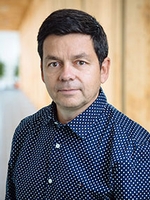
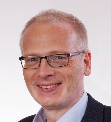
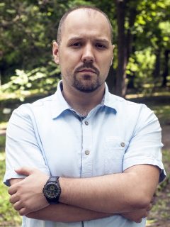
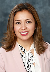
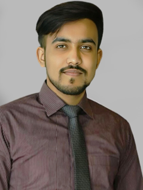
Małgorzata Andrzejewska serves as a Lecturer at the Department of Geodesy within the Faculty of Civil and Environmental Engineering at Gdańsk University of Technology. Her office is located in the HYDRO building (Faculty of Civil and Environmental Engineering building), room 404. Her academic focus centers on geospatial disciplines including: Geodesy Surveying Geomatics Spatial Information Systems Cartography Remote Sensing No scientific awards or research grants are documented in the available information. The text indicates no formal student supervision roles or leadership in research laboratories, with project involvement only referenced through a generic 'Give' prompt without specific details.
Janani Sivarajah is an Assistant Professor in the Department of Wood and Forest Sciences at Université Laval's Faculty of Forestry and Geomatics. She holds the Research Chair on Urban Trees and their Environment (CRAUM) and is a Regular Member of the Centre for Forest Research (CEF) since 2024. Her work focuses on transdisciplinary, applied research to build sustainable and resilient communities through nature-based solutions for urban environments. Dr. Sivarajah earned her PhD in Forestry specializing in Urban Forestry, MFC in Forest Conservation, and HBSc in Integrative Biology and French, all from the University of Toronto. She has over 8 years of professional experience in the urban forestry sector and non-profit organizations in Ontario. Her research spans five key themes: construction activities on urban trees (including root cutting impacts), urban soils (Maguire Avenue studies, technosols, biochar), climate change mitigation (assisted migration), urban tree inventory and management (participatory science, interactive mapping), and tropical forests. She examines how urban trees improve human health and well-being while addressing challenges like soil degradation and climate change impacts. Her recent publications (2018-2024) demonstrate a strong focus on practical applications of urban forestry research, with emphasis on tree stability in urban settings, UV protection benefits, soil science innovations, and community engagement with urban forests. Her work bridges academic research with practical implementation through collaborations with municipalities, practitioners, and communities. Dr. Sivarajah actively mentors graduate students, currently supervising one PhD candidate (Md Ahosan Habib Ador) and four Master's students (Dominic Bartolacci, Savannah Bissegger O'Connor, Tommy Gonthier, Ravosoa Tianarinoro Ramaroson), while co-advising Jeremy Latulippe. She previously directed Clément Pallafray's 2023 Master's thesis on root cutting impacts. She leads the Sivarajah Lab, which is affiliated with CRAUM and focuses on transdisciplinary research at the science-policy interface. The lab has been active in media engagement, with recent interviews on CBC, BBC, and radio programs discussing urban forestry topics like the emerald ash borer. The lab also contributes to training initiatives such as the NASER program focused on urban soils and greening.
Osvaldo Valeria is a Professor at the University of Quebec in Abitibi-Témiscamingue (UQAT) and co-holder of the UQAT-UQAM Chair in Sustainable Forest Management. He serves as Director of the Masters in Sustainable Management of Forest Ecosystems and Co-Director of the Lac Duparquet Teaching and Research Forest. His work focuses on forestry operations, geomatics and remote sensing within the field of sustainable forest management. Dr. Valeria earned his Ph.D. in Forest Sciences from Laval University in 2004, following an M.Sc. in Forest Sciences from the same institution in 1999. He completed his undergraduate education with a BSc in Forest Engineering from Universidad de Concepcion, Chile in 1991. Professor Valeria specializes in spatial analyses using geographic information systems and remote sensing systems, with additional expertise in database design. His research laboratory conducts studies focused on forest soil mapping, wetland mapping, monitoring forest dynamics following natural disturbances, bryophyte species diversity, and the automatic identification of forest roads and their closure. His work represents the cutting edge of knowledge on geospatial data, specialized software applications, remote sensing data sources, and statistical processing of spatial data in forestry contexts. He actively participates in and leads numerous research projects in sustainable forest management, with particular emphasis on the ecological, economic and social feasibility of sustainable forest management strategies in the boreal forest. An analysis of Professor Valeria's recent publications reveals a strong emphasis on sustainable forest management in the boreal region, with particular attention to carbon dynamics, climate change impacts, and the use of advanced remote sensing technologies like LiDAR. His work bridges ecological, economic, and social considerations in developing sustainable forestry practices, with increasing focus on climate adaptation strategies and carbon sequestration potential in forest ecosystems. Professor Valeria has advised numerous graduate students throughout his career, including over a dozen doctoral candidates and more than twenty master's students. His research is supported by multiple funding agencies including the UQAT-UQAM Chair in Sustainable Forest Management, the FQRNT Forest Fund, Géoïde, the CRSNG, the MRNF, DEC, MDEIE and the RGDF – Center of Excellence. His laboratory represents a significant hub for research and training in forest geomatics and sustainable management practices. Dr. Valeria's laboratory is at the forefront of applying geospatial technologies to forest management challenges. His team works extensively with LiDAR data, satellite imagery, and advanced spatial analysis techniques to address critical questions in sustainable forestry. The lab maintains strong collaborations with other researchers across Canada and internationally, contributing to a robust research environment for graduate students and postdoctoral fellows.
Prof. Hardy Lehmkühler serves as Professor and Study Dean for the Bachelor program in Surveying and Geoinformatics at Stuttgart University of Applied Sciences, with academic focus centered in Geomatics and its engineering applications. His research and teaching domains span critical geospatial disciplines: Geomatics as the foundational framework Surveying and Geoinformatics methodologies Photogrammetric analysis techniques Augmented and Virtual Reality systems integration Infrastructure Management solutions In his dean role, he oversees five degree programs: Bachelor's tracks in Surveying and Geoinformatics, Augmented Reality/Virtual Reality Engineering, and Infrastructure Management, plus Master's programs in Photogrammetry and Geoinformatics and Surveying. Contact occurs exclusively via email appointment from his office in room 2/108.
Professor Hector Altamirano-Medina is a leading academic at University College London's Bartlett Faculty of the Built Environment, where he serves as Professor of Environmental Design, Engineering and Health within the Institute for Environmental Design and Engineering. He also holds the position of BSEER Departmental Tutor (2020-present) and previously served as Deputy Course Director for the MSc Environmental Design and Engineering program (2017-2021). Dr. Altamirano-Medina is a trained architect with an educational background that includes a PhD in Building Science from University College London (2011) and an MA in Energy, Environment and Sustainable Design from the Architectural Association School of Architecture (2002). His research focuses on the critical intersection between the built environment and human health, with particular expertise in indoor environmental quality, moisture and humidity conditions in buildings, thermal comfort, and the operational performance of buildings. His groundbreaking work on the Humidity in Dwellings project (2005-2007) directly influenced building regulations for England and Wales, with findings integrated into Appendix A of the ADF 2010. He established the Healthy Infrastructure Research Group at UCL Department of Civil and Geomatic Engineering, funded through the EPSRC Challenging Engineering Programme, and currently serves as Academic Director of the UK Centre for Moisture in Buildings (UKCMB). His recent publications demonstrate a consistent focus on moisture management in buildings, thermal comfort in retrofit scenarios, heritage conservation with energy efficiency considerations, and the health impacts of indoor environments. His work spans both theoretical investigations and practical applications, often in collaboration with industry and public institutions. Honorary Professor from Universidad Austral de Chile (2012) International Postgraduate Scholarship from Conicyt (2008) Professor Altamirano-Medina has secured significant research funding including the EPSRC Challenging Engineering Programme (EP/G029881/1) for the Healthy Infrastructure Research Group and led the AirPath: Working Group on Outdoor Environments, Pathogens in Air, and Human Health project (2009-2010) supported by the joint Environment and Human Health Programme. His current research portfolio includes multiple moisture-related projects developed in partnership with industry and public institutions through the UK Centre for Moisture in Buildings. He leads the Healthy Infrastructure Research Group and collaborates extensively through the UK Centre for Moisture in Buildings, where he serves as Academic Director. His work bridges academic research with practical building science applications, particularly in addressing moisture-related challenges in the built environment.
Dr. Eng. Severina Dzhorova-Marinova is a Senior Assistant Professor at the University of Architecture, Civil Engineering and Geodesy (UACEG). She serves in the Department of Higher Geodesy within the Faculty of Geodesy, where she holds responsibilities as Secretary of the Department. Her office is located in room P422, with scheduled reception hours for student consultations and certifications. She completed her education at UACEG-Sofia, earning a Master of Engineering in Geodesy (2006) and a Doctor of Science in General, Higher and Applied Geodesy (2015). She is professionally affiliated with the Chamber of Geodetic Engineers and the Chamber of Engineers in Investment Design. Her research focuses on advanced geodetic methodologies with emphasis on: Gravimetric analysis including zero drift correction and network equalization techniques Integration of Global Navigation Satellite Systems (GNSS) with traditional geodetic methods Applications in geophysics and geological surveying Innovations in geodetic network alignment and astronomical geodesy Her publications consistently explore the integration of gravimetric data with modern positioning technologies, with recent work emphasizing practical applications in geological fault analysis, energy infrastructure mapping, and resource exploration. She teaches specialized courses including Global Navigation Satellite Systems (GNSS), Physical Geodesy, Geodetic Astronomy, and Gravimetric Applications in Geology and Geophysics.
Maria Petrova serves as faculty at the University of Architecture, Civil Engineering and Geodesy (UACEG) within the Faculty of Geodesy and Department of Applied Geodesy. She holds the academic rank of Assistant Professor (mapped from Bulgarian "chief assistant" designation) and teaches Engineering Geodesy lecture courses for the Faculty of Transport Engineering alongside exercise sessions for both Transport Engineering and Hydrotechnics students specializing in Water and Sewerage systems. Her research and teaching focus centers on Geodesy and Engineering Surveying applications in civil infrastructure projects, particularly developing educational materials for Engineering Geodesy courses covering Construction of Buildings and Facilities, Water Supply systems, and specialized transport engineering curricula across multiple academic semesters including 2024/2025 offerings. Dr. Petrova maintains regular office hours on Tuesdays from 11:00 to 13:00 in cabinet P415 and communicates through her institutional email address mpetrova_fgs@uacg.bg, with no documented scientific awards, student advisement records, or research publications in the available university directory information.
Prof. Dr. Eng. Yuri Tsanovski serves as Deputy Dean for Academic Affairs at the Faculty of Geodesy, University of Architecture, Civil Engineering and Geodesy (UACEG). He is affiliated with the Department of Higher Geodesy where he maintains Cabinet 500. His academic career spans multiple roles from Senior Assistant to current Associate Professor status. Dr. Tsanovski's research focuses on Engineering Geodesy, Cadastre, Hydrography, and GNSS technologies. His work includes significant Antarctic research participation through the 18th and 24th Bulgarian Antarctic Expeditions, contributing to geodetic surveying in extreme environments. His scientific interests bridge theoretical geodesy with practical applications in navigation systems and precision measurement. His publication portfolio demonstrates consistent advancement in GNSS technologies, evolving from foundational GPS concepts to specialized applications in kinematic positioning and precision measurements. The research trajectory shows increasing sophistication in handling complex geodetic problems, particularly in network alignment and satellite-based positioning systems. Dr. Tsanovski actively contributes to academic instruction through multiple lecture courses including Global Navigation Satellite Systems, Precise GPS Measurements, and Space Geodesy. His teaching materials reflect practical applications across both theoretical and hands-on components of geodetic education.
Assoc. Prof. Caner Güney is affiliated with the Department of Geomatics Engineering at Istanbul Technical University (ITU), part of the Civil Engineering Faculty. He holds a PhD in Geomatics Engineering from ITU and has been a faculty member since 2002, progressing to Associate Professor in 2013. His research focuses on Surveying Techniques, Geodesy, GIS, and Information Technologies in Planning. Education: PhD in Geomatics Engineering, ITU (2002–2007) MSc in Geodesy and Photogrammetry Engineering, ITU (1994–1999) BSc in Geodesy and Photogrammetry Engineering, ITU (1994–1999) Administrative Roles: President of Geospatial Informatics Initiative (2010–2020, with multiple terms) Board Member of Minister Map Cadastre Land Registry Museum Association (2016–present) Member of Chamber of Surveying and Cadastre Engineers (1999–present) His research interests emphasize innovative applications of geospatial technologies in urban planning, surveying methodologies, and geodetic data analysis. He maintains an active presence in academic and professional organizations, contributing to policy and standards in geomatics.
Professor Fraser Sturt is a Deputy Director of the Southampton Marine and Maritime Institute (SMMI) and Professor of Maritime Archaeology at the University of Southampton. His research integrates geospatial data and interdisciplinary methods to explore maritime prehistory, environmental impact assessment, and community-focused initiatives. He leads projects funded by organizations such as the AHRC, Leverhulme Trust, and Royal Academy of Engineering. Education: B.A. in Archaeology & Anthropology, University of Cambridge MA in Maritime Archaeology, University of Southampton PhD in Mesolithic/Neolithic Studies, University of Cambridge Research Interests: Submerged prehistoric landscapes Geomatics and 3D data capture Evaluation methods for cultural heritage Climate change and coastal communities Key Projects: COAST Network Plus (Coastal Communities & Seas Together for Resilience) Submerged Neolithic of the Western Isles (British Academy) Offshore Wind Spatial Planning (Lloyd's Register Foundation) Awards: Philip Leverhulme Prize (2017) Advising & Collaboration: Supervises 9 current PhD students across Archaeology and Law Collaborates with institutions like the Honor Frost Foundation and English Heritage Labs/Teams: Centre for Maritime Archaeology Southampton Marine and Maritime Institute Coastal Communities Research Group
Boris P. Radić is a Full Professor at the University of Belgrade’s Faculty of Forestry, Department of Planning and Design in Landscape Architecture. He holds academic ranks of Assistant Professor (2015), Associate Professor (2020), and Full Professor (2024). His expertise includes landscape ecology, GIS applications, and environmental management. Born in Jagodina, Serbia, he earned his PhD in Ecological Engineering (2014) from the same faculty. Radić has authored textbooks like Landscape Ecology (2024) and contributed to over 100 peer-reviewed articles in journals such as Remote Sensing , Land , and Applied Sciences . His research focuses on soil erosion modeling, urban green infrastructure, and geospatial techniques. Education: Bachelor of Landscape Architecture, University of Belgrade (2004) Doctor of Biotechnical Sciences (2014), University of Belgrade Research Interests: He explores landscape degradation processes, GIS for environmental protection, and sustainable urban planning. His work integrates innovative methods like remote sensing for erosion assessment and geodesign frameworks for green infrastructure development. Grants & Projects: Europeaid-funded erosion modeling projects Ministry of Serbia grants (e.g., 451-03-65/2024-03/200169) Professional Affiliations: International Association for Landscape Ecology Serbian Association of Landscape Architects He advises on over 100 professional projects, including spatial plans and environmental impact assessments, emphasizing practical applications of academic research.
Dr. Shabnam Jabari is an Associate Professor in the Department of Geodesy and Geomatics Engineering at the University of New Brunswick (UNB). She holds a PhD from UNB (2015), with research focused on 3D urban change detection using multi-angle/multi-sensor imagery, leading to a patented commercial technology. Her MSc (2009) and BSc (2005) in Civil Surveying Engineering were earned at the University of Tehran. Research Interests: 3D city models and GIS applications Urban change detection and disaster management (damage/flood mapping) Multi-modal mapping (integrating LiDAR, SAR, and optical data) Geospatial data for emergency response systems Awards: CFI Top Innovative Project (2018) UNB's Seven Novel Projects (2017) NSERC Recognition Teaching: Courses in GIS (GGE 3342/4423/6410), Remote Sensing, Photogrammetry, and co-instructor roles in foundational graduate courses. Professional Roles: Secretary of Canadian Remote Sensing Society (since 2020), CRSS Working Group 3 Chair (2021–), ISPRS Congress Bid Task Force member, Vice President of Canadian Institute of Geomatics, P.Eng. licensed in New Brunswick. Key Projects: Flood modeling in New Brunswick, smartphone-based crack detection systems, and LiDAR-camera fusion for urban modeling. Her work has been featured in CBC News, The Globe and Mail, and UNB Research Matters.
Isfahan Ghani is a Doctoral Researcher specializing in geotechnical engineering and environmental sustainability. His research focuses on reducing the environmental impact of soil stabilization through low-concentration lime modification and cost-effective solutions. He is affiliated with the Geotechnics and Geomatics research group, addressing challenges in soil contamination, earth material behavior, and CO₂ emissions reduction. His expertise includes soil mechanics, geotechnical engineering, and laboratory/field testing techniques. He actively conducts research, troubleshoots technical issues, and advocates for sustainable practices in construction and environmental protection. Current projects explore curing regimes for soil improvement and innovative chemical additives for soil treatment. Ghani emphasizes practical applications of geotechnical advancements to enhance structural stability while minimizing ecological footprints. His work bridges theoretical research with real-world implementation to safeguard community health and environmental integrity.
Dr Andrea Colombi is a Visiting Researcher at Imperial College London's Faculty of Natural Sciences, affiliated with the Centre for Plasmonics and Metamaterials. His research focuses on elastic metamaterials, computational elastodynamics, inverse problems, and high-performance computing applications in wave physics. He has held fellowships at ETH Zurich and ISTerre Grenoble, and currently explores seismic waves, ultrasound, and hypersound applications through experimental and numerical methods. Education: B.Sc. Industrial Engineering (Università di Brescia, 2009), Ph.D. in Seismology (ETH Zurich, 2013). Positions: Postdoctoral Fellow at ISTerre Grenoble (2013–2015), Marie Curie Fellow at Imperial College (2015–2018). Research interests include resonant metamaterials, dynamic interactions in clustered buildings, and interdisciplinary collaborations with geophysicists, mathematicians, and engineers. He plans to join ETH Zurich under an SNSF Ambizione Fellowship in 2018. Awards: Swiss National Science Foundation Fellowship, Marie Curie Fellowship, SNSF Ambizione Fellowship. His work combines laboratory experiments, field studies, and supercomputing simulations across France, Switzerland, and the UK.
Dr. Petra Helmholz is an Associate Professor in the School of Earth and Planetary Sciences at Curtin University, specializing in Photogrammetry and Remote Sensing. She holds a German Dipl.-Ing. (M.Sc.) and Dr.-Ing. (Ph.D.) in Geomatics. Her research focuses on underwater, terrestrial, and airborne photogrammetry, with applications in health, agriculture, heritage mapping, and engineering. She has received multiple awards, including the Asia Pacific Excellent Award in Education (2018) and WA Spatial Awards. She serves as National Chair of the Remote Sensing & Photogrammetry Commission (SSSI) and is an Associated Editor of the journal PE&RS. Helmholz leads the Bachelor of Surveying program at Curtin and holds licenses in remote piloting and surveying. Her work bridges geospatial technologies with interdisciplinary fields like medicine and environmental science. Education: 2006–2012: Ph.D. in Photogrammetry, Leibniz University Hannover 2003–2005: Certified Licensed Surveyor, Germany 1997–2003: B.Sc./M.Sc. in Surveying, TU Berlin Research Interests: Underwater and airborne photogrammetry, 3D reconstruction for medical and heritage applications, thermal simulation of urban environments, and geospatial data analysis. Her projects include facial analysis for rare disease diagnosis, coral growth estimation, and pipeline monitoring. Publications highlight innovations in underwater imaging techniques, urban heat island studies, and medical 3D modeling. She actively contributes to international bodies like ISPRS and ASPRS, co-chairing working groups on geospatial data standards and applications.