Associate Professor Mehmet Kizil is the Mining Engineering Program Leader at the School of Mechanical and Mining Engineering, The University of Queensland. With a career spanning 25+ years, he holds a Bachelor of Mining Engineering (1986) from Dokuz Eylul University (Turkey) and PhD (1993) from the University of Nottingham (UK). His affiliations include being an affiliate of Future Autonomous Systems and Technologies and active participation in Mining Education Australia. School of Mechanical and Mining Engineering Australian Research Council (ACARP, CRCTiME, MRIWA, SIMTARS, industry partners) Research interests focus on mine planning/design, production optimization, computer/virtual reality applications, and mine ventilation systems. His 2025-2024 publications highlight innovations in FMIPCC systems, methane dispersion modeling, digital twins for mineral processing, and sustainable underground mining. Notable scientific achievements include being recognized as Higher Education Academy Senior Fellow (2018) and receiving national teaching awards. His work with industry partners (Newcrest, Rio Tinto, BHP, Xstrata, Anglo American, Origin Energy, Iluka Resources) has secured over $3M in research funding.
Satu-Pia Reinikainen is a tenured Professor in Computational Engineering at the Lappeenranta-Lahti University of Technology (LUT) School of Engineering Sciences . With expertise in chemometrics and multivariate analysis, her work bridges statistical modeling, spectroscopy, and environmental monitoring. Research Focus Development of advanced kernel-based methods for process control Application of hyperspectral imaging in material and environmental analysis Microplastic pollution dynamics in aquatic systems Integration of spectroscopic techniques for real-time monitoring Conservation of geological and heritage materials through data-driven approaches Her research combines chemometric algorithms, environmental data analysis, and industrial process monitoring to solve complex analytical challenges.
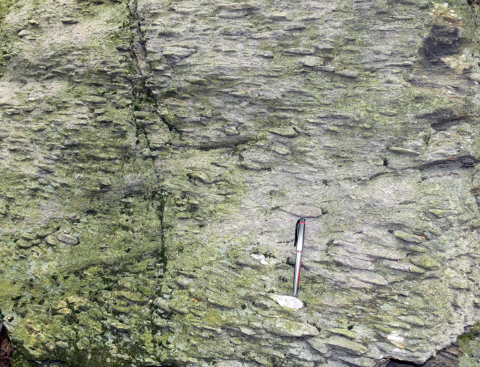
Paul M. Karabinos is the Charles L. MacMillan Professor of Natural Sciences in the Department of Geosciences at Williams College, where he has been a faculty member since 1983. He holds an endowed professorship recognizing his significant contributions to geological sciences and education. His academic career at Williams progressed from Assistant Professor (1983-1990), to Associate Professor (1990-1995), to full Professor (1995-2012), and he served as Department Chair from 2006-2012 before receiving his current named professorship. B.S. from University of Connecticut (1975) Ph.D. from Johns Hopkins University (1981) Postdoctoral Fellow at Harvard University (1981-1983) Visiting Scholar at Doshisha University, Kyoto, Japan (1993) Professor Karabinos specializes in structural geology and Appalachian tectonics, with particular expertise in the Taconic orogeny, metamorphism, and geochronology. His research has significantly advanced understanding of gneiss dome formation, thrust faulting mechanisms, and the tectonic evolution of the New England Appalachians. He has developed innovative approaches to 3D geological visualization using SketchUp, creating interactive educational tools that transform how structural geology concepts are taught. His work combines field mapping, microstructural analysis, and geochronological techniques to unravel complex deformation histories. Analysis of Karabinos' recent publications reveals a strong focus on integrating traditional geological fieldwork with digital visualization technologies. His research spans fundamental tectonic questions about Appalachian evolution while simultaneously developing educational tools that make structural geology concepts more accessible. A significant thread throughout his work involves studying the Chester Dome, Berkshire Massif, and Mount Greylock as natural laboratories for understanding orogenic processes. His publications demonstrate consistent productivity with a notable shift toward developing interactive 3D models for both research and educational purposes in his later career. Professor Karabinos has mentored over 35 undergraduate research students at Williams College, many of whom completed senior theses under his guidance. His dedication to undergraduate education is evident in his development of field-based courses and innovative teaching tools. He has received support for his research through various grants that have enabled sustained field investigations in the Appalachian region and the development of his digital visualization projects. His research involves extensive field work in the Berkshire Massif, Chester Dome, and Mount Greylock areas, often utilizing student researchers. Karabinos has developed the SketchUp Structural Geology Studio, which provides interactive 3D models for teaching structural geology concepts. His work on the Day Mountain thrust sheet and graphite redistribution in pelitic schists represents ongoing field-based research projects that integrate undergraduate students in meaningful research experiences.
Prof. Monika Sester is a distinguished Professor and Executive Director of the Institute of Cartography and Geoinformatics at Leibniz University Hannover, within the Faculty of Civil Engineering and Geodetic Science. She also serves as Spokesperson for the Leibniz Research Center FZ:GEO and holds multiple leadership roles including Faculty Information Officer (FIO) for the Faculty of Civil Engineering and Geodetic Science, Ombudsman for Good Scientific Practice, and Exchange Coordinator for Geodetic Science and Geoinformatics. Her research focuses on the intersection of geospatial information science, cartography, and urban mobility. Prof. Sester's work spans several key areas: Geospatial data processing and analysis Cartographic representation and visualization Urban mobility and transportation systems Spatial data uncertainty and quality Digital mapping technologies and applications Historical map analysis and interpretation Prof. Sester's recent publications demonstrate a strong focus on applying advanced computational techniques to geospatial problems. Her work shows increasing emphasis on machine learning applications for map analysis, urban mobility optimization, and 3D spatial modeling. She has been particularly active in researching applications of deep learning for historical map interpretation, urban mobility patterns, and spatial uncertainty visualization. Her contributions to the field have been recognized through leadership positions in major research initiatives: Executive Director, Institute of Cartography and Geoinformatics Spokesperson, Leibniz Research Center FZ:GEO Faculty Information Officer, Faculty of Civil Engineering and Geodetic Science Ombudsman for Good Scientific Practice Member of multiple academic committees including the Admissions and Examination Board Prof. Sester actively collaborates with students and researchers across multiple projects focused on geospatial information systems, urban mobility, and cartographic visualization. Her leadership extends to guiding research directions within the Leibniz Research Center FZ:GEO, which brings together interdisciplinary expertise to address complex spatial challenges.
Kuuipo Walsh is the GIScience Program Director and Senior Lecturer I at Oregon State University's College of Earth, Ocean, and Atmospheric Sciences (CEOAS). She oversees the GIScience certificate program, advising over 200 students annually on course selection, career paths, and academic plans. Her research focuses on GIS, metadata standards, digital libraries, and coastal atlases. She teaches advanced undergraduate and graduate courses in GIScience via Ecampus, including GIScience I-III and Geospatial Perspectives on Intelligence. Education: B.S. in Computer Science (California Polytechnic State University, 1993) and M.S. in Marine Resource Management (Oregon State University, 2002). Her publications emphasize spatial data infrastructure, coastal data networks, and usability in geospatial tools, with notable contributions to the Oregon Spatial Data Library and Virtual Oregon projects. She has no listed scientific awards but maintains active engagement in geospatial education and professional advising. Lab/Team Affiliation: Directs the GIScience certificate program and collaborates on geospatial initiatives within CEOAS.
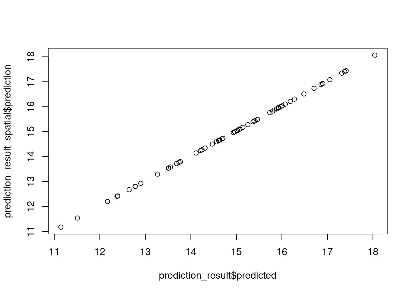
Jakub Nowosad is a researcher affiliated with Adam Mickiewicz University in Poznań and currently holding a prestigious Marie Skłodowska-Curie Actions Postdoctoral Fellowship at the University of Münster's Remote Sensing and Spatial Modeling group (August 2024-August 2026). His work bridges geography, computer science, and environmental science with a focus on spatial data analysis and machine learning applications. Nowosad's research interests center on spatial association methods, landscape metrics, information theory applications in geography, and spatial machine learning techniques. He has made significant contributions to developing and implementing computational methods for analyzing spatial patterns, particularly through R programming packages that address spatial autocorrelation challenges in machine learning. His work spans environmental monitoring, landscape ecology, and geospatial analysis with practical applications in understanding climate change impacts, forest fragmentation, and permafrost degradation. His publication record demonstrates a strong focus on methodological development in spatial data science, with numerous recent publications on spatial machine learning frameworks, computational landscape ecology, and specialized software tools. Nowosad's work shows a clear trajectory toward integrating advanced machine learning techniques with traditional spatial analysis methods to overcome limitations in spatial prediction and pattern recognition. Marie Skłodowska-Curie Actions Postdoctoral Fellowship (MSCA-PF) for the PRISM project (PReservation and RecognItion of Spatial patterns using Machine learning) Nowosad actively contributes to the open-source geospatial community through software development, including packages like spatialRF and contributions to spatial machine learning frameworks. His collaborative work spans multiple institutions including the University of Cincinnati, International Institute for Applied Systems Analysis, and various European research groups. He appears to be developing methodologies that will significantly impact how spatial patterns are recognized and preserved in environmental datasets, with applications ranging from Arctic landscape monitoring to forest conservation planning.
William Daniels is an Assistant Professor in the Department of Earth & Environmental Sciences at the University of Minnesota Duluth, part of the Swenson College of Science and Engineering. His research focuses on understanding past environmental changes through geological and biological indicators found in lake sediments, with primary emphasis on Arctic regions. Research Expertise Dr. Daniels specializes in climate, limnology and paleolimnology, biogeochemistry, water isotope systematics, and diatom analysis. His primary research area is the Arctic, though he also maintains projects in urban ponds and the Laurentian Great Lakes. He employs lipid biomarkers (GDGTs, diols, leaf waxes) and isotope ratios (D/H, 13C/12C, 15N/14N) for paleoclimate reconstructions, seeking to understand the complex interactions between Earth's climate, biosphere, and human population. Lakes serve as natural integrators and recorders of environmental changes, with their sediments preserving historical archives. Dr. Daniels analyzes mineralogy, biological and chemical fossils, sediment grain size, and other sediment properties to decipher these past changes through meticulous laboratory and field work. Research Output and Field Work His publication record demonstrates consistent field research activity from 2015 through 2022, with work spanning Arctic regions, Greenland, Maine, and Rhode Island. His research combines sediment coring, diatom analysis, and biomarker chemistry to reconstruct environmental histories. Notable work includes taxonomic research on Lindavia intermedia diatoms and paleolimnological studies of Mashapaug Pond. Collaborative Research Dr. Daniels has collaborated with NASA on the HERA XVII mission preparation and has worked with students from UMass on Arctic paleoclimate research. His laboratory maintains an active field program, with documented expeditions to diverse locations including the Arctic, Greenland, and various northeastern US water bodies. His blog "For Love of Limnology" documents ongoing research activities and scientific discoveries.
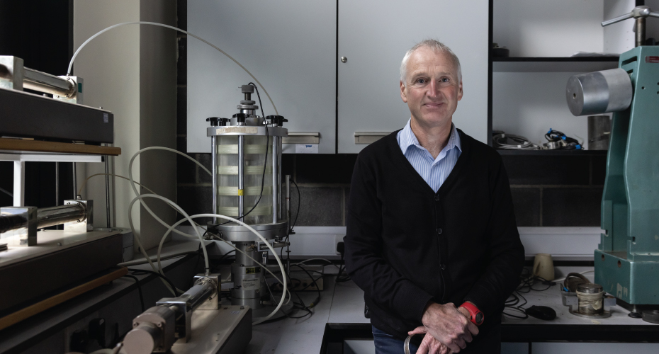
Dr. Michael Long is a Lecturer in the UCD School of Civil Engineering at University College Dublin, specializing in geotechnical engineering and sustainable ground improvement techniques. He is a key researcher in the Science Foundation Ireland (SFI) funded iCRAG center, focusing on bio- and enzyme-induced carbonate precipitation (MICP/ECIP) to strengthen granular soils while reducing carbon emissions. His work spans collaborations with Queen’s University Belfast, Arizona State University, Georgia Tech, and University of California, Davis. Research Interests: His projects address critical gaps in Ground improvement using eco-friendly methods Compliance with Eurocode 7 standards Utilization of calcite-bearing Irish sands Karst-related geotechnical challenges with implications for tunneling, coastal development, and urban infrastructure resilience. Collaborative Networks: Dr. Long works closely with geologists, chemists, and engineers across the UCD College of Engineering & Architecture, leveraging both laboratory-scale experiments and full-field trials to advance sustainable construction practices.
Merethe Frøyland is a Professor at the Science Center (Naturfagsenteret) within the Faculty of Mathematics and Natural Sciences (MN-fakultetet) at the University of Oslo (UiO). With a background in geology and a PhD in science education, she specializes in science didactics , geodidactics , and informal learning environments . Her work focuses on integrating other learning arenas (e.g., fieldwork, museums) into science teaching and improving teacher education through continuing professional development programs.
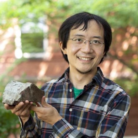
Roger Fu is a Professor of Earth and Planetary Sciences at Harvard University, leading the Paleomagnetics Lab since 2017. He holds a PhD in planetary sciences from MIT and specializes in paleomagnetism, studying planetary magnetism, tectonic reconstructions, and early Earth history. His research integrates geodynamical modeling with advanced tools like the quantum diamond microscope (QDM), enabling high-resolution magnetic imaging of geological samples. Education: BS from Harvard University (2009, Earth and Planetary Sciences & Astrophysics), PhD from MIT (planetary sciences). Post-PhD research included living with the Mapuche people of Chile to study traditional astronomy. His work focuses on Earth's geodynamo, Martian crustal magnetism, and the solar nebula's magnetic fields. Research interests span planetary formation, early Earth dynamics, and the application of QDM technology to study magnetic minerals. Notable contributions include detecting early plate motions and a reversing geodynamo by 3.5 Ga, and analyzing Martian meteorite magnetism to infer crustal cooling processes. His articles emphasize interdisciplinary approaches, linking paleomagnetic data with geodynamic models to address questions about planetary interiors and climate history. The QDM has been pivotal in visualizing magnetic mineral distributions, enhancing confidence in paleomagnetic interpretations. Labs/Teams: Director of Harvard's Paleomagnetics Lab. Collaborates with applied physics groups to advance QDM technology. Research group includes the Fu Group and the QDM development team.
Dr. Ian Church is an Associate Professor in the Department of Geodesy and Geomatics Engineering within the Faculty of Engineering at the University of New Brunswick. He specializes in ocean mapping using acoustics, with primary research interests in integrating hydrodynamic numerical modeling with ocean mapping, marine habitat mapping, acoustic water column interpretation, and evaluating autonomous mapping platforms. His research aims to better understand the marine environment using acoustics and minimize uncertainty in ocean mapping products. Dr. Church received all his degrees (B.Sc.Eng, M.Sc.Eng, Ph.D.) from UNB while working with the Ocean Mapping Group. His professional experience includes operating and managing multibeam sonar systems onboard the coast guard ship Amundsen in the Canadian Arctic (2005-2013), and positions at the University of Southern Mississippi before returning to UNB in 2016. His publications demonstrate consistent focus on hydrographic surveying, ocean mapping technologies, and marine data processing. Recent trends show increased emphasis on AI applications in seabed mapping, advanced sensor technologies, collaborative training programs, and hydrodynamic modeling for coastal management. Dr. Church also contributes to educational initiatives like the COMREN International School on Hydrographic Surveying.
Dr. Andreas Englert is a Senior Scientist at the Department of Applied Geology , Martin Luther University of Halle-Wittenberg, and a Lecturer at the University of Cologne. His work bridges hydrogeology and hydrogeophysics.
Gino Dardanelli is an Associate Professor in Geomatics at the Department of Engineering, University of Palermo, where he graduated in Civil Engineering and Transport in 2000 and earned his PhD in Geodetic and Topographic Sciences in 2006. His research focuses on advanced geospatial technologies including GNSS networks, laser scanning, satellite imagery analysis, and structural monitoring. Education: PhD in Geodetic and Topographic Sciences, University of Naples Parthenope, 2006 Degree in Civil Engineering and Transport, University of Palermo, 2000 Research Interests: Dardanelli's research addresses the integration of geomatic technologies for environmental and structural analysis. Key areas include multi-GNSS system integration, WebGIS development, laser scanning applications in cultural heritage documentation, high-resolution satellite image processing, and cadastral mapping innovations. Publication Focus: Recent publications demonstrate strong emphasis on coastal monitoring techniques using isoradiometric methods, cultural heritage documentation through 3D modeling, and geodetic network development. The research consistently integrates field measurements with computational analysis for environmental and infrastructural applications. Teaching: Regularly instructs courses including Topography (Civil Engineering), Topography/Cartography (Agricultural Engineering), and Applied Topography Laboratory (Environmental Engineering). Student Supervision: Advises graduate theses on topics including GNSS applications, geological monitoring, and surveying techniques.
Hilda Deborah is a Senior Researcher at the Department of Computer Science (IDI Gjøvik), Norwegian University of Science and Technology (NTNU). Her research focuses on spectral imaging, mathematical morphology, and soft metrology for image processing, with current interests in texture perception, digital humanities, and public dissemination of imaging research through interaction design. Education: She holds a double PhD in Computer Science from NTNU (2016) and a PhD in Signal and Image Processing from Université de Poitiers (2016). Professional History: Marie Curie Postdoctoral Fellow (2018-2020) under the FRIPRO Mobility program, funded by the Research Council of Norway. She is currently part of NTNU's Outstanding Academic Fellow Programme 4.0 (2022-2026). Research Interests: Her work spans spectral imaging applications in cultural heritage, including pigment analysis, hyperspectral dataset development, and museum visitor experience studies using imaging data. She also explores interdisciplinary methods for digital humanities and public engagement. Awards: Marie Curie Postdoctoral Fellowship, FRIPRO Mobility Grant (2018-2022), and participation in the FRIPRO Toppforsk project (2019-2024). Grants: FRIPRO Mobility (2018-2022) and Toppforsk (2019-2024) grants from Norway's Research Council. Projects include metrological texture analysis and collaborations on Dead Sea Scrolls research. Labs/Teams: Member of the Colourlab at NTNU, focusing on imaging science and cultural heritage applications. Leads initiatives like the Hyperspectral Pigment Dataset and interactive visualization tools for cultural heritage data.
Jay Alder is a Research Associate at the College of Earth, Ocean, and Atmospheric Sciences (CEOAS) at Oregon State University, holding a courtesy appointment. He is also a Research Physical Scientist with the U.S. Geological Survey (USGS) in Corvallis, Oregon, where he has been employed since 2012. His work bridges academic and federal research, focusing on climate and hydrological modeling. Education: PhD in Geography, Oregon State University (2011) MS in Geography, Oregon State University (2009) BS in Environmental Science, University of California, Riverside (2004) BS in Computer Science, University of California, Riverside (2004) Jay Alder specializes in climate modeling across temporal scales—past, present, and future—utilizing General Circulation Models (GCMs) and Regional Climate Models (RCMs). His research emphasizes dynamical downscaling , hydroclimate analysis , and the visualization and dissemination of climate data . He is particularly interested in making climate projections usable for interdisciplinary applications, including ecosystem and water resource management. His expertise also includes data communication, mathematical modeling, and software development for scientific applications. The available articles highlight a focus on hydrological impacts of climate change in western U.S. watersheds and paleoclimatic studies of North Pacific warming. These works reflect a consistent theme of applying climate models to real-world environmental planning and adaptation challenges, particularly for Indigenous communities and ecosystem resilience. Scientific Contributions: Lead contributor to streamflow projection studies for the Tongue River, supporting Northern Cheyenne water management. Team member on the POP3 project, using geological records of past warming to inform future climate predictions. Jay has been actively contributing to climate science since at least 2009. His grants and collaborative projects are primarily conducted through the USGS and involve partnerships with climate adaptation centers and water science programs. Though no formal advisees are listed, his role supports interdisciplinary science translation. He leads efforts in climate data usability, interactive mapping, and model visualization, contributing to broader scientific accessibility. Labs and Teams: He is affiliated with the Geology, Minerals, Energy, and Geophysics Science Center at USGS and collaborates with the Climate Adaptation Science Centers and Water Resources Mission Area. At Oregon State, he works through CEOAS, particularly in climate modeling and data dissemination initiatives.