
About
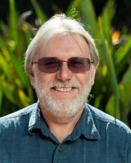
Dar Roberts is a Professor in the Department of Geography at the University of California, Santa Barbara, where he directs the Visualization & Image Processing for Environmental Research (VIPER) Lab. His research focuses on advanced remote sensing applications including:
- Imaging spectrometry for ecosystem analysis
- Wildfire fuel mapping and fire emissions modeling
- Drought impact assessment on vegetation
- Land use/land cover change detection
- Integration of remote sensing with climate modeling
Roberts leads the Southern California Wildfire Hazard Center and has pioneered techniques for mapping wildfire fuels using remote sensing technologies. His work combines field measurements with satellite, airborne, and drone-based sensors to monitor environmental changes.
0Publications listed
Find Dar Roberts elsewhere
Related Searches
You Might Also Like
 Phil DennisonUniversity of Utah · Professor
 Jonathan GreenbergUniversity of Nevada, Reno · Associate Professor
 Robert KennedyOregon State University · Professor
 Mark GrosvenorKing’s College London · Academic
 Marc MayesUtah State University · Adjunct Assistant Professor
 Robert KremensRochester Institute of Technology (RIT) · Researcher